Ice Tethered Profiler 126 Data Data from ITP126 deployed in September 2021
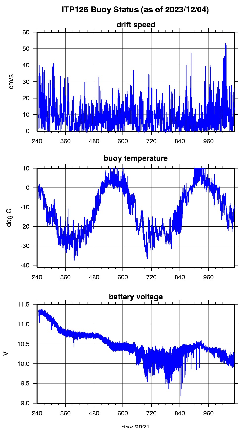
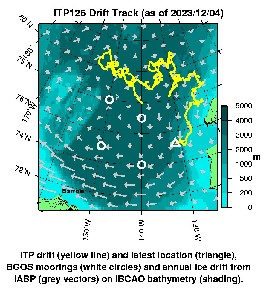
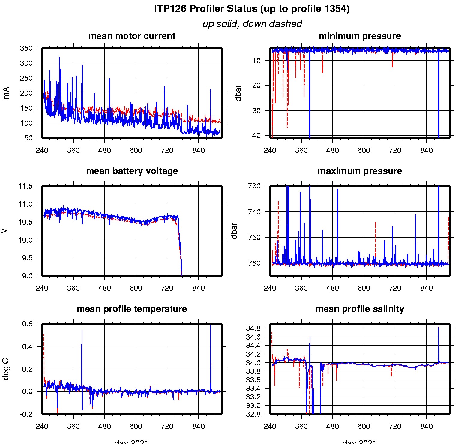
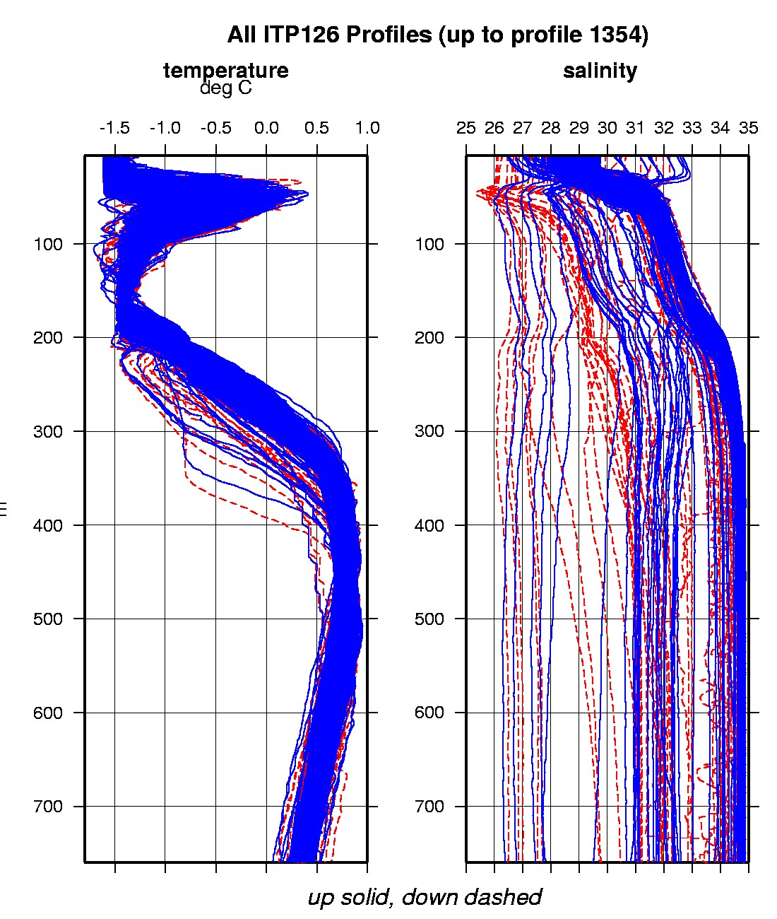
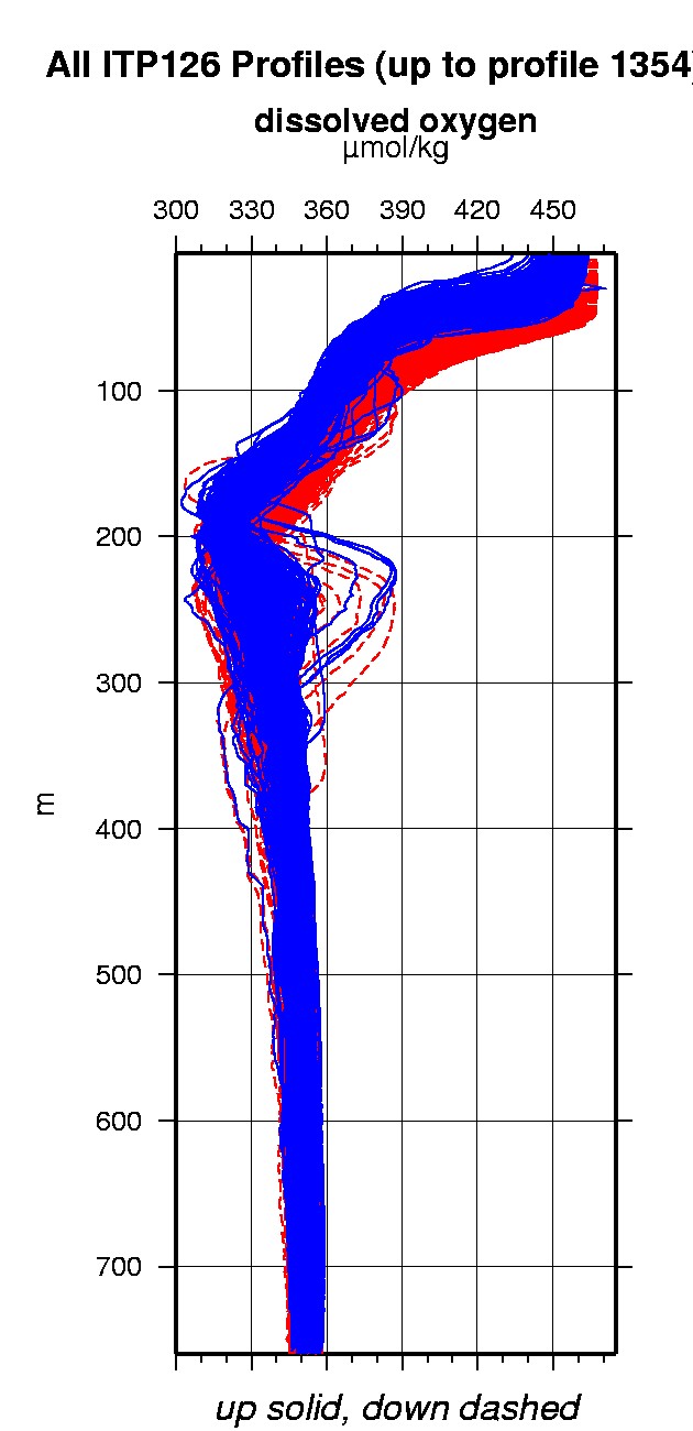
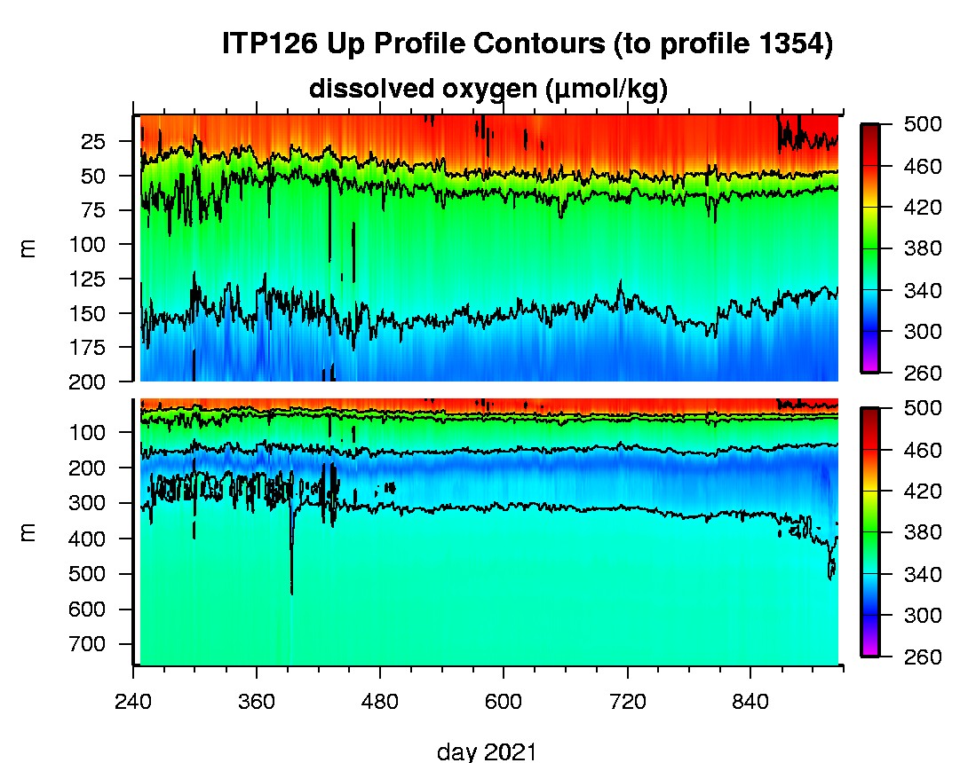
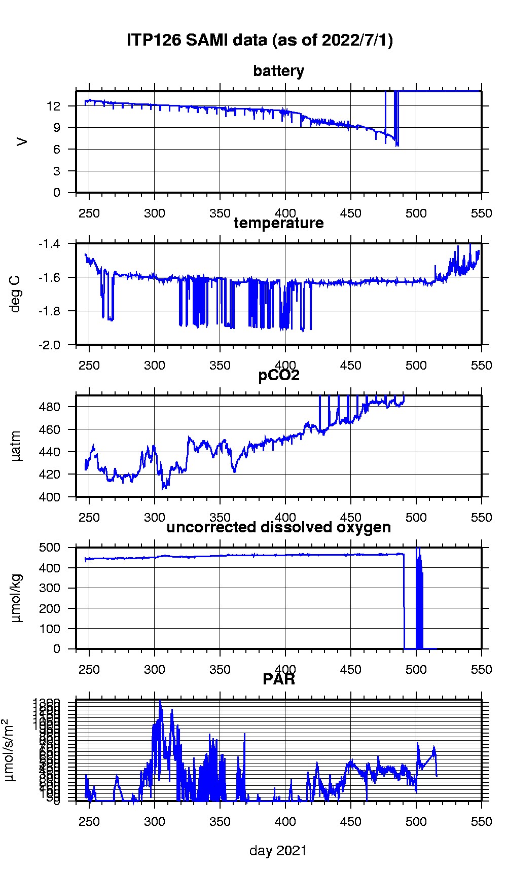
Last buoy status on 2023/12/4 63046 UTC : temperature = -10.375 °C, battery = 10.12 V Last position on 2023/12/4 63046 UTC : 75.2025° N, 131.5147° W Last profile (number 1354) on 2023/7/13 602 UTC Last profile mean motor current = 101.1432 mA, mean battery = 7.6804 V Last profile depth: minimum = 6.369, maximum = 742.1786 m Last profile temperature: minimum = -1.5216, maximum = 0.70801 °C Last profile salinity: minimum = 29.1784, maximum = 34.8674 Last profile dissolved oxygen: minimum = 316.49, maximum = 466.1355 μmol/kg Last SAMI pCO2 sample (number 23807) on 2022/7/1 221517 UTC Last pCO2 = 1106.0937 μatm Last SAMI ODO sample (number 23425) on 2022/5/30 201530 UTC Last uncorrected Dissolved Oxygen = 0 μmol/kg Last SAMI PAR sample (number 23426) on 2022/5/30 201537 UTC Last PAR = 331.2414 μmol/s/m^2 The raw GPS buoy location data are available in an ASCII file: itp126rawlocs.dat Depth averaged profiler data files (with interpolated location) and time series SAMI data are available in two formats: ITP126 was deployed on a 0.95 m ice floe in the Beaufort Sea on September 3, 2021 at 77° 58.5 N, 139° 47.6 W as part of the Beaufort Gyre Observing System (BGOS) during the JOIS 2021 cruise on the CCGS Louis S. St. Laurent. On the same icefloe, a prototype Tethered Ocean Profiler (TOP3) was also installed. The ITP includes a dissolved oxygen sensor and is operating on a standard sampling schedule of 2 one-way profiles between 7 and 760 m depth each day and includes a fixed SAMI PCO2 with ODO and PAR at 5 m depth.
|