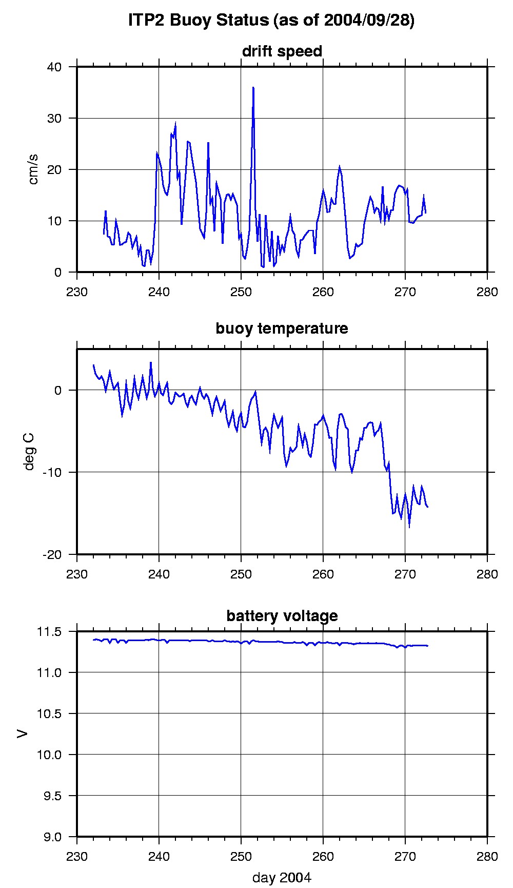
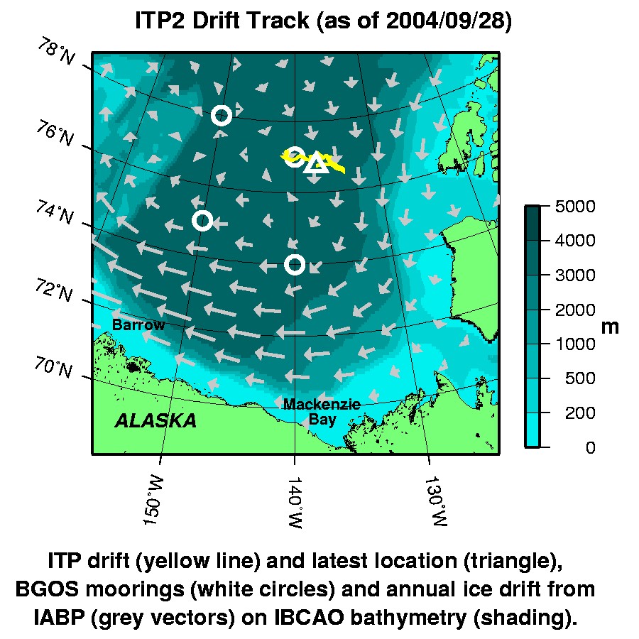
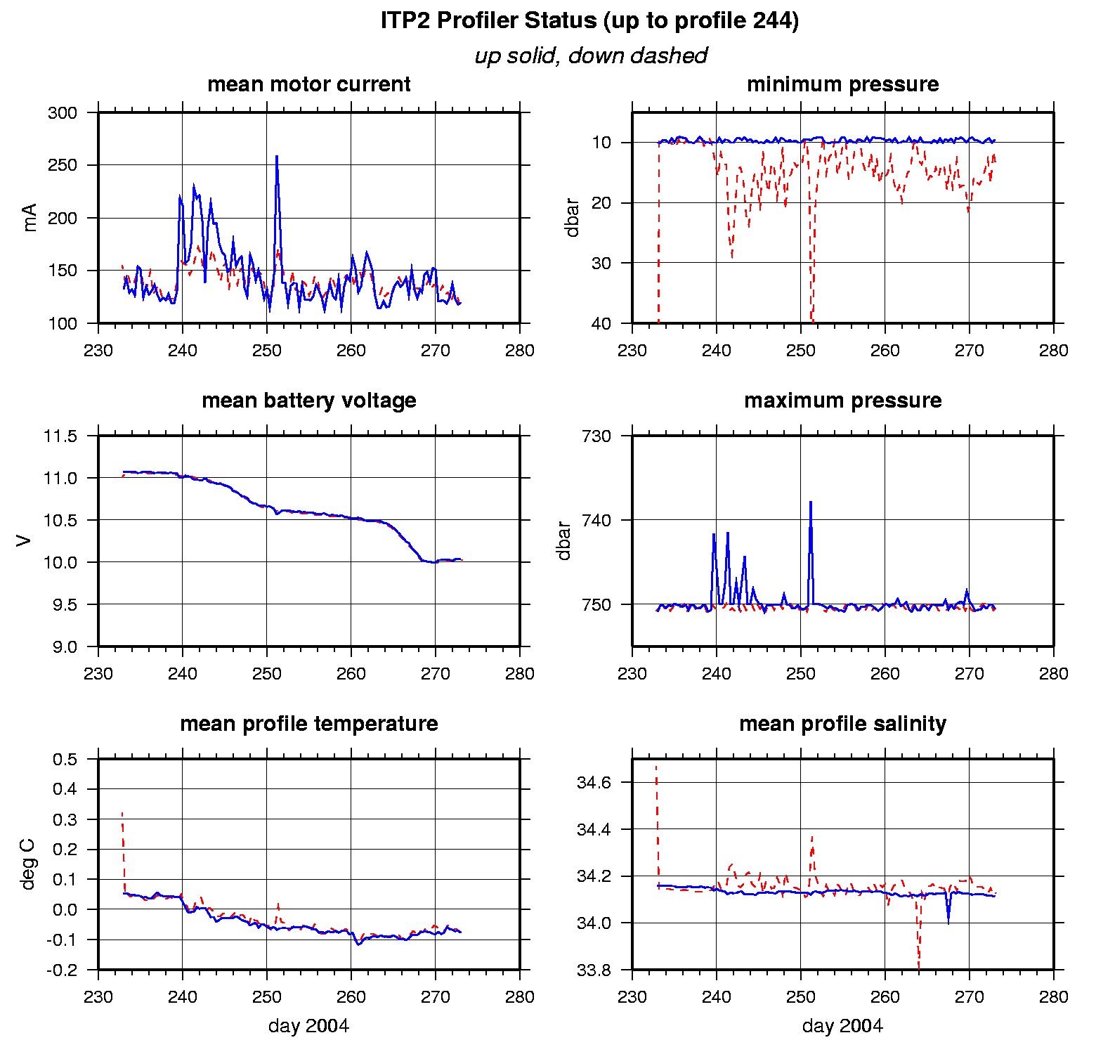
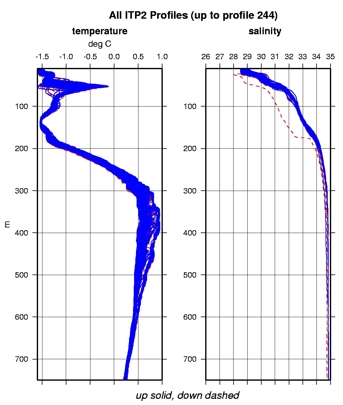
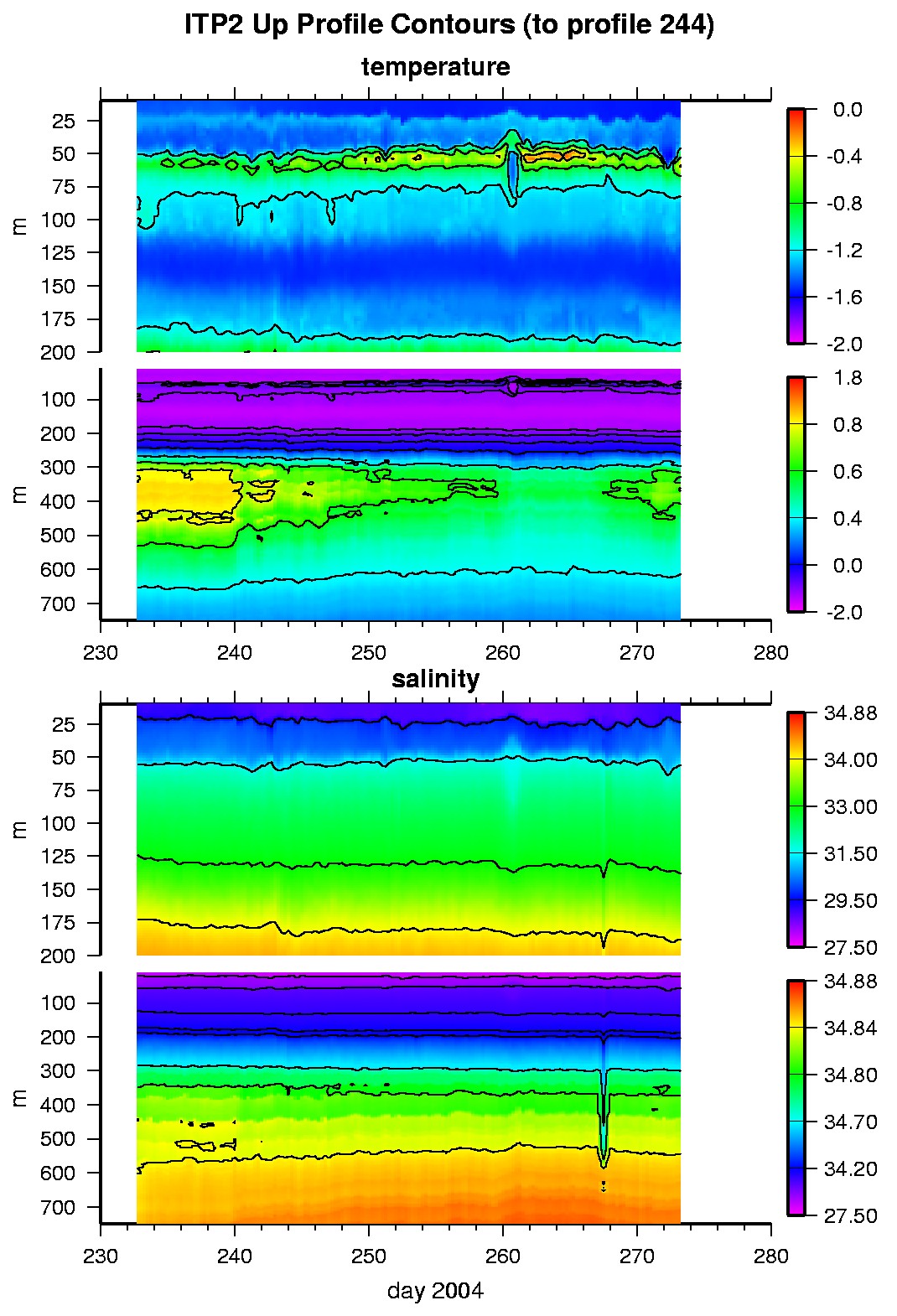
Data from the first Ice-tethered Profiler (ITP) deployed in the Arctic Ocean is available here. The first ITP was deployed in the Beaufort Sea on August 19, 2004 at 77.174 N, 141.238 W as part of the Beaufort Gyre Freshwater Experiment (BGFE) during the JWACS 2004 cruise on the CCGS Louis S. St. Laurent. The ITP and one Ice Mass Balance Buoy (IMB) buoy were deployed on a 4 m thick multiyear ice floe in a location designed to drift through the BGFE array during the following year. The ITP profiler acquires temperature and salinity measurements at better than 1-m vertical resolution, and relays the raw data to the surface package where it is broadcast by the transmitters in near-real time, alleviating the need for expensive recovery operations. The unit is operating on a fast sample schedule of 6 one-way profiles between 10 and 750 m depth each day (fast so we can test endurance and identify any failure modes sooner rather than later). The IMB (developed at the US Army Cold Regions Research and Engineering Laboratory; CRREL) primarily acquires time series of ice temperature profiles and measures the growth and ablation of sea ice (and snow) at the top and bottom surface. The combination of the ITP and IMB is an example of an Ice-Based Observatory (IBO) that is being developed for a sustained Arctic observing system. We envision a loose array of approximately 20 of these IBOs being maintained throughout the Arctic Ocean to observe the annual and interannual variations of the upper ocean. As part of our development program and in consultation with the polar research community, we will develop specific plans for establishing and maintaining such an array. Data from an IBO array will provide the basis for operational activities as well as process studies and model validation/assimilation research, work that will ultimately lead to better understanding of the Arctic Oceans response and role in global climate change.
- The raw GPS buoy location data are available in an ASCII
file: itp2rawlocs.dat
Depth averaged profiler data files (with interpolated location)
are available in two formats: itp2grddata.tar.Z or itp2grddata.zip.


