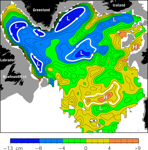
A map of large-scale ocean circulation at 700 meters (2,300 feet) from analysis of float trajectories plotted in the cover figure. Flow is shown as pressure contours, analogous to a weather map. In such maps, flow (of water or air) is along the contours, and tightly packed contours indicate higher speeds. Float trajectories did not measure predicted clear southward flow along the western boundary, but instead revealed an unexpected series of recirculations, which appear as counterclockwise flow around low pressure (L) centers. (Illustration by Kara Lavender)
|