P. Traykovski, J. Irish and J. Lynch's STRATAFORM RESEARCH |
| Part of the ONR sponsored STRATAFORM project was designed to study the processes that control continental margin stratigraphy. In particular a series of observations were conducted on the Northern California continental shelf near the Eel river to examine flood deposits caused by winter storms. With this in mind the WHOI Ocean Acoustics Lab deployed several systems to observe sediment transport in the bottom boundary layer at the mud-sand transition in the winter of 1995-96, and over the entire water column on three positions on the STRATAFORM K-line in the winter of 1997-98. | 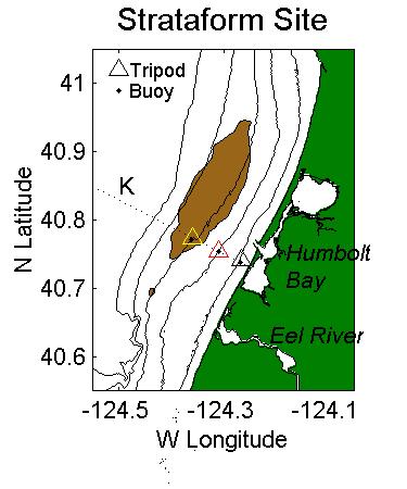
The location of the 1995 and 1997 flood deposits is shown above (Data courtesy of R. Wheatcroft): |
Other useful STRATAFORM links:
![]() Back to WHOI Ocean Acoustics Laboratory
home page
Back to WHOI Ocean Acoustics Laboratory
home page
Created and Maintained by
Peter Traykovski
(last update: 2/28/96)