Please note: You are viewing the unstyled version of this website. Either your browser does not support CSS (cascading style sheets) or it has been disabled. Skip navigation.

Image : Mysterious Flotsam in Gulf of Mexico Came from Deepwater Horizon Rig, Study Finds

   Print Change text to small (default) Change text to medium Change text to large

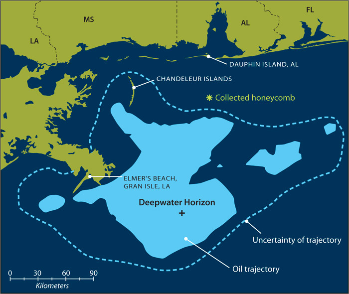
map with sampling locations
Officials used a model that incorporated currents and wind speeds, along with data from planes and satellites, to predict a trajectory of the oil slick spreading from the Deepwater Horizon oil rig. Shaded area represent the predicted trajectory on May 7, 2010. But predictions are not exact; the dotted line represents the degree of uncertainty for the prediction. The mysterious debris was found about 6.2 miles ahead of the projected trajectory of the spreading slick. (Map adapted from NOAA/NOS/OR&R Trajectory Forecast Mississippi Canyon 252) (Illustration by Jack Cook, Woods Hole Oceanographic Institution)

[back]


Last updated: July 28, 2014


whoi logo

Copyright ©2007 Woods Hole Oceanographic Institution, All Rights Reserved, Privacy Policy.
Problems or questions about the site, please contact webdev@whoi.edu
Contact | Site Map | Support WHOI Research
WHOI Facebook WHOI You TubeWHOI Twitter