Please note: You are viewing the unstyled version of this website. Either your browser does not support CSS (cascading style sheets) or it has been disabled. Skip navigation.

Image : A Glide Across the Gulf Stream

   Print Change text to small (default) Change text to medium Change text to large

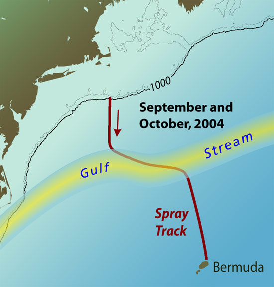
map of spray journey
A 7-WEEK, 600-MILE JOURNEY—On Sept. 11, 2004, researchers launched Spray glider near a mooring located on the continental south of Nantucket Island. The yellow swath shows the average path of the Gulf Stream—a large, powerful ocean current that often forms strong vortices to its north and south. As sailors know, it is difficult to navigate through these vortices to reach Bermuda, a problem that also challenged Spray. As a result, the glider's path took a few unexpected turns before researchers retrieved Spray offshore Bermuda. (Illustration by Jayne Doucette, WHOI Graphic Services)

[back]


Last updated: April 28, 2011


whoi logo

Copyright ©2007 Woods Hole Oceanographic Institution, All Rights Reserved, Privacy Policy.
Problems or questions about the site, please contact webdev@whoi.edu
Contact | Site Map | Support WHOI Research
WHOI Facebook WHOI You TubeWHOI Twitter