Please note: You are viewing the unstyled version of this website. Either your browser does not support CSS (cascading style sheets) or it has been disabled. Skip navigation.

Image : WHOI Scientists Map and Confirm Origin of Large, Underwater Hydrocarbon Plume in Gulf

   Print Change text to small (default) Change text to medium Change text to large

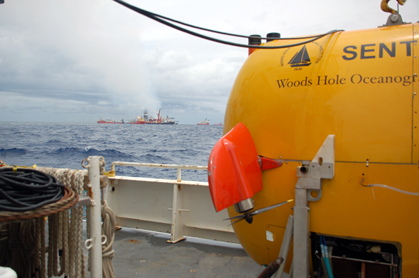
Funded by NSF and developed and operated by WHOI, Sentry is capable of exploring the ocean down to 14,764 feet (4,500 meters) depth. Equipped with its advanced analytical systems, it was able to crisscross plume boundaries 19 times to help determine the trapped plume?s size, shape, and composition.
Funded by NSF and developed and operated by WHOI, Sentry is capable of exploring the ocean down to 14,764 feet (4,500 meters) depth. Equipped with its advanced analytical systems, it was able to crisscross plume boundaries 19 times to help determine the trapped plume’s size, shape, and composition.

[back]


Last updated: July 28, 2014


whoi logo

Copyright ©2007 Woods Hole Oceanographic Institution, All Rights Reserved, Privacy Policy.
Problems or questions about the site, please contact webdev@whoi.edu
Contact | Site Map | Support WHOI Research
WHOI Facebook WHOI You TubeWHOI Twitter