Please note: You are viewing the unstyled version of this website. Either your browser does not support CSS (cascading style sheets) or it has been disabled. Skip navigation.

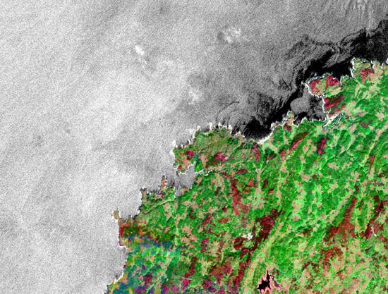
Image : Mixing Oil and Water

   Print Change text to small (default) Change text to medium Change text to large

satellite image of oil spill
Satellite radar images show the extent of the 2002 Prestige oil spill along a 30-mile stretch of the northwest coast of Spain. The slick (black areas) is visible because the oil smooths the ocean surface. The surface of clean water appears bright because it scatters and reflects light back towards the satellite. Oil can have wildly different impacts depending on where it is spilled and what the weather is doing in the hours and days afterward. (Courtesy: RADARSAT / Canadian Space Agency.)

[back]


Last updated: May 24, 2011


whoi logo

Copyright ©2007 Woods Hole Oceanographic Institution, All Rights Reserved, Privacy Policy.
Problems or questions about the site, please contact webdev@whoi.edu
Contact | Site Map | Support WHOI Research
WHOI Facebook WHOI You TubeWHOI Twitter