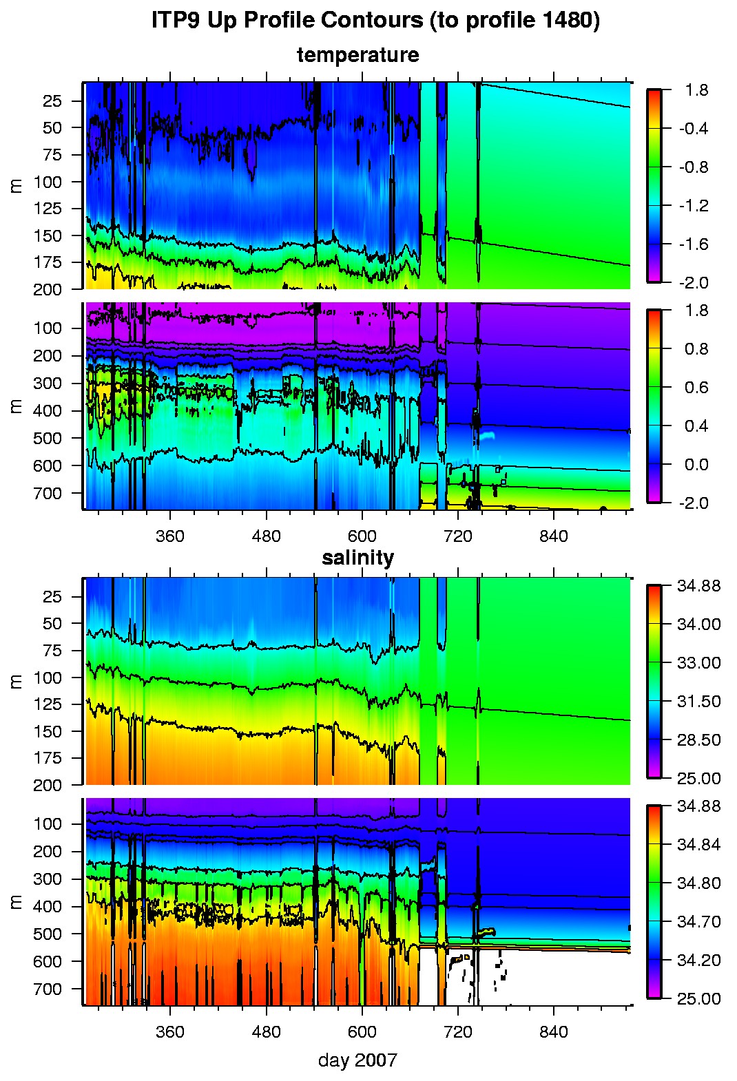
Ice Tethered Profiler 9 Data Data from ITP9 deployed in September 2007
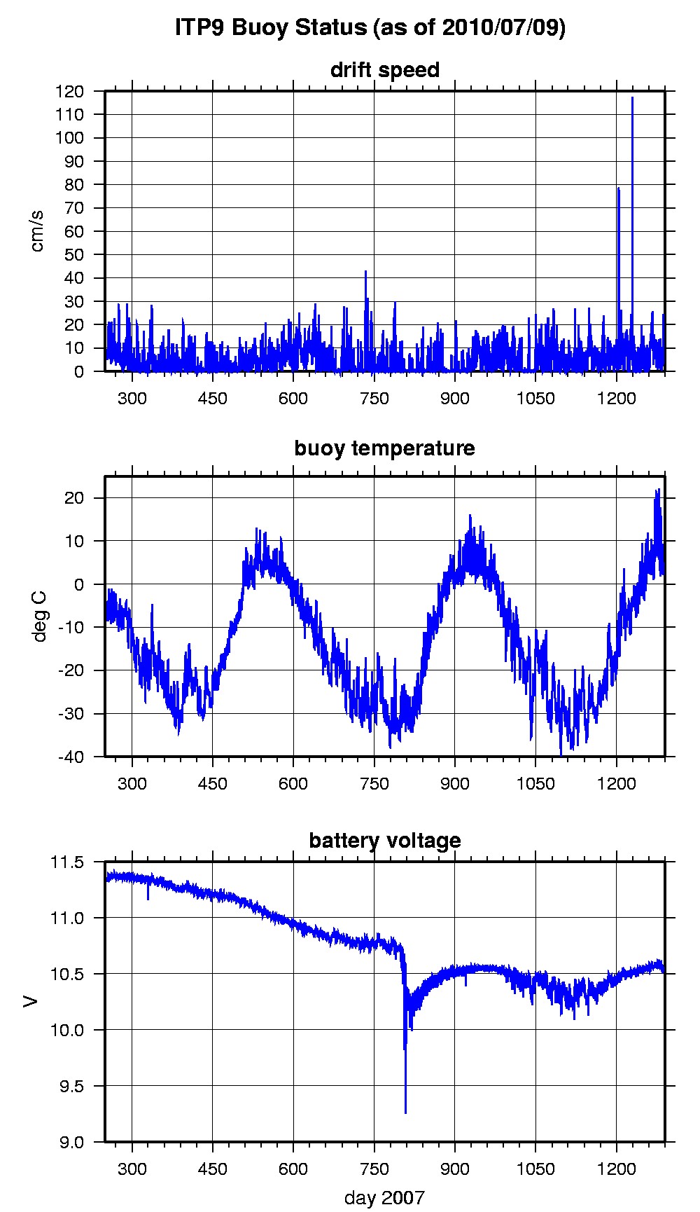
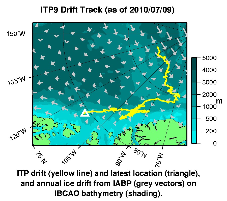
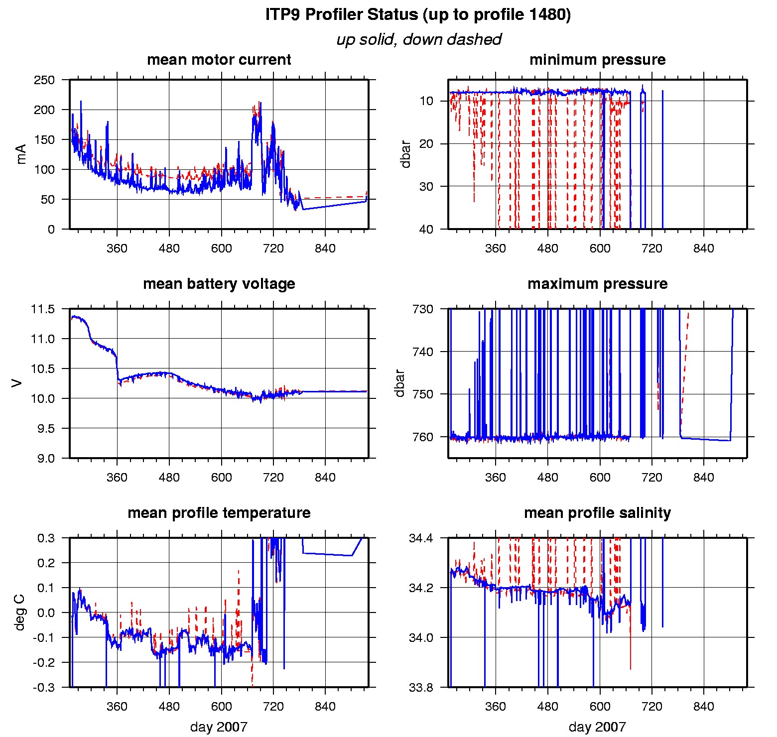
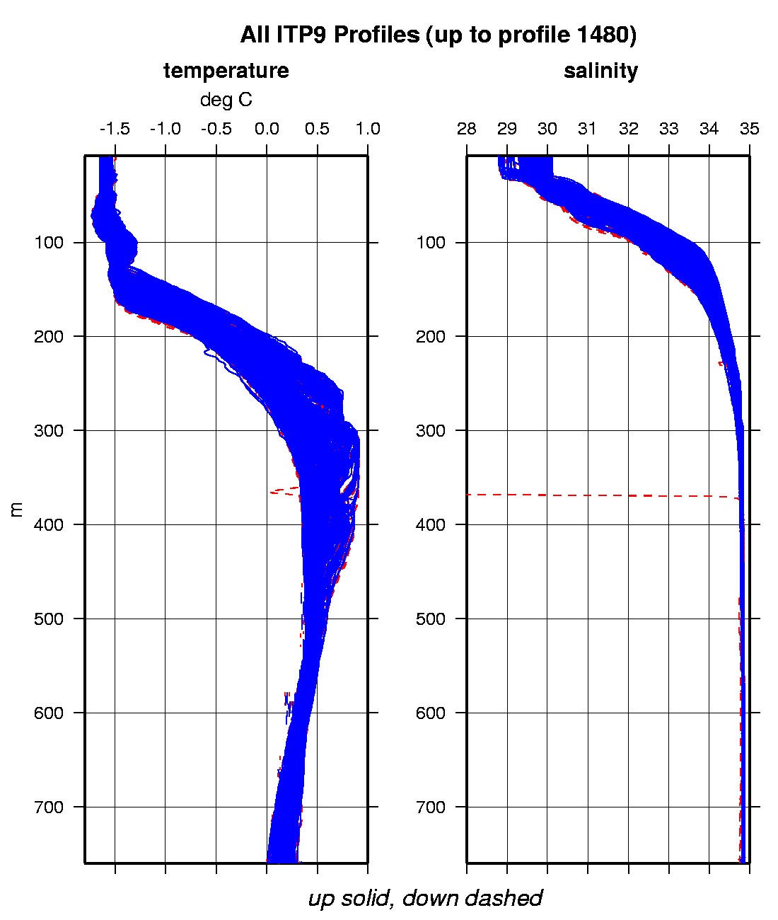
Last buoy status on 2010/7/9 230043 UTC : temperature = 2.25 °C, battery = 10.55 V Last position on 2010/7/9 230107 UTC : 79.6466° N, 113.515° W Last profile (number 1480) on 2009/7/23 624 UTC Last profile mean motor current = 62.7243 mA, mean battery = 10.1093 V Last profile depth: minimum = 462.7618, maximum = 471.6433 m Last profile temperature: minimum = 0.34458, maximum = 0.34674 °C Last profile salinity: minimum = 34.8373, maximum = 34.8426 The raw GPS buoy location data are available in an ASCII file: itp9rawlocs.dat Depth averaged profiler data files (with interpolated location) are available in two formats: ITP9 was deployed on a 2.7 m thick icefloe on 11 September 2007 at 87° 4.217 N, 130° 16.528 W from the Russian icebreaker "Akademik Federov" as part of the European Union DAMOCLES Program. On the same icefloe, a US Army Cold Regions Research and Engineering Laboratory (CRREL) Ice Mass Balance Buoy (IMB 30295) was also installed. The ITP is operating on a typical sampling schedule of 2 one-way profiles between 7 and 760 m depth each day.
|