Ice Tethered Profiler 88 Data Data from ITP88 deployed in September 2015
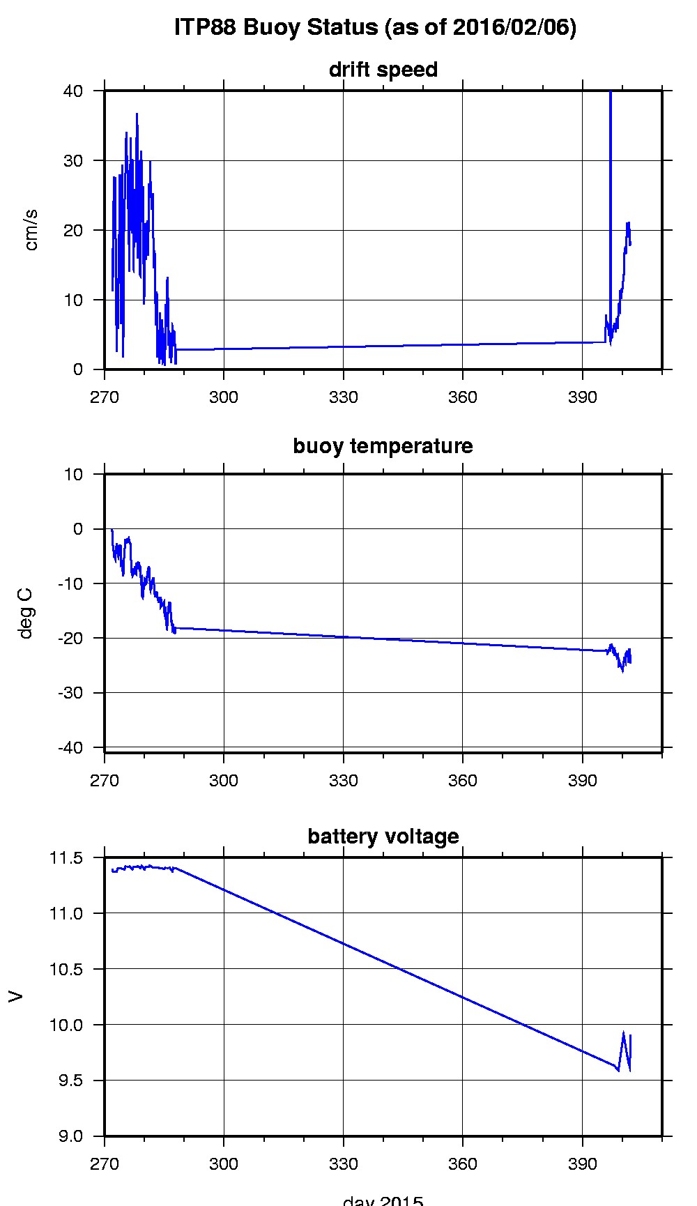
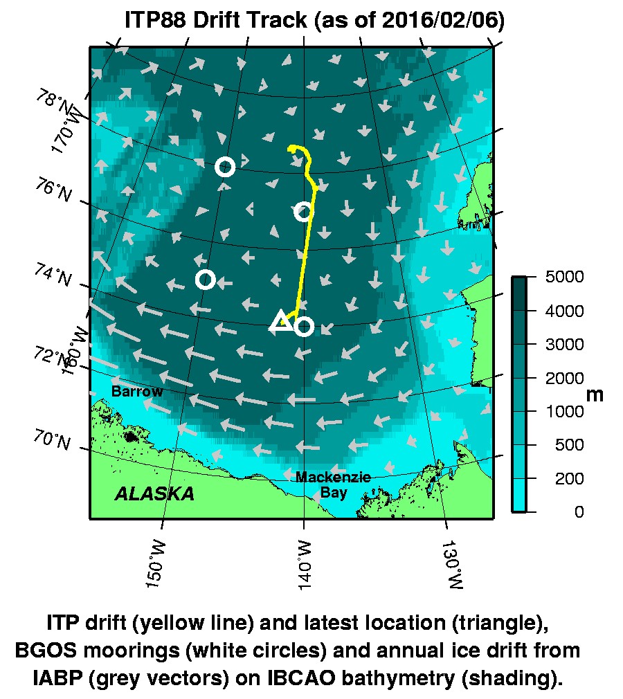
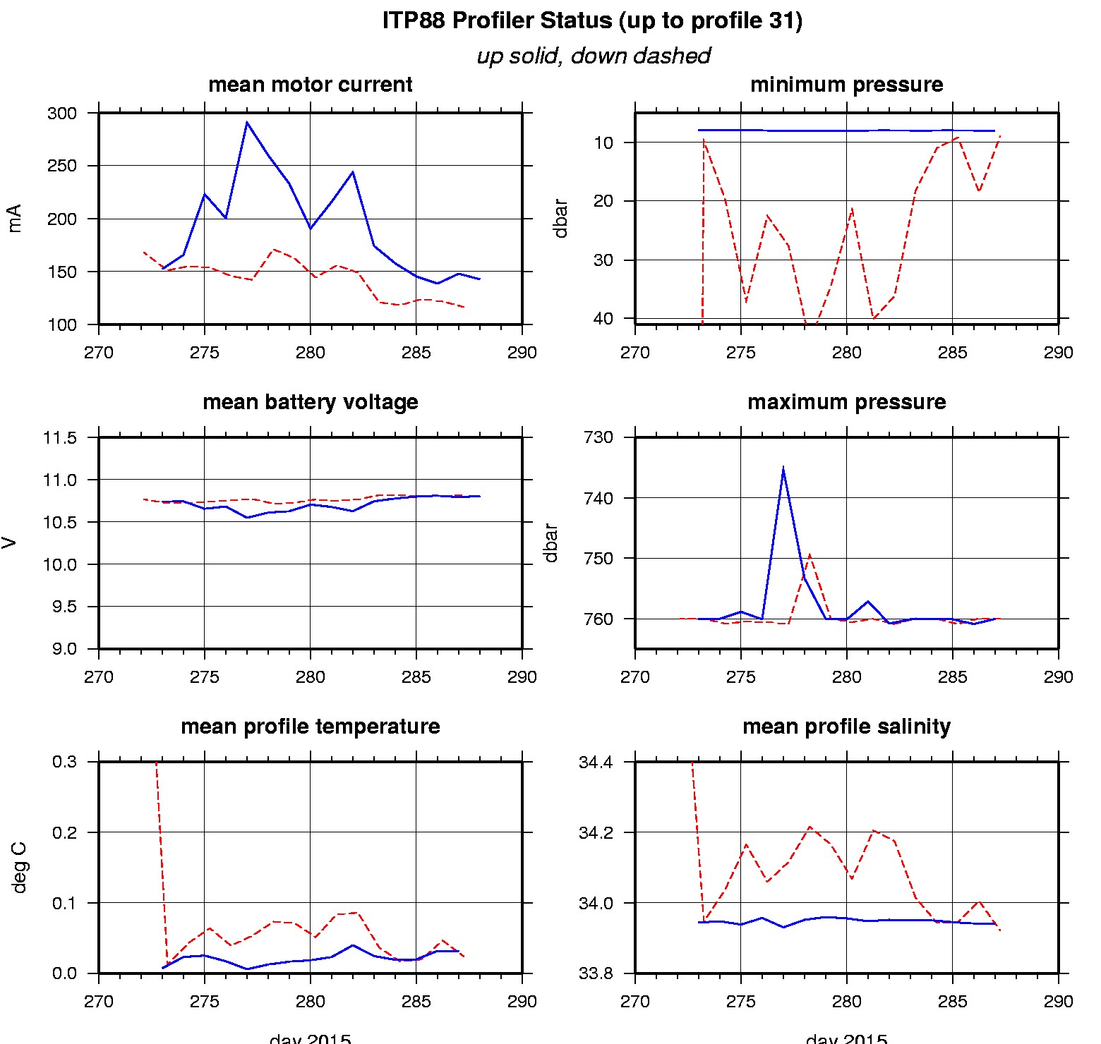
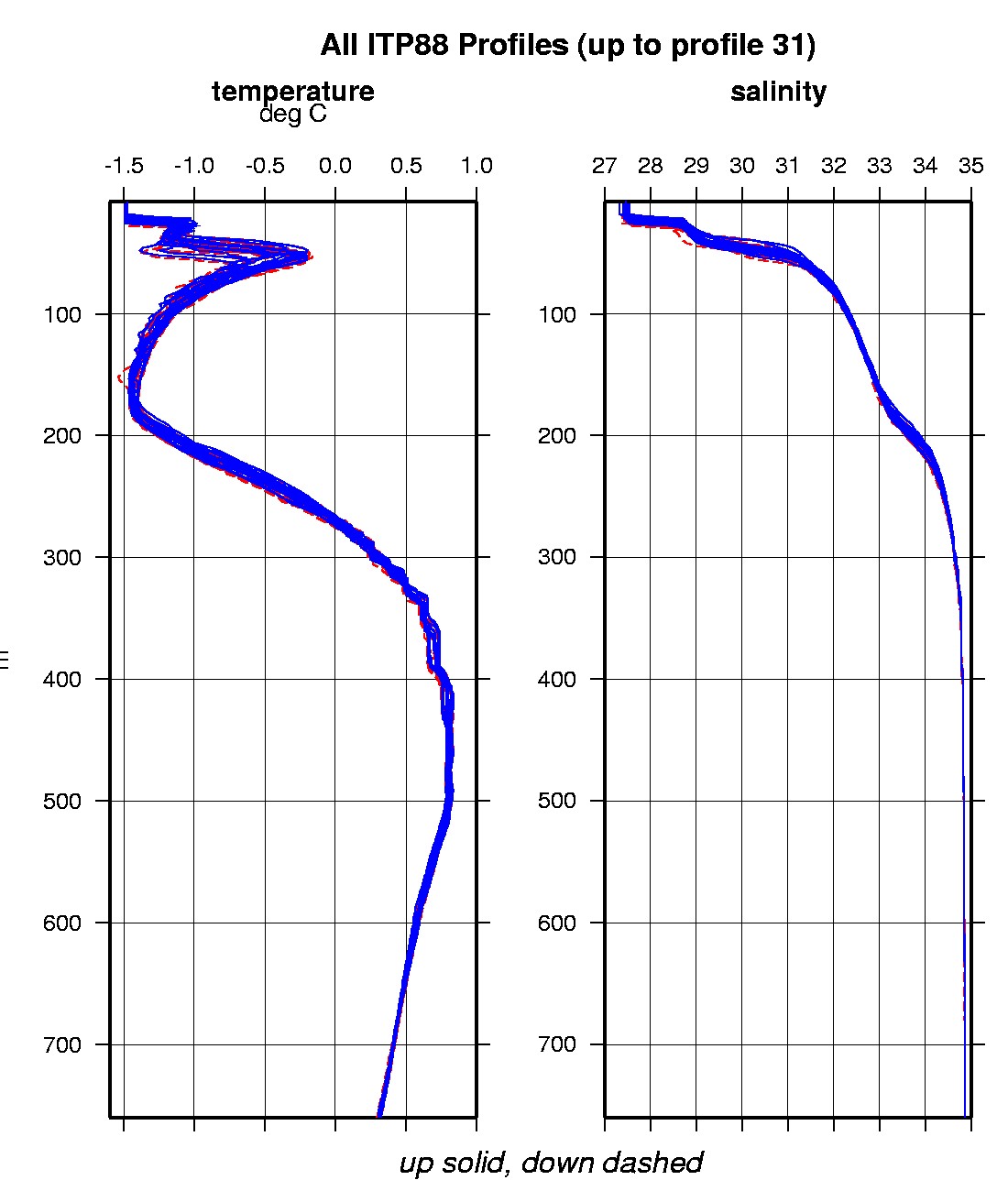
Last buoy status on 2016/2/6 22013 UTC : temperature = -24.6875 °C, battery = 9.913 V Last position on 2016/2/6 20434 UTC : 74.0711° N, 142.1935° W Last profile (number 31) on 2015/10/15 2 UTC Last profile mean motor current = 142.6327 mA, mean battery = 10.8042 V Last profile depth: minimum = 8.9115, maximum = 760.0288 m Last profile temperature: minimum = -1.4975, maximum = 0.79391 °C Last profile salinity: minimum = 27.4924, maximum = 34.8561 The raw GPS buoy location data are available in an ASCII file: itp88rawlocs.dat Depth averaged profiler data files (with interpolated location) are available in two formats: ITP88 was deployed on a 1.0 m thick ice floe in the Beaufort Sea on September 28, 2015 at 78° 34.0 N, 141° 22.1 W as part of the Beaufort Gyre Observing System (BGOS) during the JOIS 2015 cruise on the CCGS Louis S. St. Laurent. On the same icefloe, a US Army Cold Regions Research and Engineering Laboratory (CRREL) Seasonal Ice Mass Balance Buoy 2 and an autonomous atmospheric chemistry buoy (O-Buoy) were also installed. The ITP is operating on a standard sampling schedule of 2 one-way profiles between 7 and 760 m depth each day.
|