Ice Tethered Profiler 79 Data Data from ITP79 deployed in March 2014
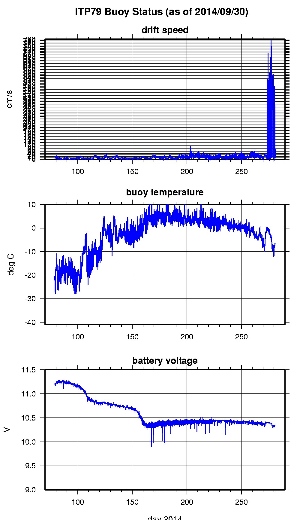
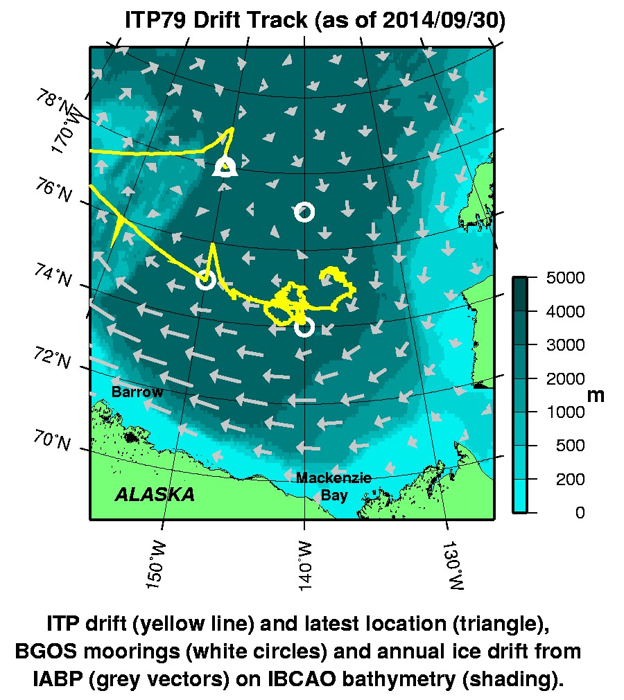
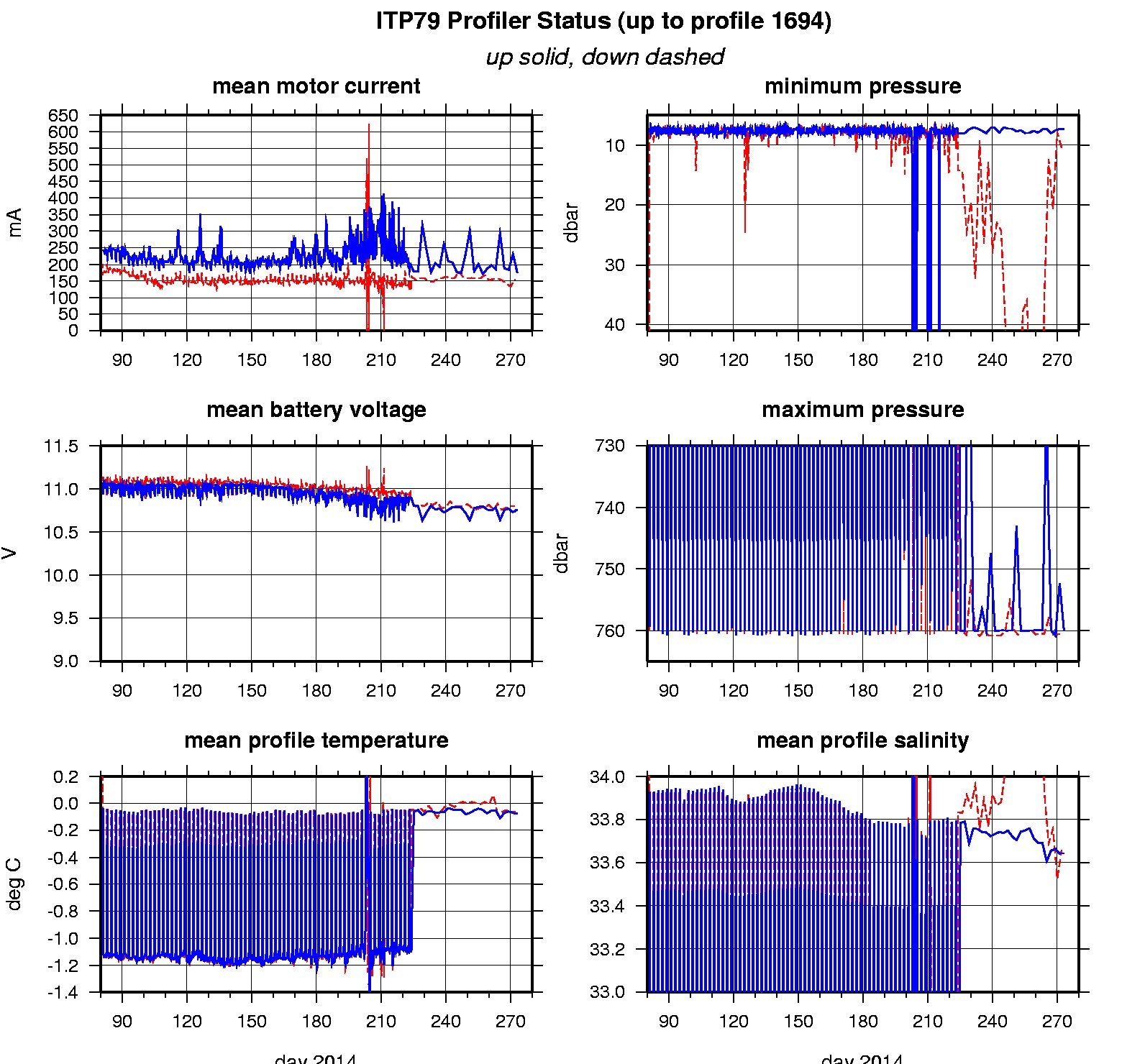
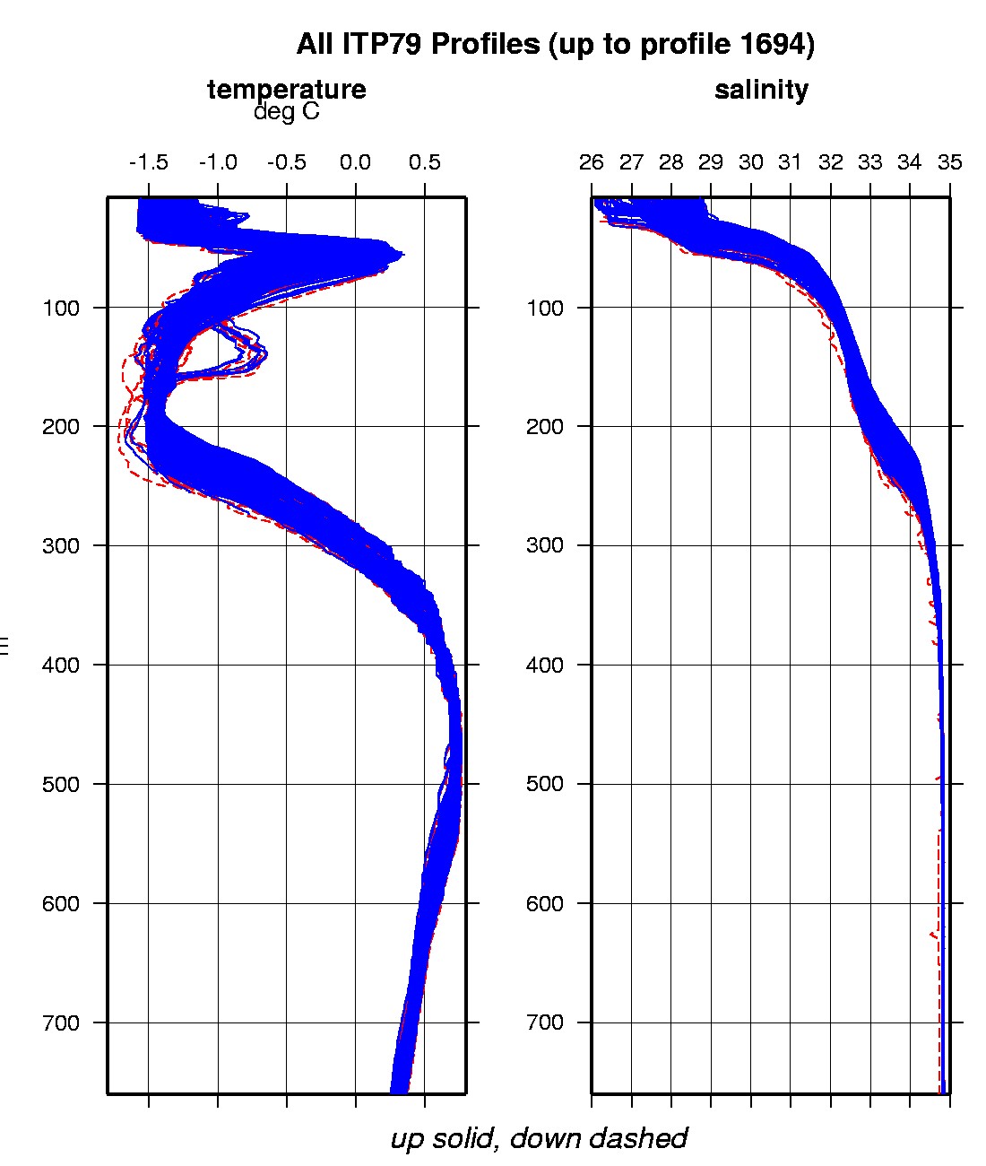
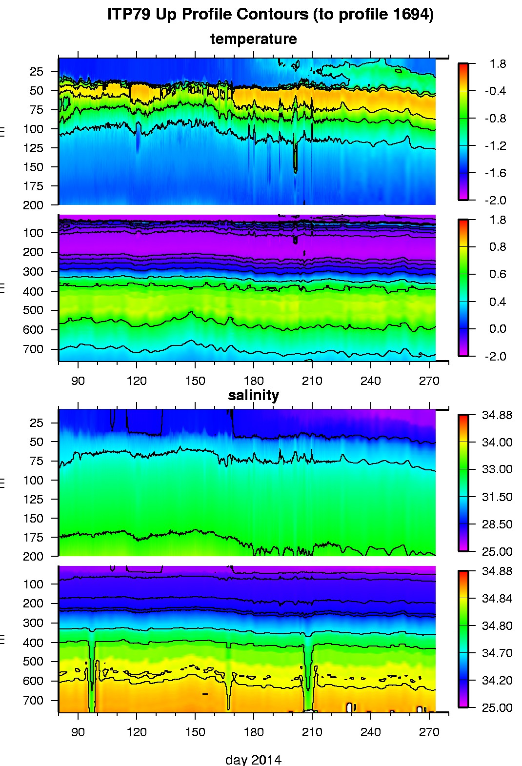
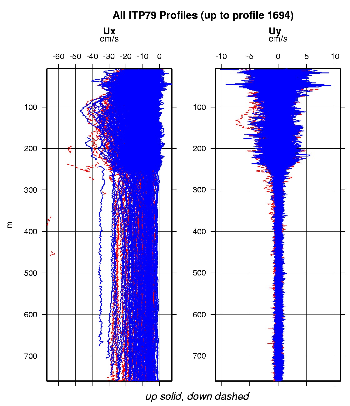
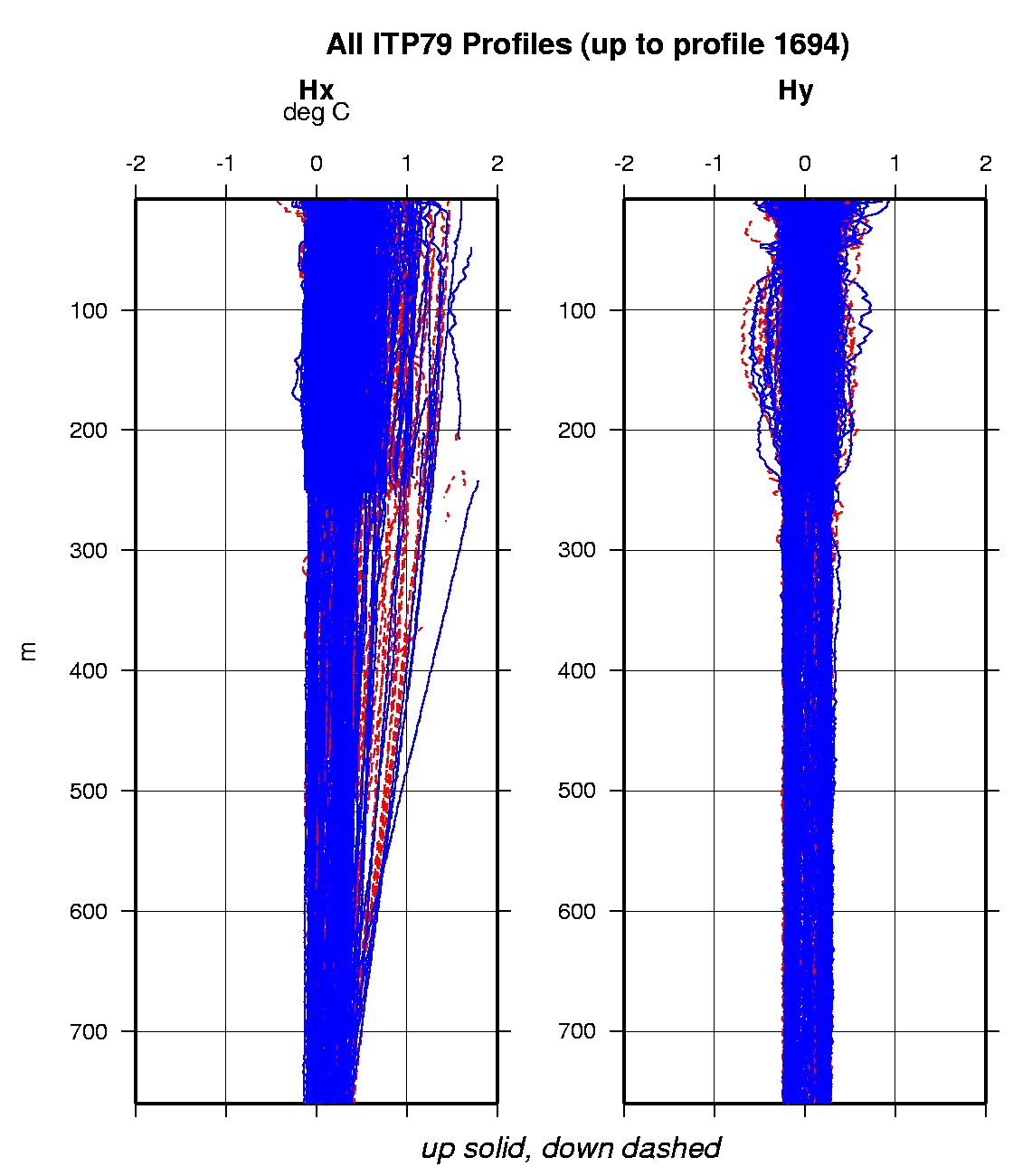
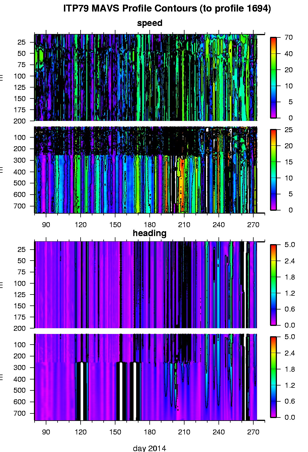
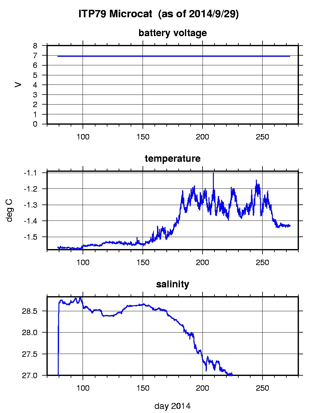
Last buoy status on 2014/10/8 0 UTC : temperature = -6.29 °C, battery = 10.35 V Last position on 2014/10/8 0 UTC : 77.9647° N, 150.0533° W Last profile (number 1694) on 2014/9/30 2 UTC Last profile mean motor current = 174.3765 mA, mean battery = 10.7591 V Last profile depth: minimum = 7.3168, maximum = 760.0275 m Last profile temperature: minimum = -1.5176, maximum = 0.74539 °C Last profile salinity: minimum = 26.3779, maximum = 34.8505 Last Microcat sample (number 19865) on 2014/9/29 234747 UTC Last battery = 6.9 V, temperature = -1.4289 °C, salinity = 26.3855 The raw GPS buoy location data are available in an ASCII file: itp79rawlocs.dat Depth averaged profiler data files (with interpolated location) and time series microcat data are available in two formats: ITP79 was deployed on a 1.6 m thick icefloe in the Beaufort Sea on March 19, 2014 at 75° 24.2 N, 137° 11.1 W as part of the ONR Marginal Ice Zone (MIZ) program. The ITP includes a second generation prototype MAVS current sensor operating on a pattern profiling schedule including 2 one-way profiles between 7 and 760 m depth each day and SBE-37 microcat fixed at 6 m depth.
|