Ice Tethered Profiler 77 Data Data from ITP77 deployed in March 2014
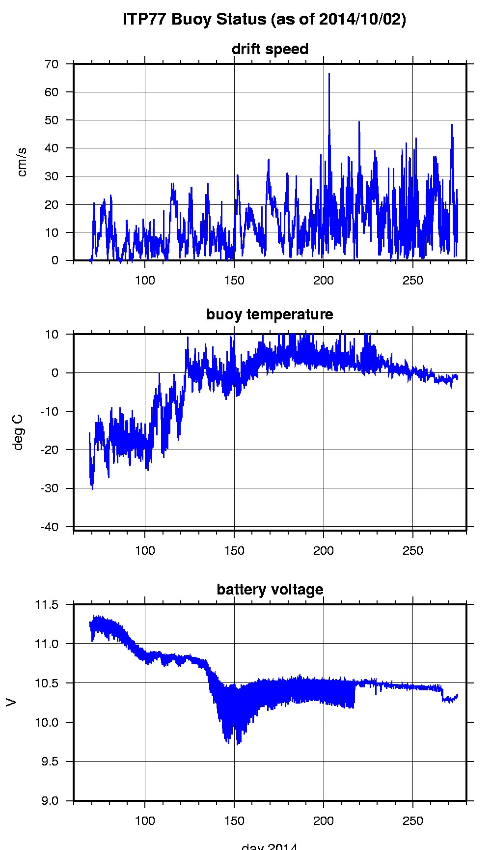
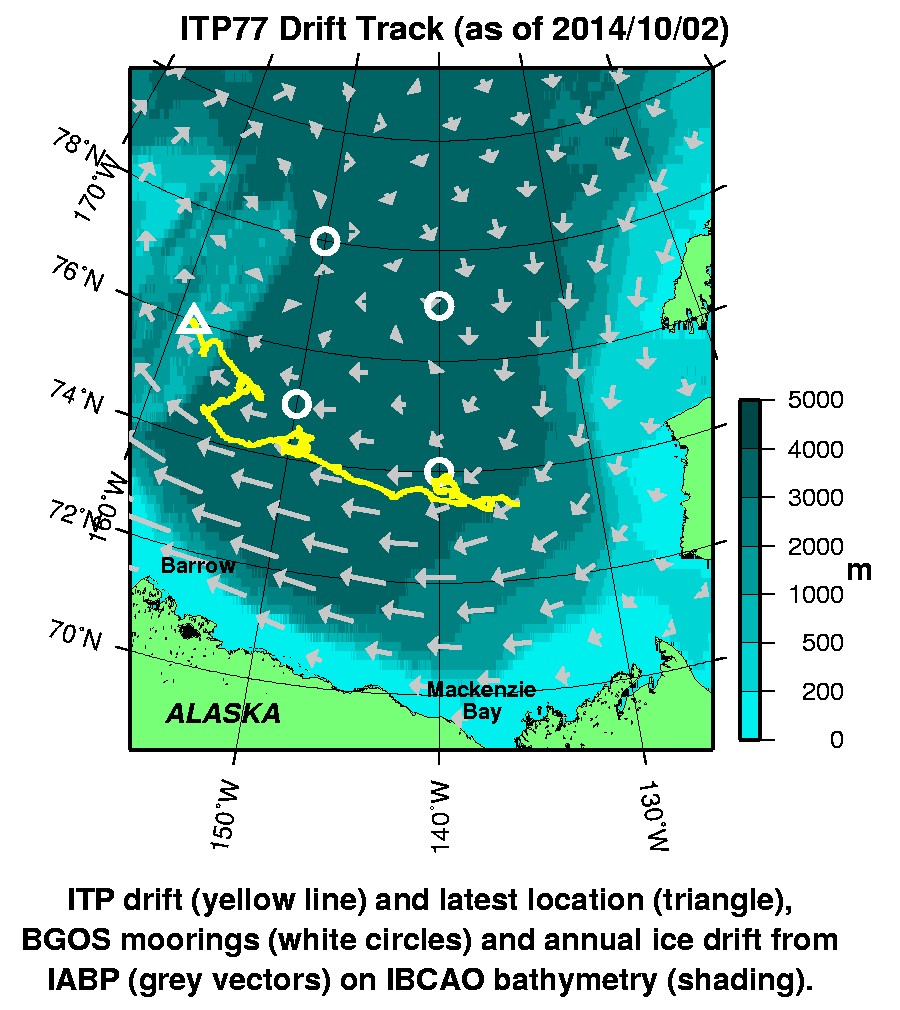
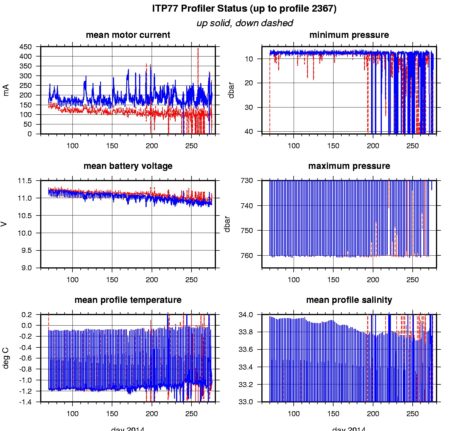
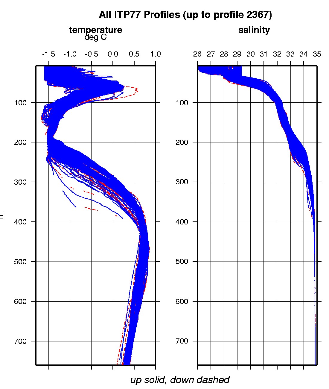
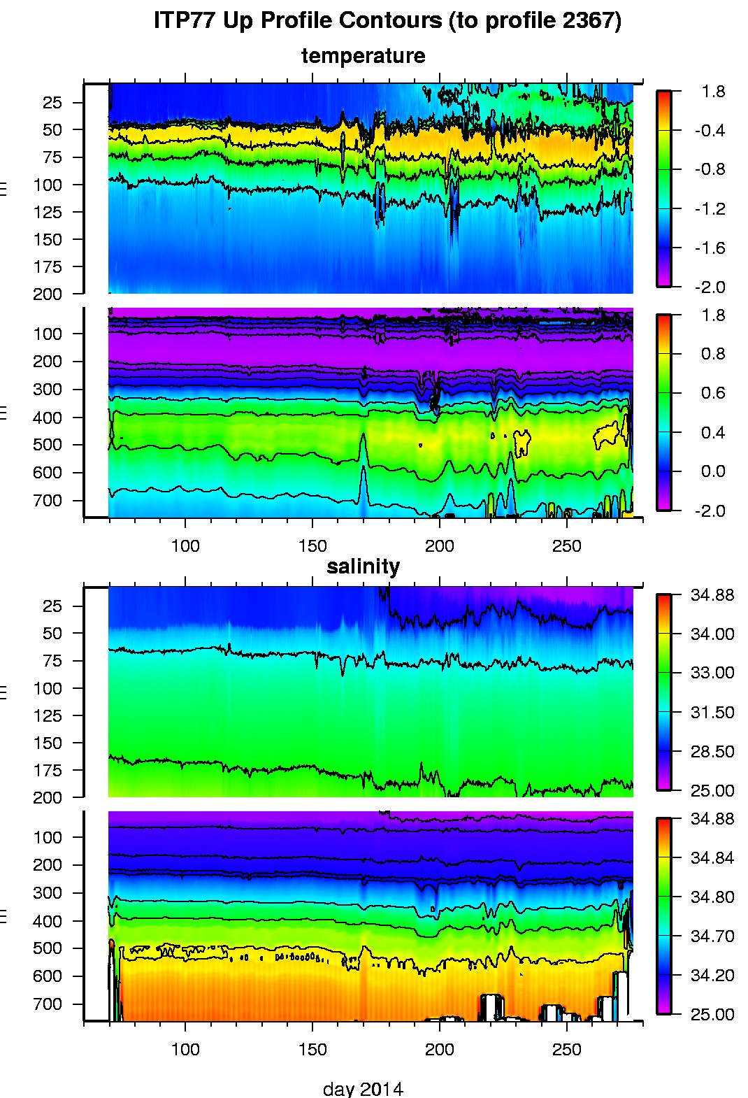
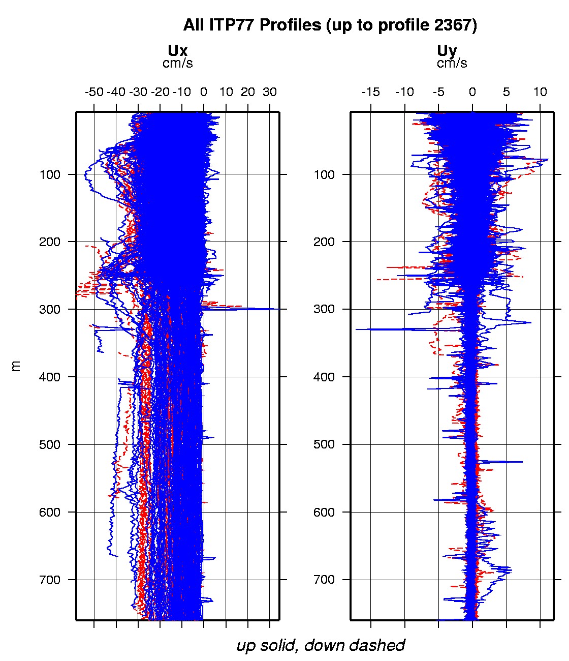
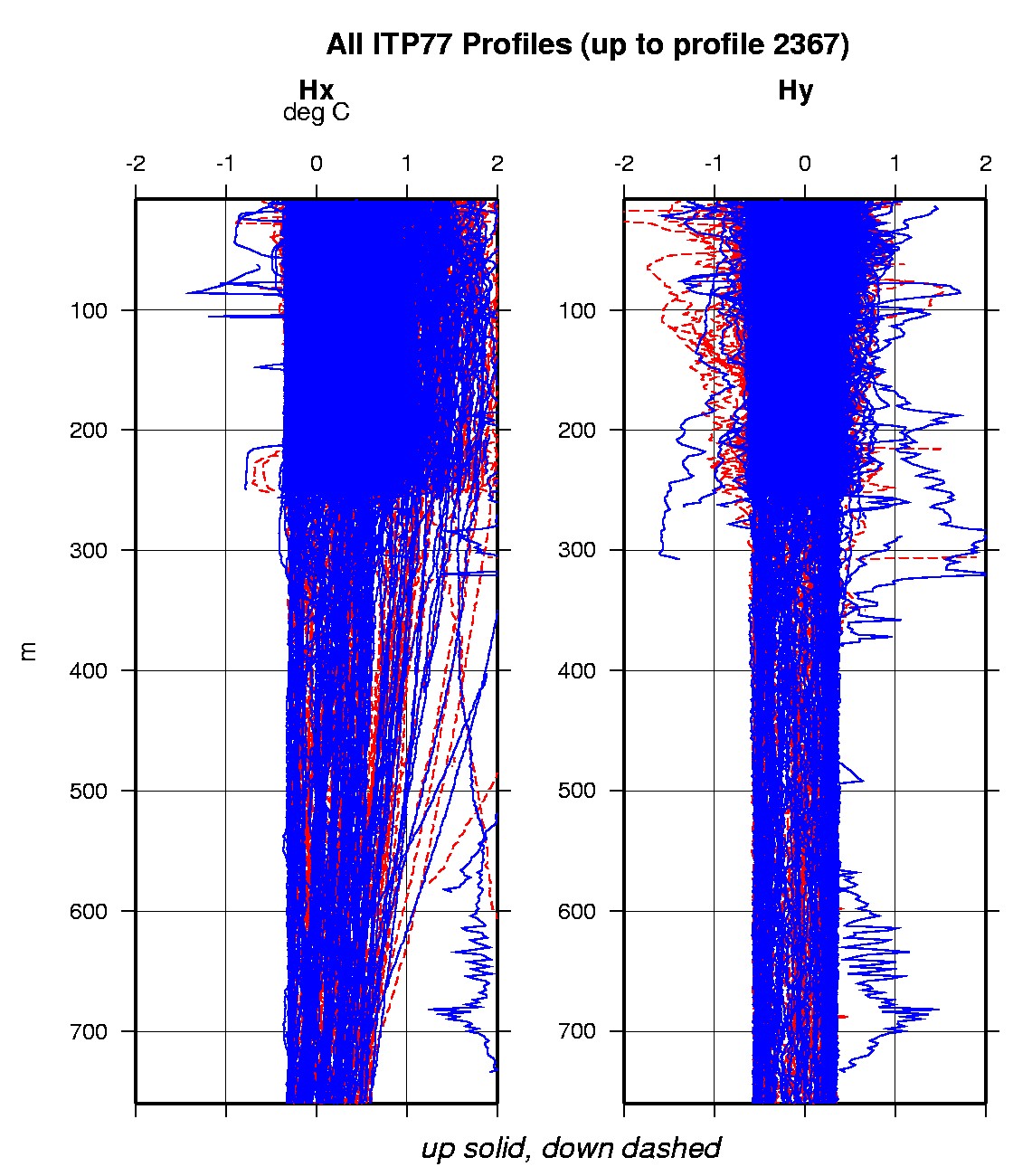
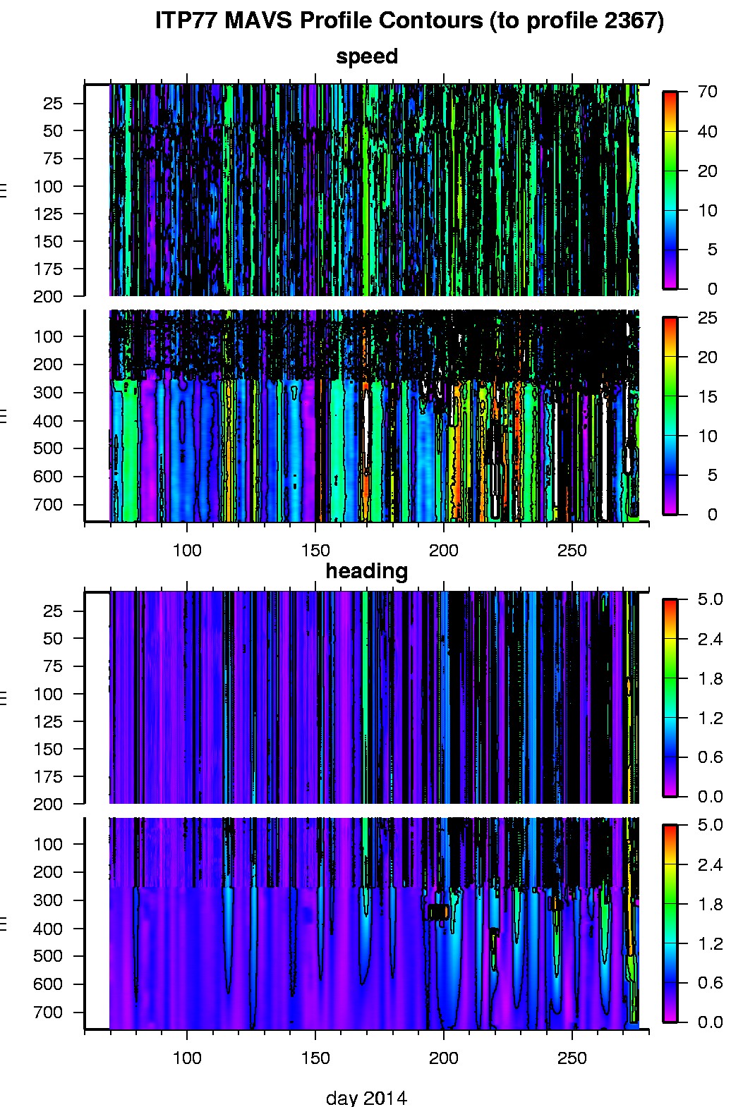
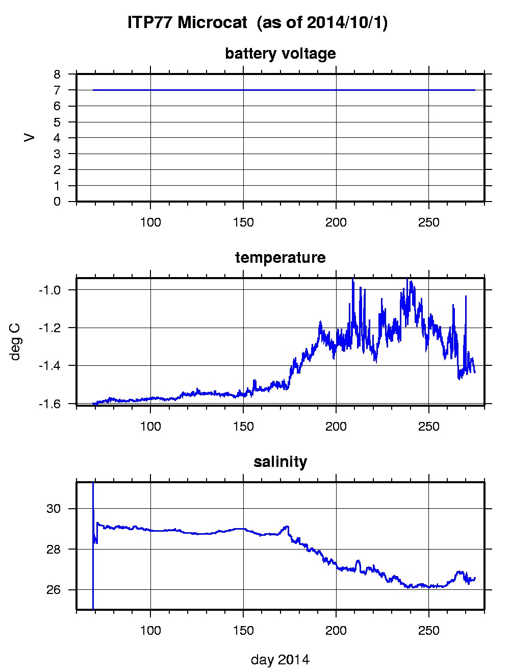
Last buoy status on 2014/10/2 0 UTC : temperature = -1.77 °C, battery = 10.32 V Last position on 2014/10/2 0 UTC : 75.962° N, 158.6148° W Last profile (number 2367) on 2014/10/2 1802 UTC Last profile mean motor current = 214.4312 mA, mean battery = 10.8302 V Last profile depth: minimum = 8.042, maximum = 273.6614 m Last profile temperature: minimum = -1.472, maximum = 0.06845 °C Last profile salinity: minimum = 26.5553, maximum = 34.3411 Last Microcat sample (number 20042) on 2014/10/1 235931 UTC Last battery = 7 V, temperature = -1.4322 °C, salinity = 26.5692 The raw GPS buoy location data are available in an ASCII file: itp77rawlocs.dat Depth averaged profiler data files (with interpolated location) and time series microcat data are available in two formats: ITP77 was deployed on a 2.0 m thick icefloe in the Beaufort Sea on March 9, 2014 at 73° 21.9 N, 134° 59.2 W as part of the ONR Marginal Ice Zone (MIZ) program. On the same icefloe, a Naval Postgraduate School Arctic Ocean Flux Buoy (AOFB) was deployed. The ITP includes a second generation prototype MAVS current sensor operating on a pattern profiling schedule including 2 one-way profiles between 7 and 760 m depth each day and SBE-37 microcat fixed at 6 m depth.
|