Ice Tethered Profiler 71 Data Data from ITP71 deployed in August 2013
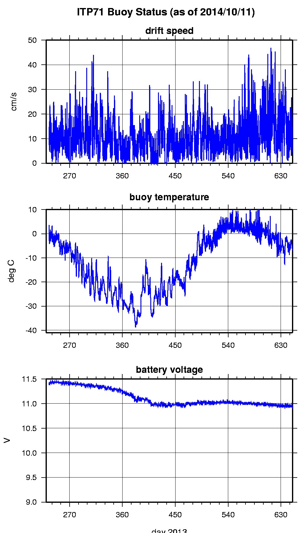
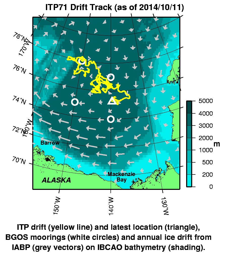
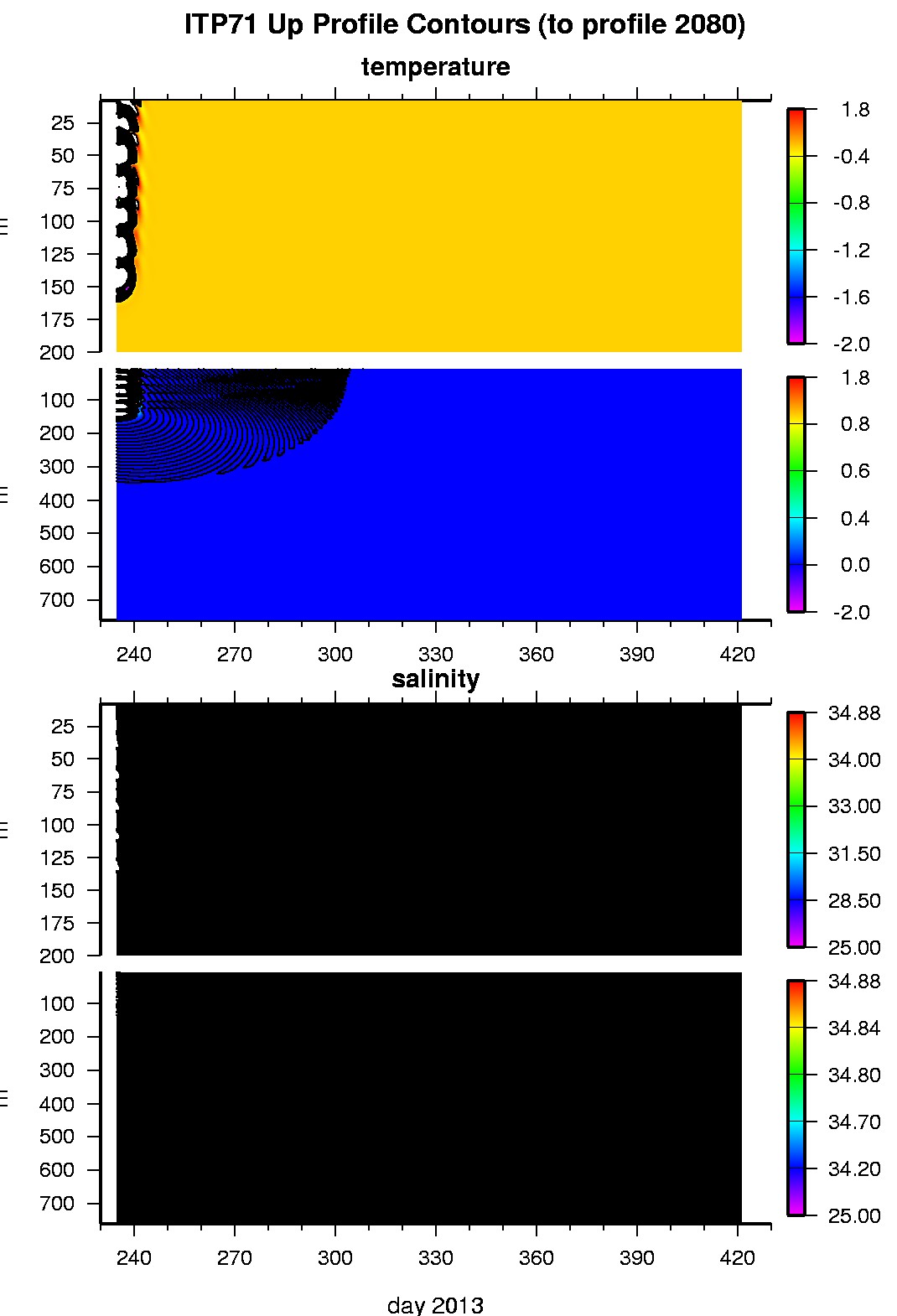
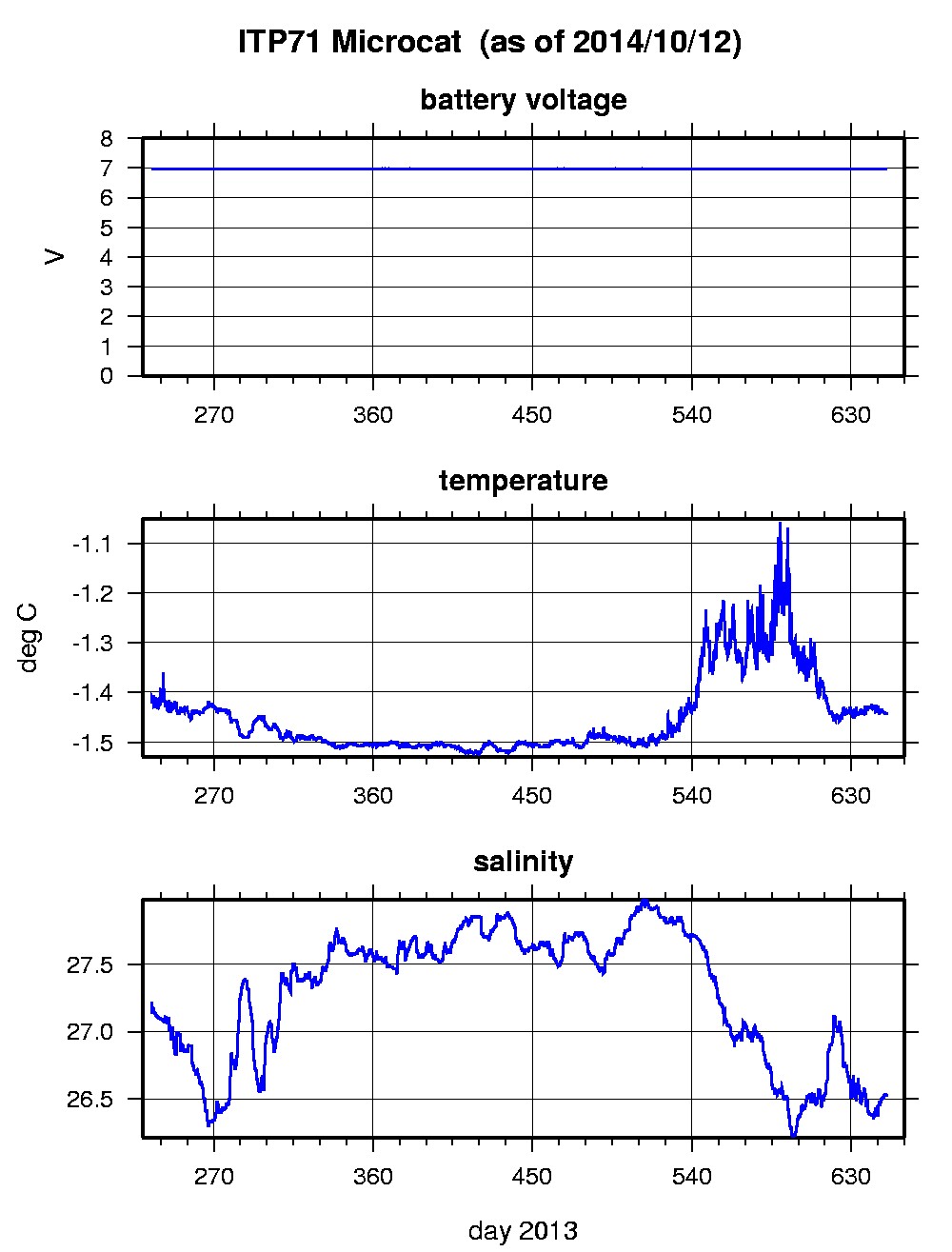
Last buoy status on 2014/10/11 230001 UTC : temperature = -6.58 °C, battery = 10.94 V Last position on 2014/10/11 230006 UTC : 75.249° N, 139.6707° W Last profile (number 2080) on 2014/2/24 2102 UTC Last profile mean motor current = NaN mA, mean battery = NaN V Last profile depth: minimum = NaN, maximum = NaN m Last profile temperature: minimum = NaN, maximum = NaN °C Last profile salinity: minimum = NaN, maximum = NaN Last Microcat sample (number 39913) on 2014/10/12 1 UTC Last battery = 6.96 V, temperature = -1.4452 °C, salinity = 26.5253 The raw GPS buoy location data are available in an ASCII file: itp71rawlocs.dat Depth averaged profiler data files (with interpolated location) and time series microcat data are available in two formats: ITP71 was deployed on a 2.63 m thick icefloe in the Beaufort Sea on August 22, 2013 at 77° 31.3 N, 147° 52.2 W as part of the Beaufort Gyre Observing System (BGOS) during the JOIS 2013 cruise on the CCGS Louis S. St. Laurent. On the same icefloe, a US Army Cold Regions Research and Engineering Laboratory (CRREL) Ice Mass Balance Buoy (IMB), and Marlin-Yug Uptempo buoy were also installed. The ITP includes a second generation prototype MAVS current sensor operating on a pattern profiling schedule (but unable to acquire sensor data) and SBE-37 microcat fixed at 6 m depth.
|