Ice Tethered Profiler 6 Data Data from ITP6 deployed in September 2006
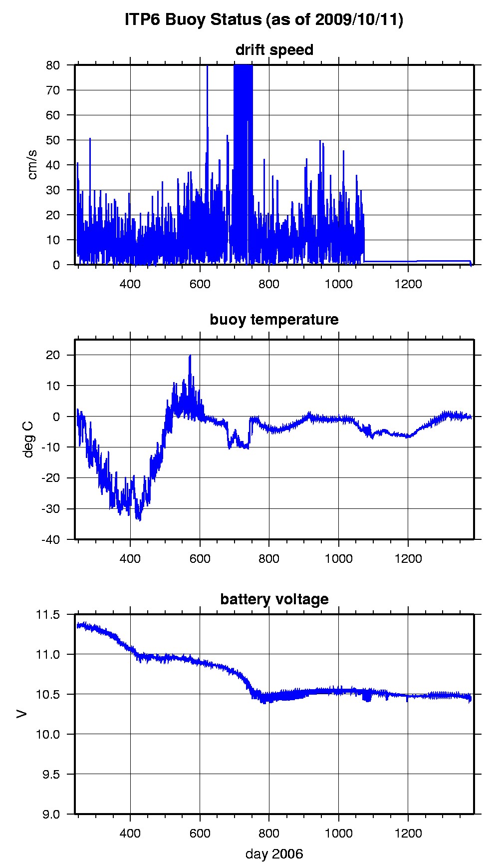
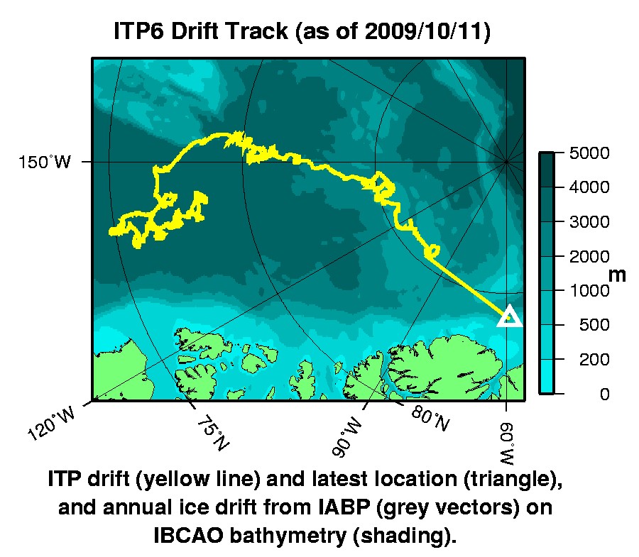
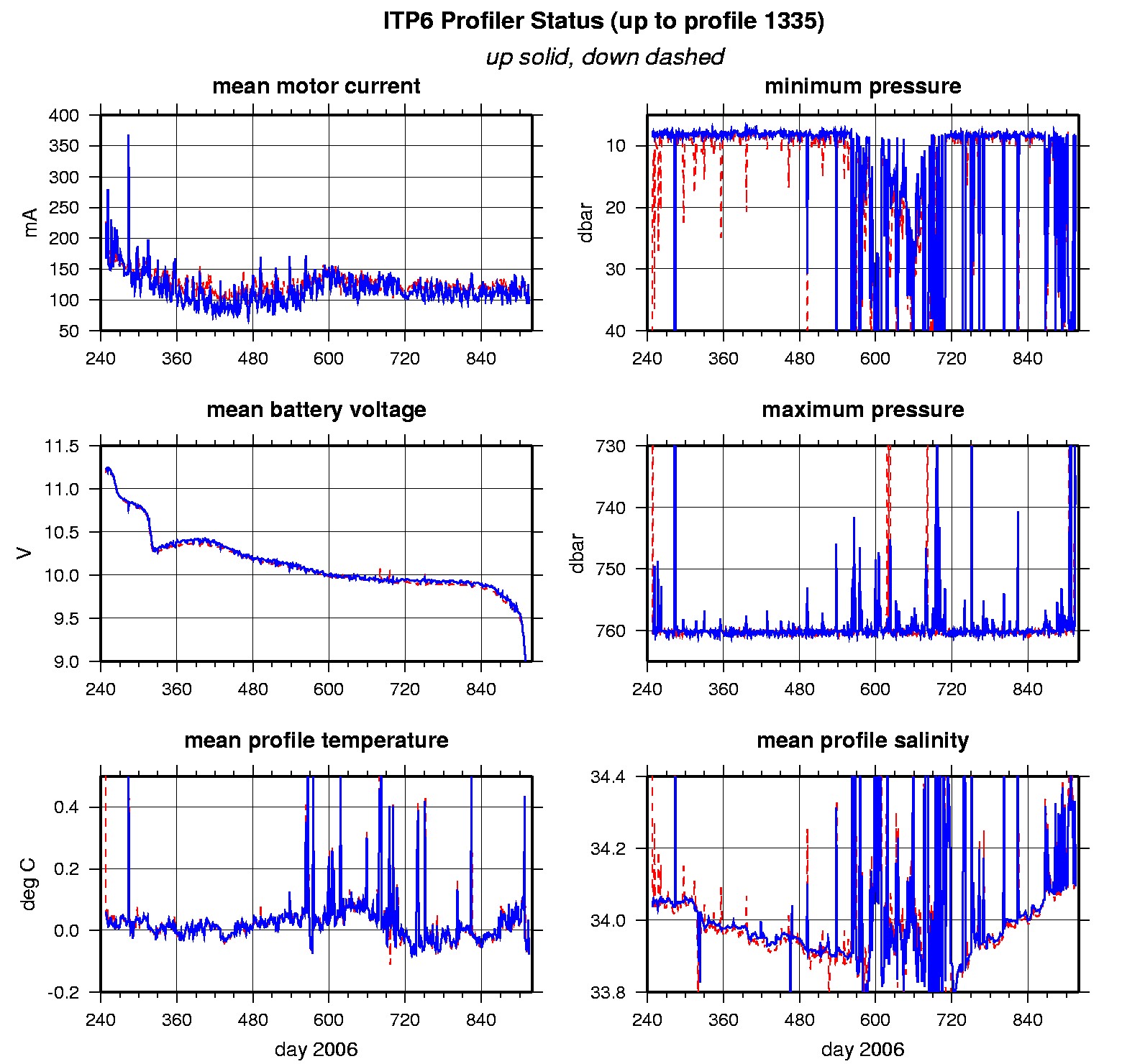
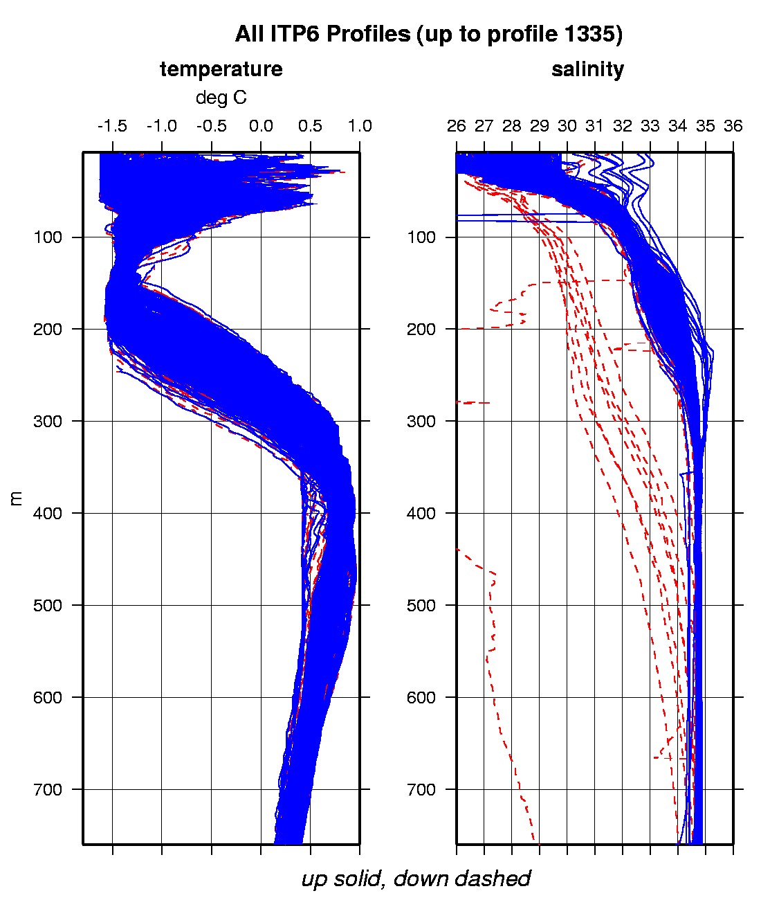
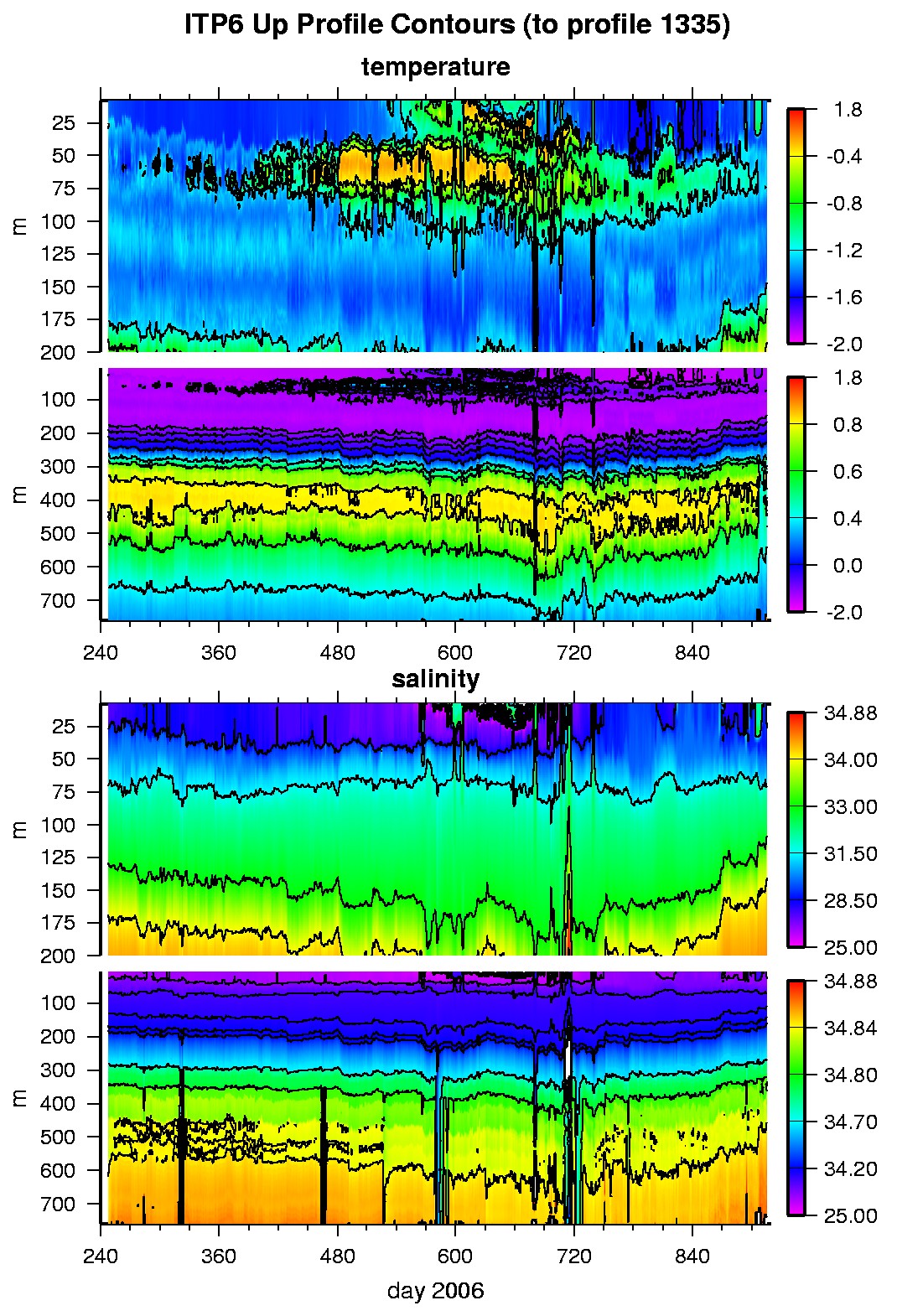
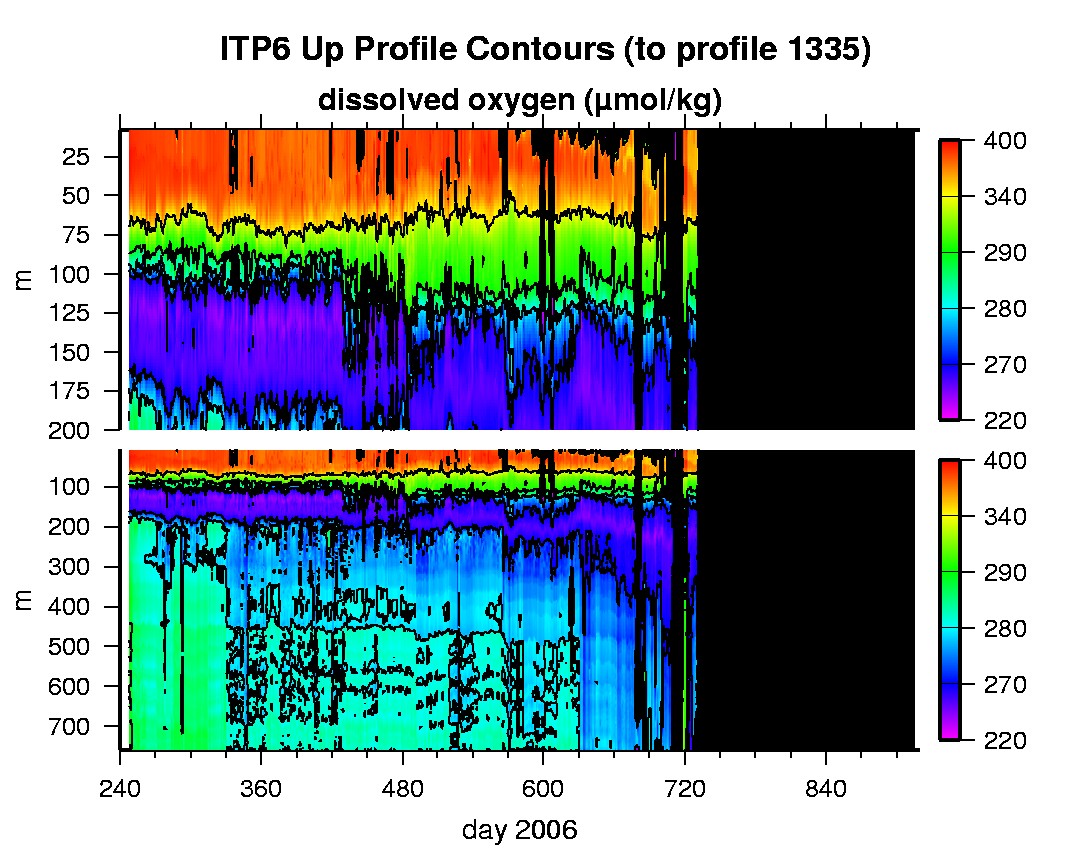
Last buoy status on 2009/10/11 230044 UTC : temperature = -0.31 °C, battery = 10.45 V Last position on 2009/10/11 231310 UTC : 84.0445° N, 58.9217° W Last profile (number 1335) on 2008/7/3 0 UTC Last profile mean motor current = 93.5497 mA, mean battery = 8.0133 V Last profile depth: minimum = 8.3025, maximum = 739.5332 m Last profile temperature: minimum = -1.4811, maximum = 0.54829 °C Last profile salinity: minimum = 28.644, maximum = 34.8684 Last profile dissolved oxygen: minimum = -86.5804, maximum = -80.6171 μmol/kg The raw GPS buoy location data are available in an ASCII file: itp6rawlocs.dat Depth averaged profiler data files (with interpolated location) are available in two formats: ITP6 was deployed on a 3.1 m thick ice floe on 4 September 2006 near 77.894°N, 140.420 °W in the Beaufort Sea as part of the Beaufort Gyre Observing System (BGOS) during the JWACS 2006 cruise on the CCGS Louis S. St. Laurent. On the same icefloe, a US Army Cold Regions Research and Engineering Laboratory (CRREL) Ice Mass Balance Buoy (IMB 07413) and a Naval Postgraduate School Arctic Ocean Flux Buoy (AOFB) were also installed. The ITP is operating on a standard sampling schedule of 2 one-way profiles between 9 and 760 m depth each day. GPS locations are not avaiable from the ITP between September 13 to November 10, 2007, so hourly averaged Argos locations from the IMB are used for that period.
|