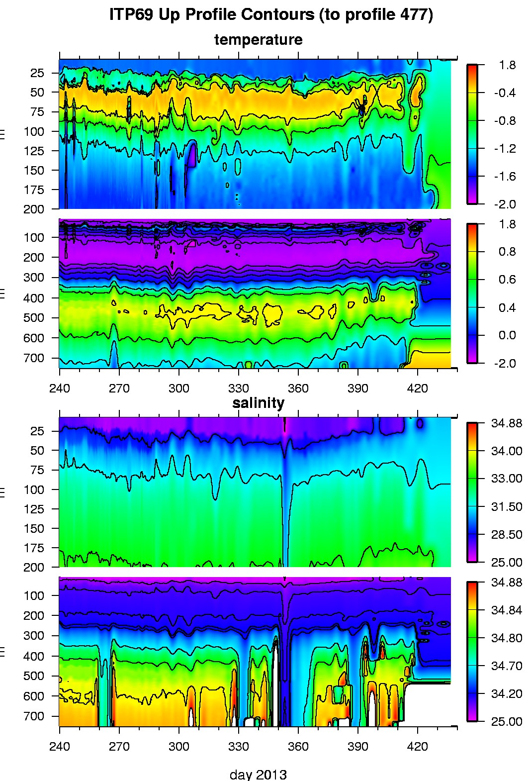
Ice Tethered Profiler 69 Data Data from ITP69 deployed in August 2013
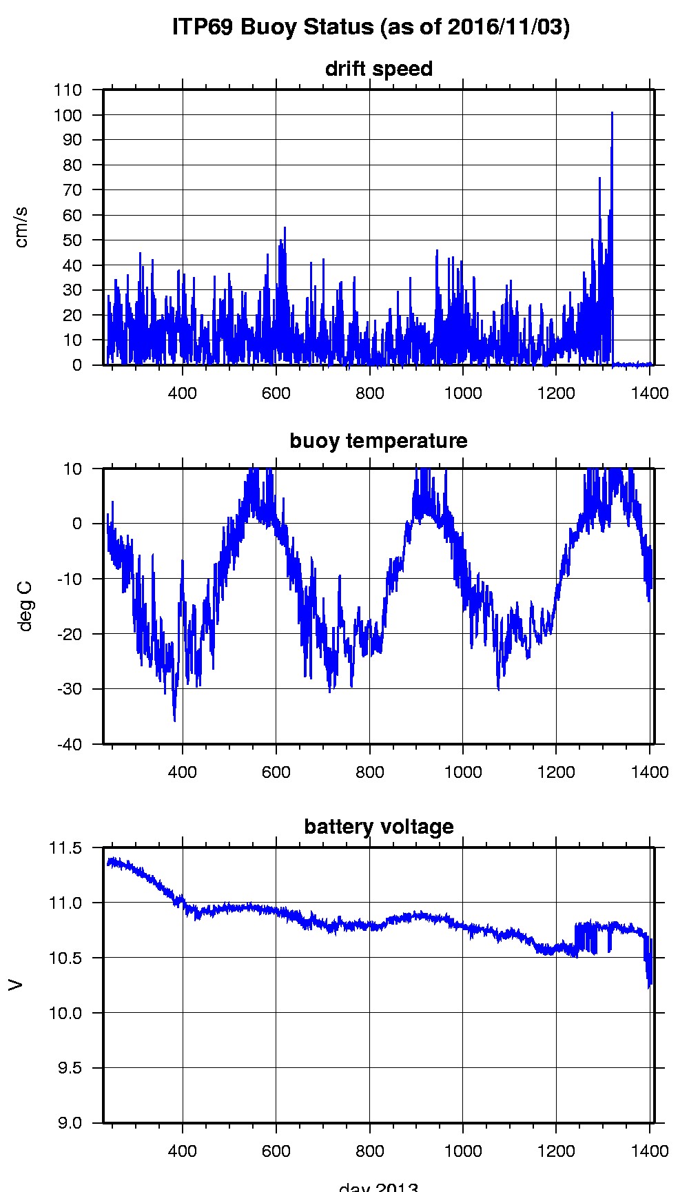
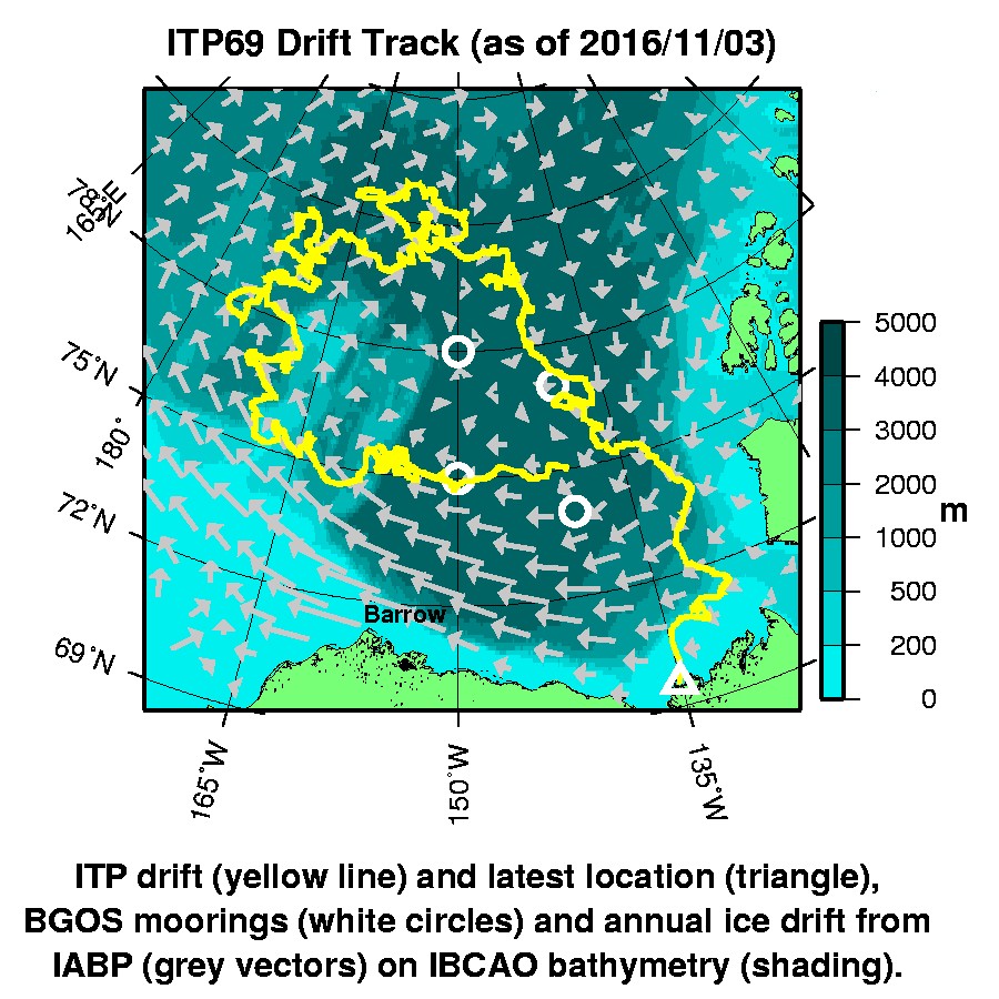
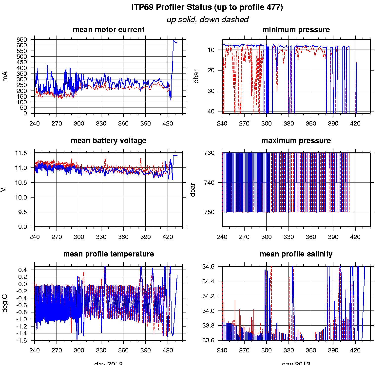
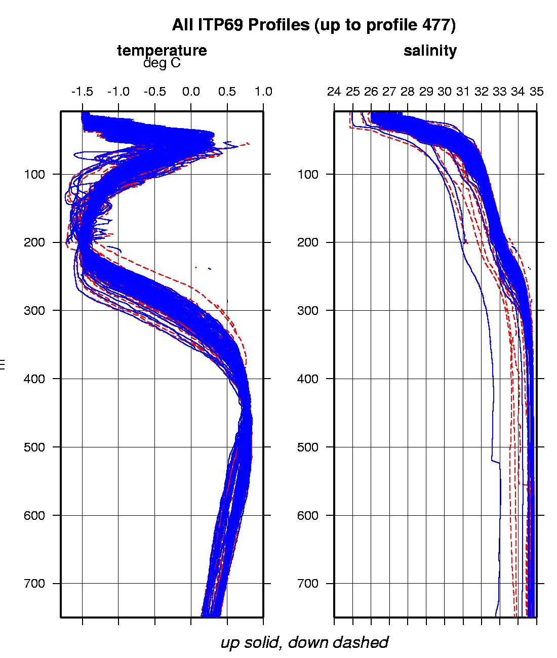
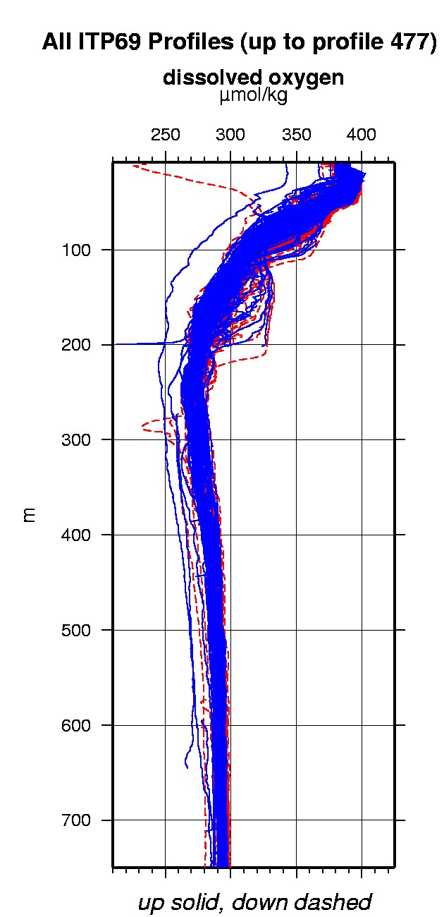
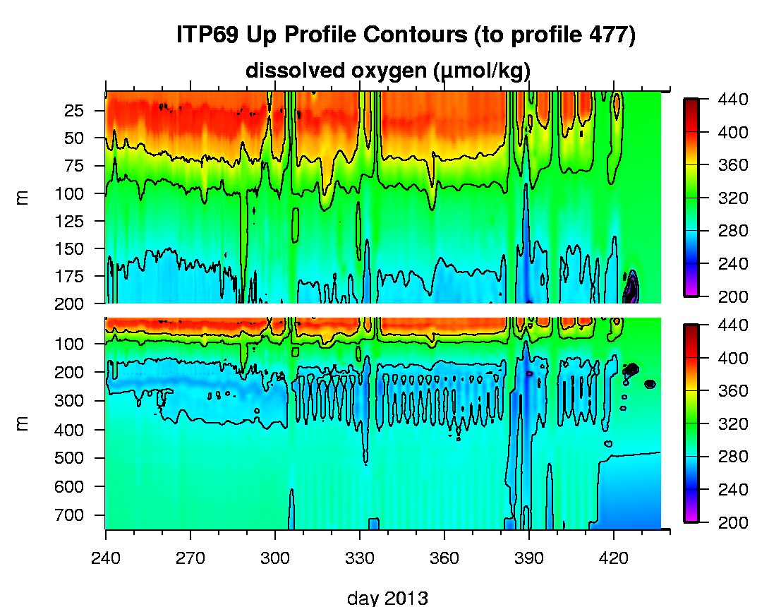
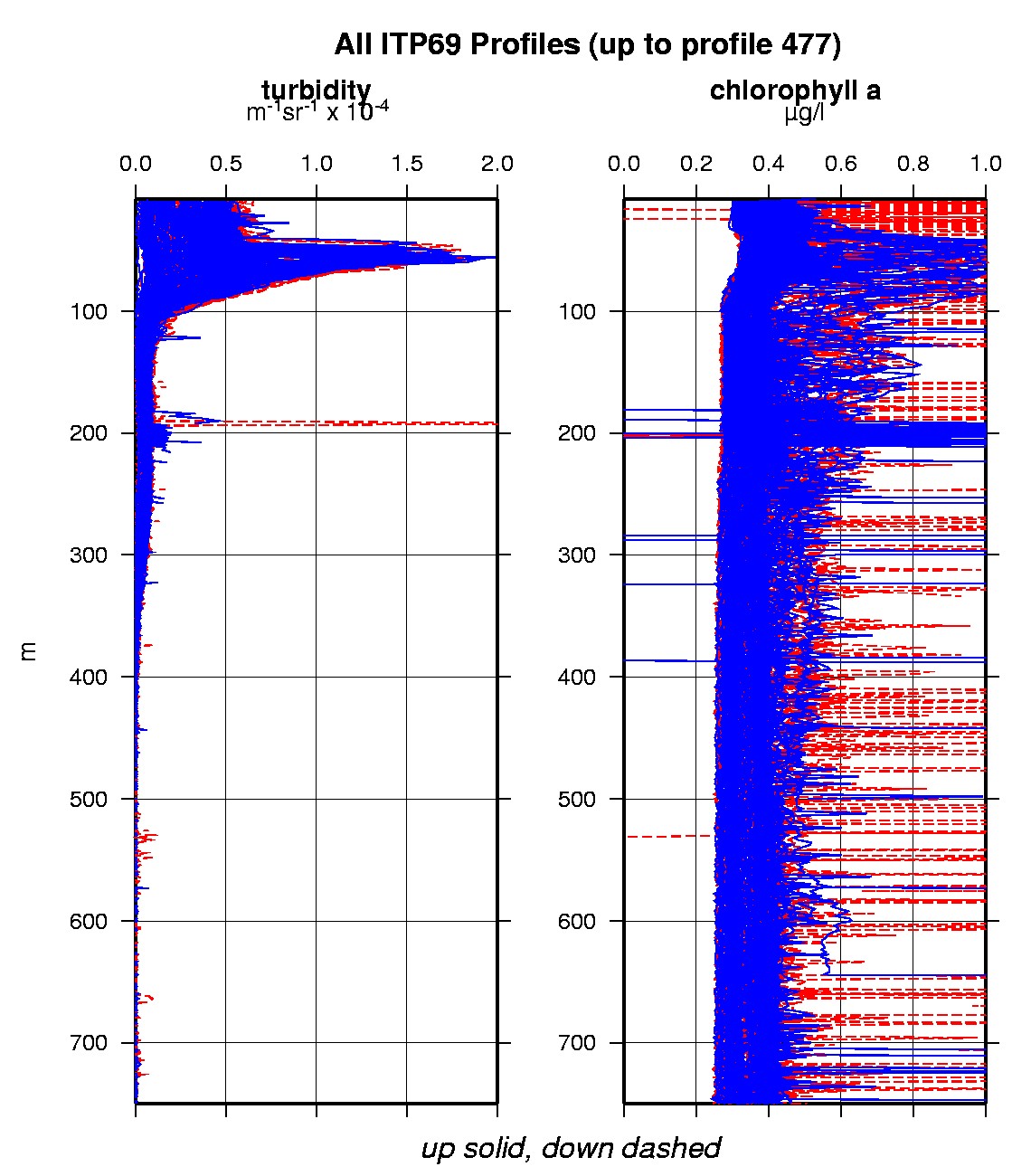
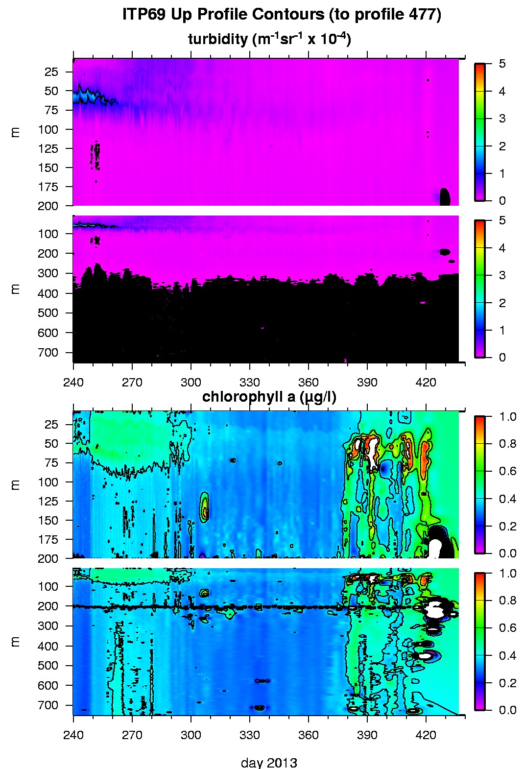
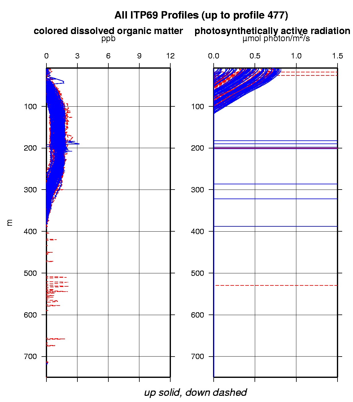
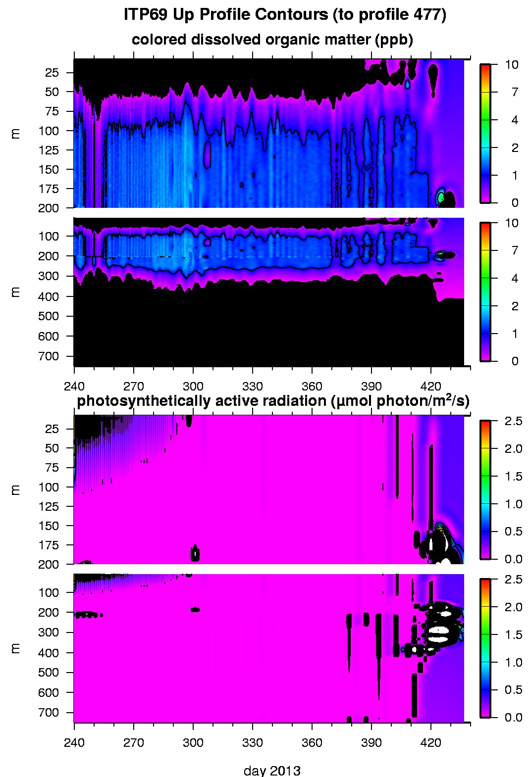
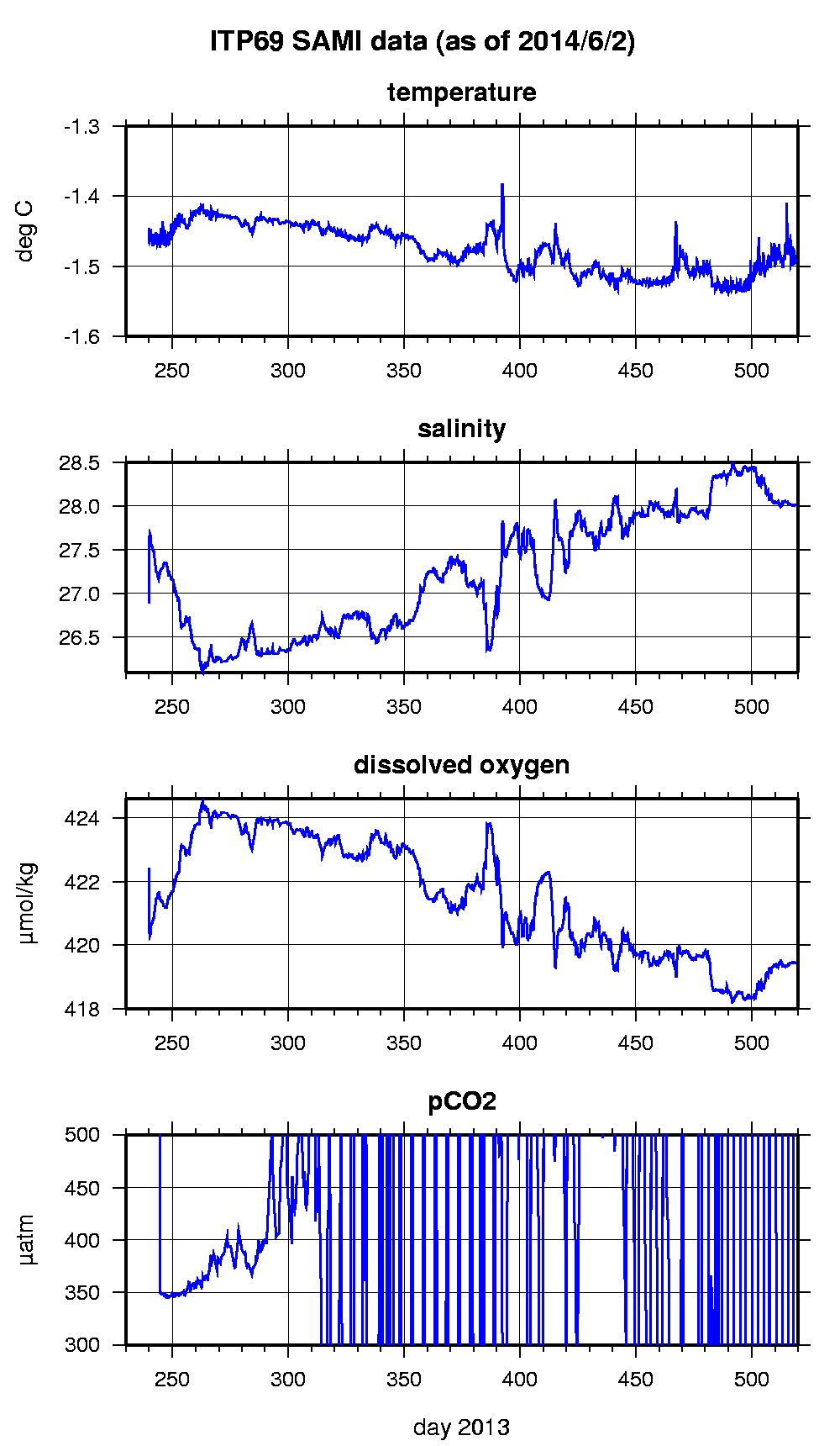
Last buoy status on 2016/11/3 230200 UTC : temperature = -11.85 °C, battery = 10.26 V Last position on 2016/11/3 232122 UTC : 69.538° N, 135.1037° W Last profile (number 477) on 2014/3/12 608 UTC Last profile mean motor current = NaN mA, mean battery = NaN V Last profile depth: minimum = NaN, maximum = NaN m Last profile temperature: minimum = NaN, maximum = NaN °C Last profile salinity: minimum = NaN, maximum = NaN Last profile dissolved oxygen: minimum = NaN, maximum = NaN μmol/kg Last SAMI IMM transfer on 2014/6/3 13 UTC Last Microcat sample (number 2926) on 2014/6/2 231528 UTC Last temperature = -1.4947 °C, salinity = 28.0234 Last Optode sample (number 2926) on 2014/3/1 131523 UTC Last Dissolved Oxygen = 419.417 μmol/kg Last SAMI pCO2 sample (number 2926) on 2014/6/2 231517 UTC Last pCO2 = -1249.7449 μatm The raw GPS buoy location data are available in an ASCII file: itp69rawlocs.dat Depth averaged profiler data files (with interpolated location) and time series SAMI data are available in two formats: ITP69 was deployed on a 2.9 m thick ice floe in the Beaufort Sea on August 27, 2013 at 75° 0.5 N, 140° 2.5 W as part of the Beaufort Gyre Observing System (BGOS) during the JOIS 2012 cruise on the CCGS Louis S. St. Laurent. On the same icefloe, a US Army Cold Regions Research and Engineering Laboratory (CRREL) Seasonal Ice Mass Balance Buoy (S-IMB) was also installed. The ITP includes a dissolved oxygen sensor and full biosuite system operating on a pattern profiling sampling schedule including one full one-way profile between 9 and 760 m depth every 1.5 days and a fixed SAMI PCO2 and SAMI pH at 6 m depth. More information on the biosuite sensor package and data handling can be found here .
|