Ice Tethered Profiler 68 Data Data from ITP68 deployed in August 2013
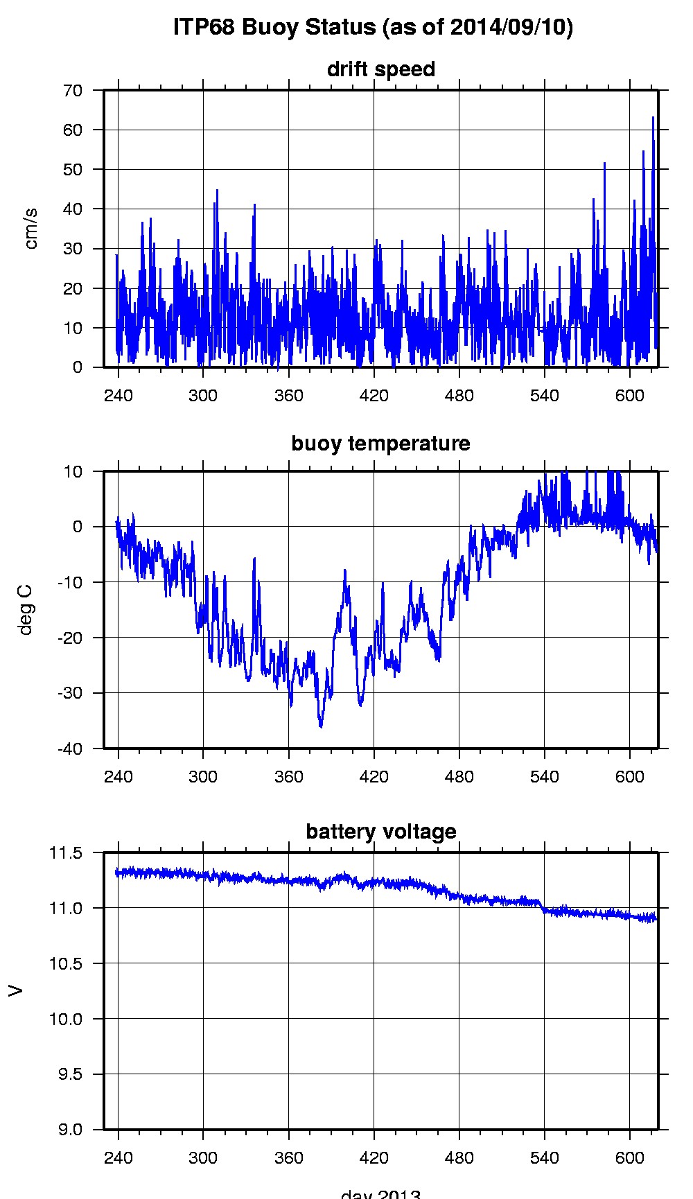
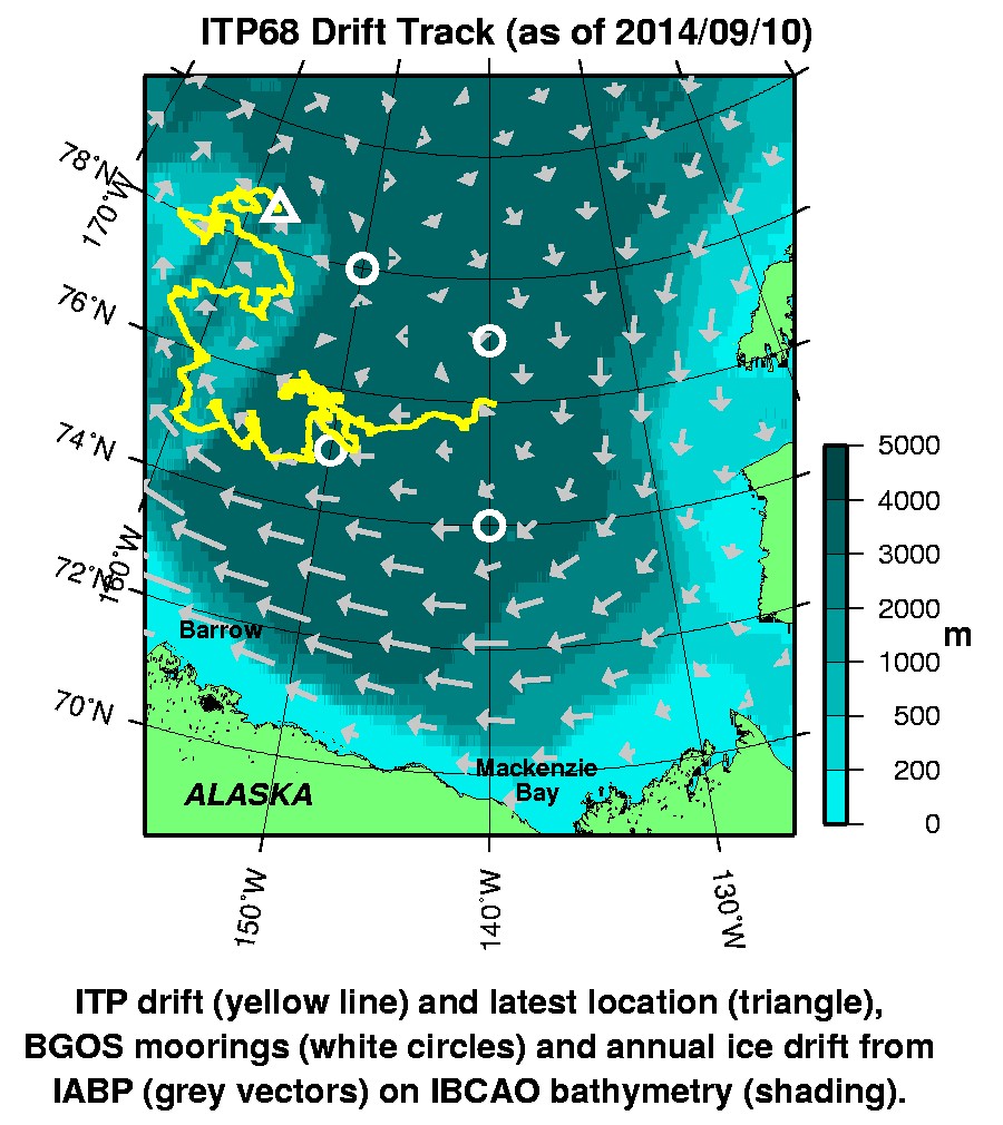
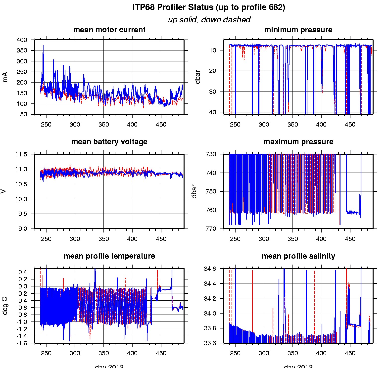
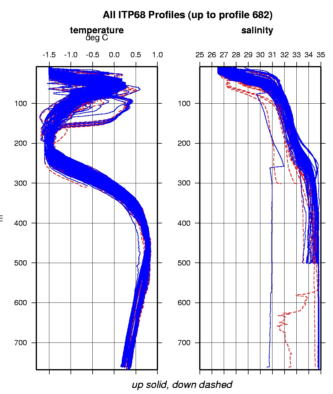
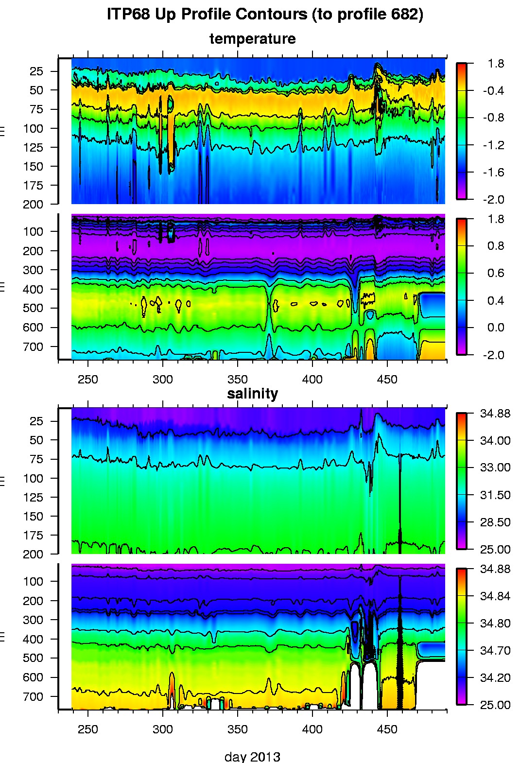
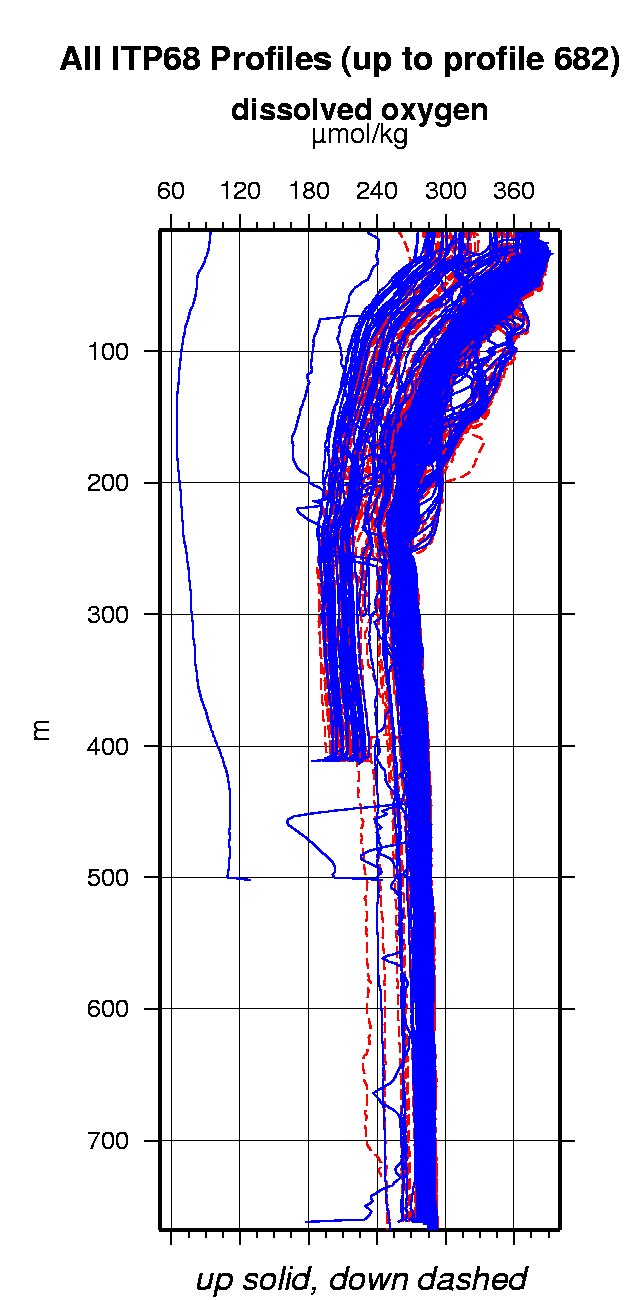
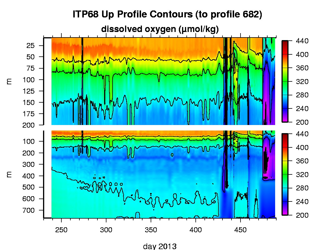
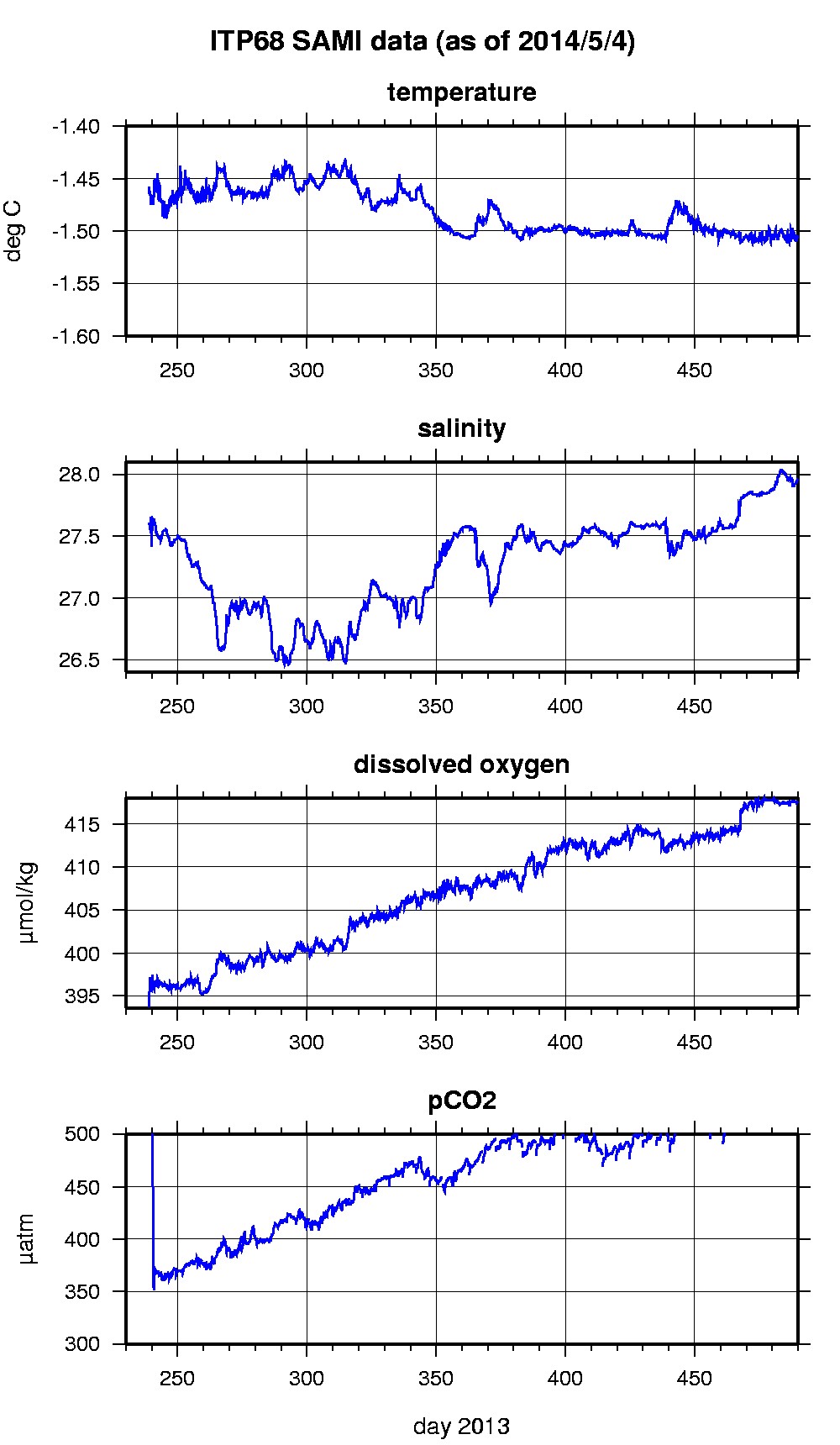
Last buoy status on 2014/9/10 230028 UTC : temperature = -3.22 °C, battery = 10.9 V Last position on 2014/9/10 230031 UTC : 78.5978° N, 157.5956° W Last profile (number 682) on 2014/5/3 602 UTC Last profile mean motor current = 120.6384 mA, mean battery = 10.8356 V Last profile depth: minimum = 9.2638, maximum = 411.2672 m Last profile temperature: minimum = -1.5001, maximum = 0.73683 °C Last profile salinity: minimum = 27.894, maximum = 34.7876 Last profile dissolved oxygen: minimum = 217.0968, maximum = 328.9811 μmol/kg Last SAMI IMM transfer on 2014/5/5 13 UTC Last Microcat sample (number 3366) on 2014/5/4 231528 UTC Last temperature = -1.5047 °C, salinity = 27.9586 Last Optode sample (number 3366) on 2013/12/30 91523 UTC Last Dissolved Oxygen = 417.4355 μmol/kg Last SAMI pCO2 sample (number 3366) on 2014/5/4 231517 UTC Last pCO2 = 531.6032 μatm The raw GPS buoy location data are available in an ASCII file: itp68rawlocs.dat Depth averaged profiler data files (with interpolated location) and time series SAMI data are available in two formats: ITP68 was deployed on a 2.49 m thick ice floe in the Beaufort Sea on August 26, 2013 at 75° 59.3 N, 139° 43.2 W as part of the Beaufort Gyre Observing System (BGOS) during the JOIS 2013 cruise on the CCGS Louis S. St. Laurent. On the same icefloe, an Environment Canada Ice Mass Balance Buoy (IMB) and Marlin-Yug Uptempo buoy were also installed. The ITP includes a dissolved oxygen sensor and full biosuite system operating on a pattern profiling sampling schedule including one full one-way profile between 8 and 760 m depth every 1.5 days and a fixed SAMI PCO2 and SAMI pH at 6 m depth. More information on the biosuite sensor package and data handling can be found here .
|