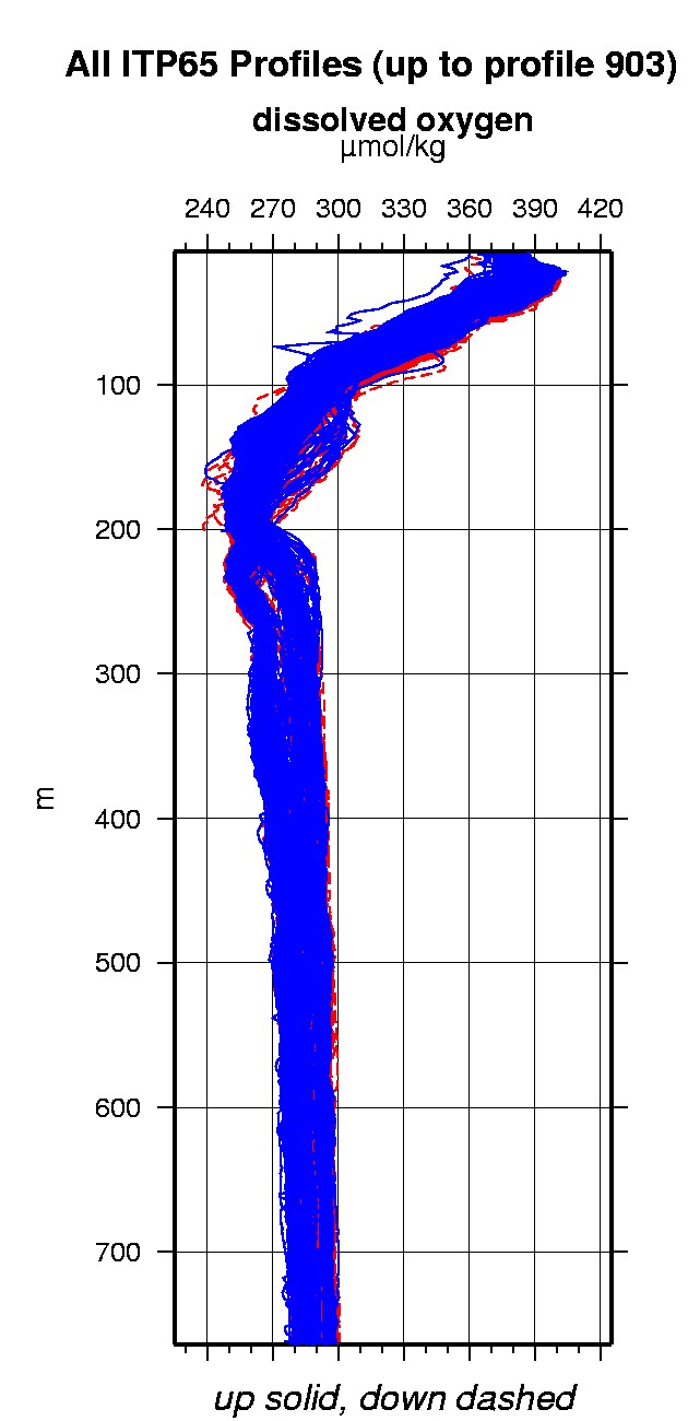
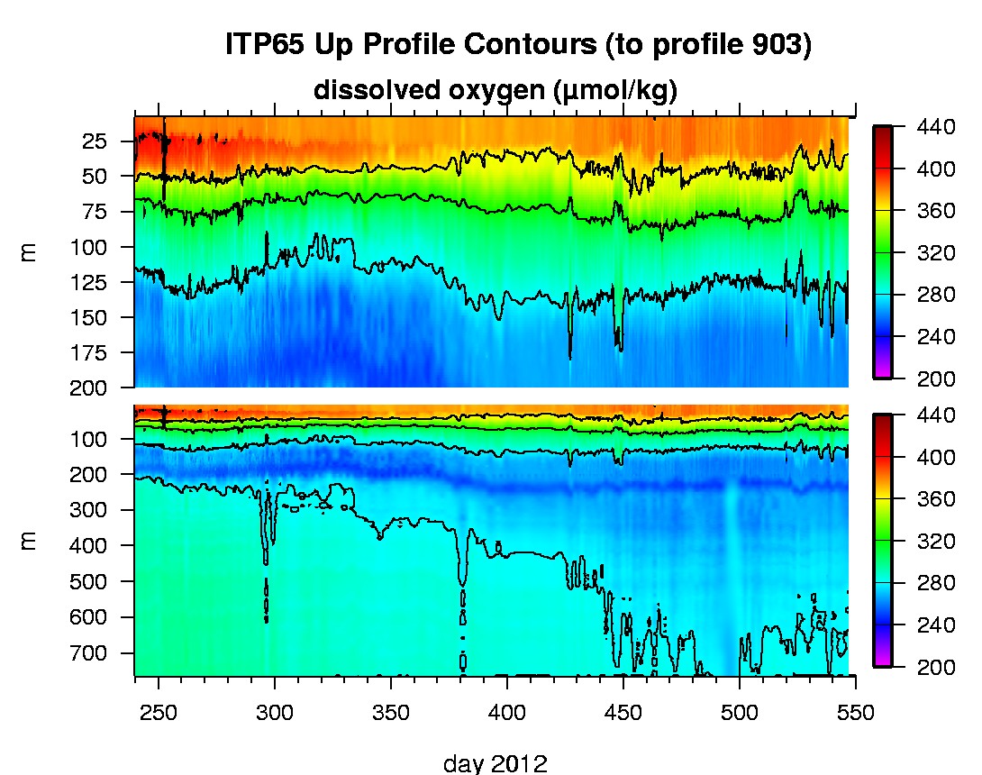
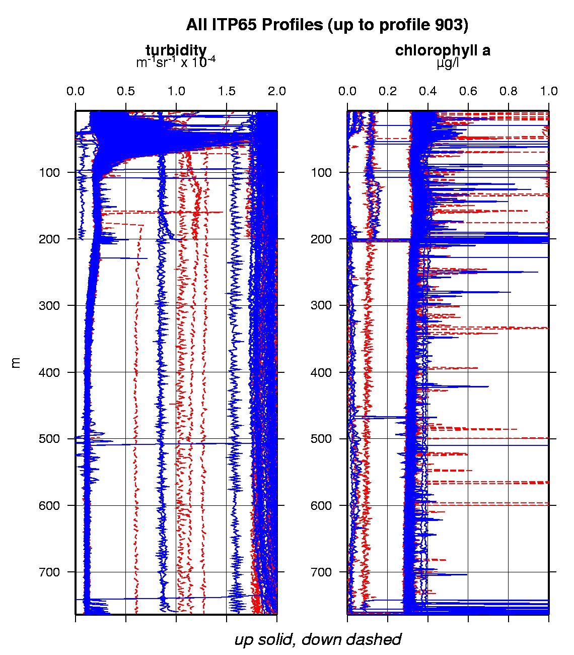
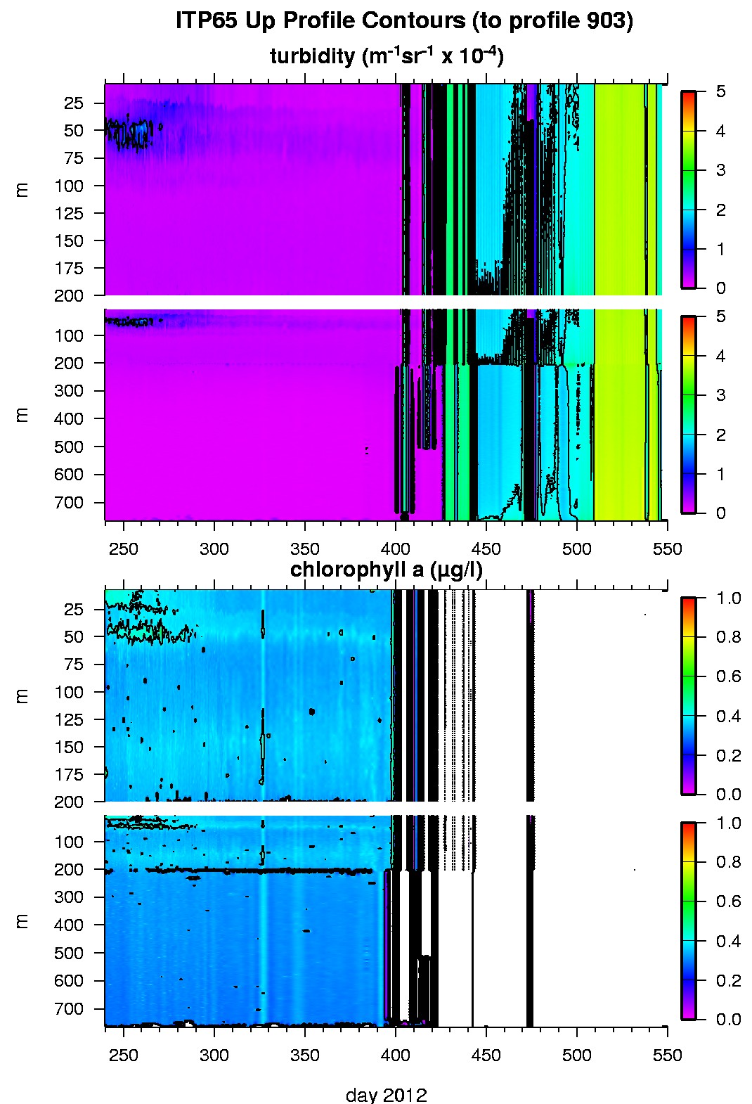
Ice Tethered Profiler 65 Data Data from ITP65 deployed in August 2012
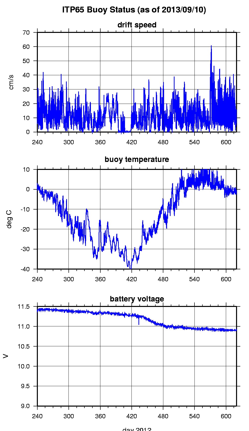
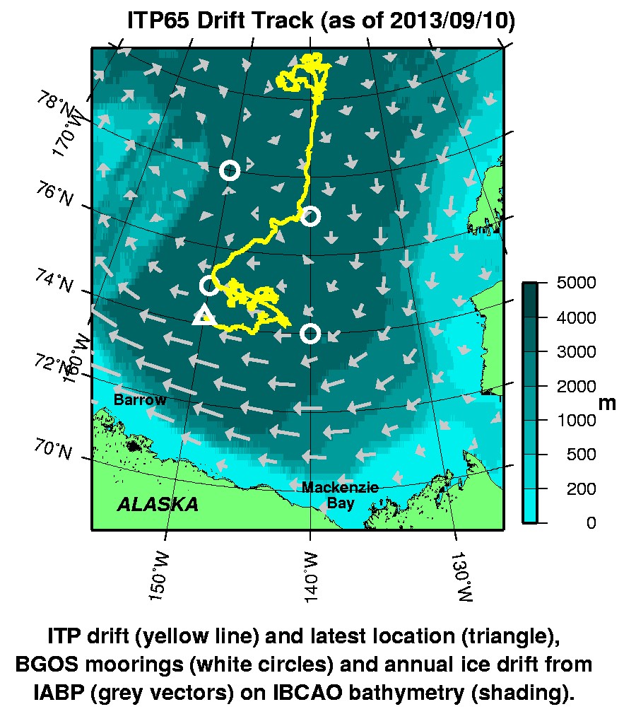
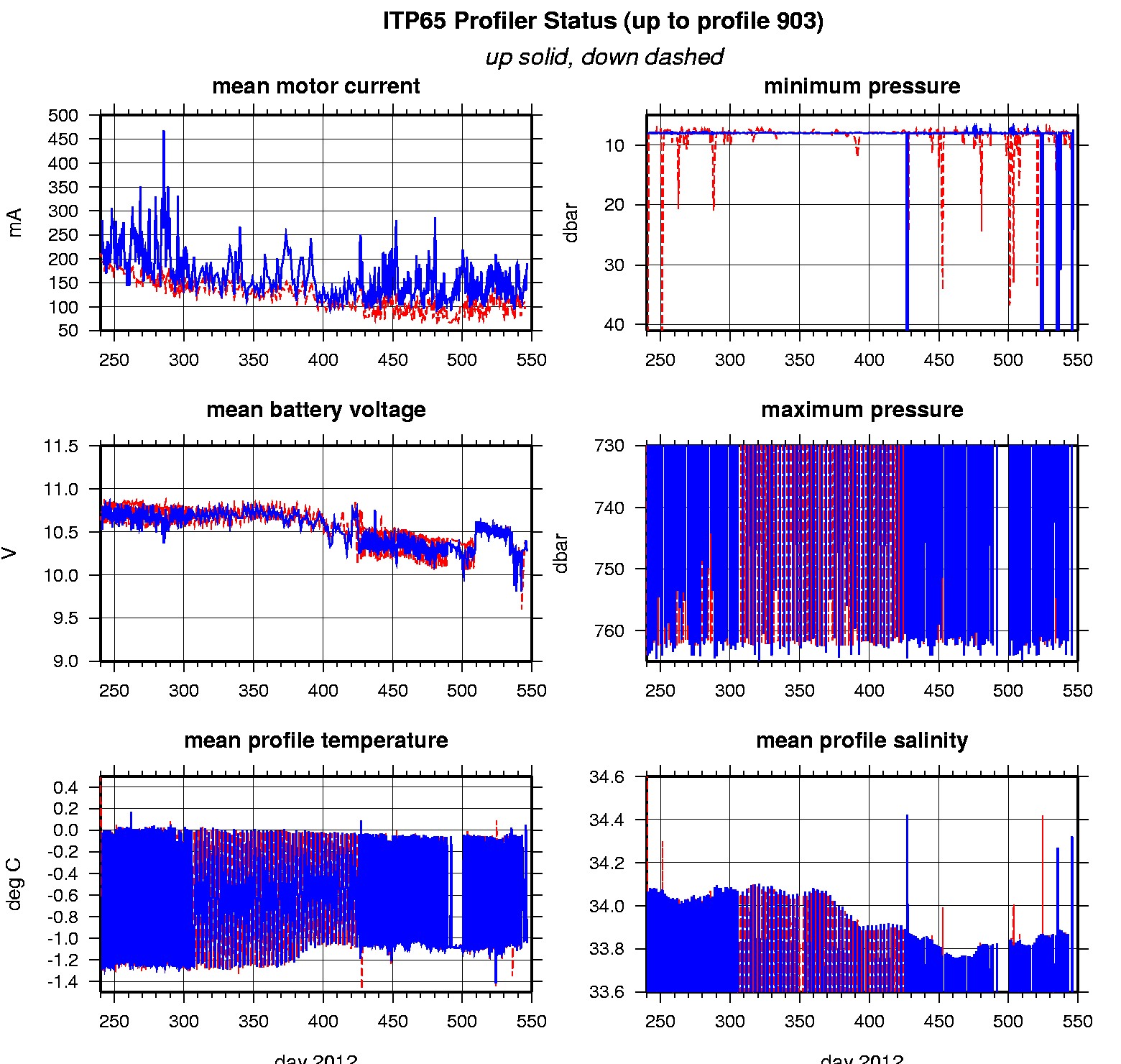
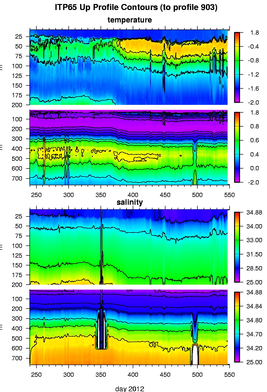
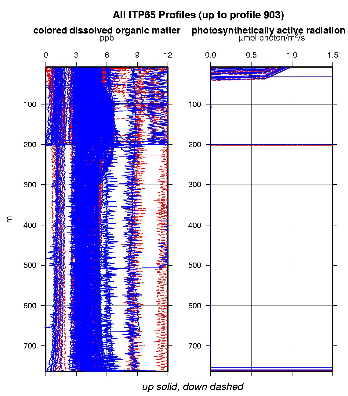
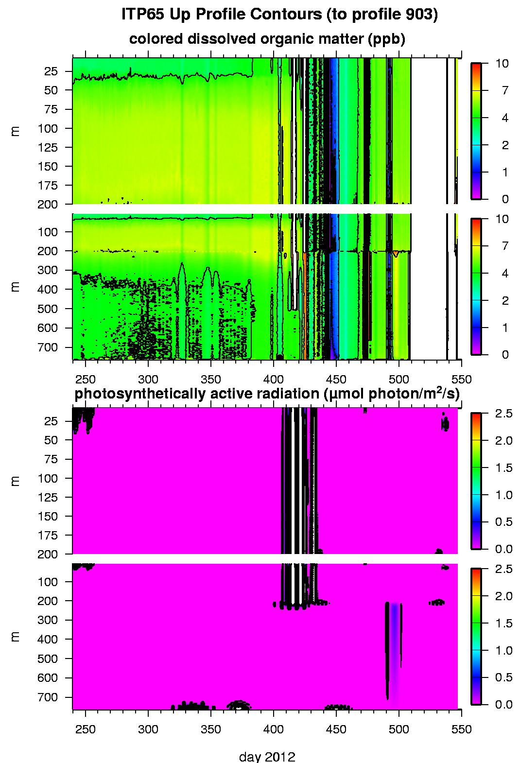
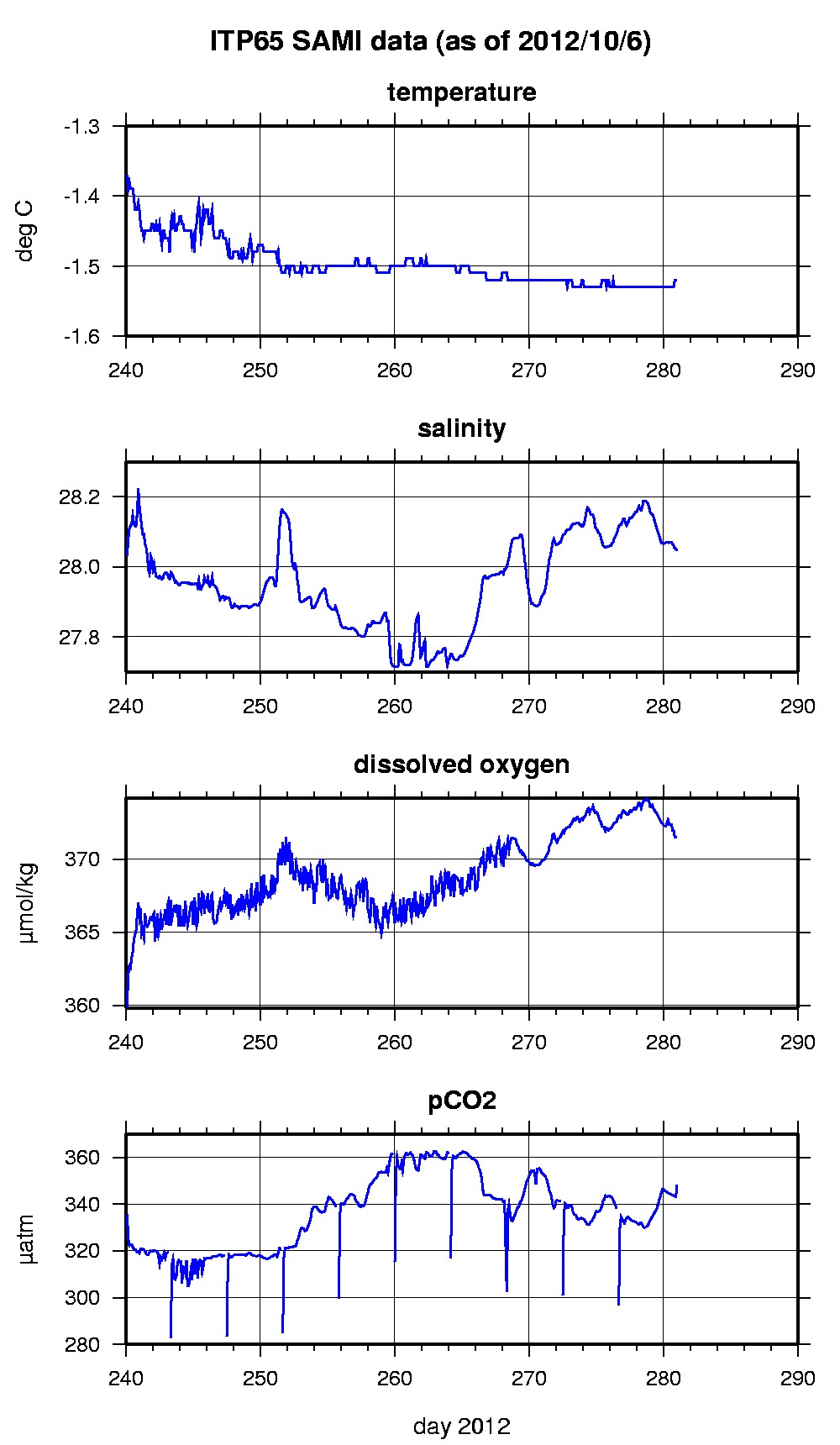
Last buoy status on 2013/9/10 230159 UTC : temperature = -0.52 °C, battery = 10.9 V Last position on 2013/9/10 230159 UTC : 74.1767° N, 149.9916° W Last profile (number 903) on 2013/6/29 1202 UTC Last profile mean motor current = 190.0541 mA, mean battery = 10.2754 V Last profile depth: minimum = 7.4127, maximum = 220.1149 m Last profile temperature: minimum = -1.541, maximum = 0.15369 °C Last profile salinity: minimum = 27.845, maximum = 33.5128 Last profile dissolved oxygen: minimum = 257.2909, maximum = 377.0743 μmol/kg Last SAMI IMM transfer on 2012/10/7 12 UTC Last Microcat sample (number 7005) on 2012/10/6 233030 UTC Last temperature = -1.52 °C, salinity = 28.0473 Last Optode sample (number 7005) on 2012/10/6 233026 UTC Last Dissolved Oxygen = 371.5299 μmol/kg Last SAMI pCO2 sample (number 7005) on 2012/10/6 233017 UTC Last pCO2 = 348.2825 μatm The raw GPS buoy location data are available in an ASCII file: itp65rawlocs.dat Depth averaged profiler data files (with interpolated location) and time series SAMI data are available in two formats: ITP65 was deployed on a 1.52 m thick ice floe in the Beaufort Sea on August 27, 2012 at 80° 53.4 N, 137° 25.8 W as part of the Beaufort Gyre Observing System (BGOS) during the JOIS 2012 cruise on the CCGS Louis S. St. Laurent. On the same icefloe, a Naval Postgraduate School Arctic Ocean Flux Buoy (AOFB), a US Army Cold Regions Research and Engineering Laboratory (CRREL) Ice Mass Balance Buoy (IMB), an autonomous atmospheric chemistry buoy (O-Buoy) and an Ice-Tethered Micro were also installed. The ITP includes a dissolved oxygen sensor and full biosuite system and a fixed SAMI PCO2 with SBE-37 microcat at 6 m depth and is operating on a pattern profiling sampling schedule including one full one-way profile between 7 and 760 m depth every 1.5 days. More information on the biosuite sensor package and data handling can be found here .
|