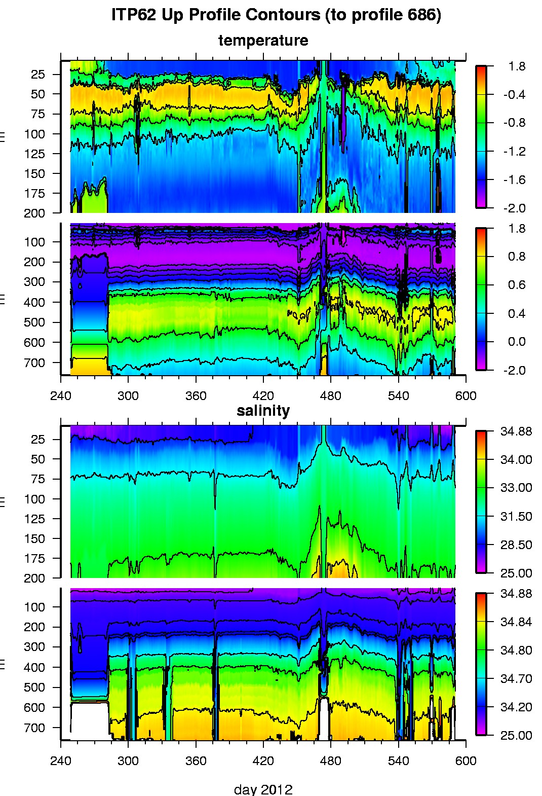
Ice Tethered Profiler 62 Data Data from ITP62 deployed in September 2012
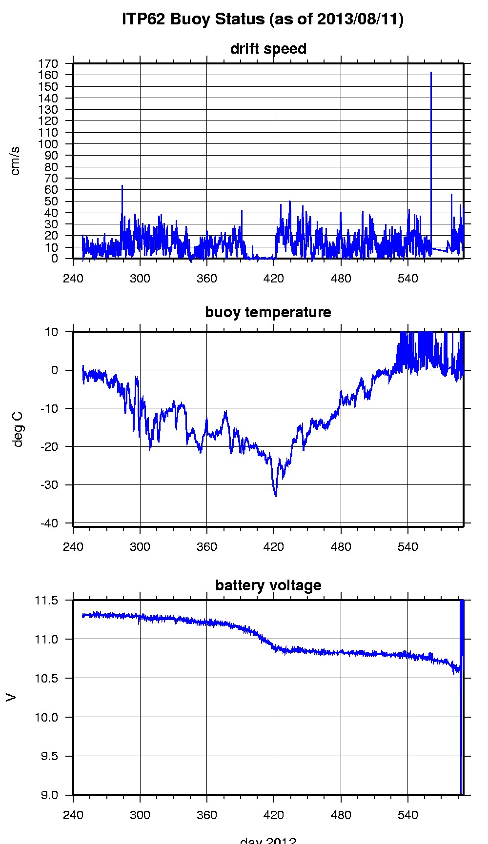
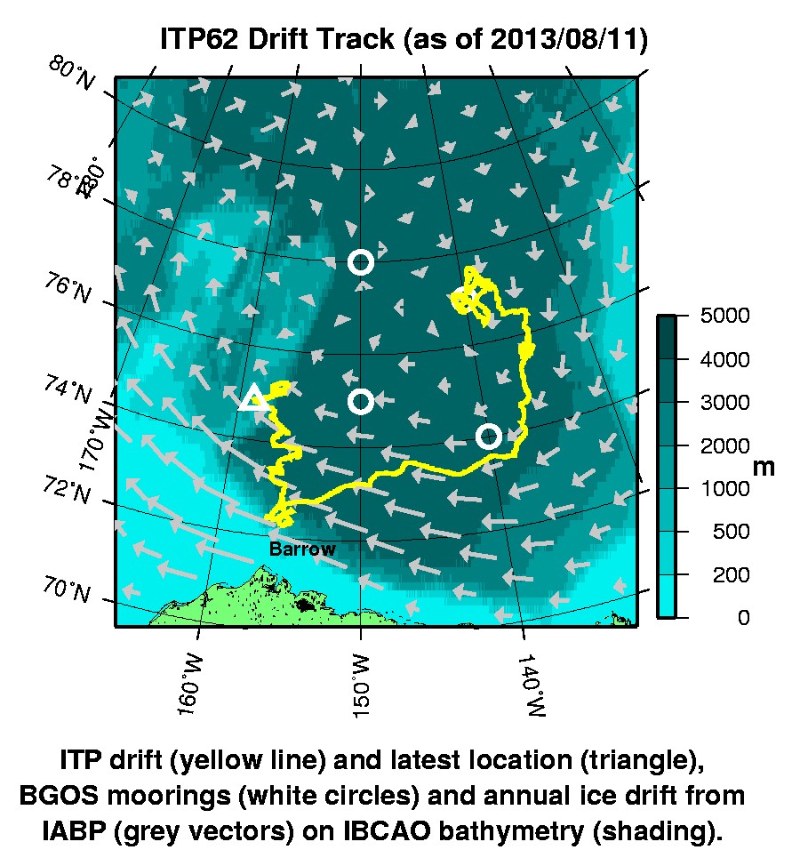
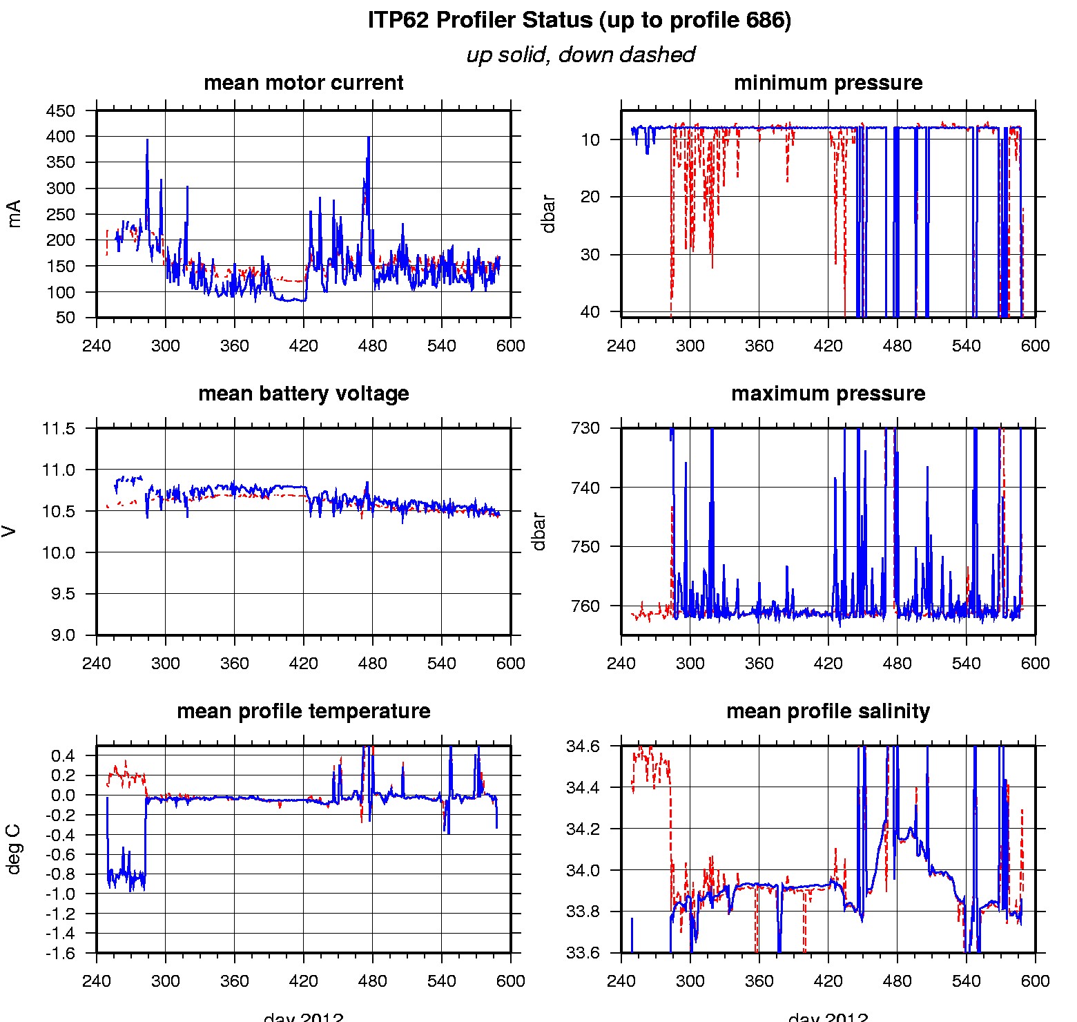
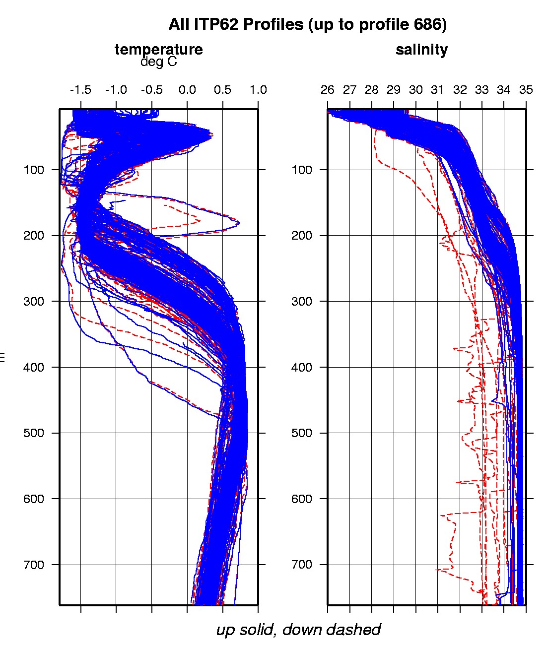
Last buoy status on 2013/8/11 230011 UTC : temperature = 0.02 °C, battery = 12.52 V Last position on 2013/8/11 230011 UTC : 74.8267° N, 158.8068° W Last profile (number 686) on 2013/8/12 600 UTC Last profile mean motor current = 149.3624 mA, mean battery = 10.4647 V Last profile depth: minimum = NaN, maximum = NaN m Last profile temperature: minimum = NaN, maximum = NaN °C Last profile salinity: minimum = NaN, maximum = NaN The raw GPS buoy location data are available in an ASCII file: itp62rawlocs.dat Depth averaged profiler data files (with interpolated location) are available in two formats: ITP62 was deployed in open water the Beaufort Seat on September 4, 2012 at 76° 57.0 N, 139° 32.4 W as part of the Beaufort Gyre Observing System (BGOS) during the JOIS 2012 cruise on the CCGS Louis S. St. Laurent. The ITP is operating on a typical sampling schedule of 2 one-way profiles between 7 and 760 m depth each day.
|