Ice Tethered Profiler 54 Data Data from ITP54 deployed in August 2011
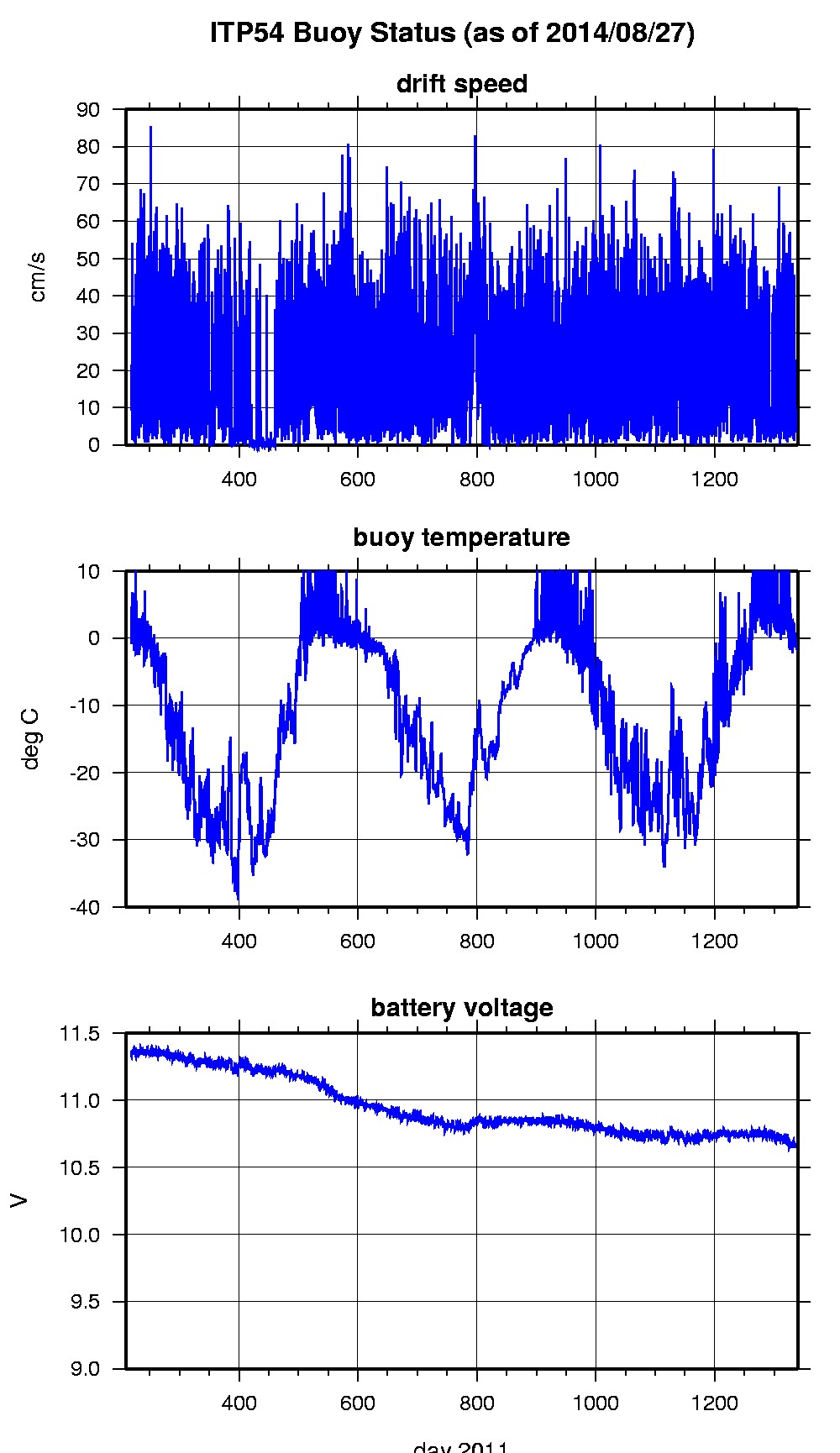
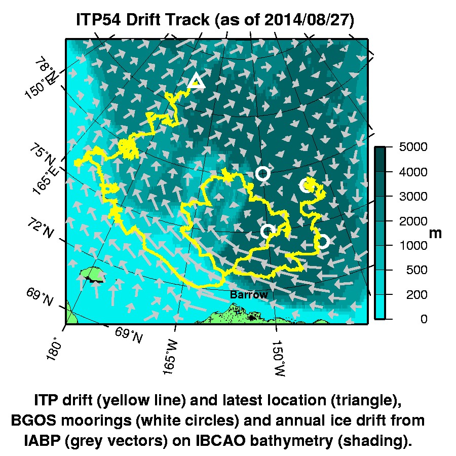
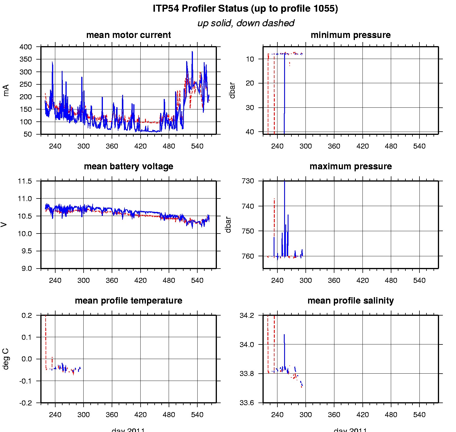
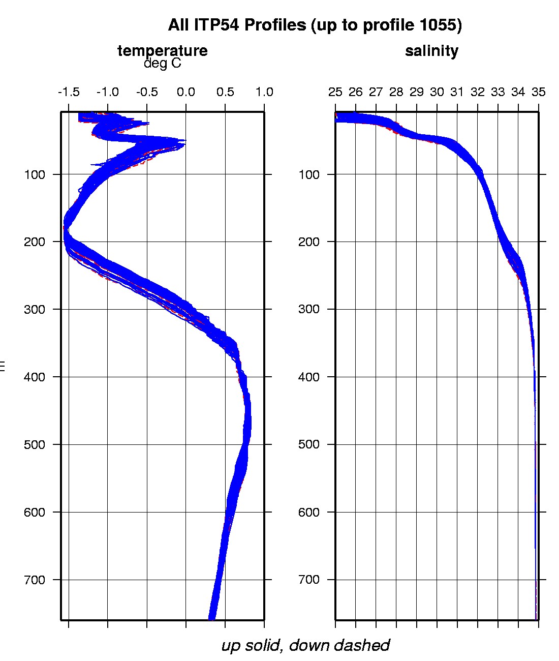
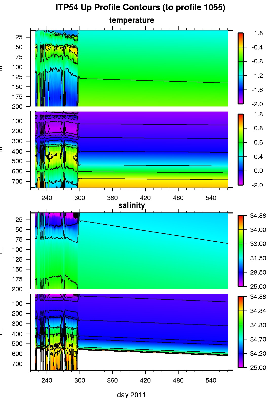
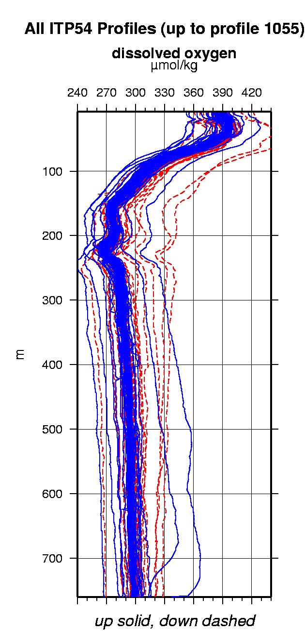
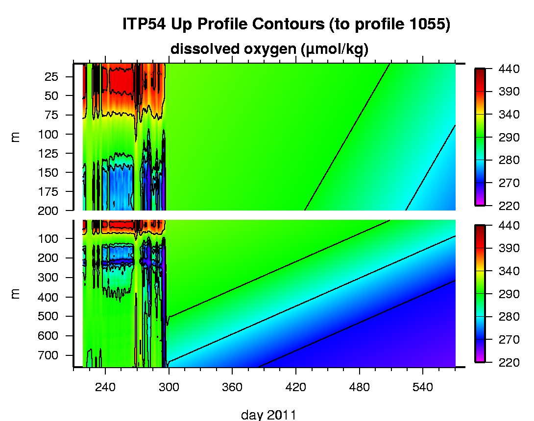
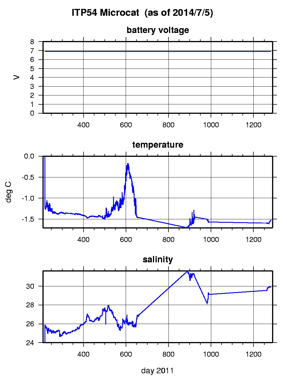
Last buoy status on 2014/8/27 230030 UTC : temperature = 0.03 °C, battery = 10.67 V Last position on 2014/8/27 230031 UTC : 82.4075° N, 173.6714° W Last profile (number 1055) on 2012/7/23 600 UTC Last profile mean motor current = NaN mA, mean battery = NaN V Last profile depth: minimum = NaN, maximum = NaN m Last profile temperature: minimum = NaN, maximum = NaN °C Last profile salinity: minimum = NaN, maximum = NaN Last profile dissolved oxygen: minimum = NaN, maximum = NaN μmol/kg Last Microcat sample (number 102085) on 2014/7/5 1 UTC Last battery = 6.88 V, temperature = -1.5127 °C, salinity = 29.8805 The raw GPS buoy location data are available in an ASCII file: itp54rawlocs.dat Depth averaged profiler data files (with interpolated location) and time series microcat data are available in two formats: ITP54 was deployed on August 6, 2011 on a 2.23 m thick ice floe in the Beaufort Sea at 77° 0.1 N, 140° 5.7 W as part of the Beaufort Gyre Observing System (BGOS) during the JOIS 2011 cruise on the CCGS Louis S. St. Laurent. On the same icefloe, a Naval Postgraduate School Arctic Ocean Flux Buoy (AOFB 25), a US Army Cold Regions Research and Engineering Laboratory (CRREL) Ice Mass Balance Buoy (IMB), a Yale University array of 3 MetOcean Ice Beacons, and an Uptempo buoy were also installed. The ITP includes a dissolved oxygen sensor and a fixed SBE-37 microcat at 6 m depth and is operating on a standard sampling schedule of 2 one-way profiles between 7 and 760 m depth each day.
|