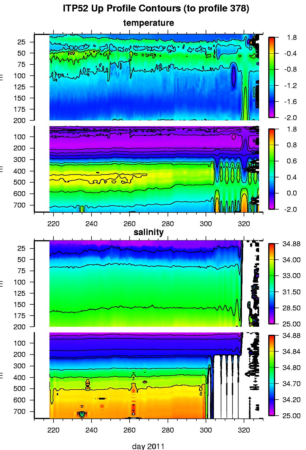
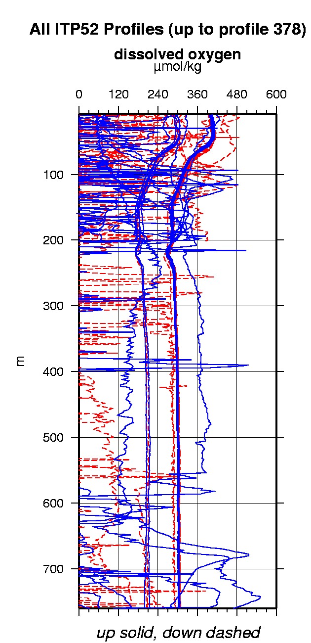
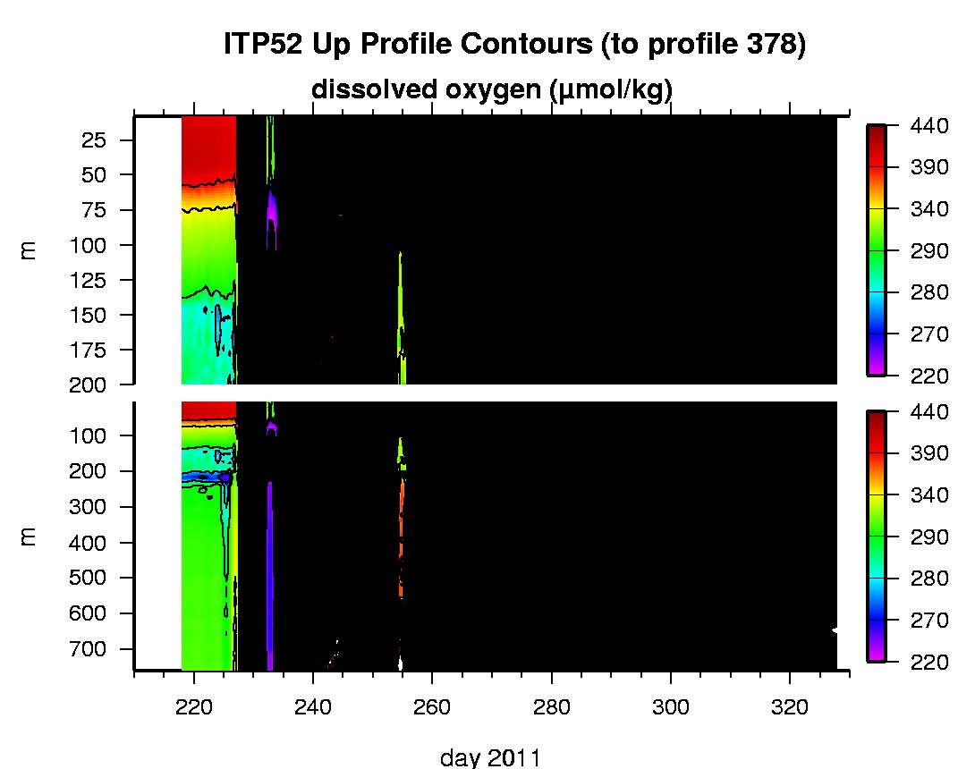
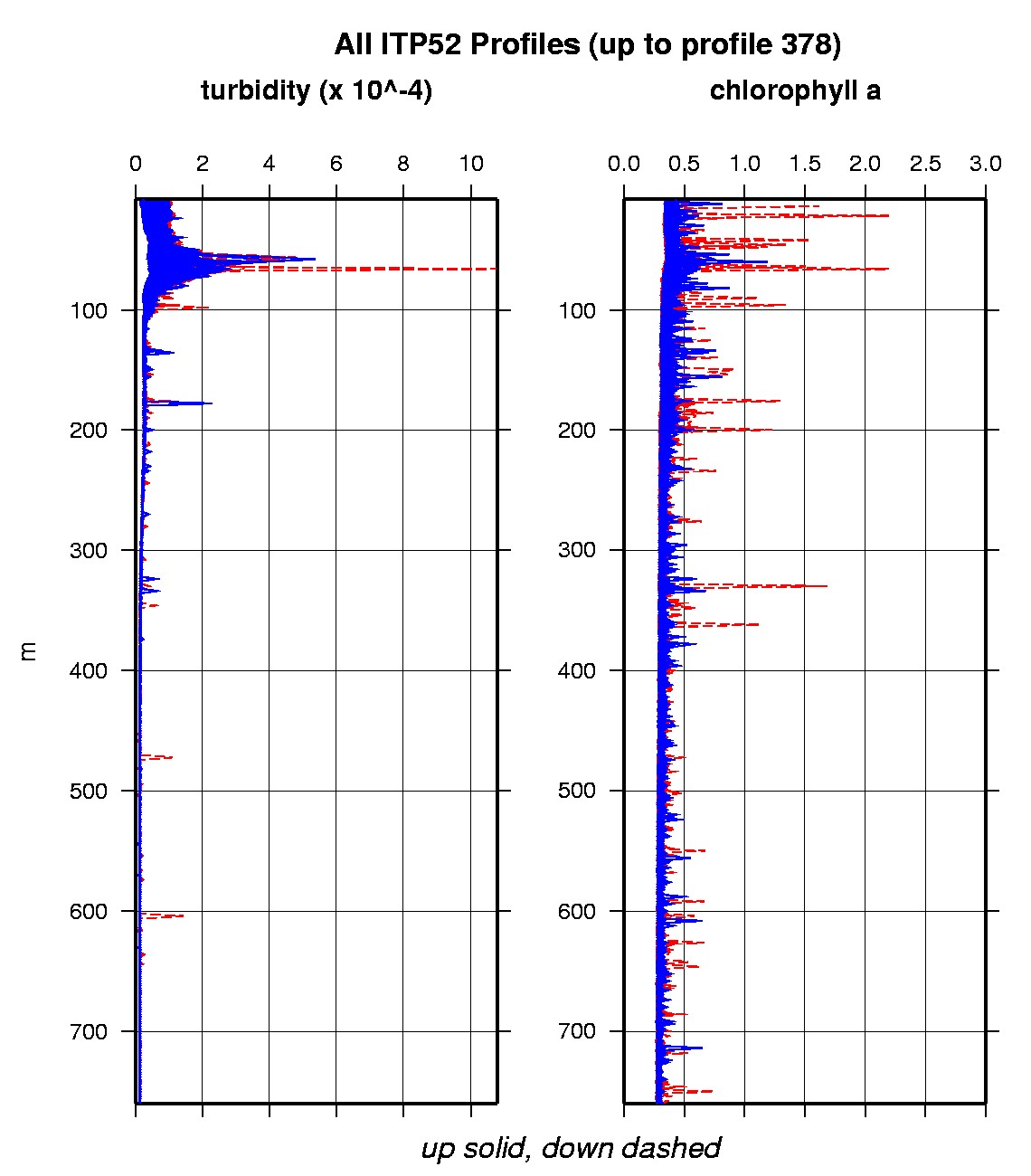
Ice Tethered Profiler 52 Data Data from ITP52 deployed in August 2011
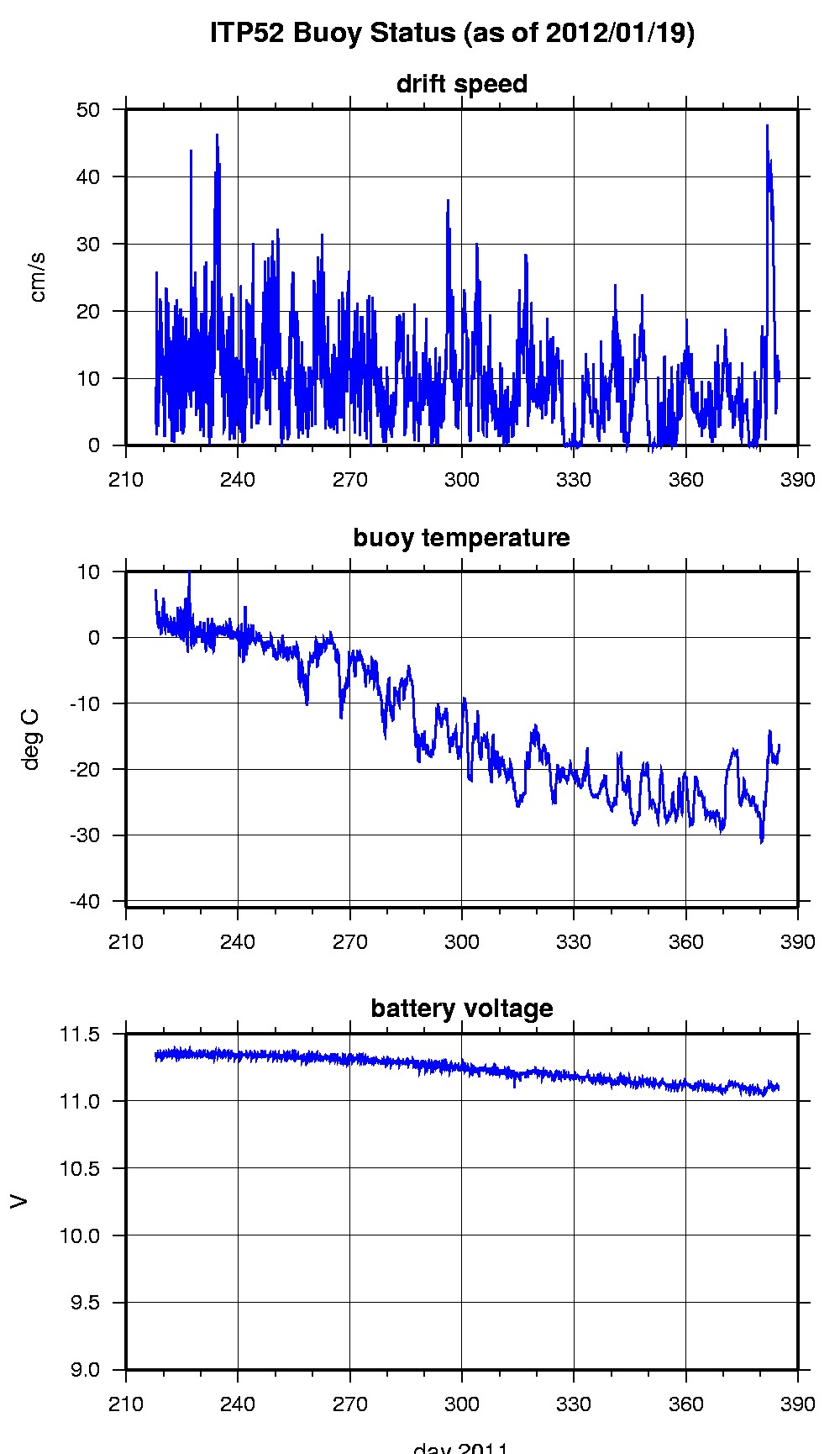
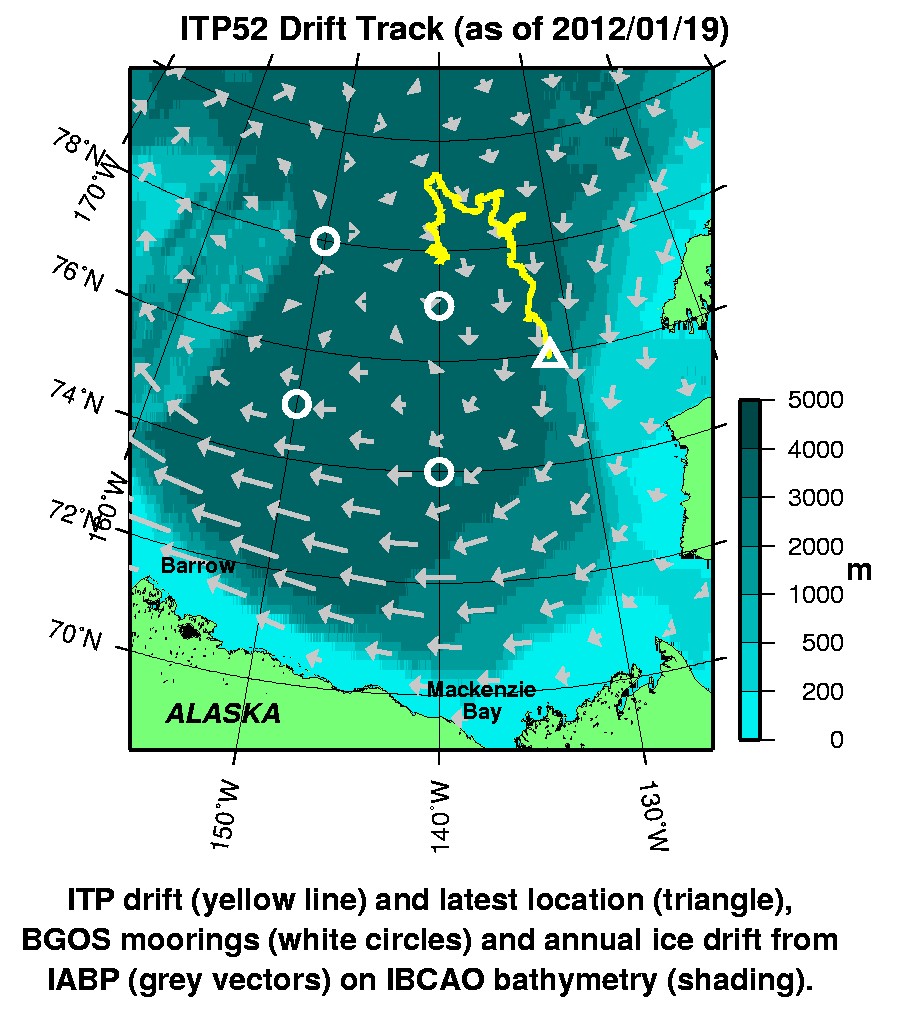
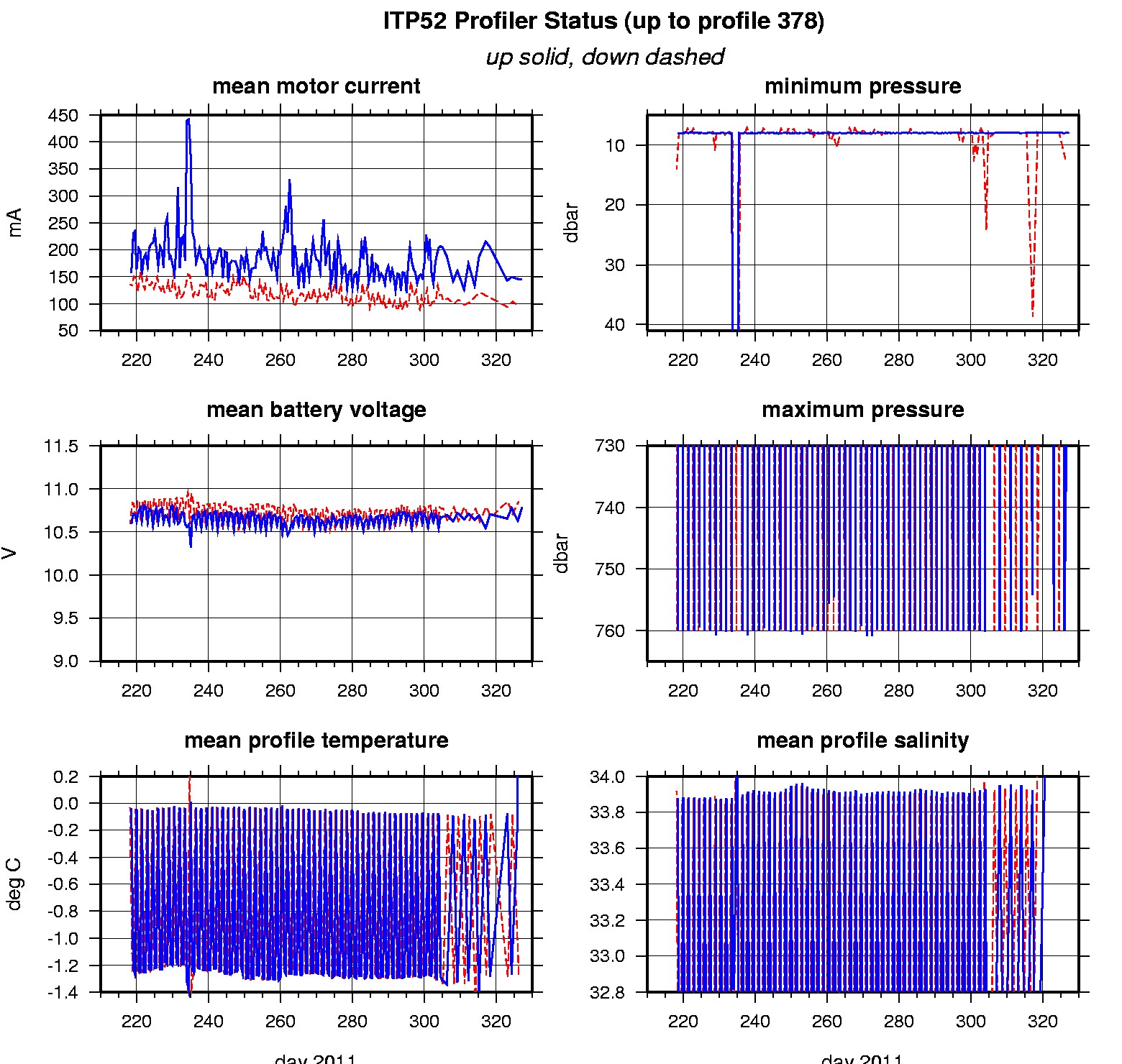
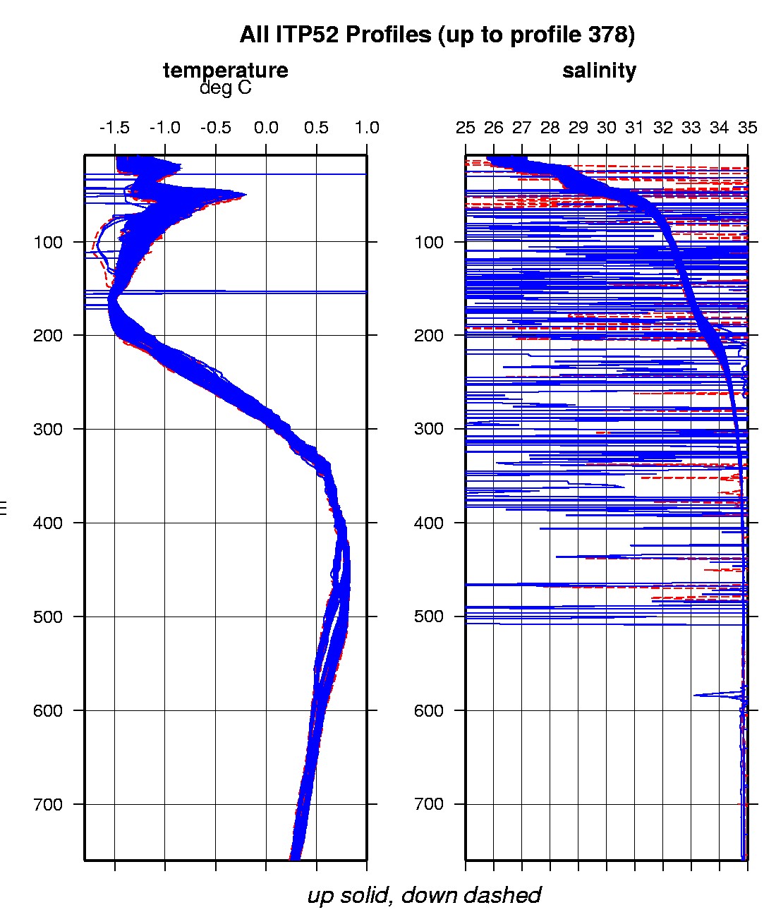
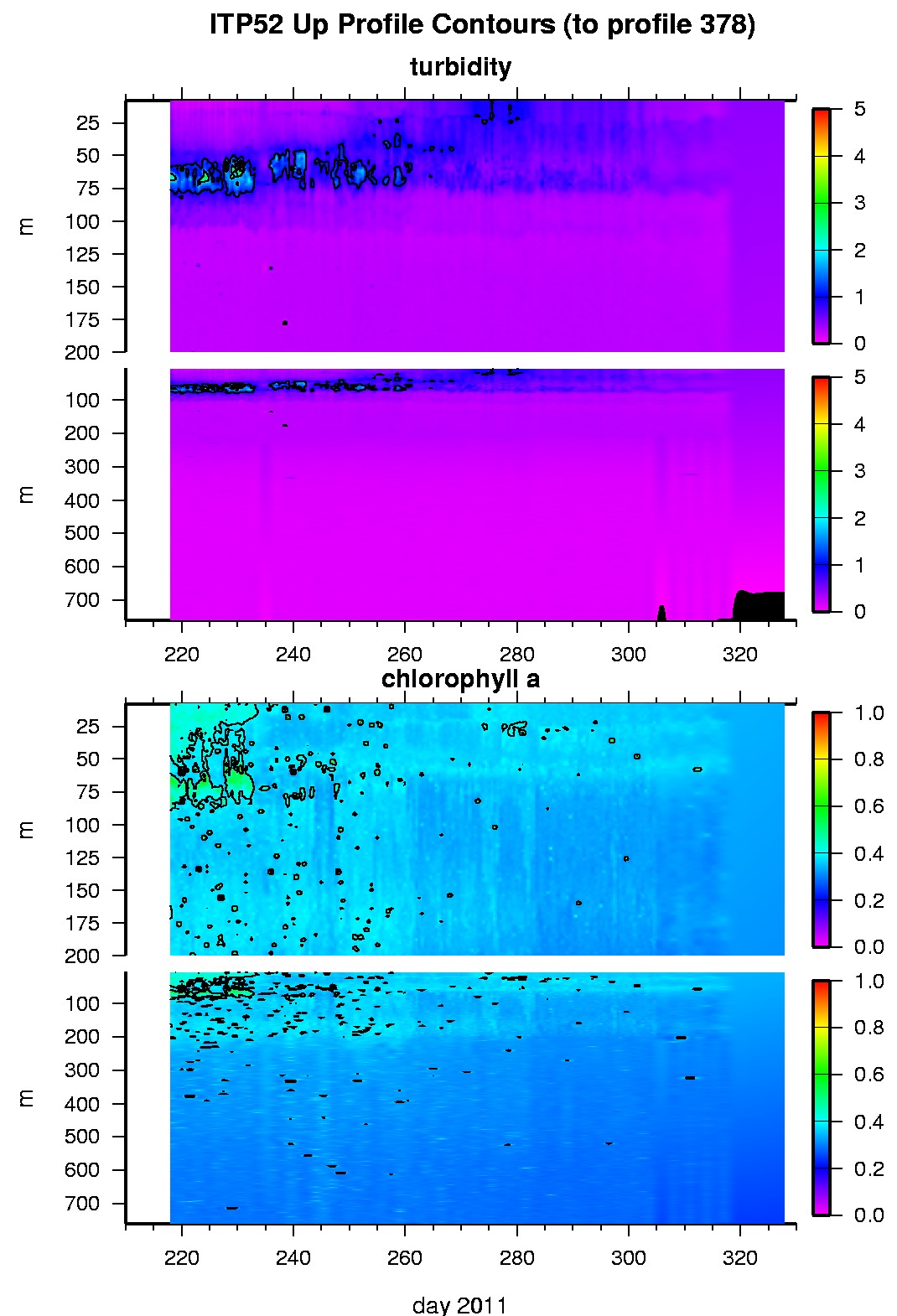
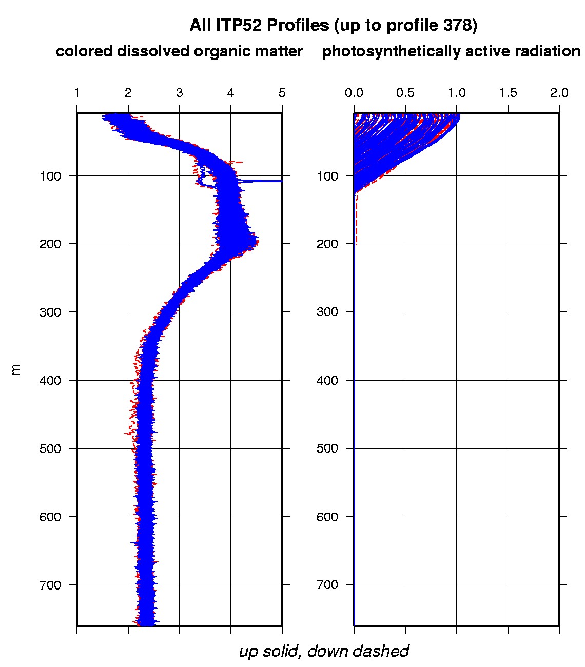
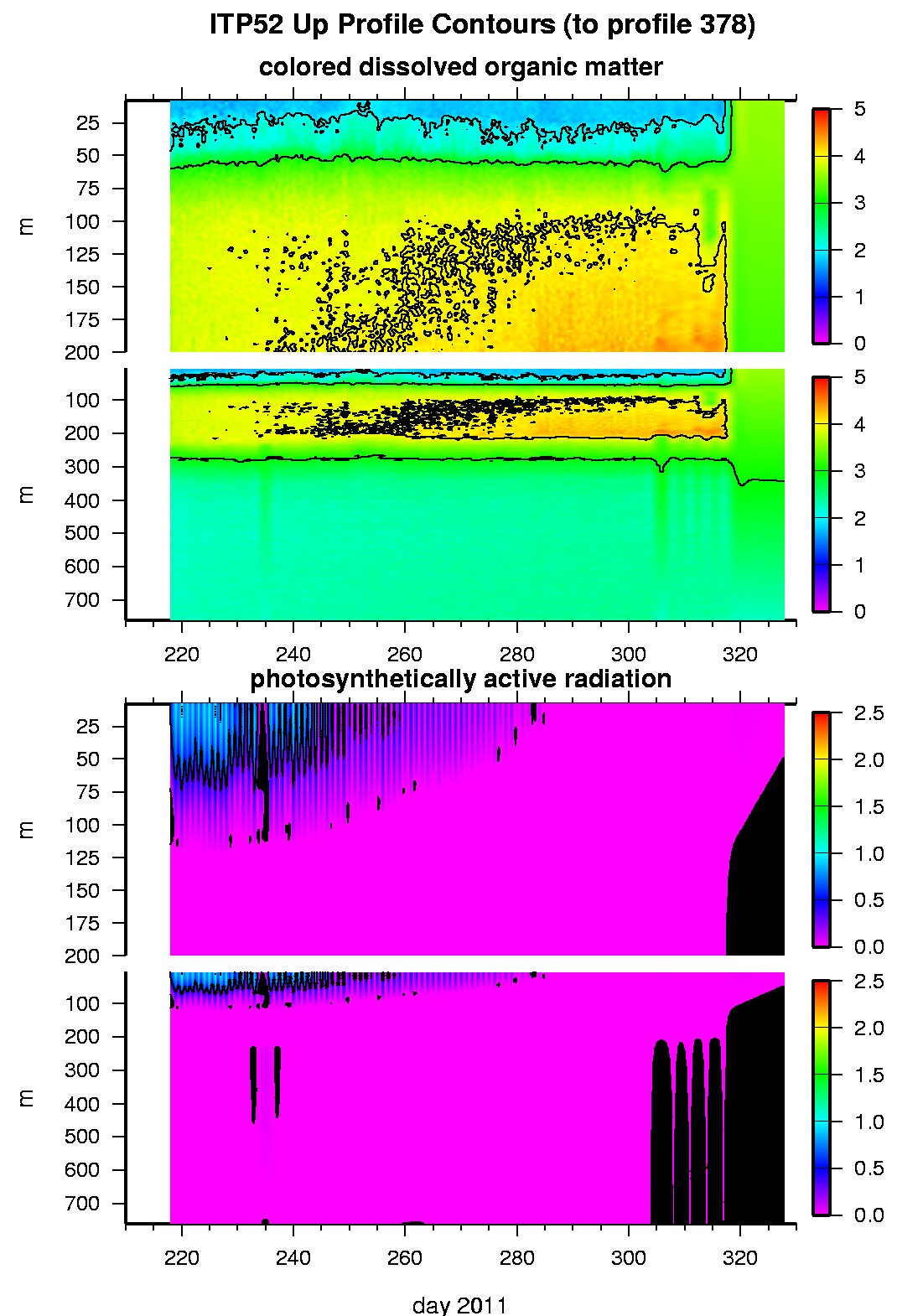
Last buoy status on 2012/1/19 230032 UTC : temperature = -16.3 °C, battery = 11.11 V Last position on 2012/1/19 230032 UTC : 75.9258° N, 131.7575° W Last profile (number 378) on 2011/11/23 1202 UTC Last profile mean motor current = 86.2964 mA, mean battery = 10.8412 V Last profile depth: minimum = NaN, maximum = NaN m Last profile temperature: minimum = NaN, maximum = NaN °C Last profile salinity: minimum = NaN, maximum = NaN Last profile dissolved oxygen: minimum = NaN, maximum = NaN μmol/kg The raw GPS buoy location data are available in an ASCII file: itp52rawlocs.dat Depth averaged profiler data files (with interpolated location) are available in two formats: ITP52 was deployed on August 5, 2011 on a 4.20 m thick ice floe in the Beaufort Sea at 78° 0.4 N, 139° 55.5 W as part of the Beaufort Gyre Observing System (BGOS) during the JOIS 2011 cruise on the CCGS Louis S. St. Laurent. On the same icefloe, a US Army Cold Regions Research and Engineering Laboratory (CRREL) Ice Mass Balance Buoy (IMB), and an autonomous atmospheric chemistry buoy (O-Buoy) were also installed. The ITP includes a dissolved oxygen sensor and full biosuite system and is operating on a pattern profiling sampling schedule including one full one-way profile between 7 and 760 m depth every 1.5 days. More information on the biosuite sensor package and data handling can be found here .
|