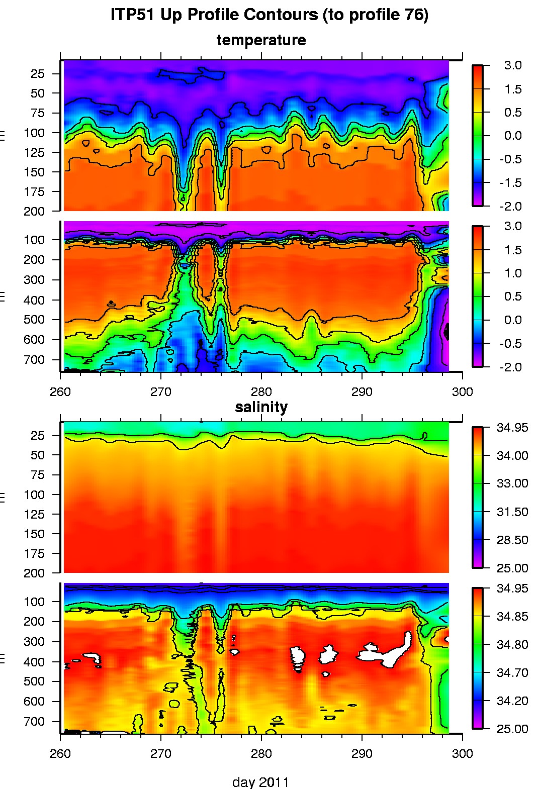
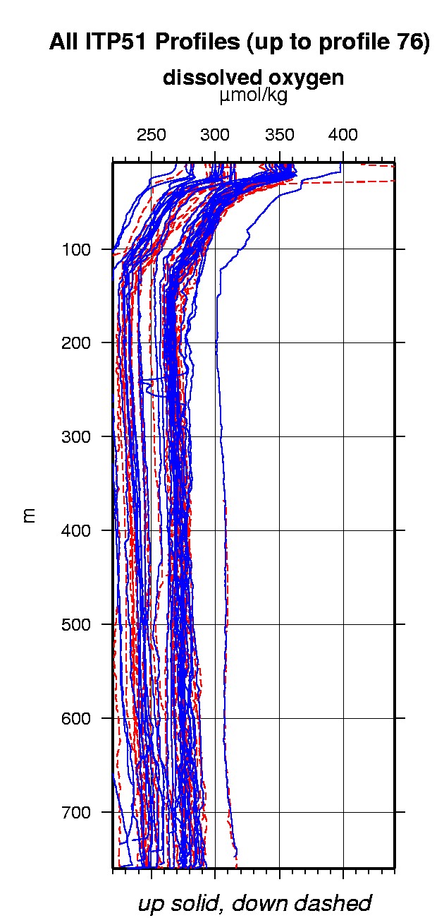
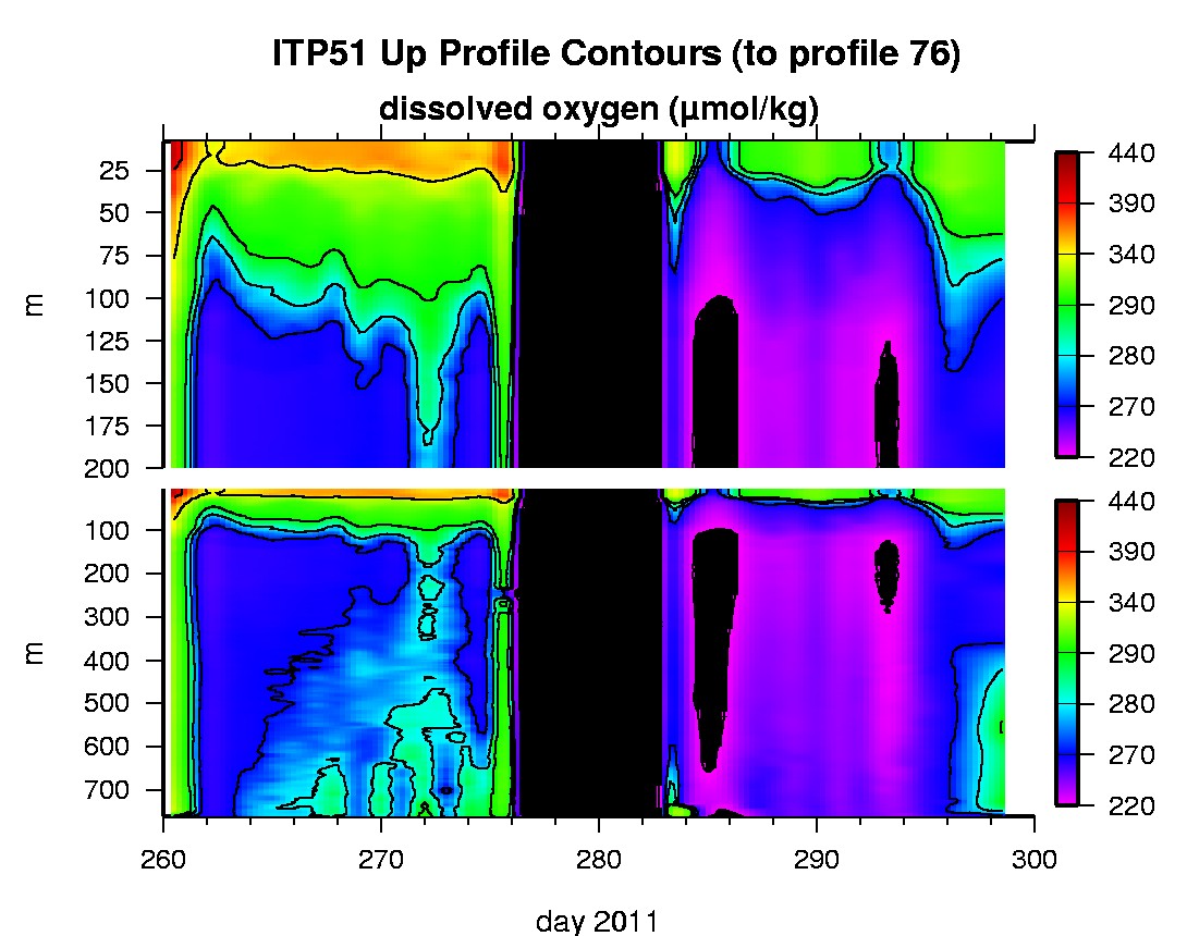
Ice Tethered Profiler 51 Data Data from ITP51 deployed in September 2011
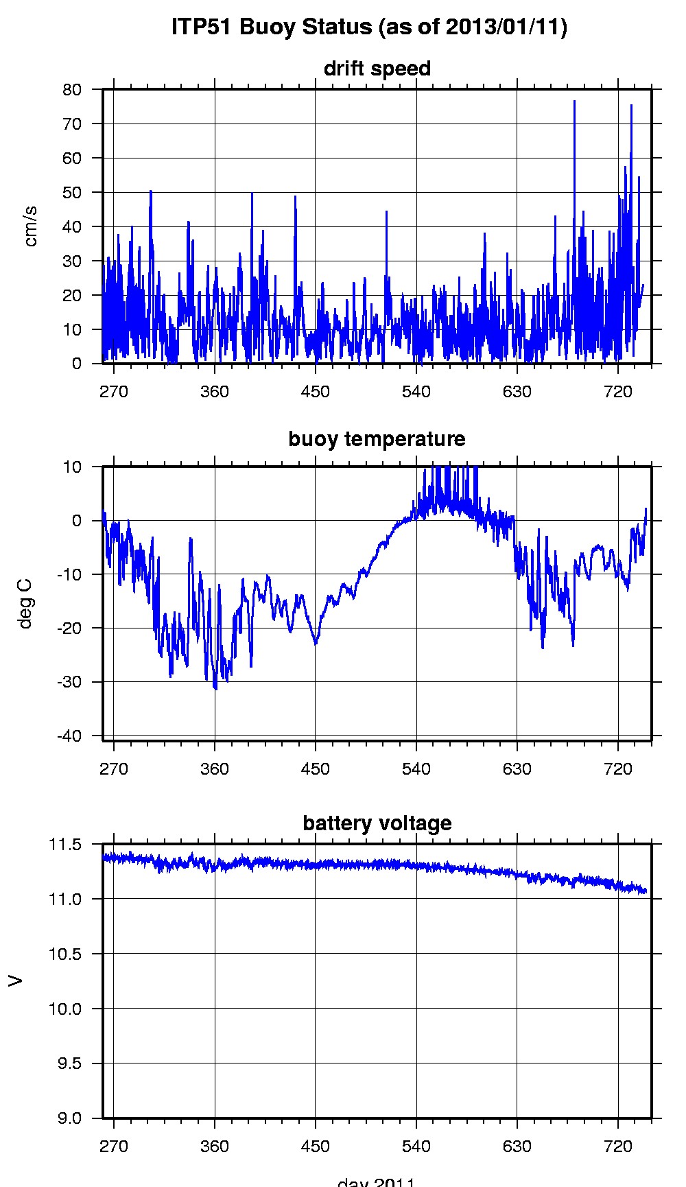
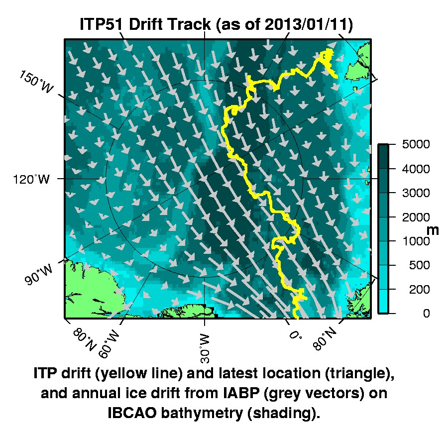
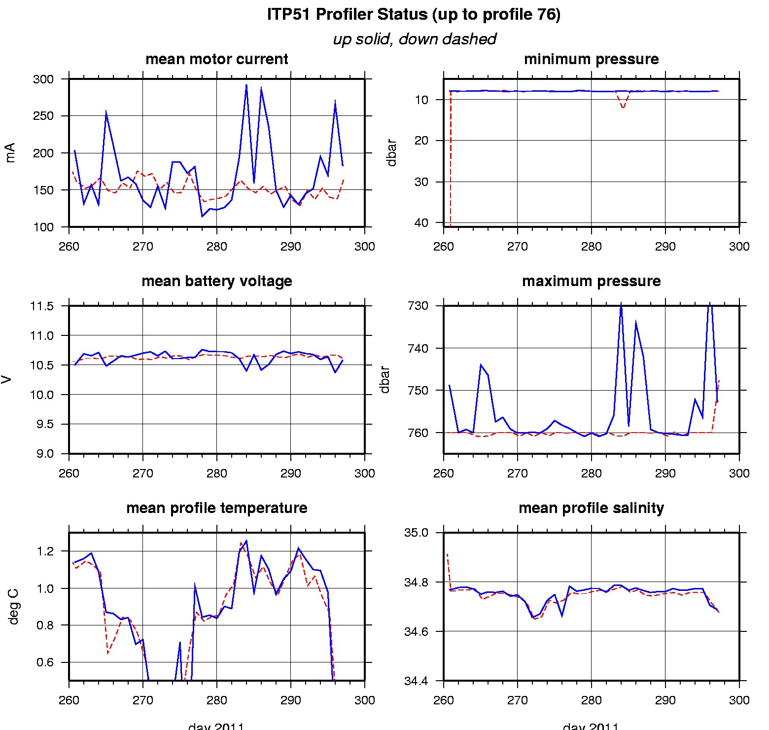
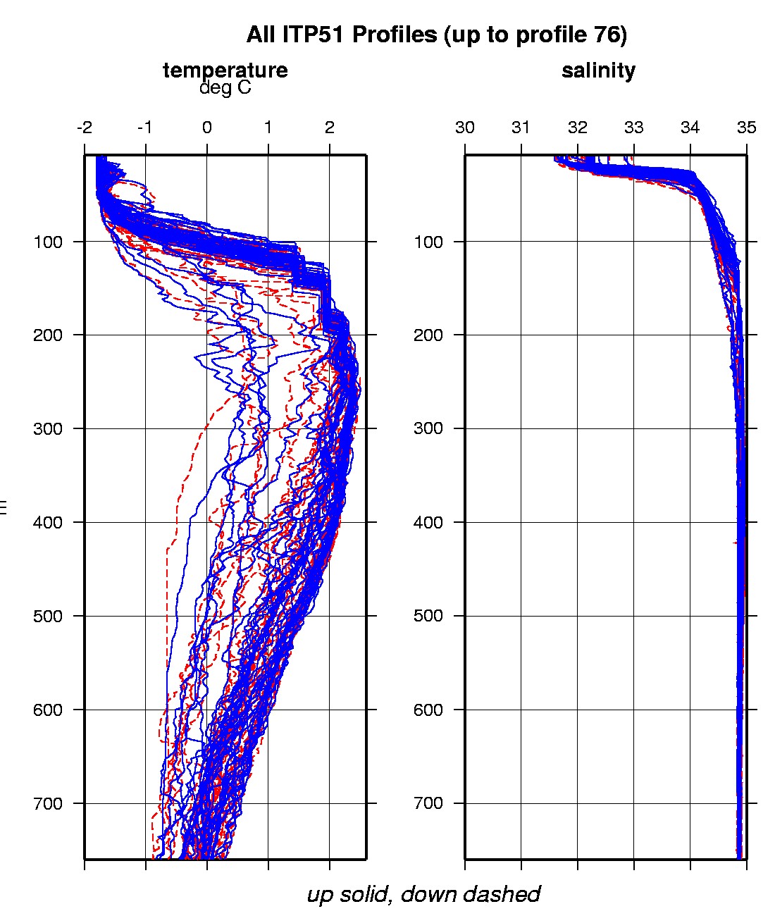
Last buoy status on 2013/1/13 230001 UTC : temperature = 0.46 °C, battery = 11.08 V Last position on 2013/1/11 110125 UTC : 79.2039° N, 2.2237° E Last profile (number 76) on 2011/10/25 600 UTC Last profile mean motor current = 428.0904 mA, mean battery = 10.82 V Last profile depth: minimum = 494.3854, maximum = 499.633 m Last profile temperature: minimum = -0.42067, maximum = -0.40713 °C Last profile salinity: minimum = 34.8243, maximum = 34.8258 Last profile dissolved oxygen: minimum = 279.474, maximum = 280.4697 μmol/kg The raw GPS buoy location data are available in an ASCII file: itp51rawlocs.dat Depth averaged profiler data files (with interpolated location) are available in two formats: ITP51 was deployed on September 17, 2011 on a 2 m thick ice floe in the Transpolar Drift at 81° 29.2 N, 103° 11.6 E during the ARK-XXVI/3 cruise (TransArc) on the R/V Polarstern as a contribution to the Hybrid Arctic/Antarctic Float Observation System (HAFOS). The ITP includes a dissolved oxygen sensor and is operating on a standard sampling schedule of 2 one-way profiles between 7 and 760 m depth each day.
|