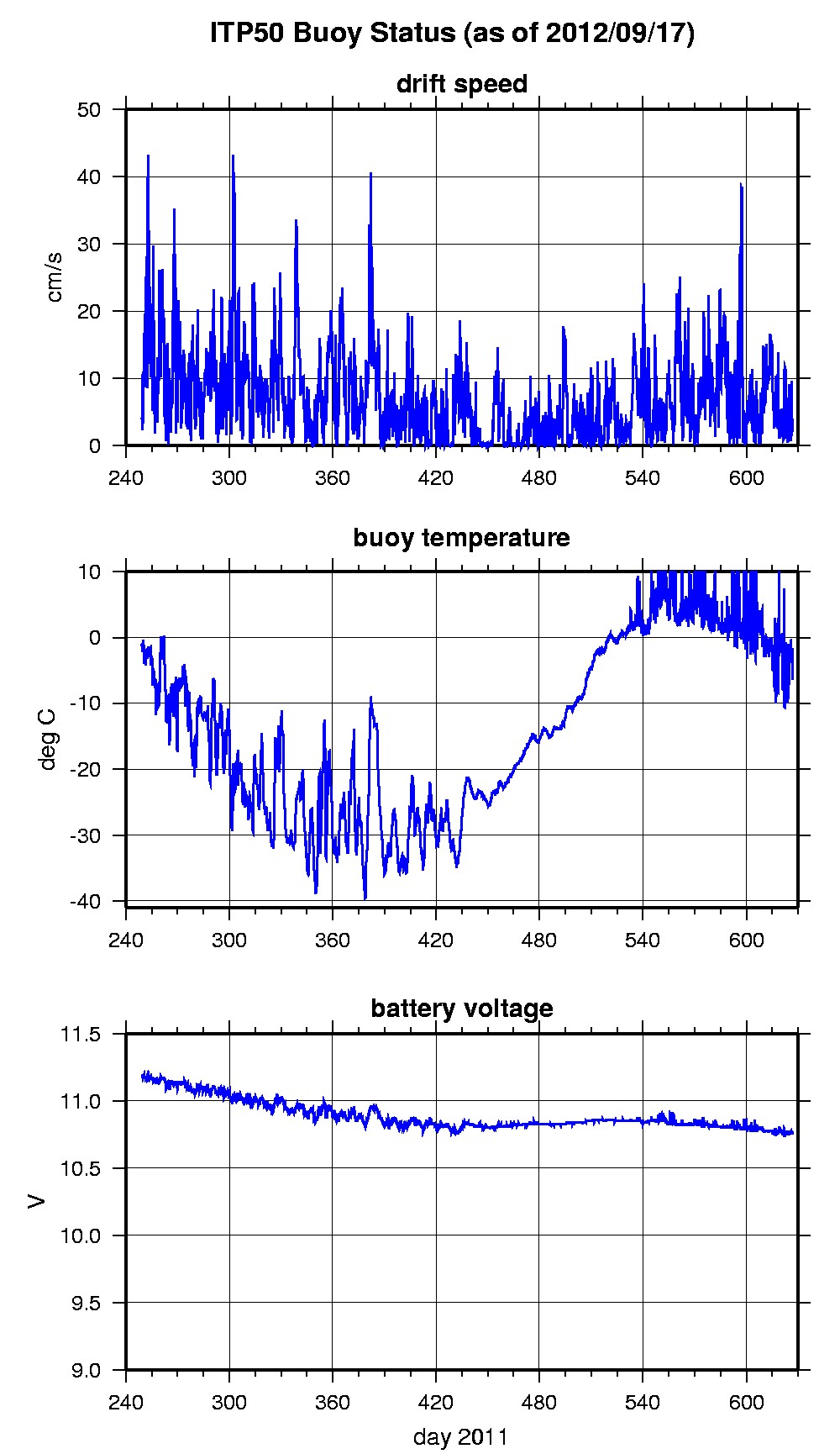
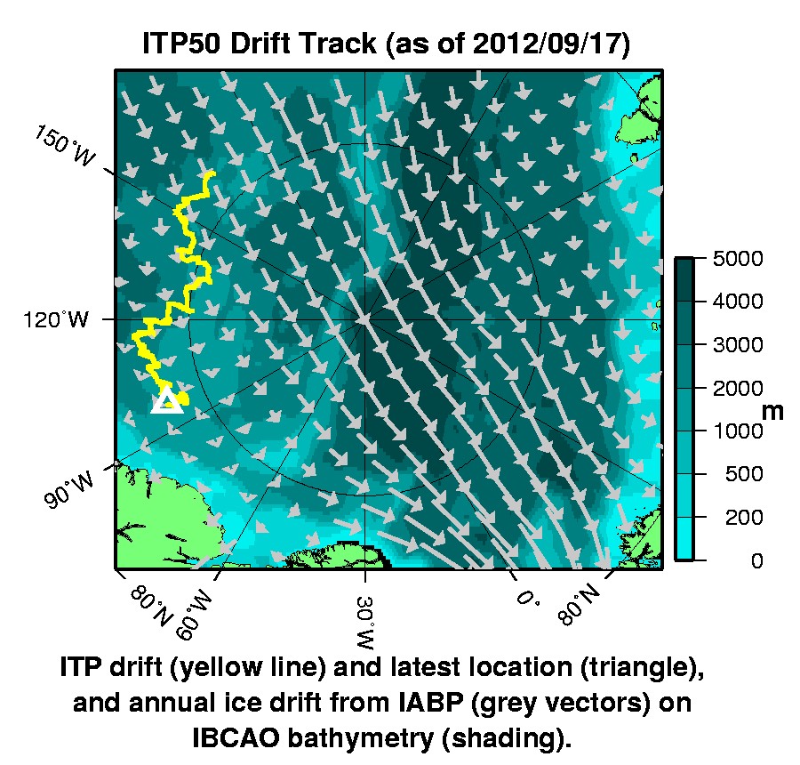
ITP50 was deployed on September 6, 2011 on a 3 m thick ice floe in the Transpolar Drift at 84° 4.7 N, 164° 11.4 W during the ARK-XXVI/3 cruise (TransArc) on the R/V Polarstern as a contribution to the Hybrid Arctic/Antarctic Float Observation System (HAFOS). The ITP includes a dissolved oxygen sensor is operating on a standard sampling schedule of 2 one-way profiles between 7 and 760 m depth each day. Unfortunately, the underwater profiler and surface unit are not communicating, so the profile data is not being received at this time.