Ice Tethered Profiler 49 Data Data from ITP49 deployed in September 2011
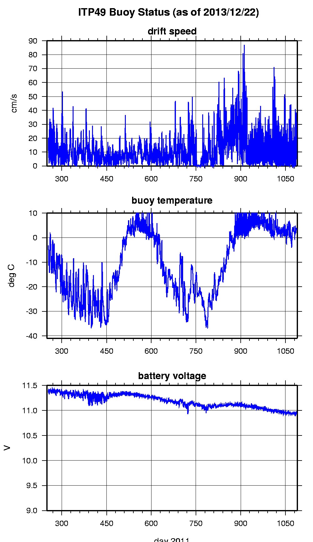
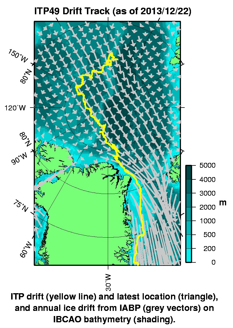
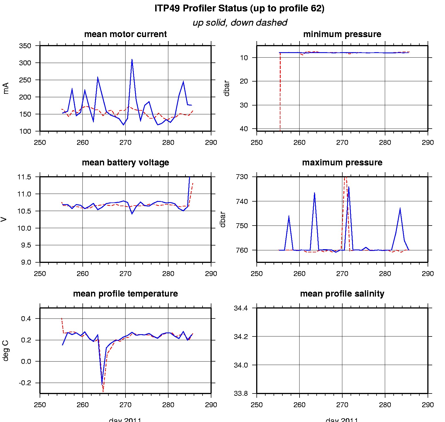
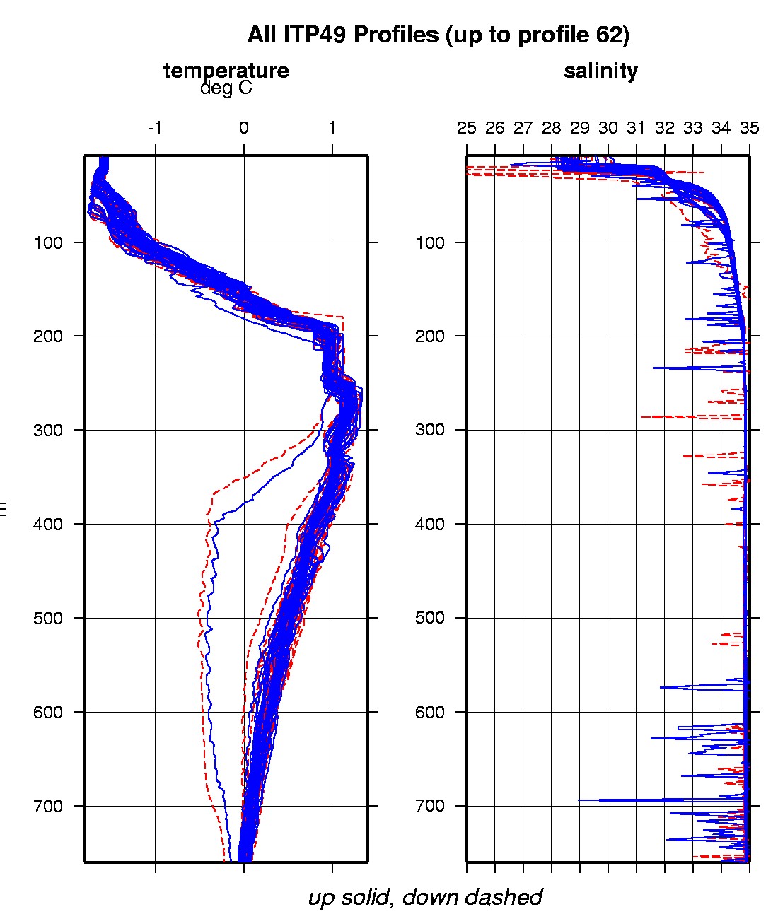
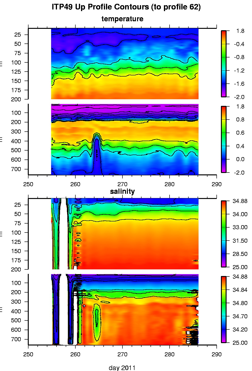
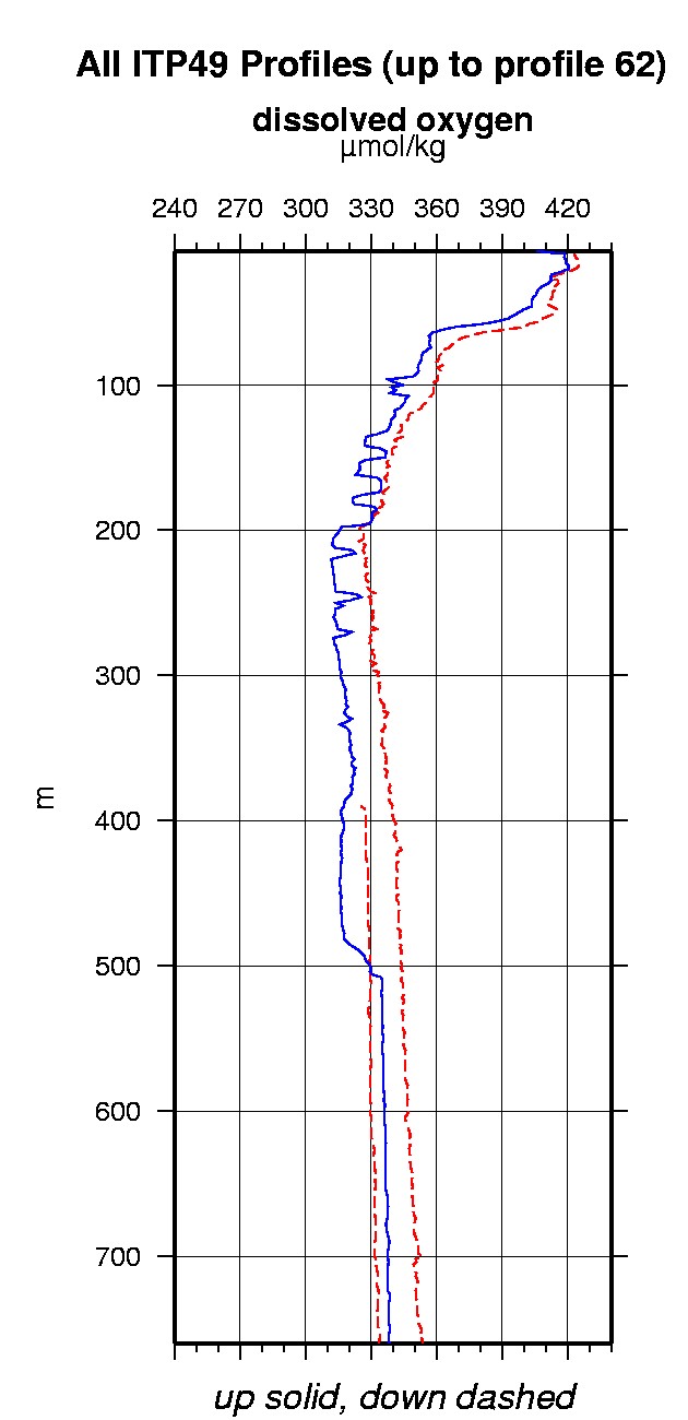
Last buoy status on 2013/12/22 230054 UTC : temperature = 3.45 °C, battery = 10.94 V Last position on 2013/12/22 230054 UTC : 66.4392° N, 22.3128° W Last profile (number 62) on 2011/10/12 1800 UTC Last profile mean motor current = 159.2245 mA, mean battery = 11.3167 V Last profile depth: minimum = 7.677, maximum = 760.05 m Last profile temperature: minimum = -1.6809, maximum = 1.2412 °C Last profile salinity: minimum = 18.1371, maximum = 38.9274 Last profile dissolved oxygen: minimum = -125.5704, maximum = -102.6993 μmol/kg The raw GPS buoy location data are available in an ASCII file: itp49rawlocs.dat Depth averaged profiler data files (with interpolated location) are available in two formats: ITP49 was deployed on September 11, 2011 on a 2 m thick ice floe in the Transpolar Drift at 84° 22.0 N, 139° 52.6 E during the ARK-XXVI/3 cruise (TransArc) on the R/V Polarstern as a contribution to the Hybrid Arctic/Antarctic Float Observation System (HAFOS). The ITP includes a dissolved oxygen sensor and will operate on a standard sampling schedule of 2 one-way profiles between 7 and 760 m depth each day.
|