Ice Tethered Profiler 44 Data Data from ITP44 deployed in October 2010
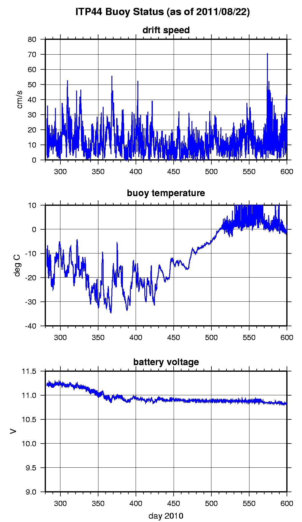
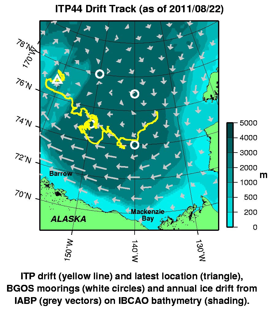
Last buoy status on 2011/8/22 230031 UTC : temperature = 1.73 °C, battery = 10.83 V Last position on 2011/8/22 230031 UTC : 76.9625° N, 160.7586° W Last profile (number 0) on 2010/10/9 302 UTC Last profile mean motor current = 223.3023 mA, mean battery = 10.6857 V Last profile depth: minimum = 318.5189, maximum = 753.0519 m Last profile temperature: minimum = 0.28326, maximum = 0.76614 °C Last profile salinity: minimum = 34.5225, maximum = 34.7283 The raw GPS buoy location data are available in an ASCII file: itp44rawlocs.dat Depth averaged profiler data files (with interpolated location) are available in two formats: ITP44 was deployed on October 9, 2010 on a 1.5 m thick ice floe in the Beaufort Sea at 75° 51.6 N, 134° 39.7 W as part of the Beaufort Gyre Observing System (BGOS) during the JOIS 2010 cruise on the CCGS Louis S. St. Laurent. The ITP includes a prototype MAVS current sensor and is operating on a pattern profiling schedule including 2 one-way profiles between 7 and 760 m depth each day.
|