Ice Tethered Profiler 43 Data Data from ITP43 deployed in October 2010
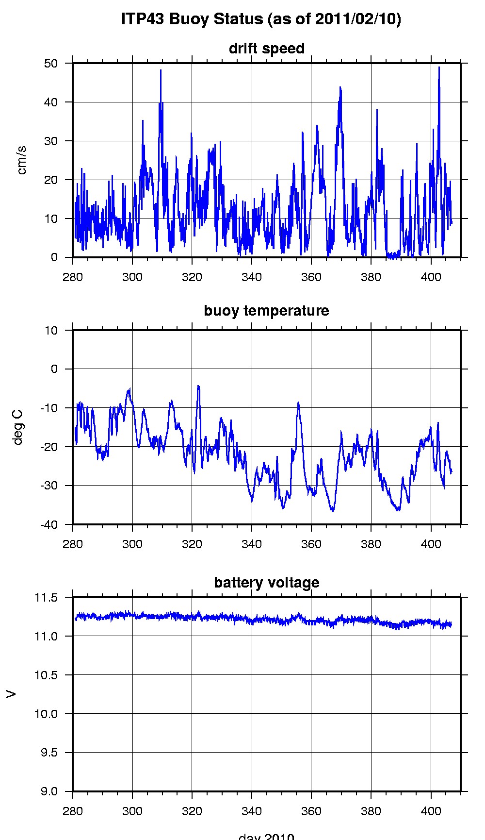
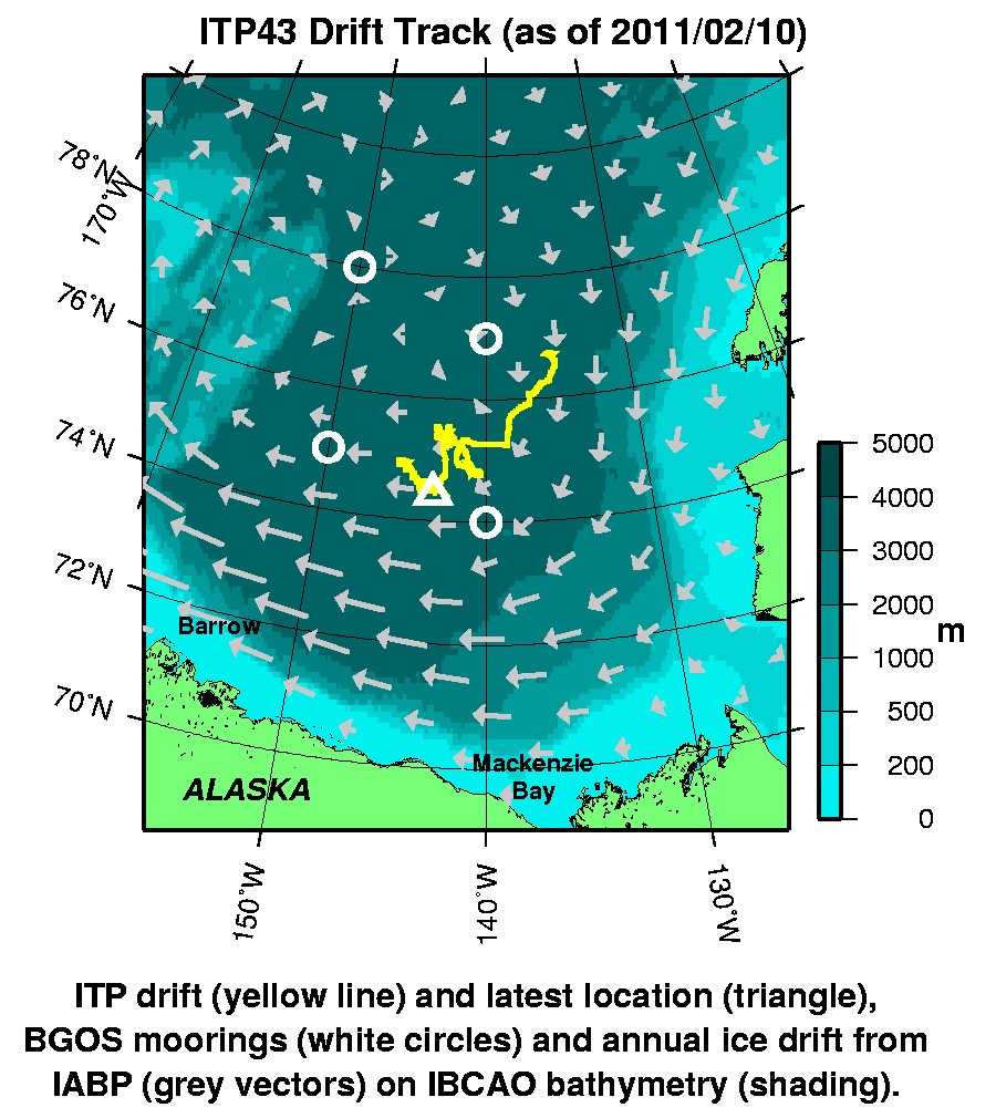
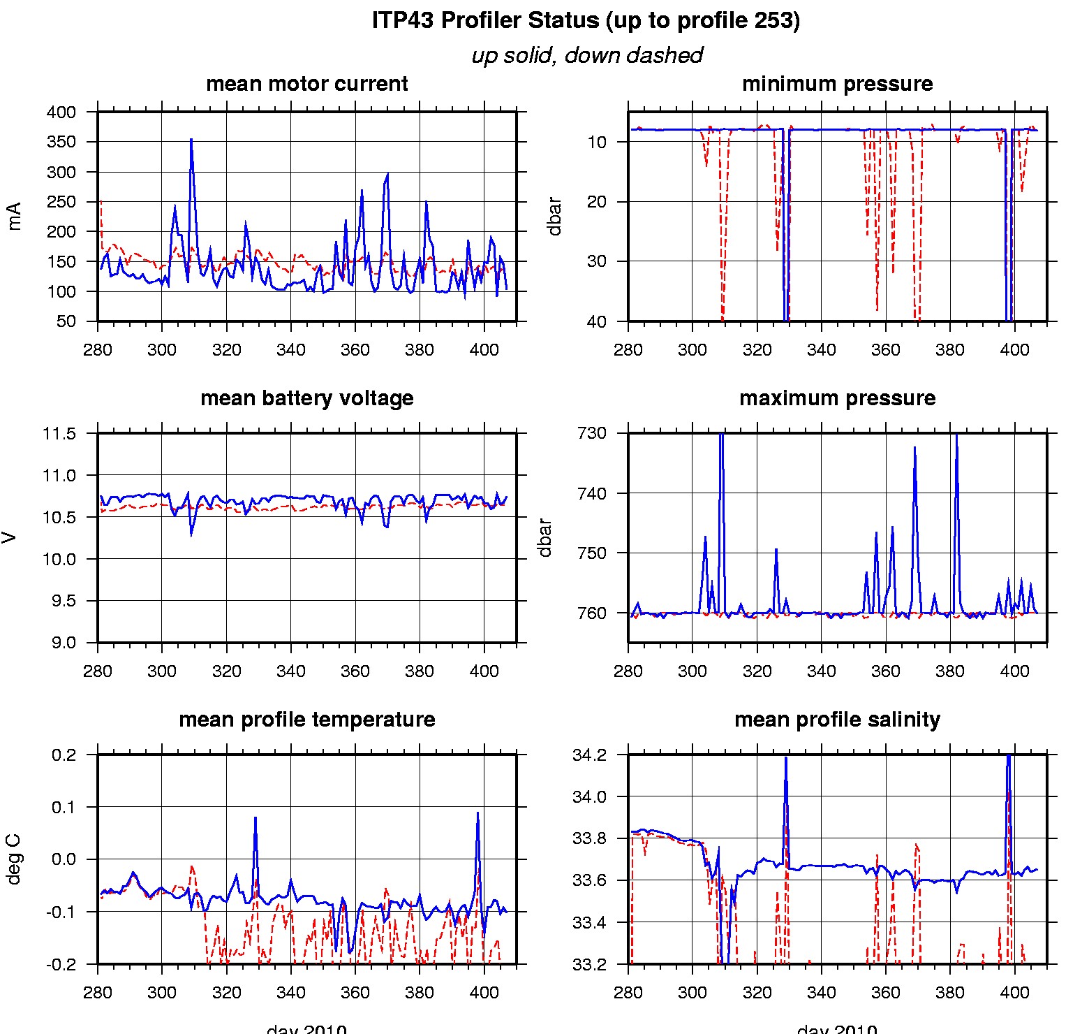
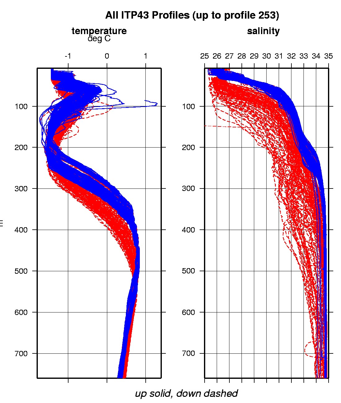
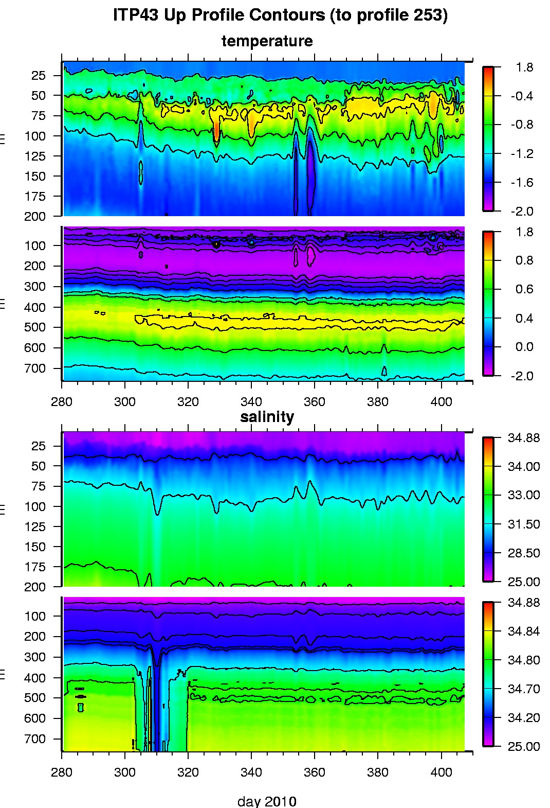
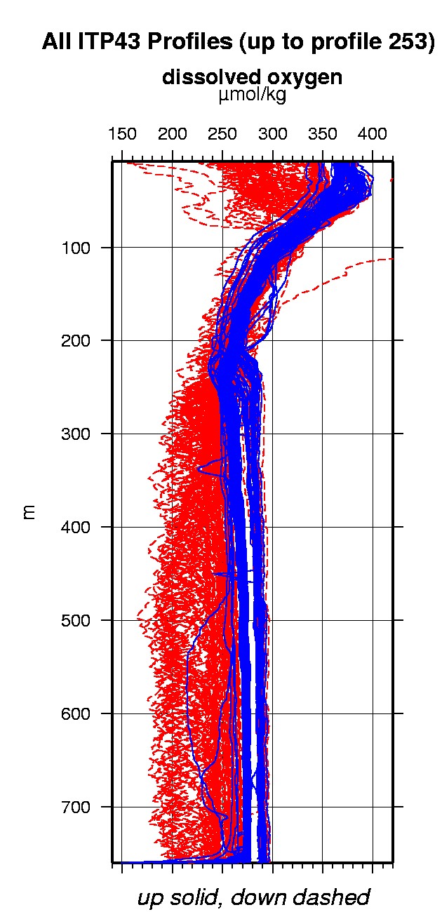
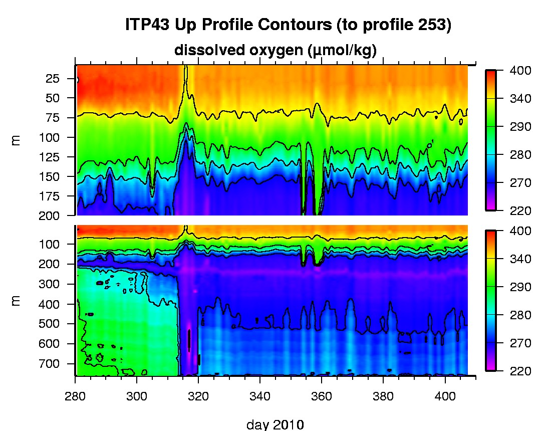
Last buoy status on 2011/2/10 230031 UTC : temperature = -26.53 °C, battery = 11.15 V Last position on 2011/2/10 230032 UTC : 74.4424° N, 143.2144° W Last profile (number 253) on 2011/2/11 0 UTC Last profile mean motor current = 102.953 mA, mean battery = 10.7453 V Last profile depth: minimum = 8.0614, maximum = 760.1443 m Last profile temperature: minimum = -1.5542, maximum = 0.8136 °C Last profile salinity: minimum = 26.5131, maximum = 34.8344 Last profile dissolved oxygen: minimum = 244.1804, maximum = 365.4453 μmol/kg The raw GPS buoy location data are available in an ASCII file: itp43rawlocs.dat Depth averaged profiler data files (with interpolated location) are available in two formats: ITP43 was deployed on October 7, 2010 on a 2.45 m thick ice floe in the Beaufort Sea at 76° 42.9 N, 135° 11.7 W as part of the Beaufort Gyre Observing System (BGOS) during the JOIS 2010 cruise on the CCGS Louis S. St. Laurent. On the same icefloe, a Naval Postgraduate School Arctic Ocean Flux Buoy (AOFB 21), a US Army Cold Regions Research and Engineering Laboratory (CRREL) Ice Mass Balance Buoy (IMB 2010F), and an autonomous atmospheric chemistry buoy (O-Buoy) were also installed. The ITP includes a dissolved oxygen sensor and is operating on a standard sampling schedule of 2 one-way profiles between 7 and 760 m depth each day.
|