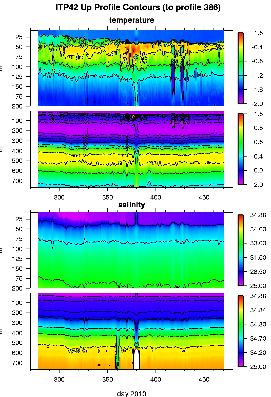
Ice Tethered Profiler 42 Data Data from ITP42 deployed in October 2010
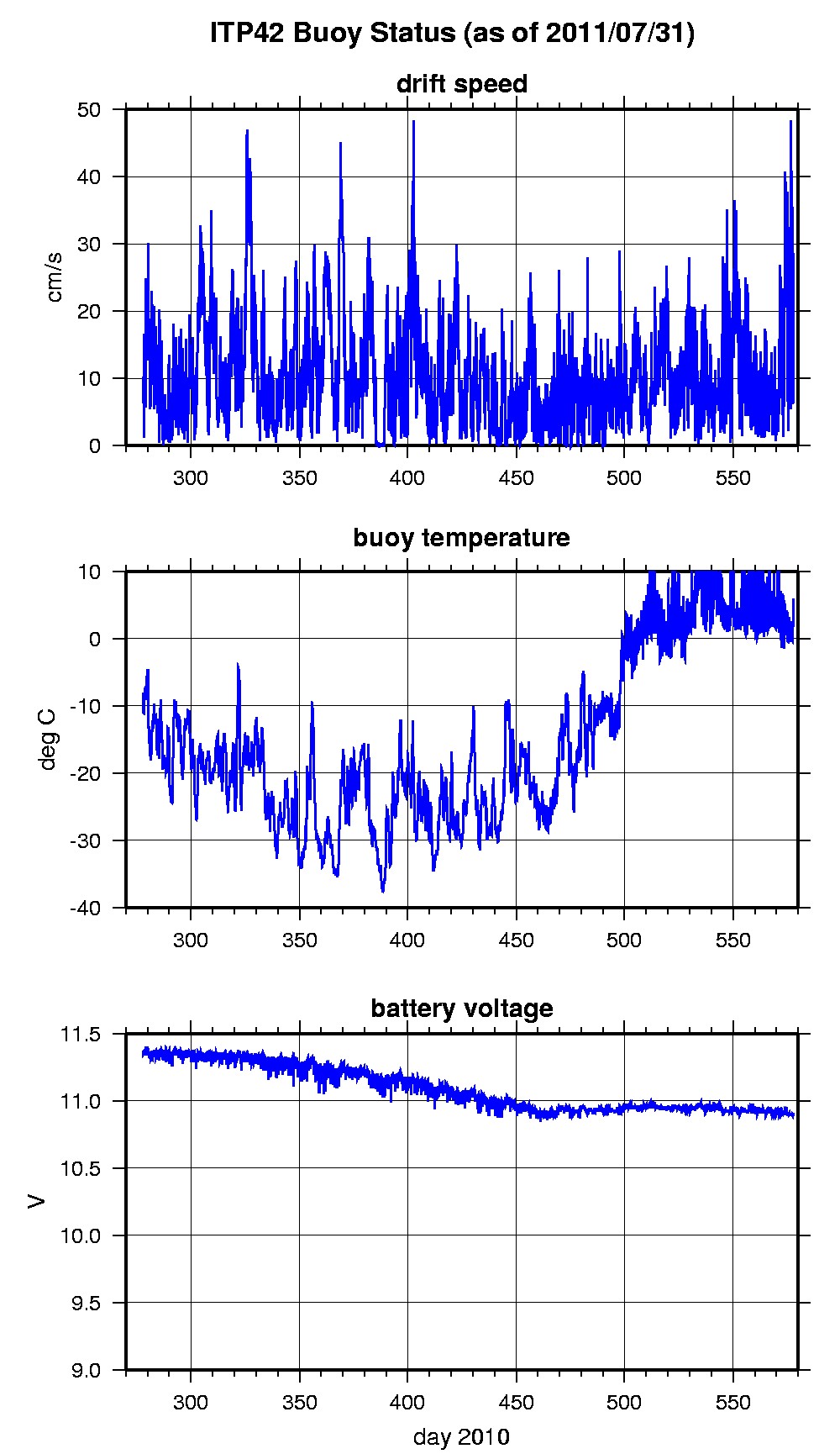
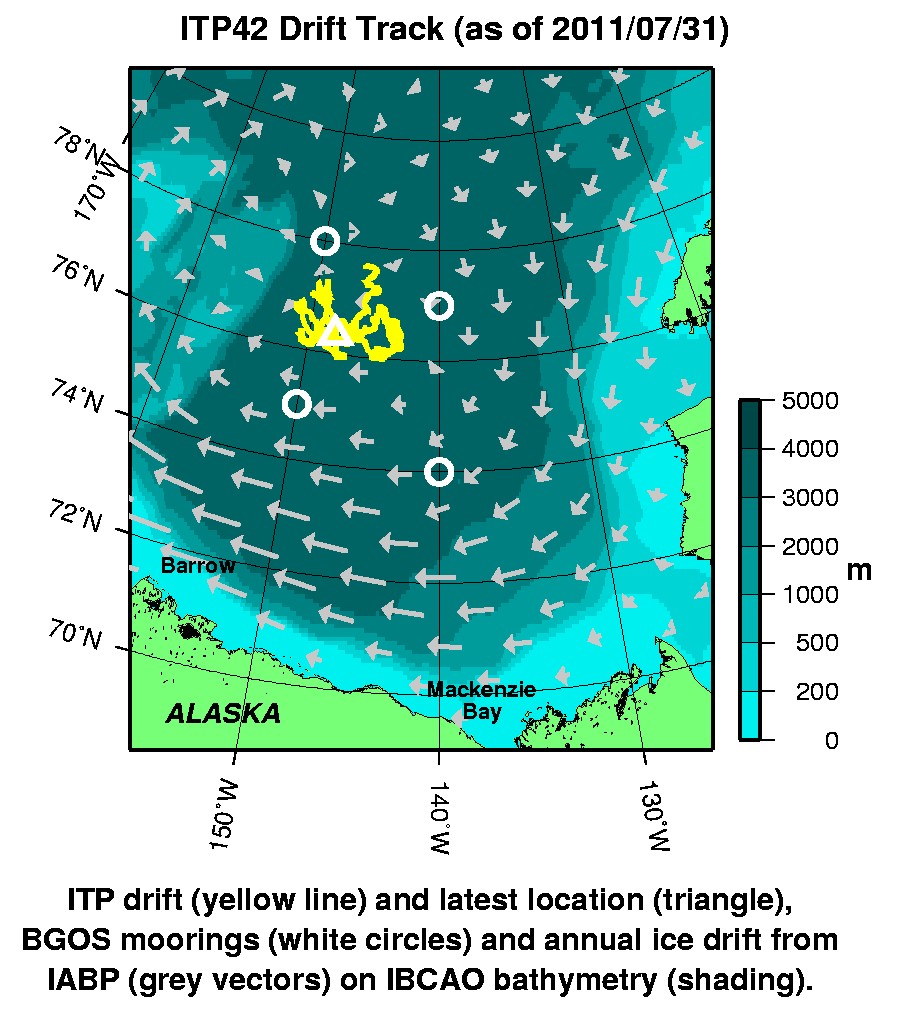
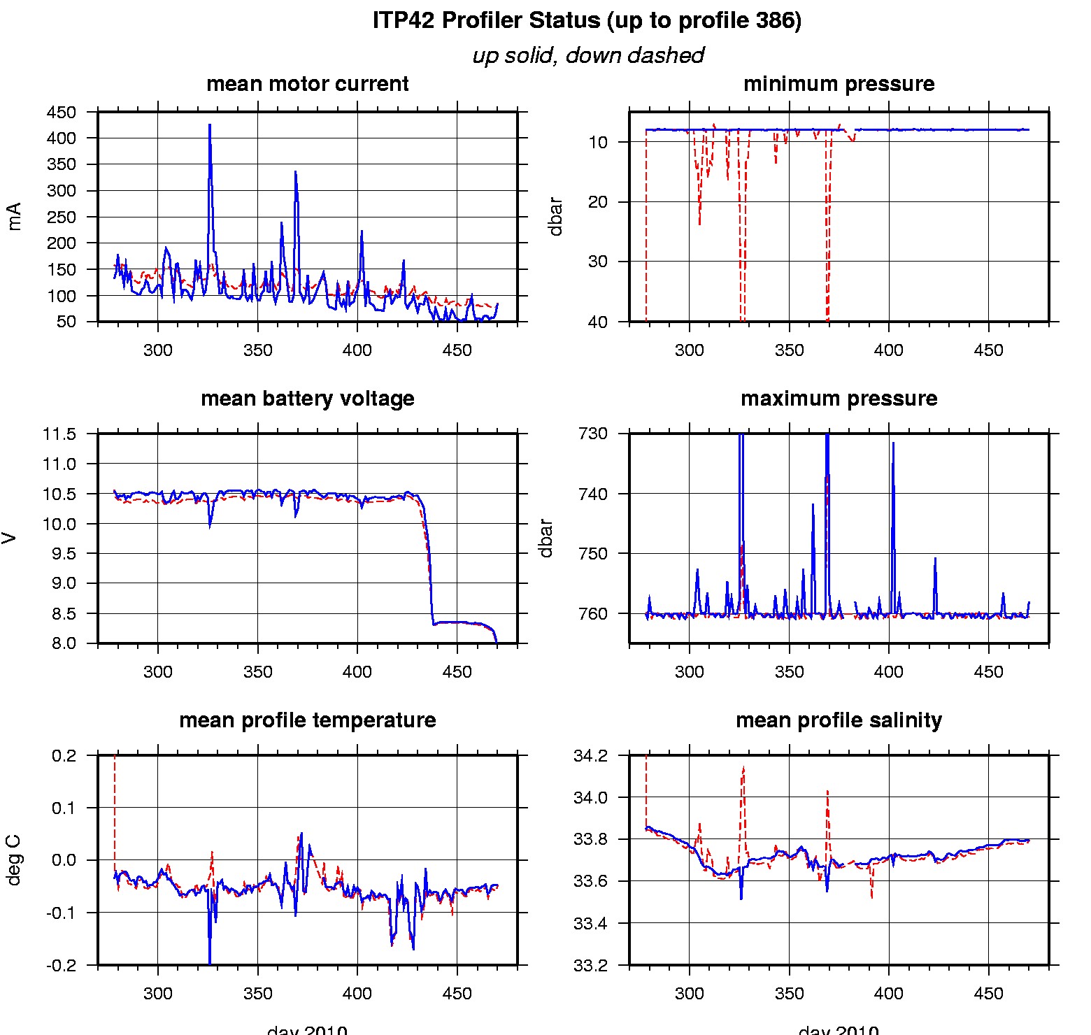
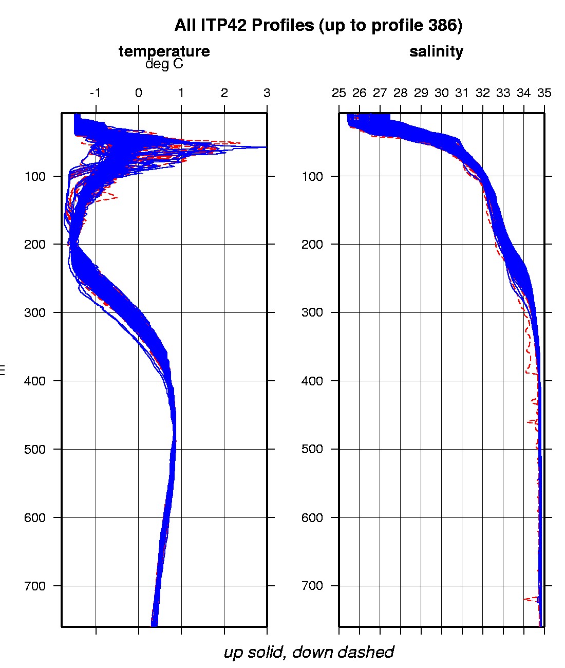
Last buoy status on 2011/7/31 230159 UTC : temperature = 5.92 °C, battery = 10.91 V Last position on 2011/7/31 230200 UTC : 76.3431° N, 148.0454° W Last profile (number 386) on 2011/4/15 624 UTC Last profile mean motor current = 85.2103 mA, mean battery = 7.7512 V Last profile depth: minimum = 7.9527, maximum = 760.5426 m Last profile temperature: minimum = -1.5663, maximum = 0.84979 °C Last profile salinity: minimum = 27.4681, maximum = 34.8566 The raw GPS buoy location data are available in an ASCII file: itp42rawlocs.dat Depth averaged profiler data files (with interpolated location) are available in two formats: ITP42 was deployed on October 4, 2010 on a 2.35 m thick ice floe in the Beaufort Sea at 77° 39.8 N, 146° 15.5 W as part of the Beaufort Gyre Observing System (BGOS) during the JOIS 2010 cruise on the CCGS Louis S. St. Laurent. On the same icefloe, a Naval Postgraduate School Arctic Ocean Flux Buoy (AOFB 22) and a US Army Cold Regions Research and Engineering Laboratory (CRREL) Ice Mass Balance Buoy (IMB 2010E) were installed. The ITP is operating on a standard sampling schedule of 2 one-way profiles between 7 and 760 m depth each day.
|