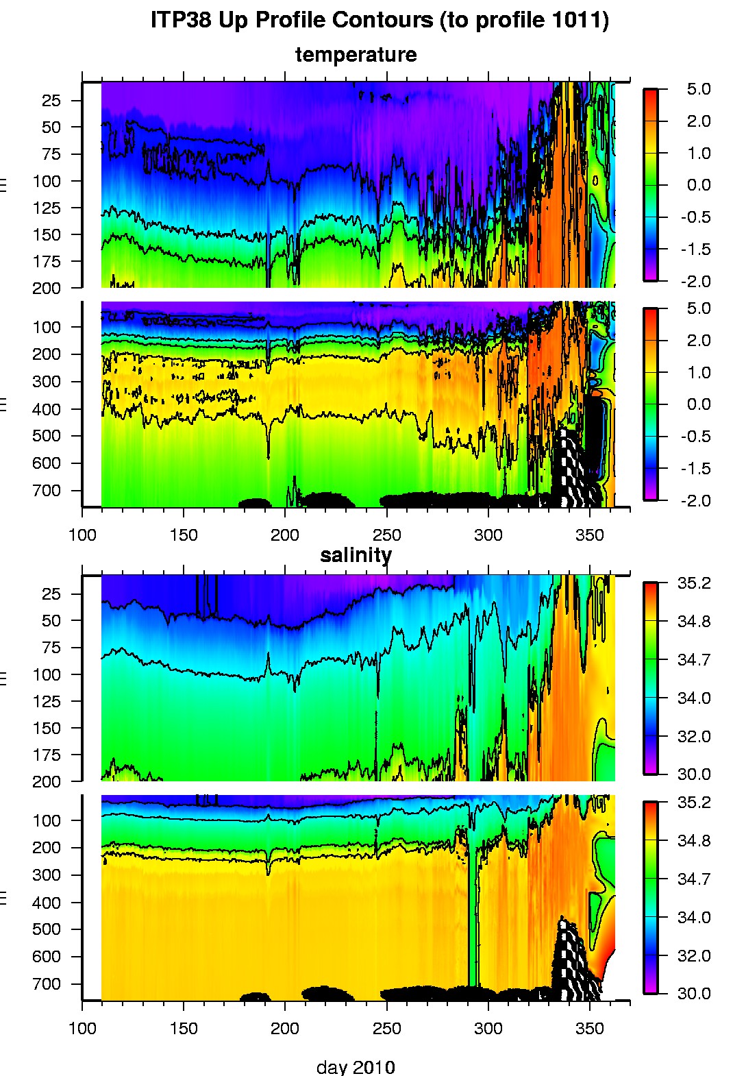
Ice Tethered Profiler 38 Data Data from ITP38 deployed in April 2010
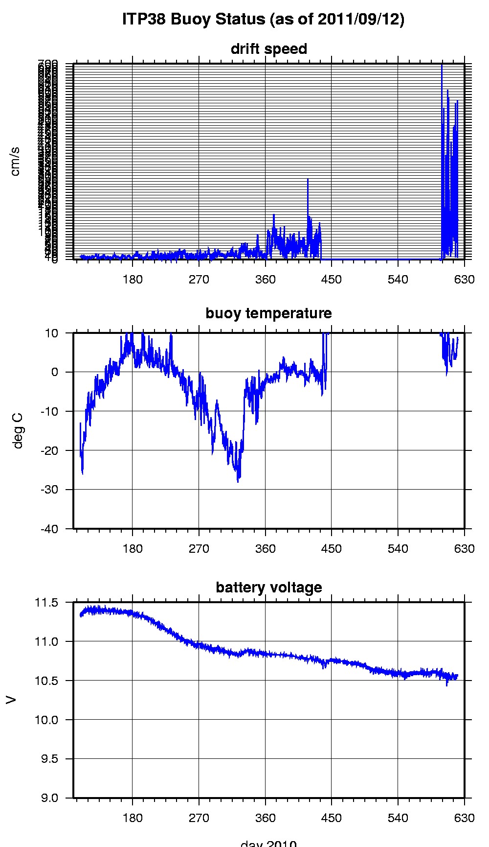
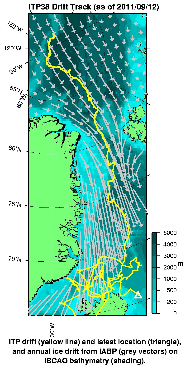
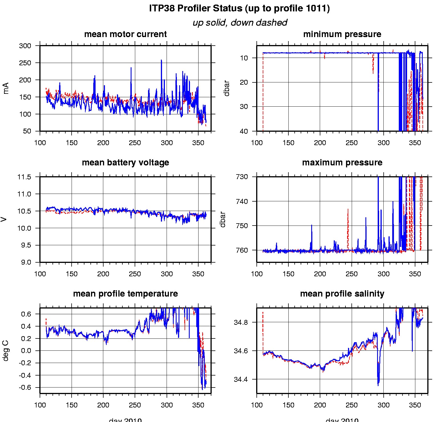
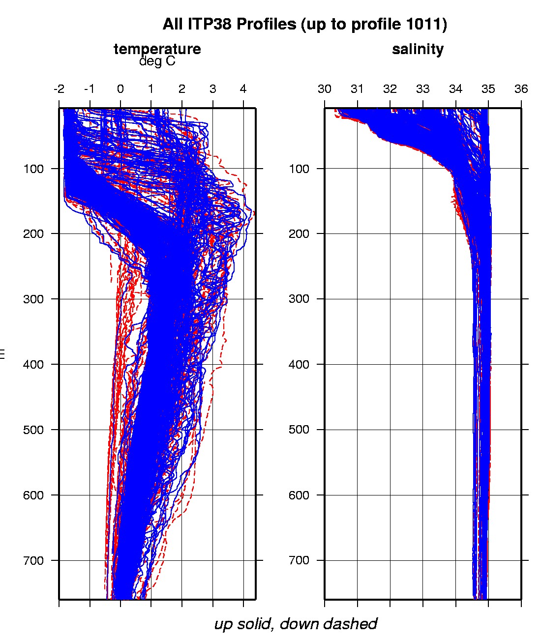
Last buoy status on 2011/9/12 230200 UTC : temperature = 8.18 °C, battery = 10.57 V Last position on 2011/9/12 230200 UTC : 65.5767° N, 10.8443° W Last profile (number 1011) on 2010/12/28 600 UTC Last profile mean motor current = 81.6247 mA, mean battery = 10.4086 V Last profile depth: minimum = 26.8265, maximum = 47.1157 m Last profile temperature: minimum = -0.50838, maximum = -0.4852 °C Last profile salinity: minimum = 34.8319, maximum = 34.833 The raw GPS buoy location data are available in an ASCII file: itp38rawlocs.dat Depth averaged profiler data files (with interpolated location) are available in two formats: ITP38 was deployed on a 1.7 m thick icefloe in the Transpolar Drift on April 19, 2010 at 88° 39.4 N, 145° 35.7 E as part of the North Pole Environmental Observatory (NPEO) . On the same icefloe, a Naval Postgraduate School Arctic Ocean Flux Buoy (AOFB), an US Army Cold Regions Research and Engineering Laboratory (CRREL) Ice Mass Balance Buoy , an US-IABP Polar Area Weather Station (PAWS) and NOAA/PMEL webcam were deployed. The ITP is operating on a fast sampling schedule of 4 one-way profiles between 7 and 760 m depth each day.
|