Ice Tethered Profiler 37 Data Data from ITP37 deployed in August 2009
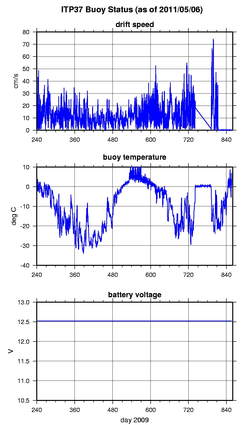
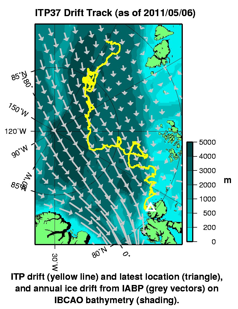
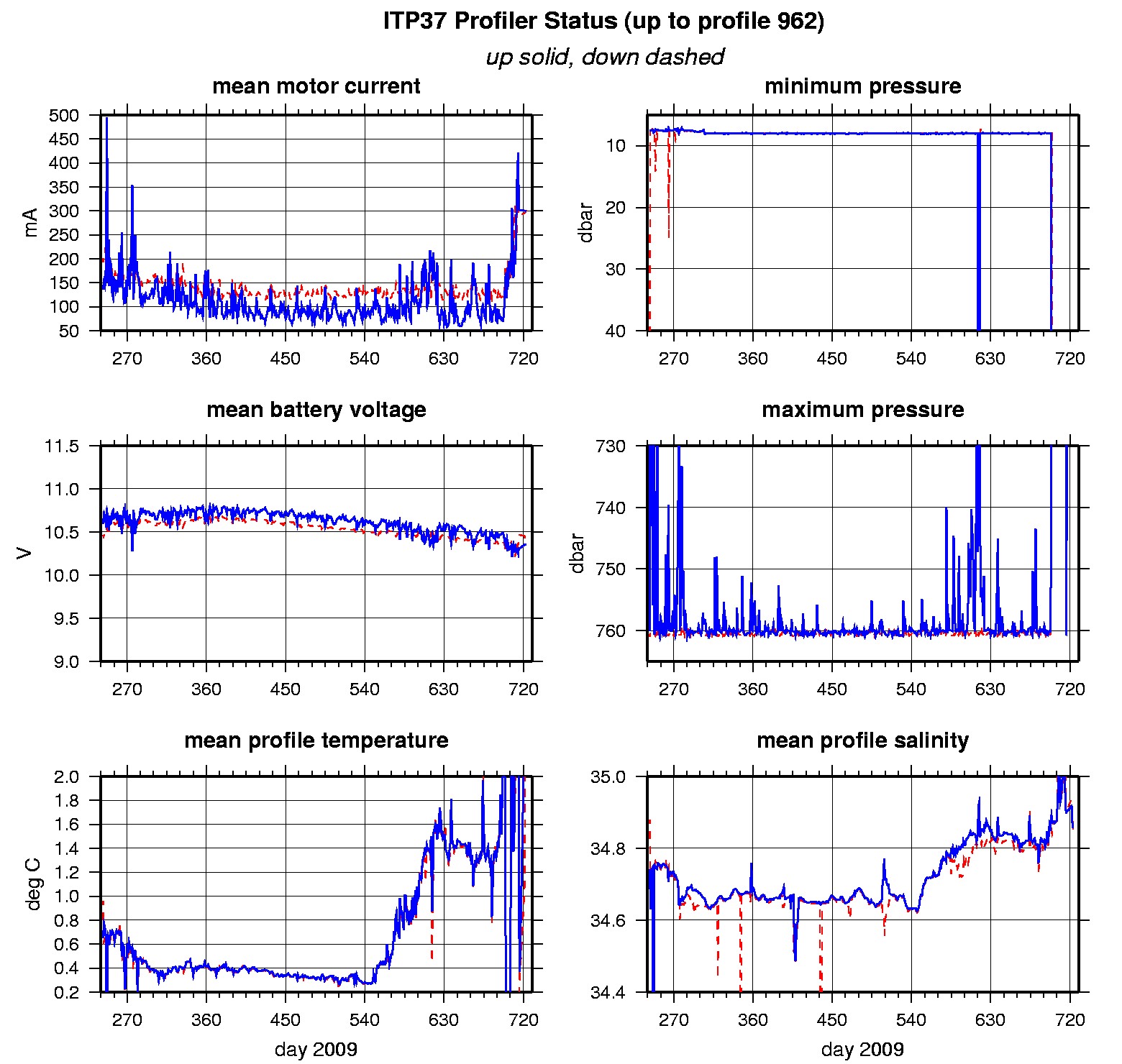
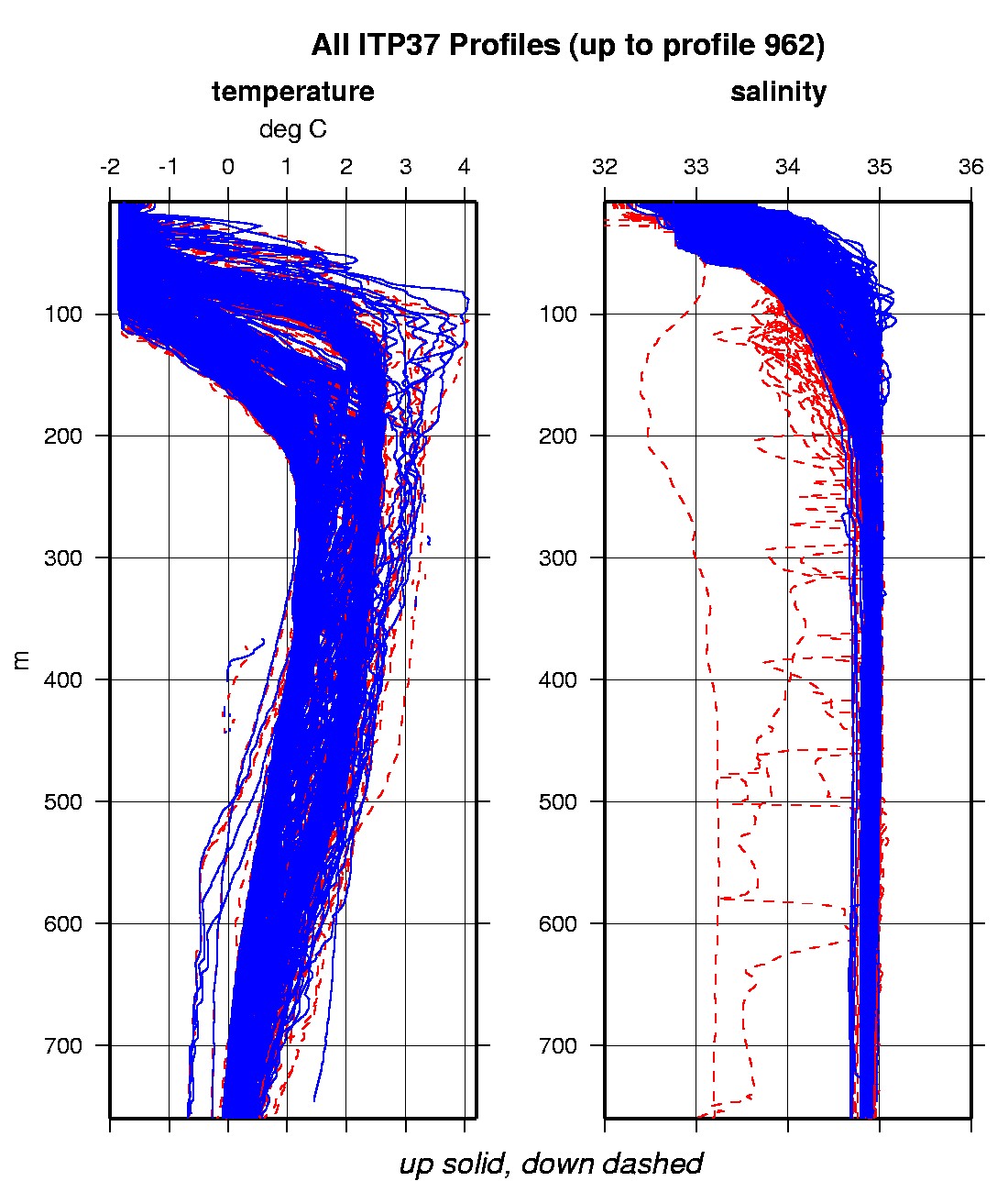
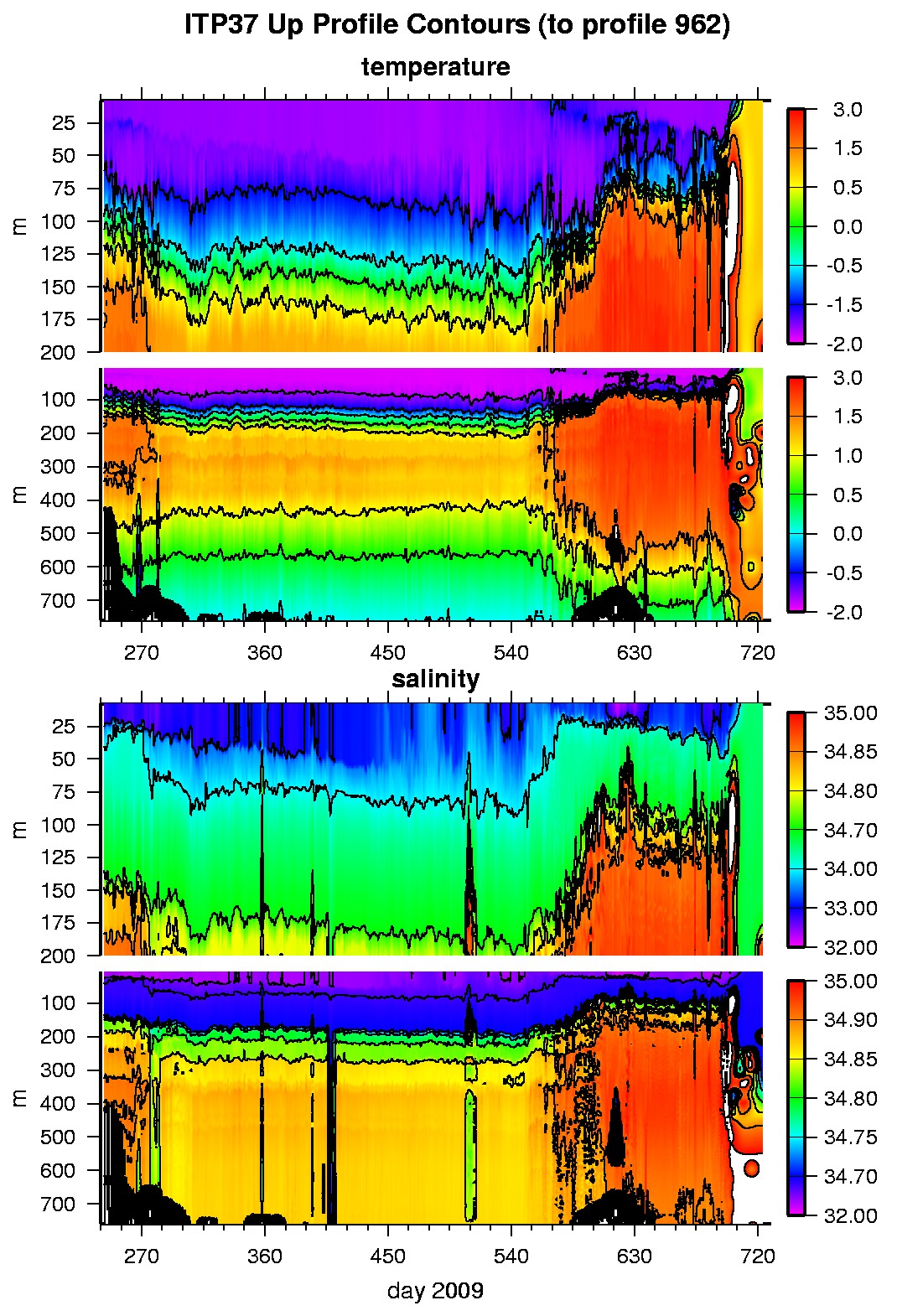
Last buoy status on 2011/5/6 230200 UTC : temperature = 6.89 °C, battery = 12.52 V Last position on 2011/5/6 230200 UTC : 80.3862° N, 21.2711° E Last profile (number 962) on 2010/12/24 600 UTC Last profile mean motor current = 302.1424 mA, mean battery = 10.3641 V Last profile depth: minimum = 176.2107, maximum = 179.8266 m Last profile temperature: minimum = 2.298, maximum = 2.3123 °C Last profile salinity: minimum = 34.8454, maximum = 34.8474 The raw GPS buoy location data are available in an ASCII file: itp37rawlocs.dat Depth averaged profiler data files (with interpolated location) are available in two formats: ITP37 was deployed on August 30, 2009 in open water at 81° 55.7 N, 120° 10.1 E in the Transpolar Drift in collaboration with the Nansen and Amundsen Basins Observational System (NABOS) project from I/B Kapitan Dranitsyn. The ITP is operating on a typical sampling schedule of 2 one-way profiles between 7 and 760 m depth each day.
|