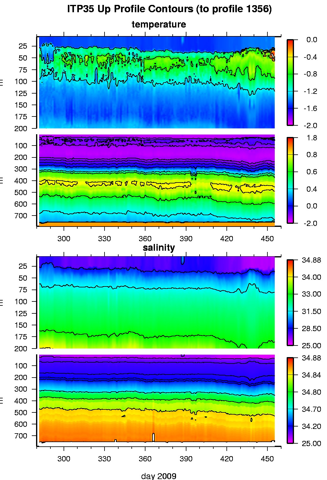
Ice Tethered Profiler 35 Data Data from ITP35 deployed in October 2009
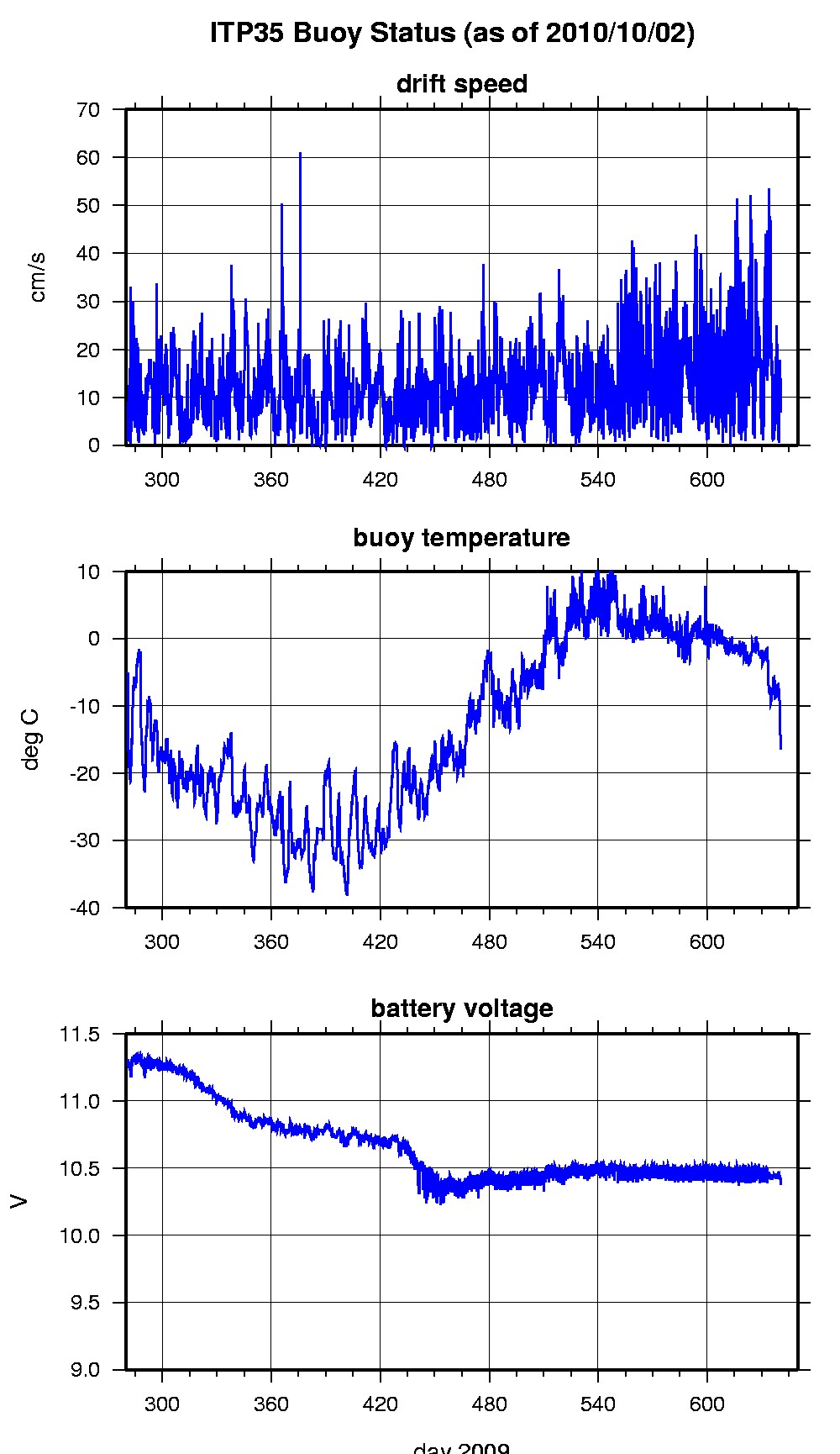
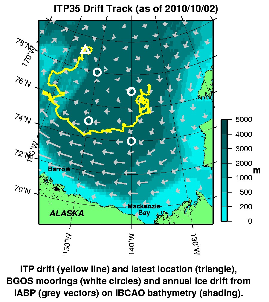
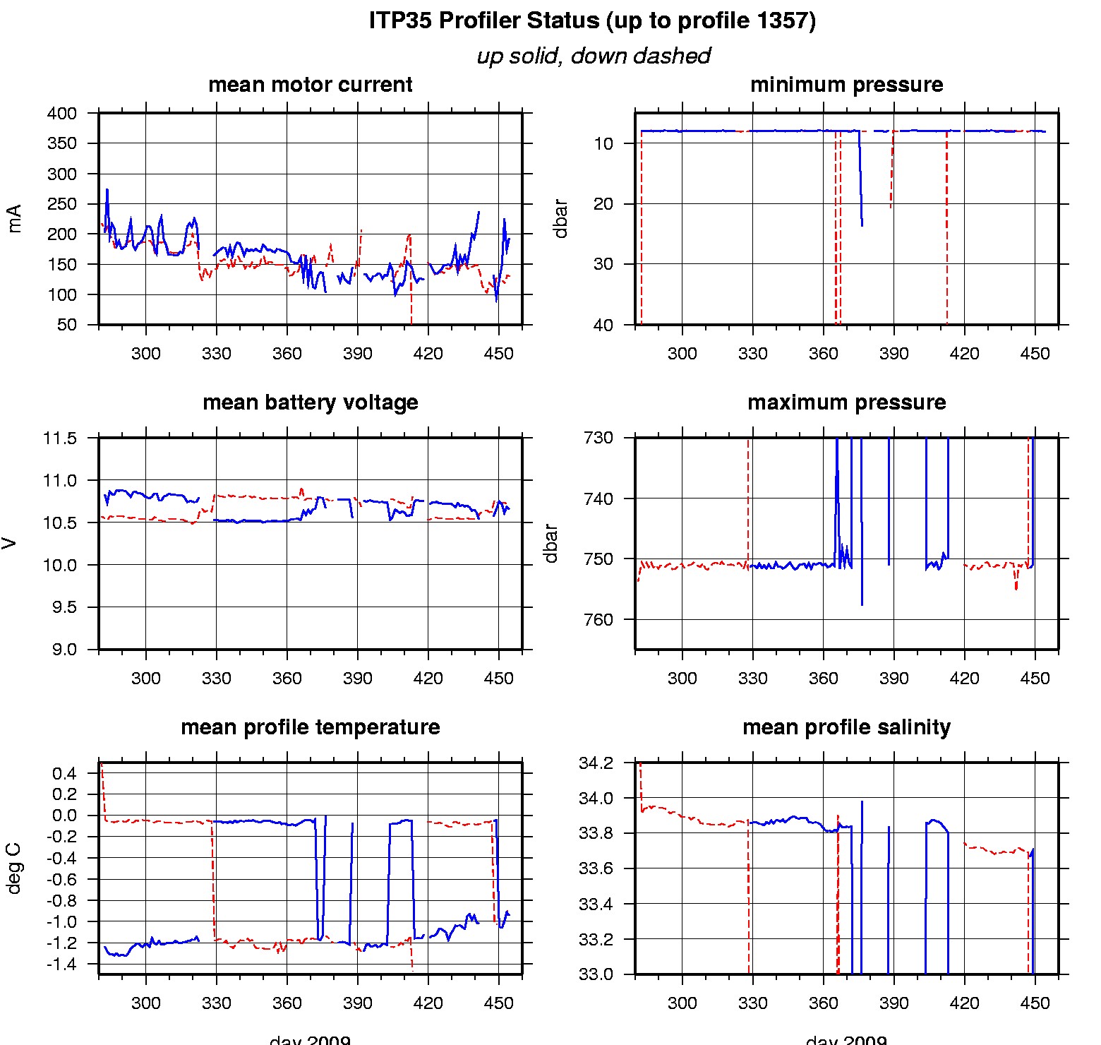
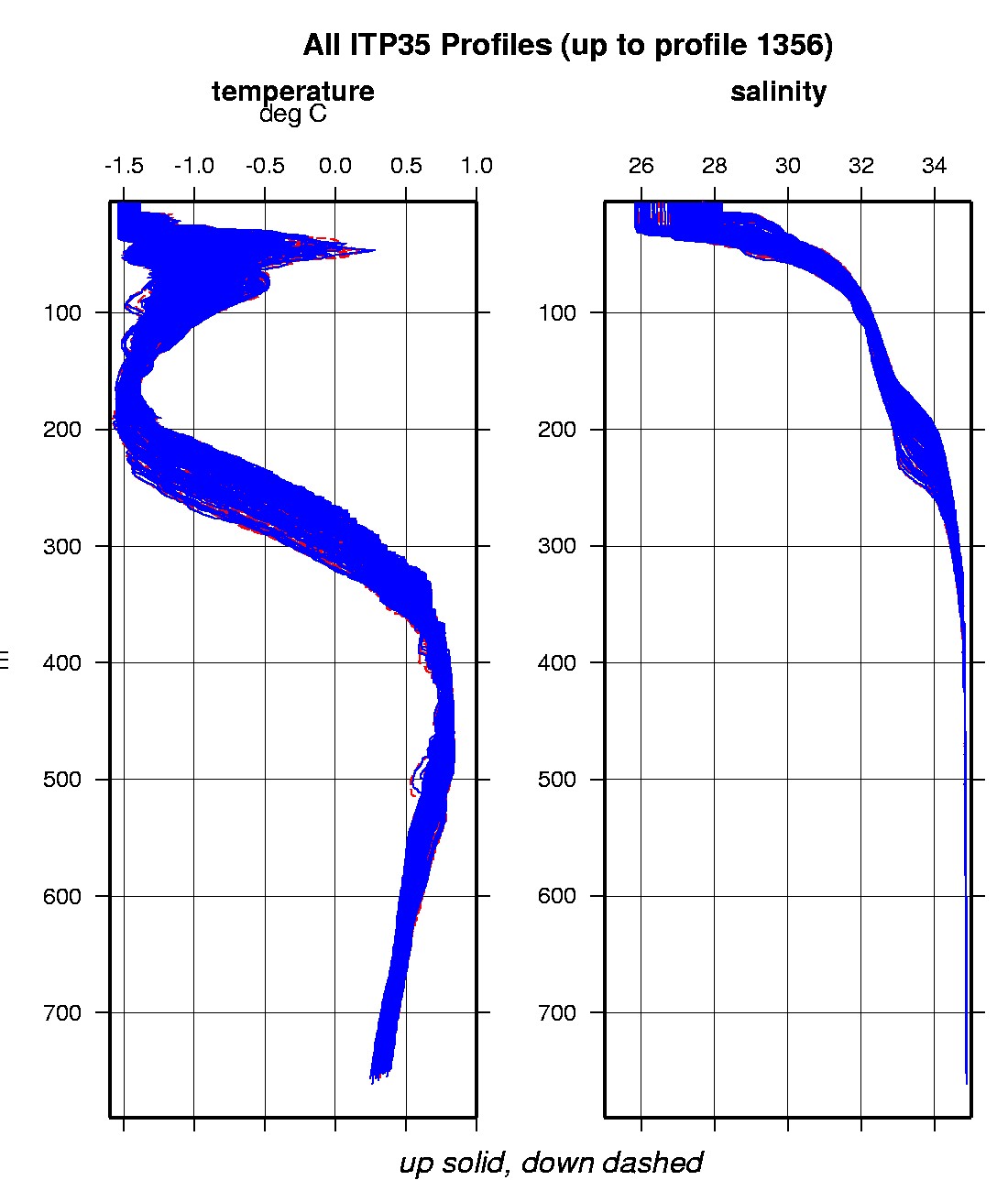
Last buoy status on 2010/10/5 230200 UTC : temperature = 2.26 °C, battery = 10.49 V Last position on 2010/10/5 230201 UTC : 77.3987° N, 141.992° W Last profile (number 1357) on 2010/3/31 403 UTC Last profile mean motor current = 128.9412 mA, mean battery = 10.7341 V Last profile depth: minimum = 8.0263, maximum = 151.4552 m Last profile temperature: minimum = -1.4452, maximum = -0.15251 °C Last profile salinity: minimum = 26.1856, maximum = 32.6699 The raw GPS buoy location data are available in an ASCII file: itp35rawlocs.dat Depth averaged profiler data files (with interpolated location) are available in two formats: ITP35 was deployed on October 8, 2009 on a 2.6 m thick ice floe in the Beaufort Sea at 77° 4.5 N, 135° 25.8 W as part of the Beaufort Gyre Observing System (BGOS) during the JOIS 2009 cruise on the CCGS Louis S. St. Laurent. On the same icefloe, a US Army Cold Regions Research and Engineering Laboratory (CRREL) Ice Mass Balance Buoy (IMB 2009G) and an autonomous atmospheric chemistry buoy (O-Buoy) were also installed. The prototype ITP includes a MAVS current meter and is operating on a pattern profiling schedule between 7 and 760 m depth each day.
|