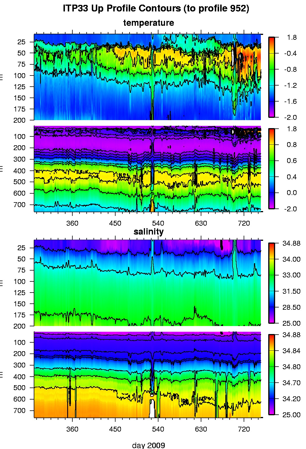
Ice Tethered Profiler 33 Data Data from ITP33 deployed in October 2009
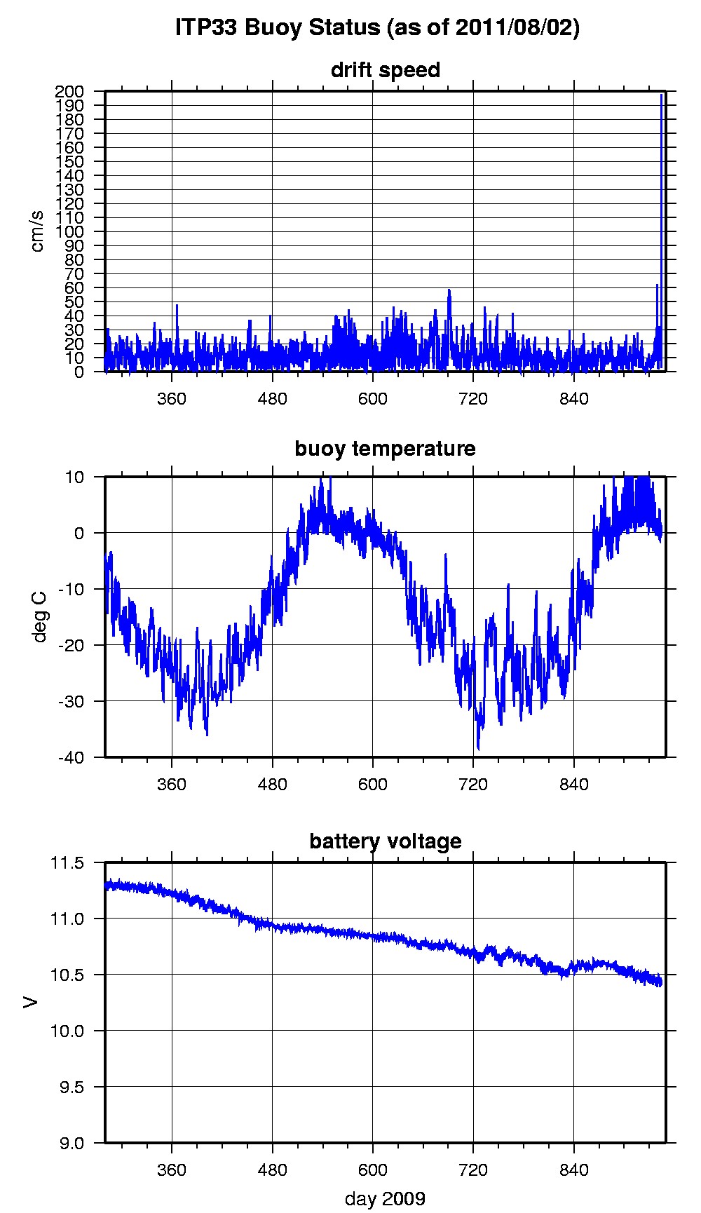
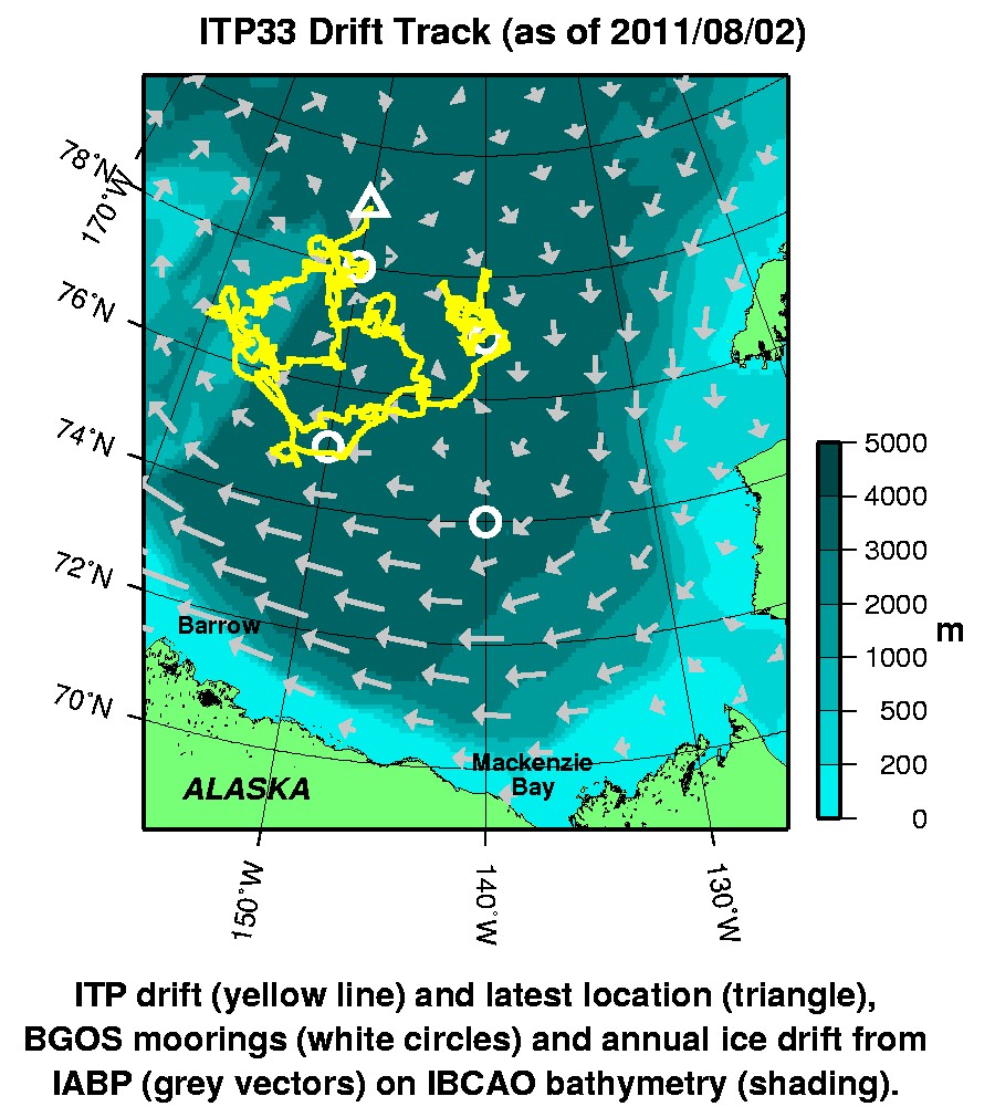
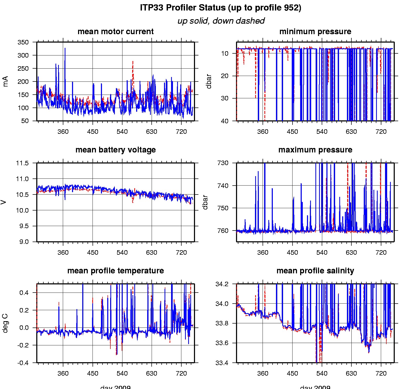
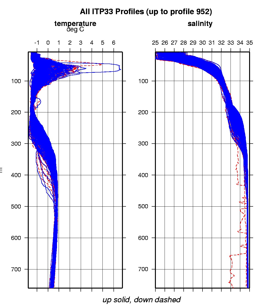
Last buoy status on 2011/8/2 230133 UTC : temperature = 0.86 °C, battery = 10.44 V Last position on 2011/8/2 230133 UTC : 79.0111° N, 150.0193° W Last profile (number 952) on 2011/1/25 600 UTC Last profile mean motor current = 166.6932 mA, mean battery = 10.2241 V Last profile depth: minimum = 7.9633, maximum = 760.773 m Last profile temperature: minimum = -1.5827, maximum = 1.5992 °C Last profile salinity: minimum = 27.6391, maximum = 34.8474 The raw GPS buoy location data are available in an ASCII file: itp33rawlocs.dat Depth averaged profiler data files (with interpolated location) are available in two formats: ITP33 was deployed on October 7, 2009 on a 4.2 m thick ice floe in the Beaufort Sea at 77° 59.7 N, 149° 14.5 W as part of the Beaufort Gyre Observing System (BGOS) during the JOIS 2009 cruise on the CCGS Louis S. St. Laurent. The ITP is operating on a standard sampling schedule of 2 one-way profiles between 7 and 760 m depth each day.
|