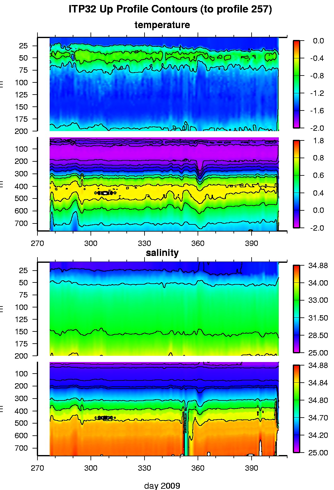
Ice Tethered Profiler 32 Data Data from ITP32 deployed in October 2009
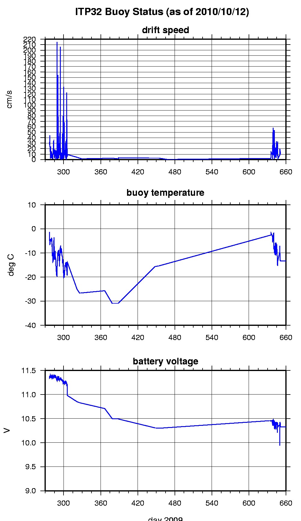
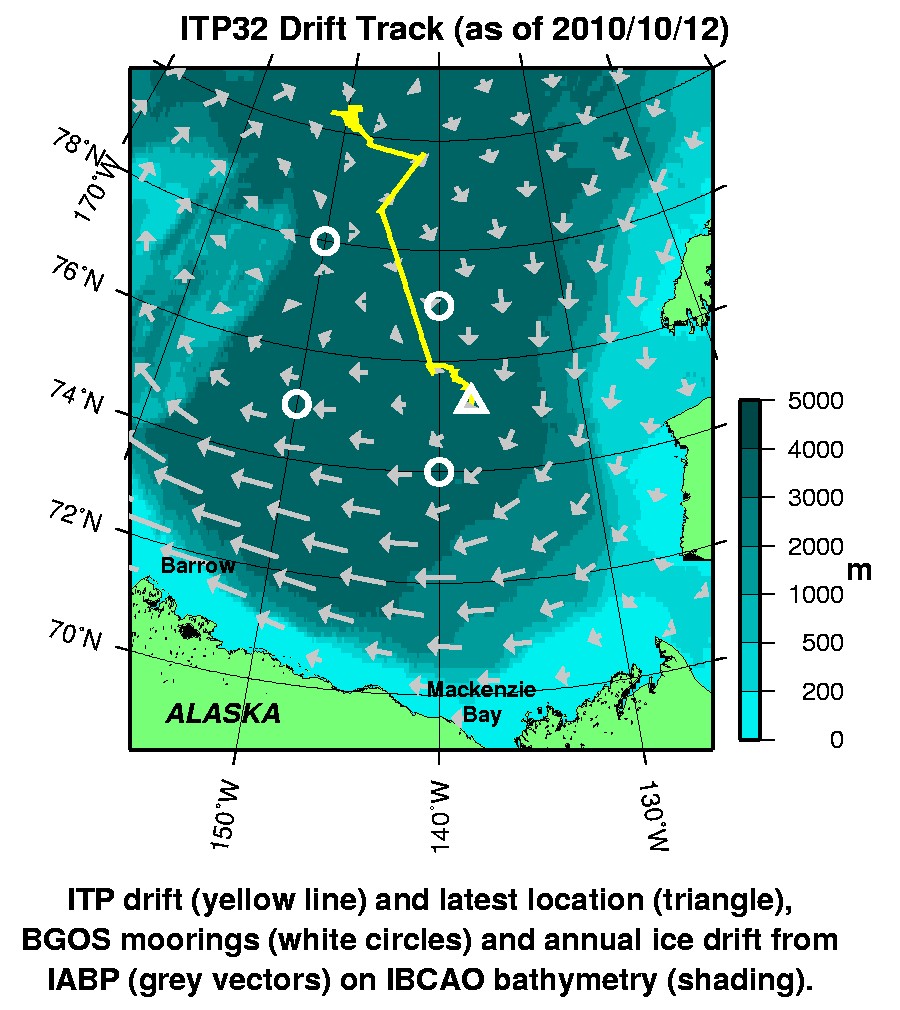
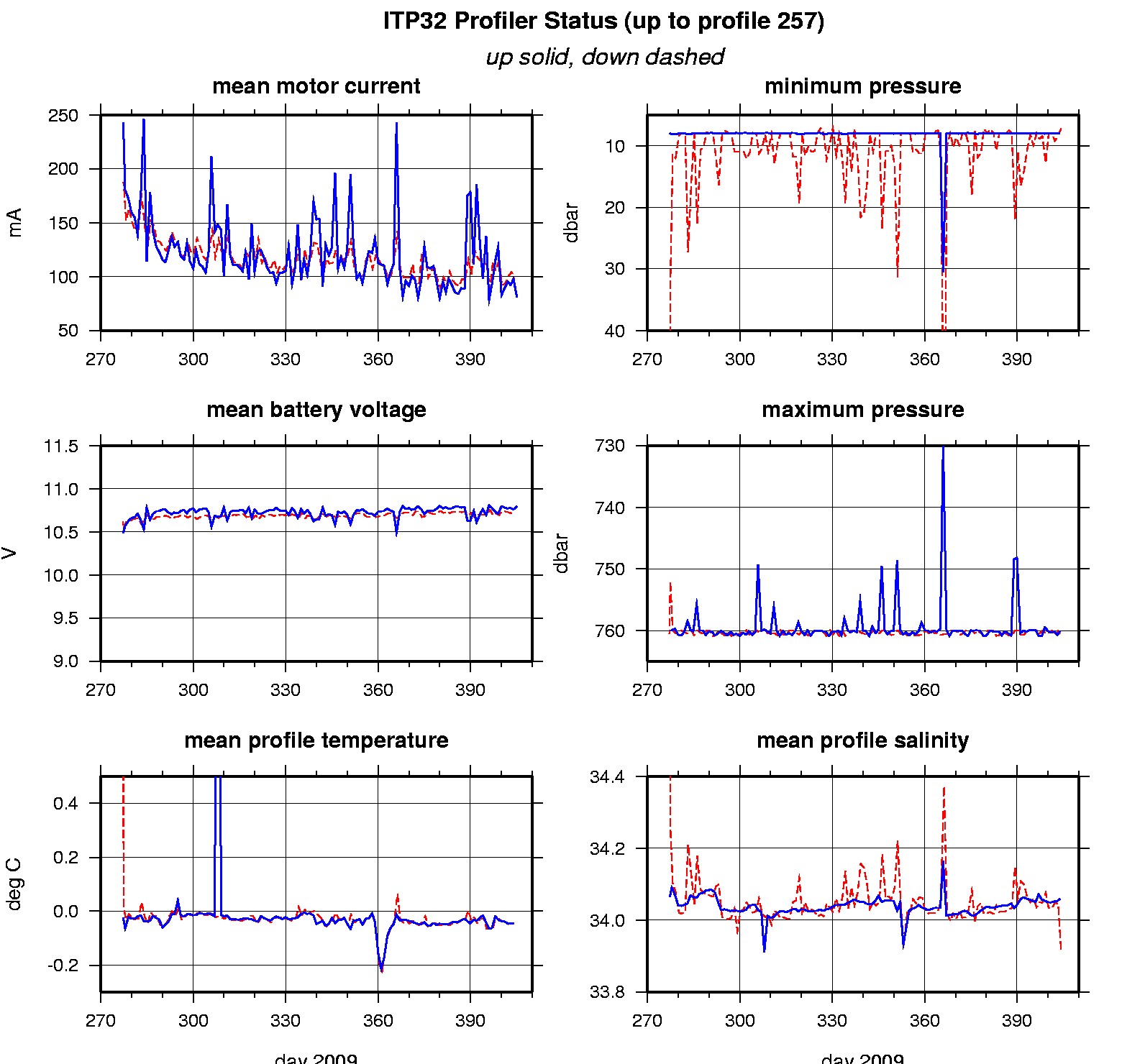
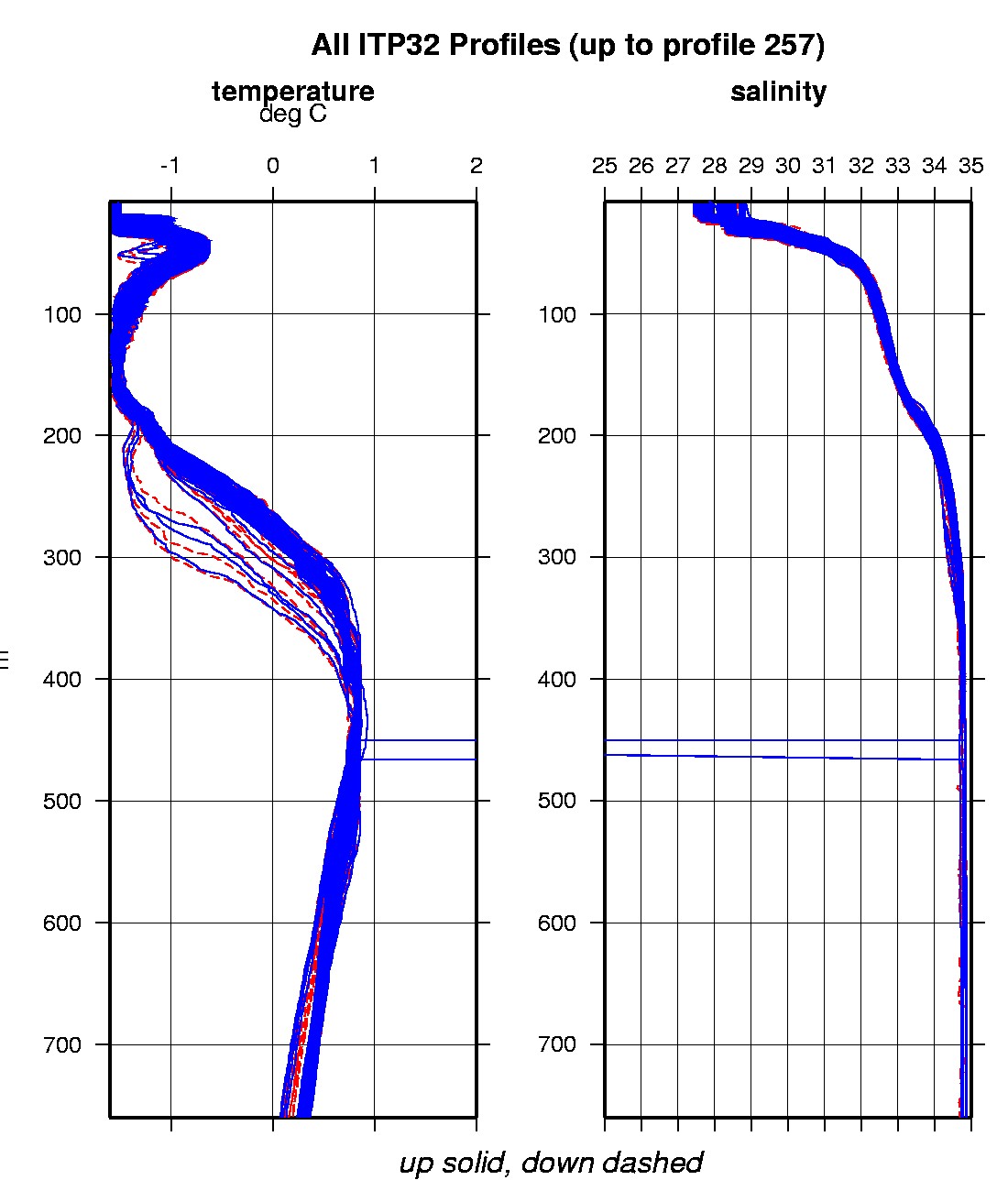
Last buoy status on 2036/1/1 10202 UTC : temperature = -19 °C, battery = 11.31 V Last position on 2010/10/12 230021 UTC : 75.2267° N, 137.7274° W Last profile (number 257) on 2010/2/9 0 UTC Last profile mean motor current = 81.2781 mA, mean battery = 10.8014 V Last profile depth: minimum = NaN, maximum = NaN m Last profile temperature: minimum = NaN, maximum = NaN °C Last profile salinity: minimum = NaN, maximum = NaN The raw GPS buoy location data are available in an ASCII file: itp32rawlocs.dat Depth averaged profiler data files (with interpolated location) are available in two formats: ITP32 was deployed on October 4, 2009 on a 3 m thick ice floe (formerly occupied by ITP 8) in the Beaufort Sea at 80° 19.4 N, 151° 45.7 W as part of the Beaufort Gyre Observing System (BGOS) during the JOIS 2009 cruise on the CCGS Louis S. St. Laurent. The ITP is operating on a standard sampling schedule of 2 one-way profiles between 7 and 760 m depth each day.
|