Ice Tethered Profiler 30 Data Data from ITP30 deployed in August 2008
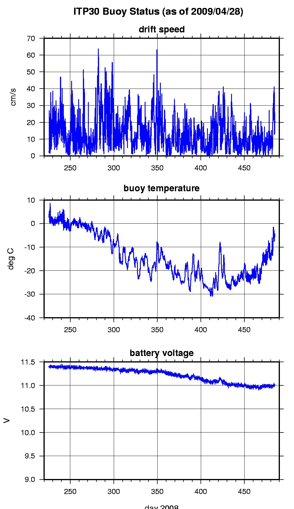
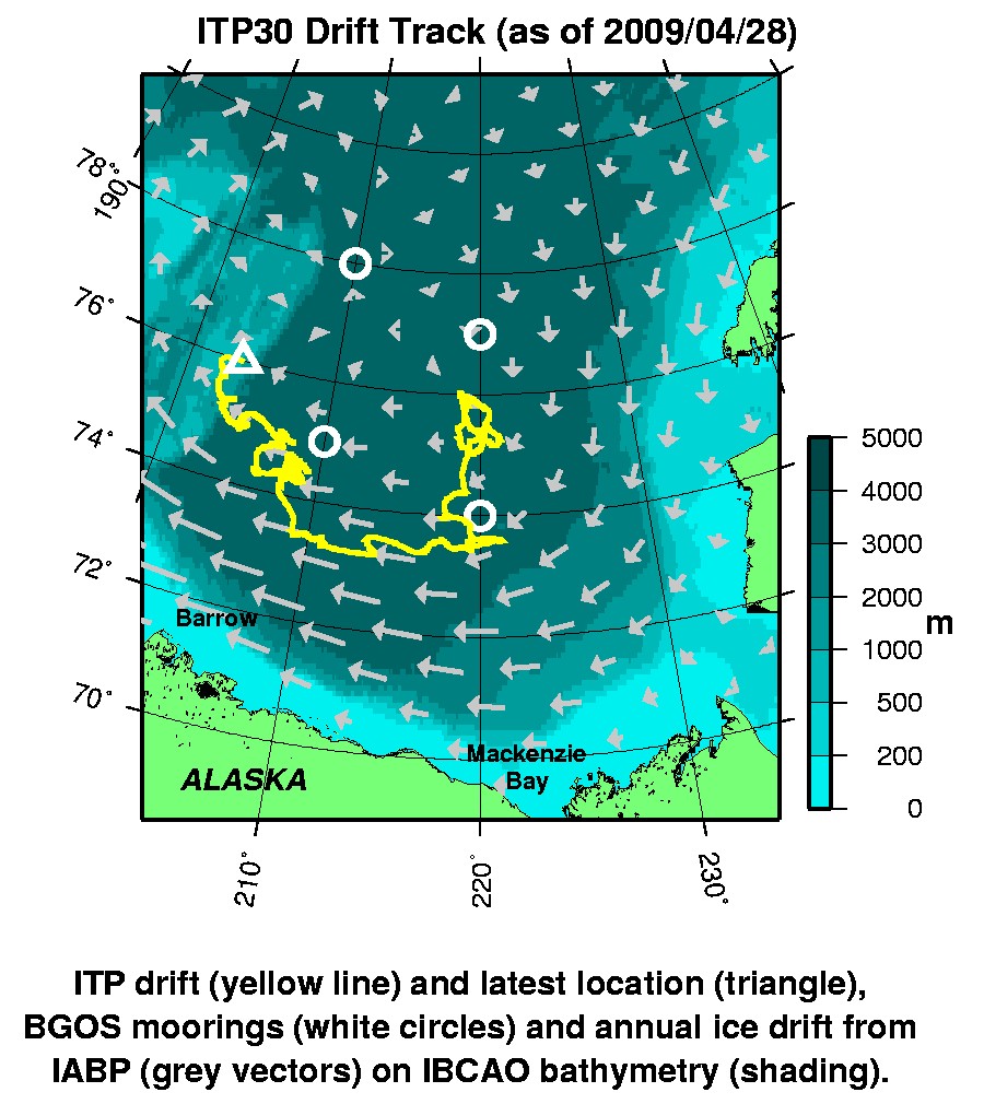
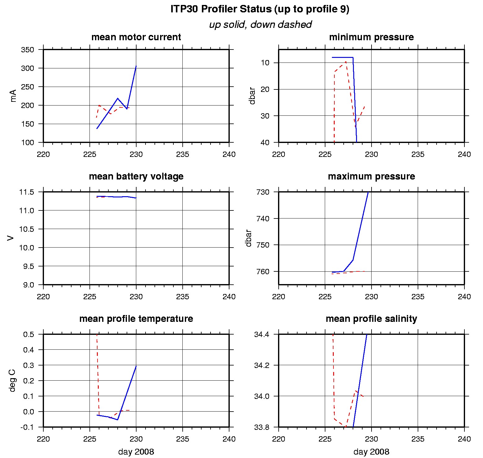
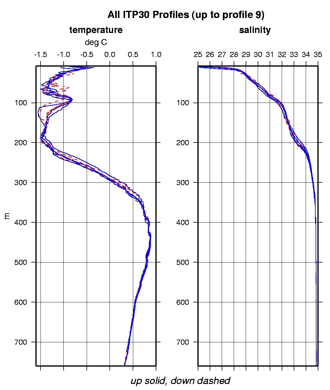
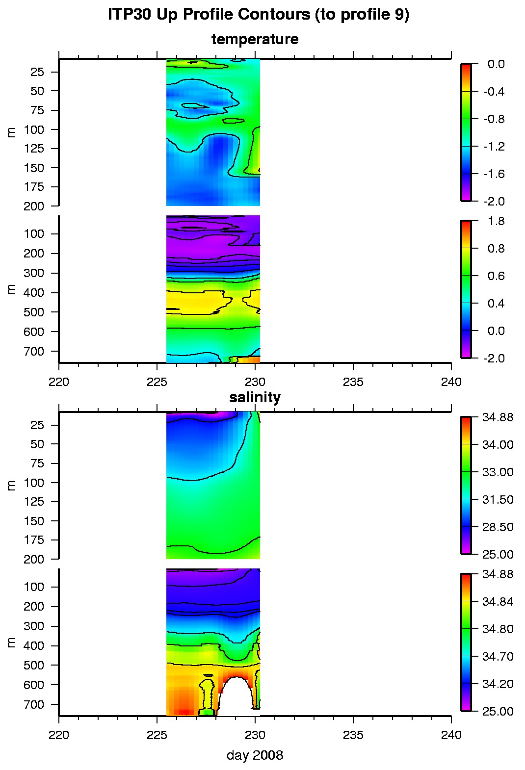
Last buoy status on 2009/4/28 230038 UTC : temperature = -4.56 °C, battery = 11.01 V Last position on 2009/4/28 230038 UTC : 75.9896° N, 156.4395° W Last profile (number 9) on 2008/8/17 0 UTC Last profile mean motor current = 306.9132 mA, mean battery = 11.3355 V Last profile depth: minimum = 164.4061, maximum = 724.3801 m Last profile temperature: minimum = -1.4606, maximum = 0.86903 °C Last profile salinity: minimum = 32.8434, maximum = 34.8552 The raw GPS buoy location data are available in an ASCII file: itp30rawlocs.dat Depth averaged profiler data files (with interpolated location) are available in two formats: ITP30 was deployed on August 12, 2008 on a 2.4 m thick ice floe in the Beaufort Sea at 75° 54.6 N, 140° 36.9 W as part of the Beaufort Gyre Observing System (BGOS) during the JOIS 2008 cruise on the CCGS Louis S. St. Laurent. On the same icefloe, a Scottish Association for Marine Science (SAMS) Ice Mass Balance Array (SIMBA A) was also installed. The ITP is configured with a FSI EMCTD and is operating on a standard sampling schedule of 2 one-way profiles between 7 and 760 m depth each day.
|