Ice Tethered Profiler 25 Data Data from ITP25 deployed in September 2008
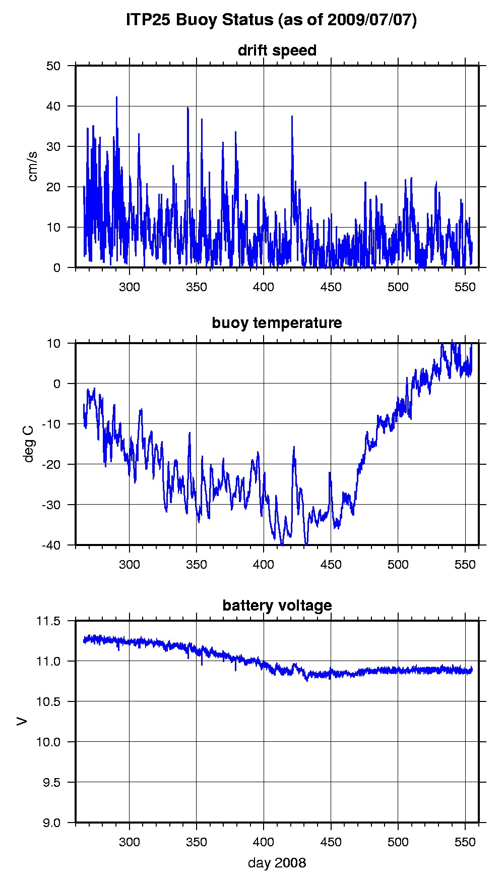
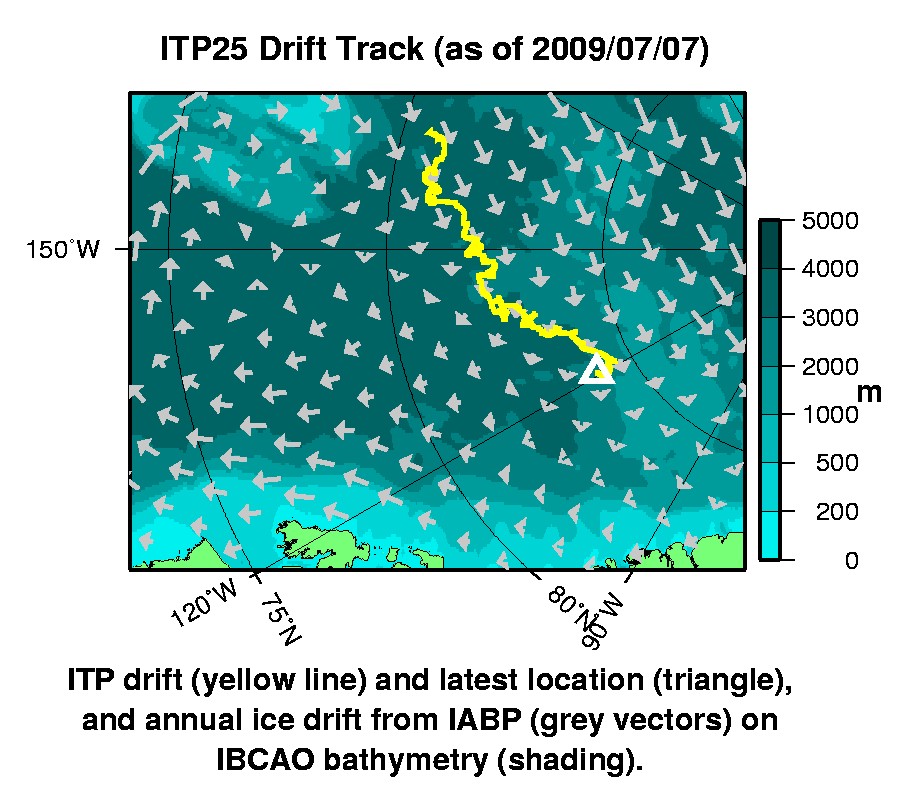
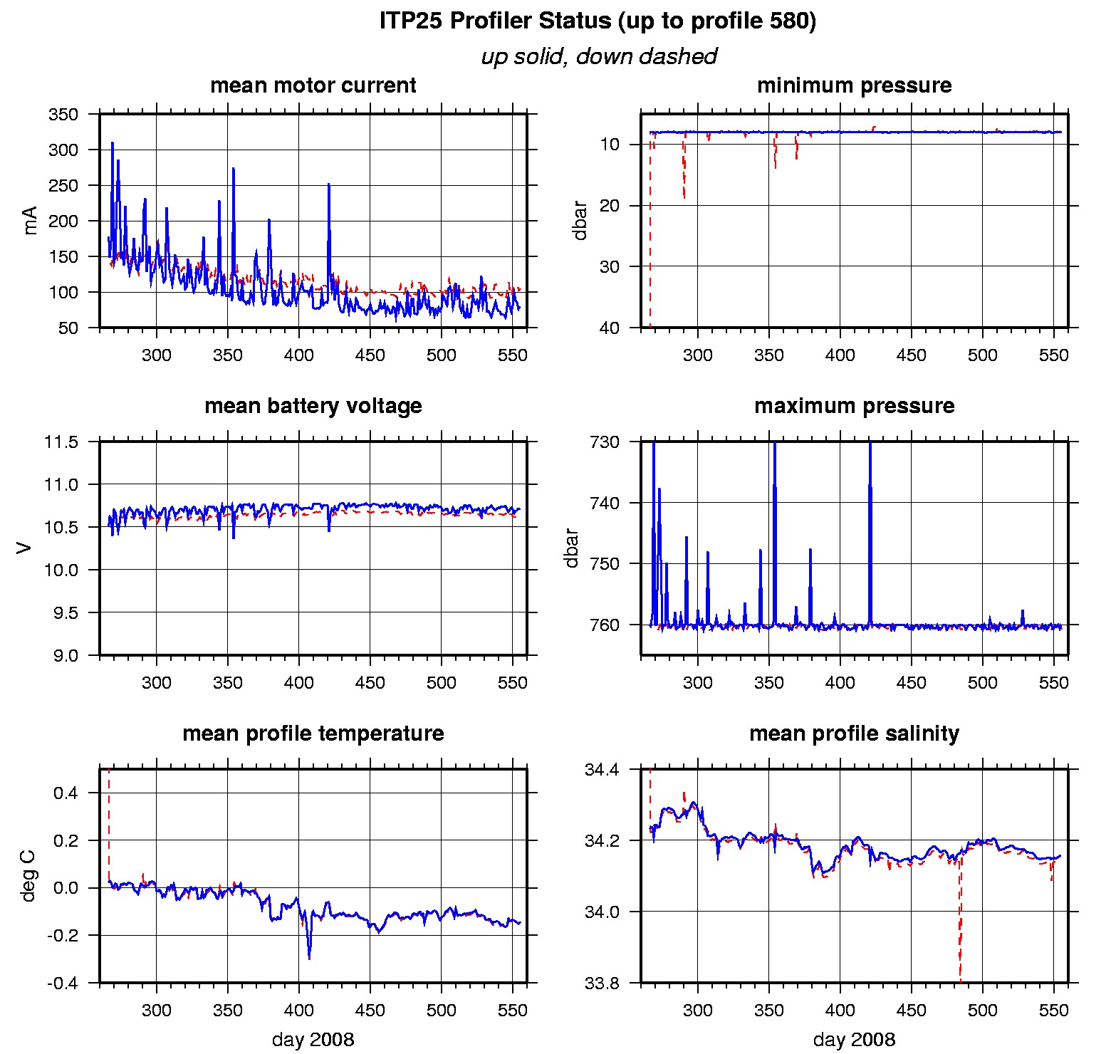
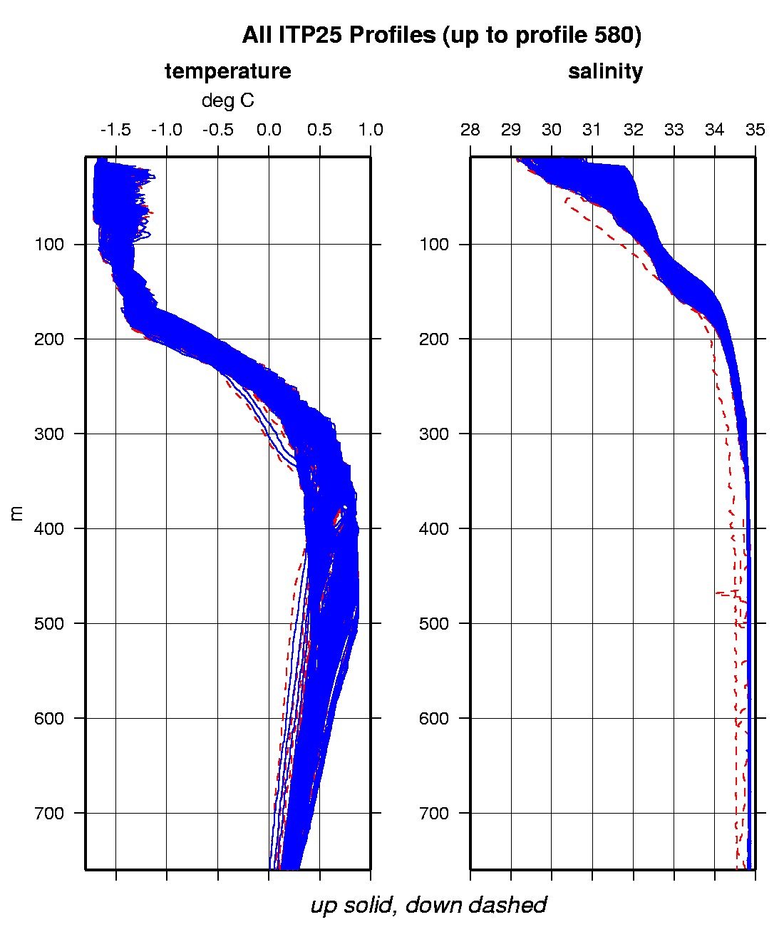
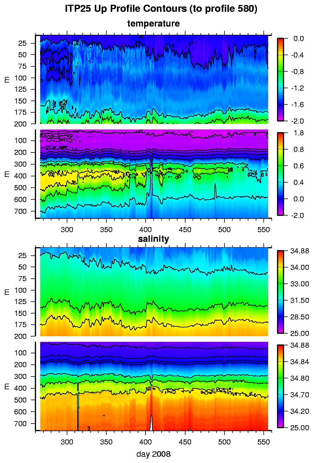
Last buoy status on 2009/7/7 230016 UTC : temperature = 13.34 °C, battery = 10.9 V Last position on 2009/7/7 230016 UTC : 84.1081° N, 120.7157° W Last profile (number 580) on 2009/7/8 600 UTC Last profile mean motor current = 104.4284 mA, mean battery = 10.626 V Last profile depth: minimum = 7.98, maximum = 760.6859 m Last profile temperature: minimum = -1.6063, maximum = 0.46549 °C Last profile salinity: minimum = 29.9986, maximum = 34.8768 The raw GPS buoy location data are available in an ASCII file: itp25rawlocs.dat Depth averaged profiler data files (with interpolated location) are available in two formats: ITP25 was deployed on September 22, 2008 on a 1.6 m icefloe in the Beaufort Gyre at 80° 38.5 N, 166° 46.0 W from the German Research Vessel Polarstern as part of the European Union DAMOCLES Program. On the same icefloe, an Optimare ITAC with GPS mast and University of Hamburg (ZMAW) PAWS meteorological station were also installed. The ITP is operating on a typical sampling schedule of 2 one-way profiles between 7 and 760 m depth each day.
|