Ice Tethered Profiler 23 Data Data from ITP23 deployed in August 2008
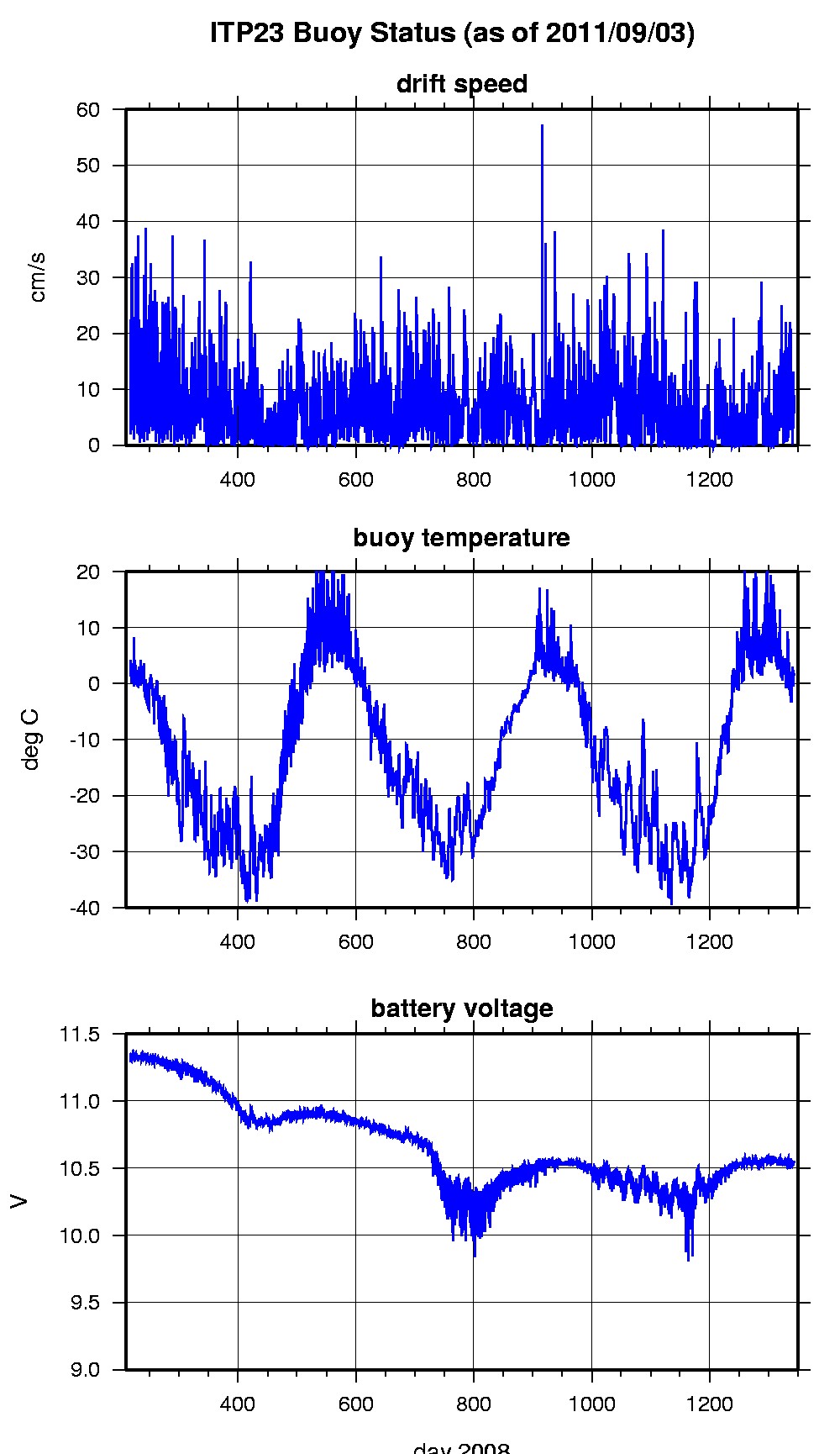
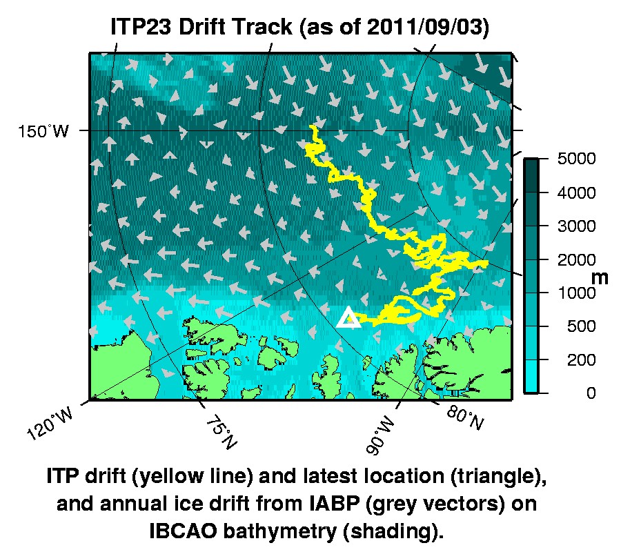
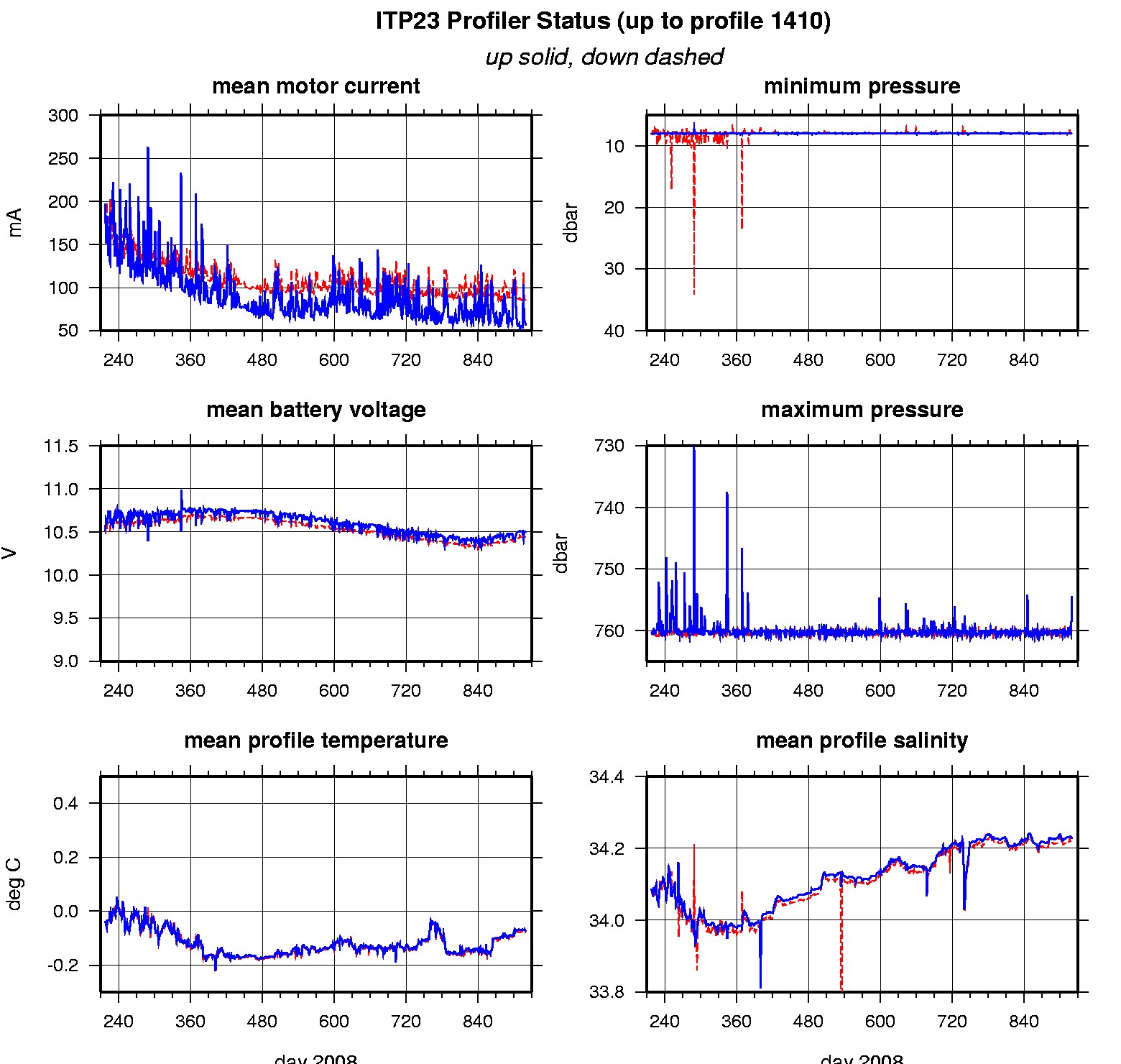
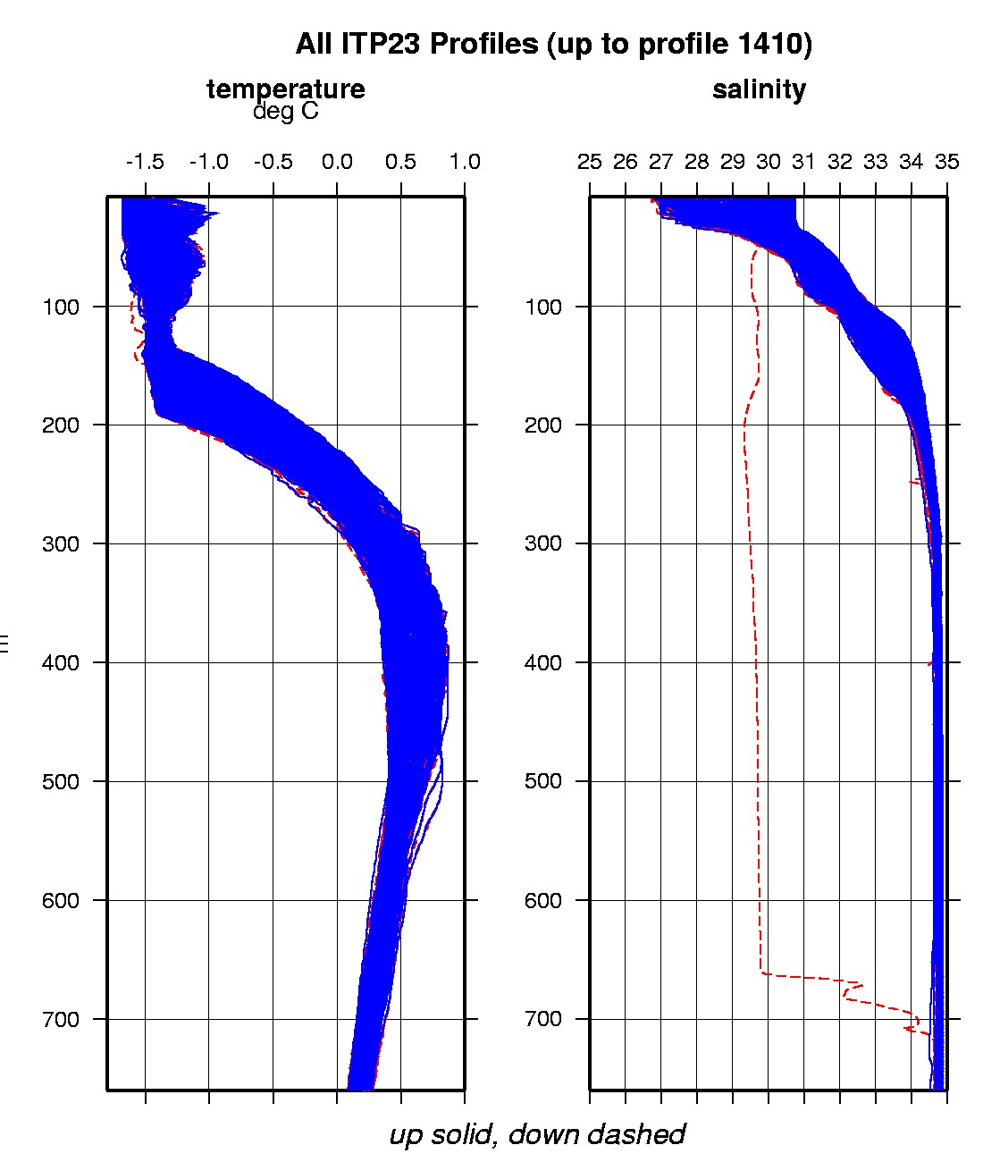
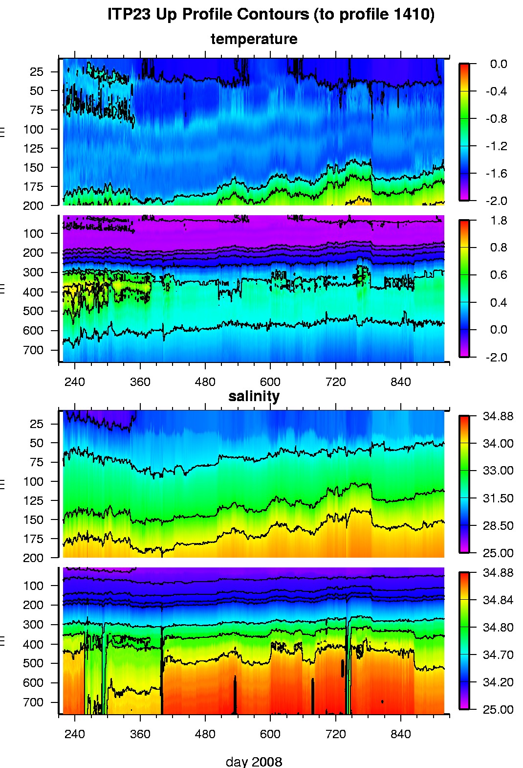
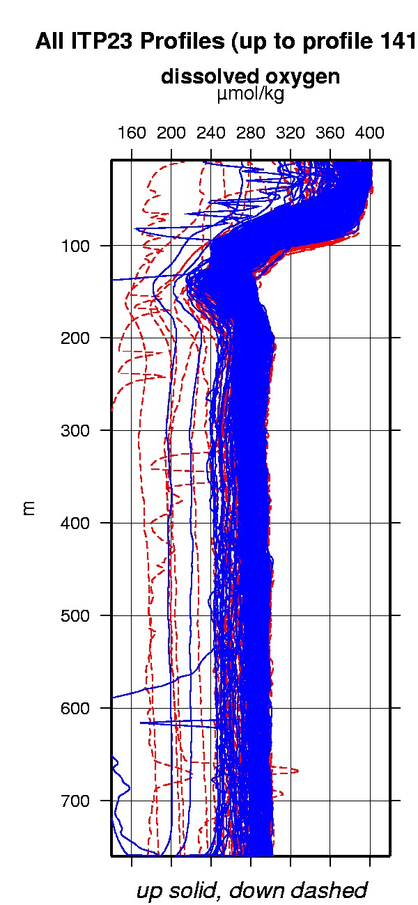
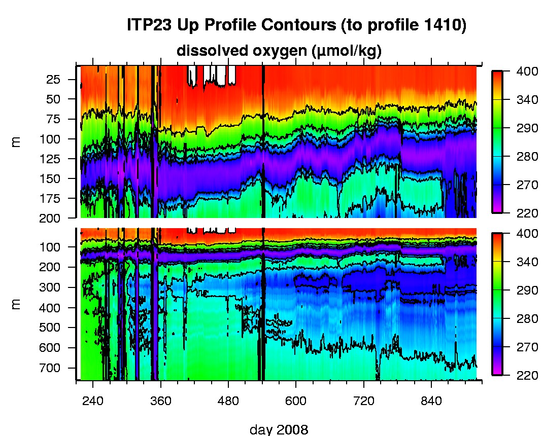
Last buoy status on 2011/9/3 230037 UTC : temperature = 1.44 °C, battery = 10.55 V Last position on 2011/9/3 230038 UTC : 80.5462° N, 107.6659° W Last profile (number 1410) on 2010/7/8 624 UTC Last profile mean motor current = 84.9927 mA, mean battery = 10.4459 V Last profile depth: minimum = 8.01, maximum = 760.0657 m Last profile temperature: minimum = -1.576, maximum = 0.51547 °C Last profile salinity: minimum = 30.0081, maximum = 34.8673 Last profile dissolved oxygen: minimum = 243.7619, maximum = 392.3215 μmol/kg The raw GPS buoy location data are available in an ASCII file: itp23rawlocs.dat Depth averaged profiler data files (with interpolated location) are available in two formats: ITP23 was deployed on August 5, 2008 on a 1.9 m thick ice floe in the Beaufort Sea at 81° 44.5 N, 150° 53.4 W as part of the Beaufort Gyre Observing System (BGOS) during the JOIS 2008 cruise on the CCGS Louis S. St. Laurent. On the same icefloe, a Naval Postgraduate School Arctic Ocean Flux Buoy (AOFB 17) was also installed. The ITP includes a dissolved oxygen sensor and is operating on a standard sampling schedule of 2 one-way profiles between 7 and 760 m depth each day.
|