Ice Tethered Profiler 22 Data Data from ITP22 deployed in August 2008
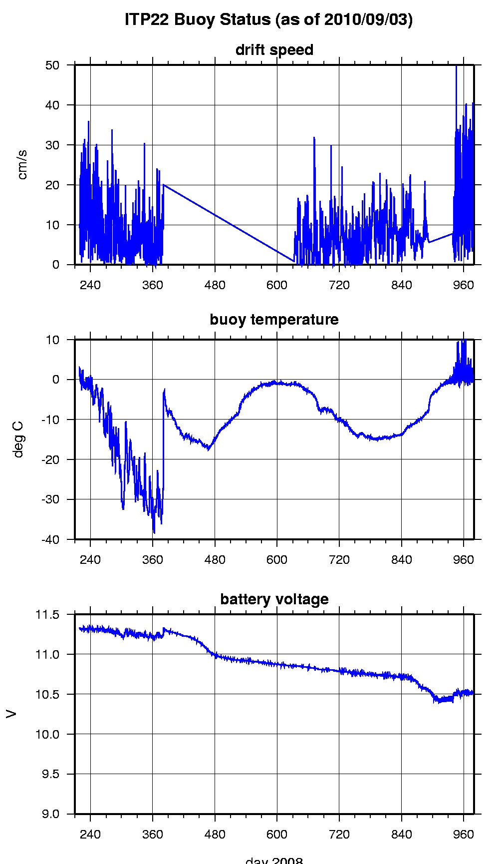
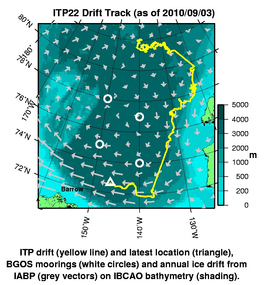
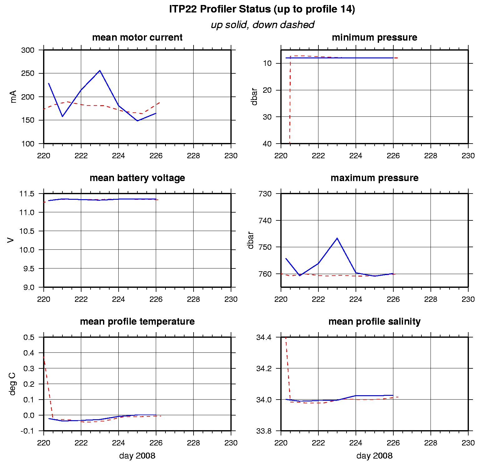
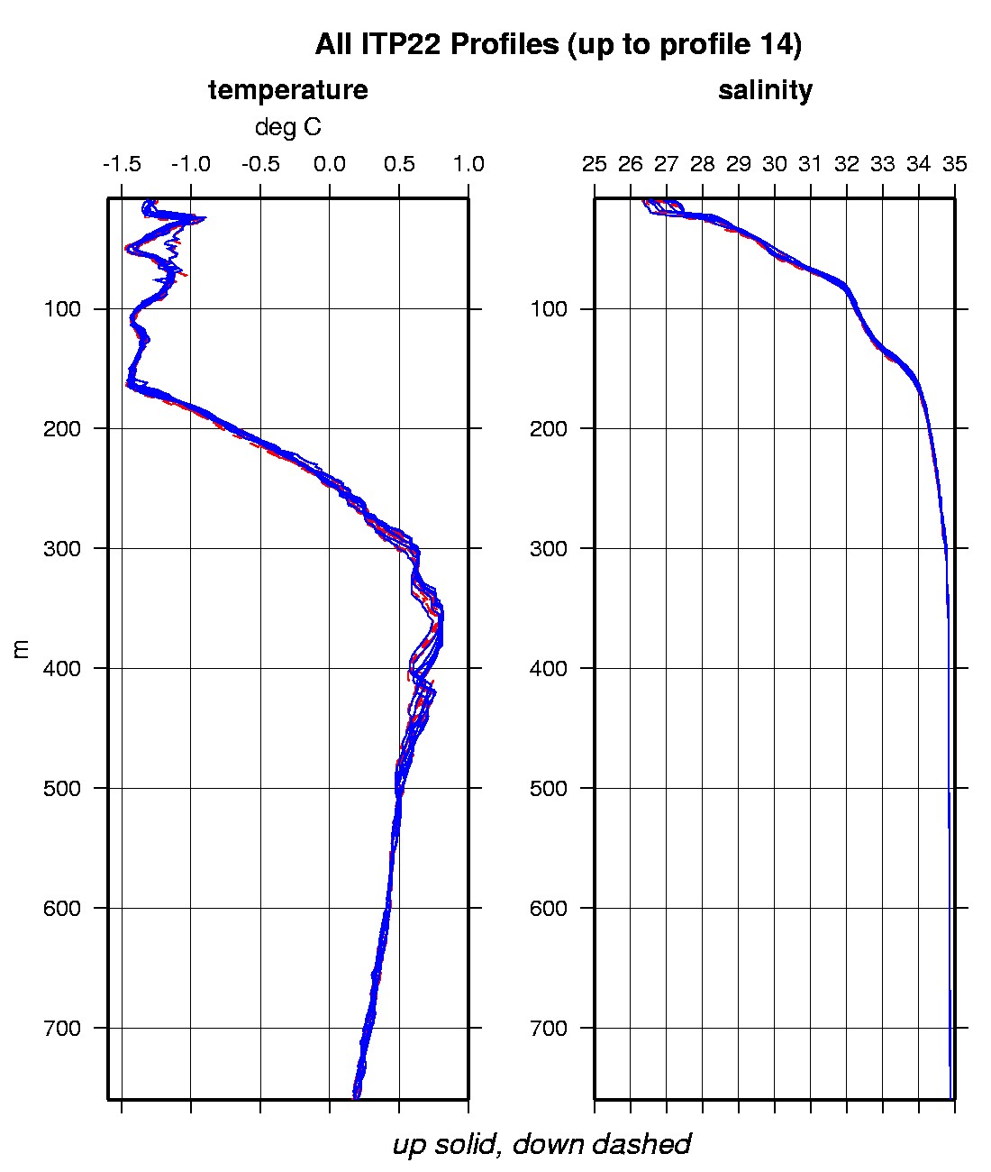
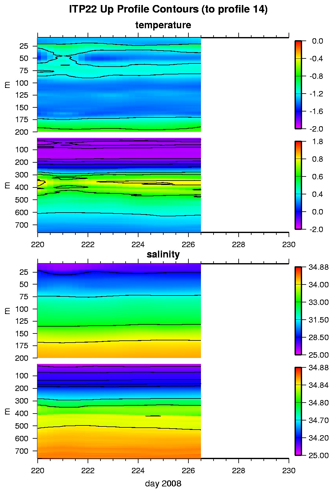
Last buoy status on 2010/9/3 230040 UTC : temperature = 0.33 °C, battery = 10.52 V Last position on 2010/9/3 230040 UTC : 72.6273° N, 146.3279° W Last profile (number 14) on 2008/8/13 600 UTC Last profile mean motor current = 189.5127 mA, mean battery = 11.3355 V Last profile depth: minimum = 7.9456, maximum = 759.9886 m Last profile temperature: minimum = -1.4739, maximum = 0.8129 °C Last profile salinity: minimum = 26.495, maximum = 34.8628 The raw GPS buoy location data are available in an ASCII file: itp22rawlocs.dat Depth averaged profiler data files (with interpolated location) are available in two formats: ITP22 was deployed on August 6, 2008 on a 3.5 m thick ice floe in the Beaufort Sea at 82° 0.5 N, 140° 3.2 W as part of the Beaufort Gyre Observing System (BGOS) during the JOIS 2008 cruise on the CCGS Louis S. St. Laurent. On the same icefloe, a Scottish Association for Marine Science (SAMS) Ice Mass Balance Array (SIMBA C) was also installed. The ITP is operating on a standard sampling schedule of 2 one-way profiles between 7 and 760 m depth each day.
|