Ice Tethered Profiler 19 Data Data from ITP19 deployed in April 2008
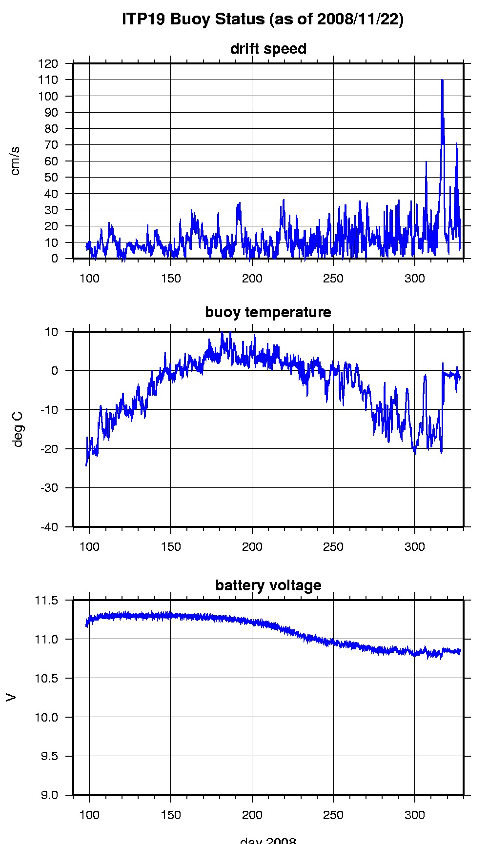
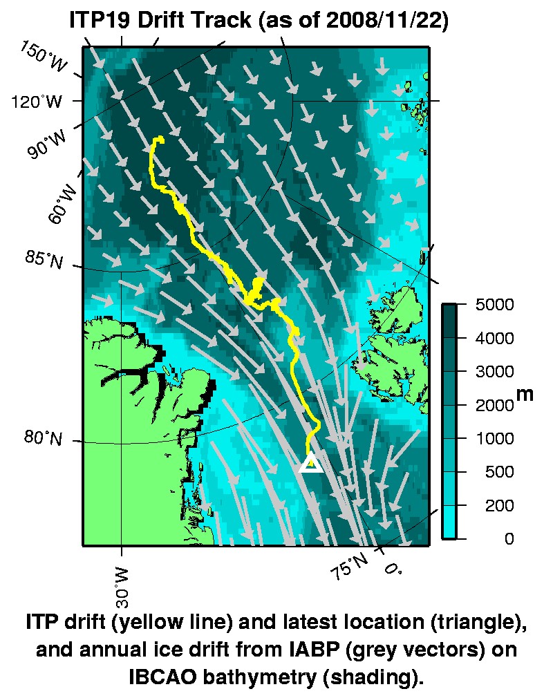
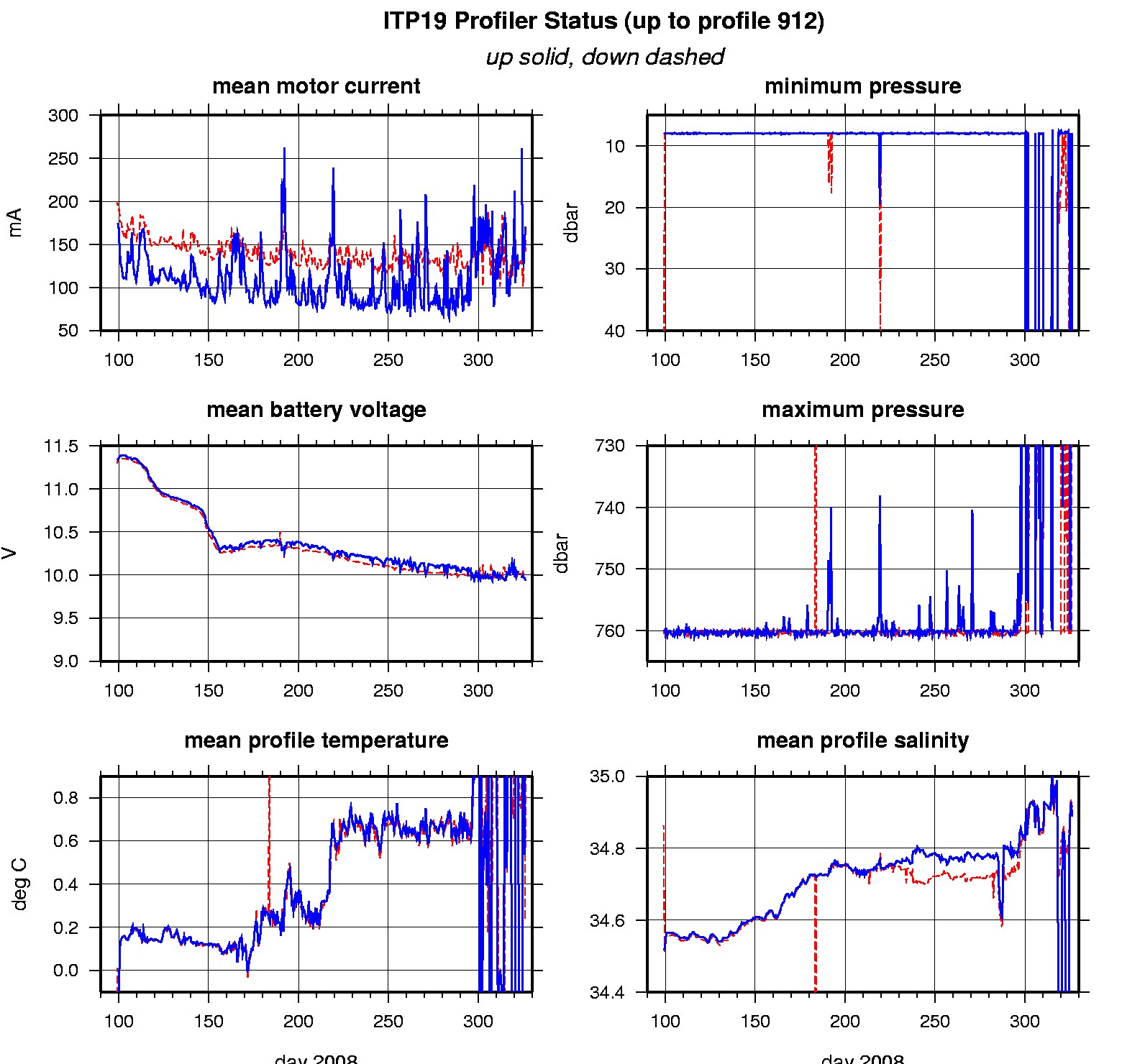
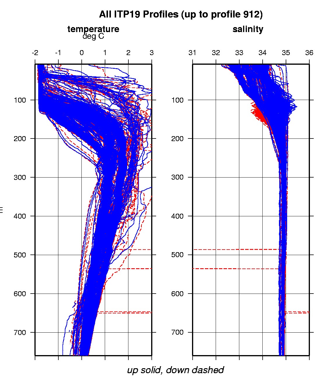
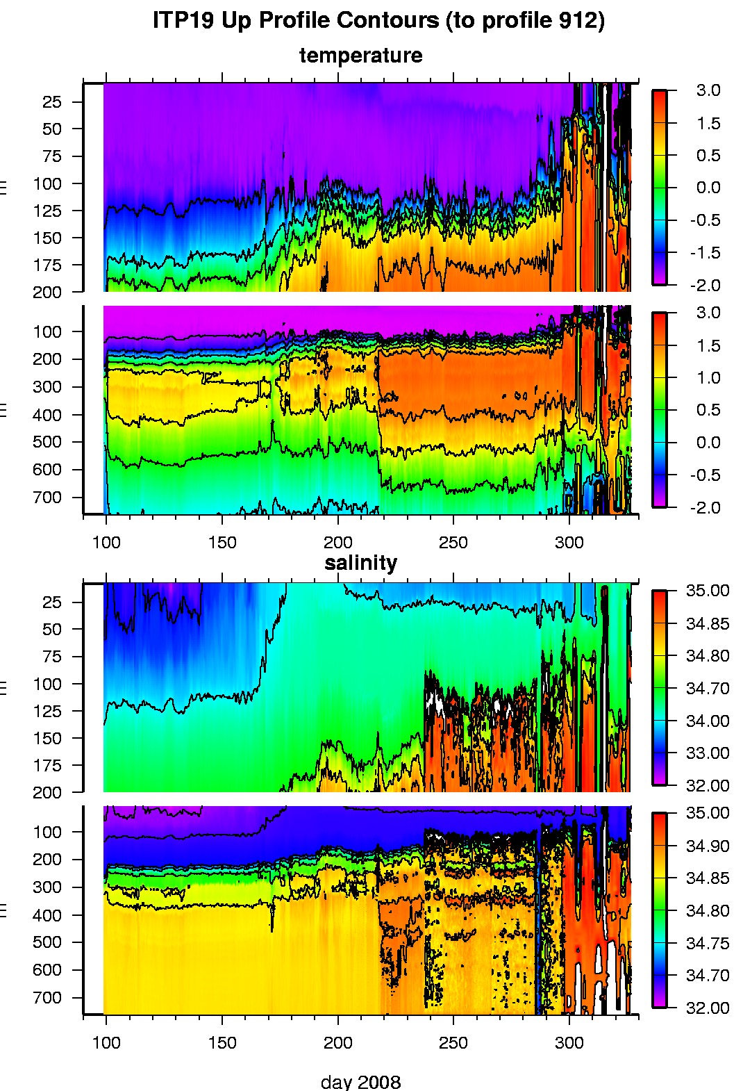
Last buoy status on 2008/11/22 230019 UTC : temperature = -1.42 °C, battery = 10.84 V Last position on 2008/11/22 230019 UTC : 78.0394° N, 2.5569° W Last profile (number 912) on 2008/11/21 1200 UTC Last profile mean motor current = 142.1998 mA, mean battery = 9.9414 V Last profile depth: minimum = 20.1471, maximum = 509.67 m Last profile temperature: minimum = -1.4707, maximum = 2.791 °C Last profile salinity: minimum = 34.2371, maximum = 35.0222 The raw GPS buoy location data are available in an ASCII file: itp19rawlocs.dat Depth averaged profiler data files (with interpolated location) are available in two formats: ITP19 was deployed on a 1.9 m thick icefloe in the Transpolar Drift on April 7, 2008 at 88° 27.1 N, 16° 57.7 E as part of the North Pole Environmental Observatory (NPEO) . On the same icefloe, a Naval Postgraduate School Arctic Ocean Flux Buoy (AOFB), a US Army Cold Regions Research and Engineering Laboratory (CRREL) Ice Mass Balance Buoy and NOAA/PMEL Weatherex station were deployed. The ITP is operating on a fast sampling schedule of 4 one-way profiles between 7 and 760 m depth each day.
|