Ice Tethered Profiler 16 Data Data from ITP16 deployed in September 2007
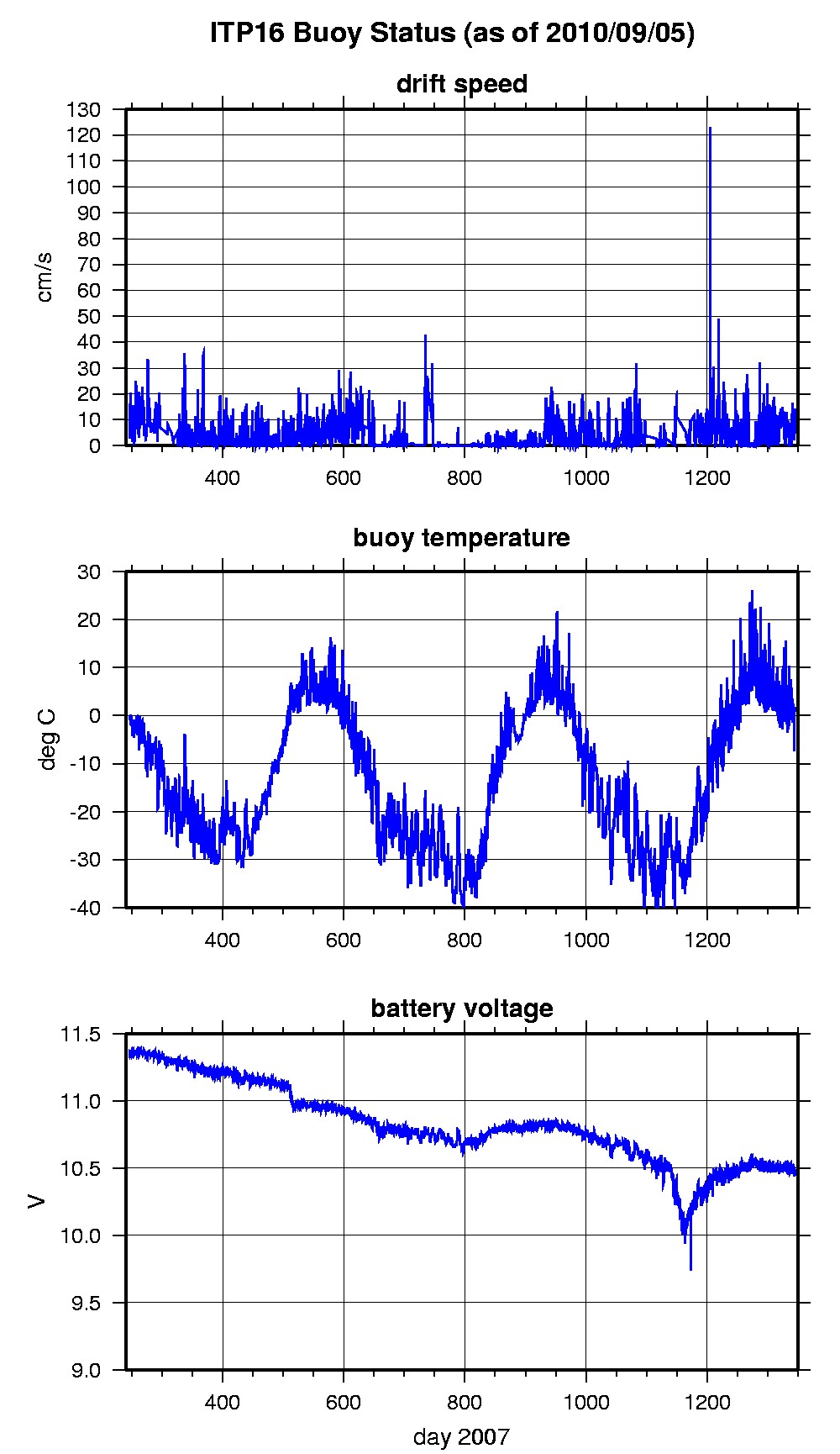
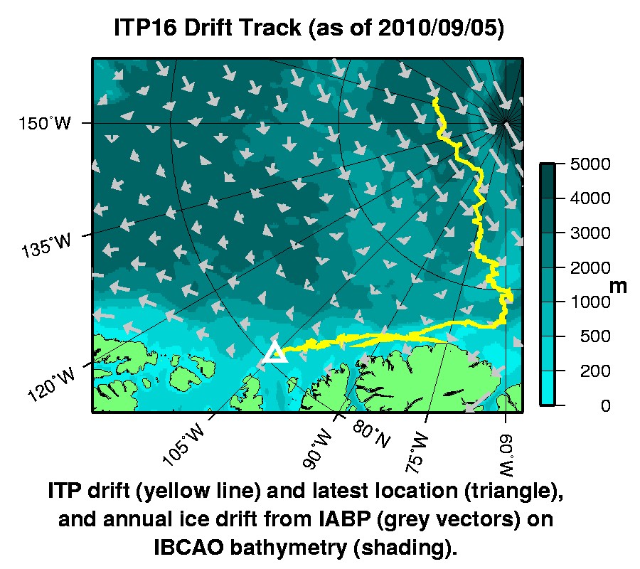
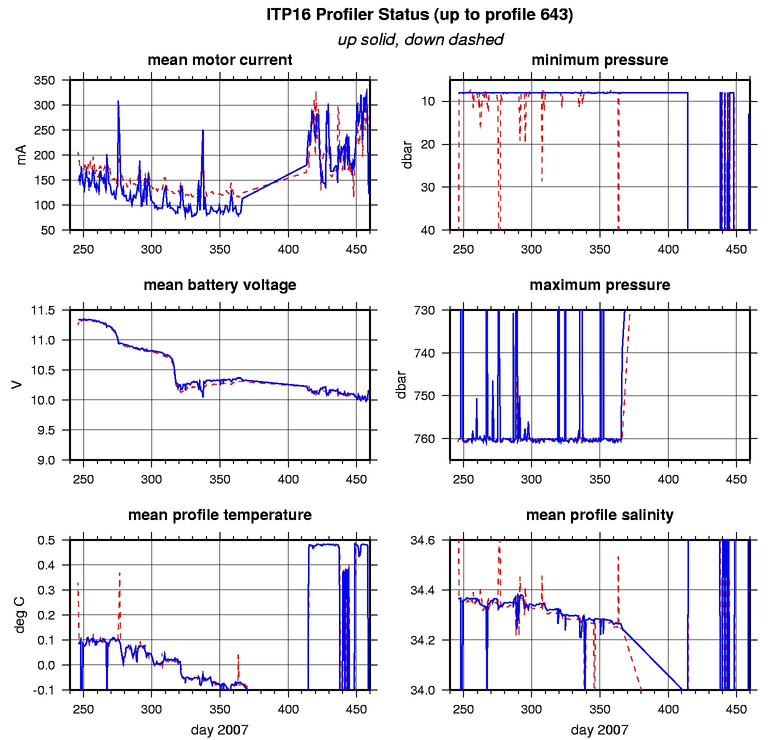
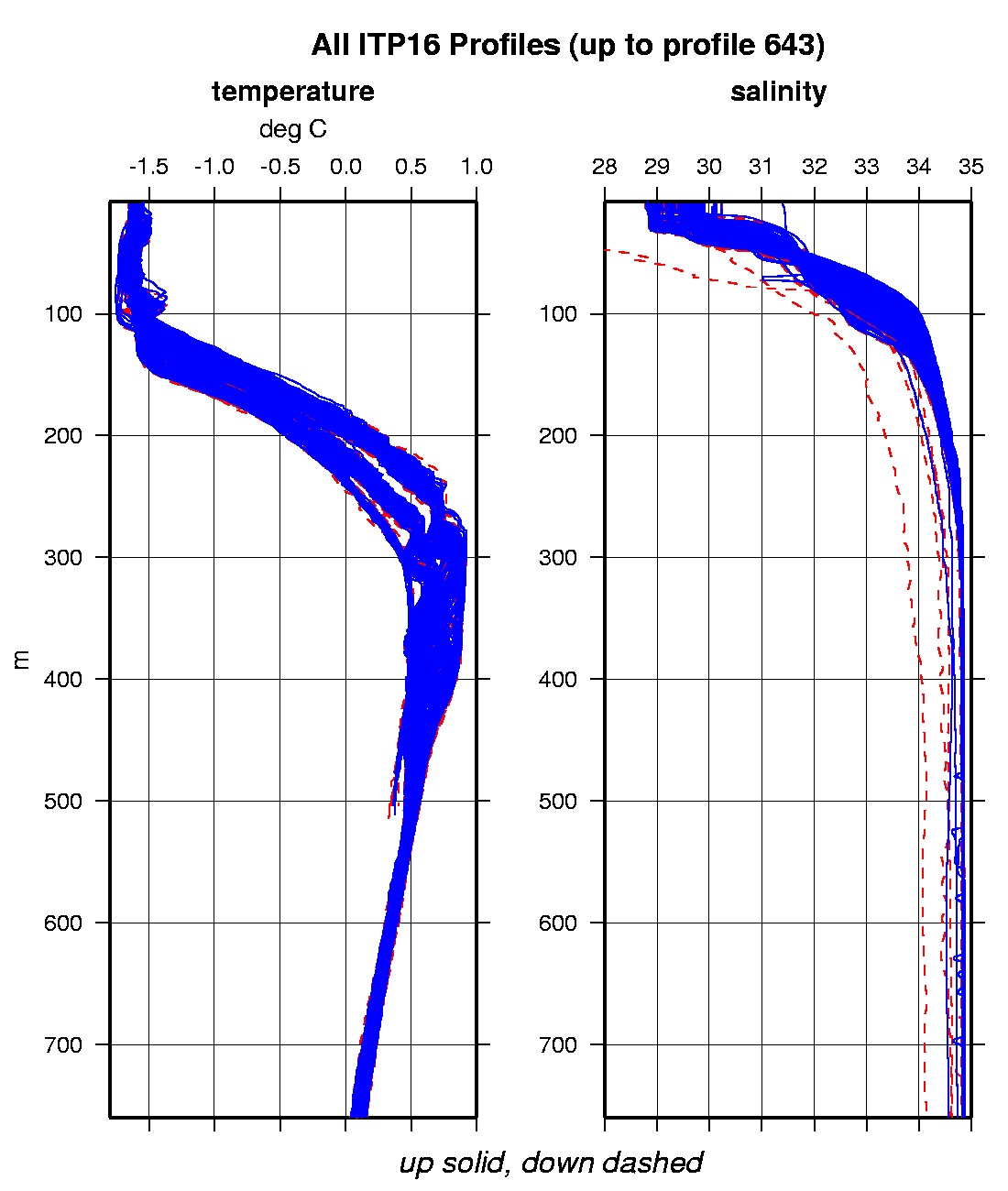
Last buoy status on 2010/9/5 230118 UTC : temperature = 1.64 °C, battery = 10.49 V Last position on 2010/9/5 230118 UTC : 80.247° N, 104.854° W Last profile (number 643) on 2008/4/3 24 UTC Last profile mean motor current = 122.2923 mA, mean battery = 10.1657 V Last profile depth: minimum = 12.9015, maximum = 407.2659 m Last profile temperature: minimum = -1.6479, maximum = 0.48326 °C Last profile salinity: minimum = 30.0532, maximum = 34.8474 The raw GPS buoy location data are available in an ASCII file: itp16rawlocs.dat Depth averaged profiler data files (with interpolated location) are available in two formats: ITP16 was deployed on 2 September 2007 near 87° 50 N, 169° 48 W from the German icebreaker "Polarstern" as part of the European Union DAMOCLES Program. The ITP is operating on a rapid sampling schedule of 3 one-way profiles between 7 and 760 m depth each day.
|