Ice Tethered Profiler 14 Data Data from ITP14 deployed in September 2007
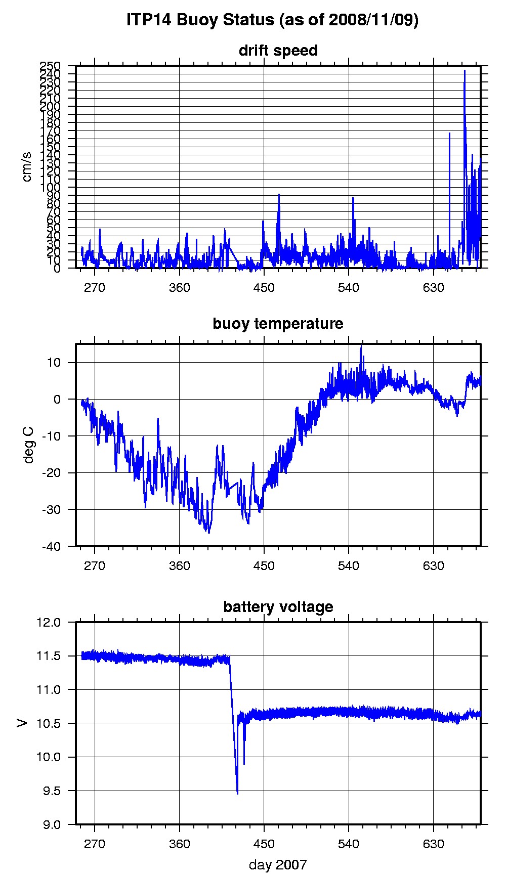
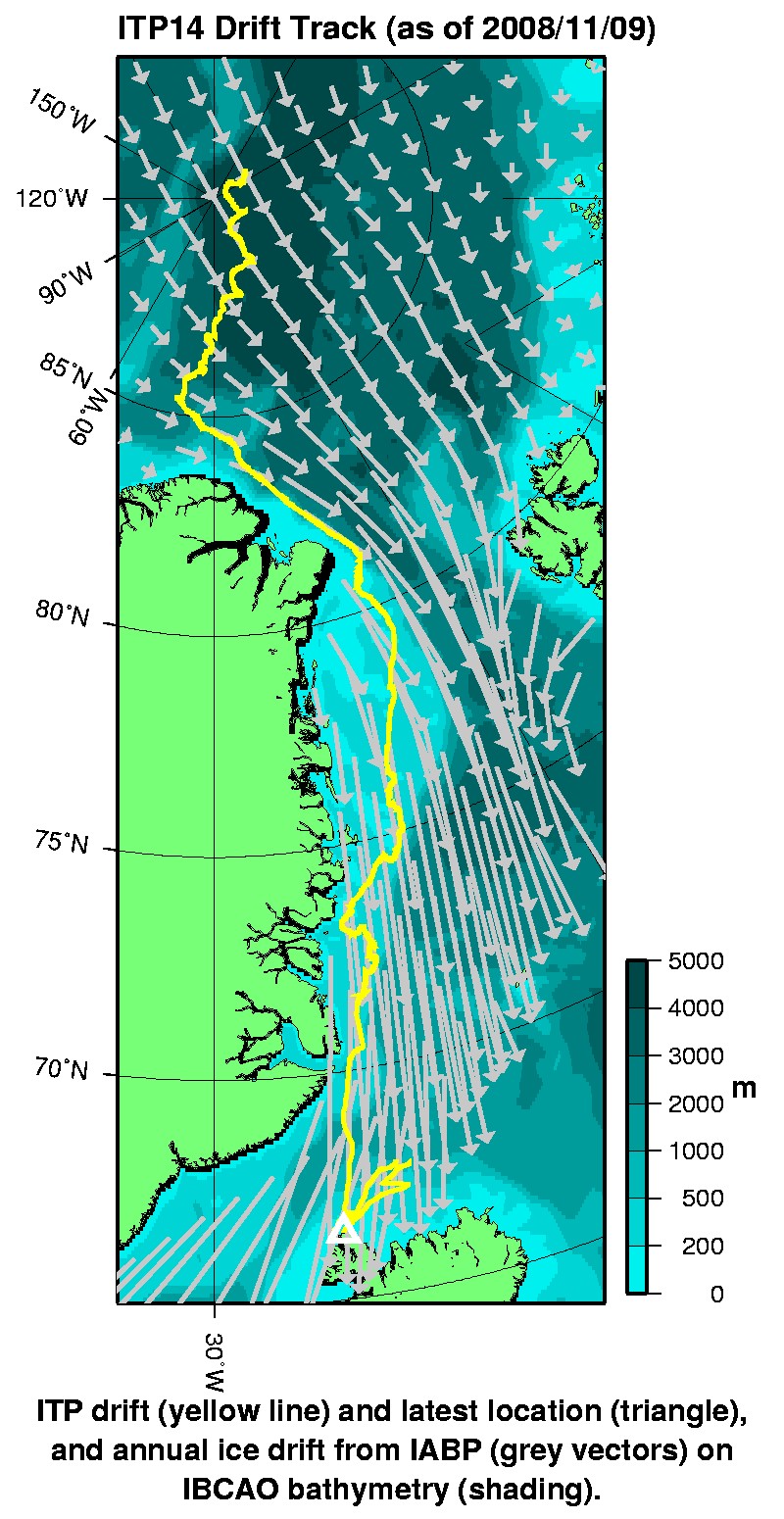
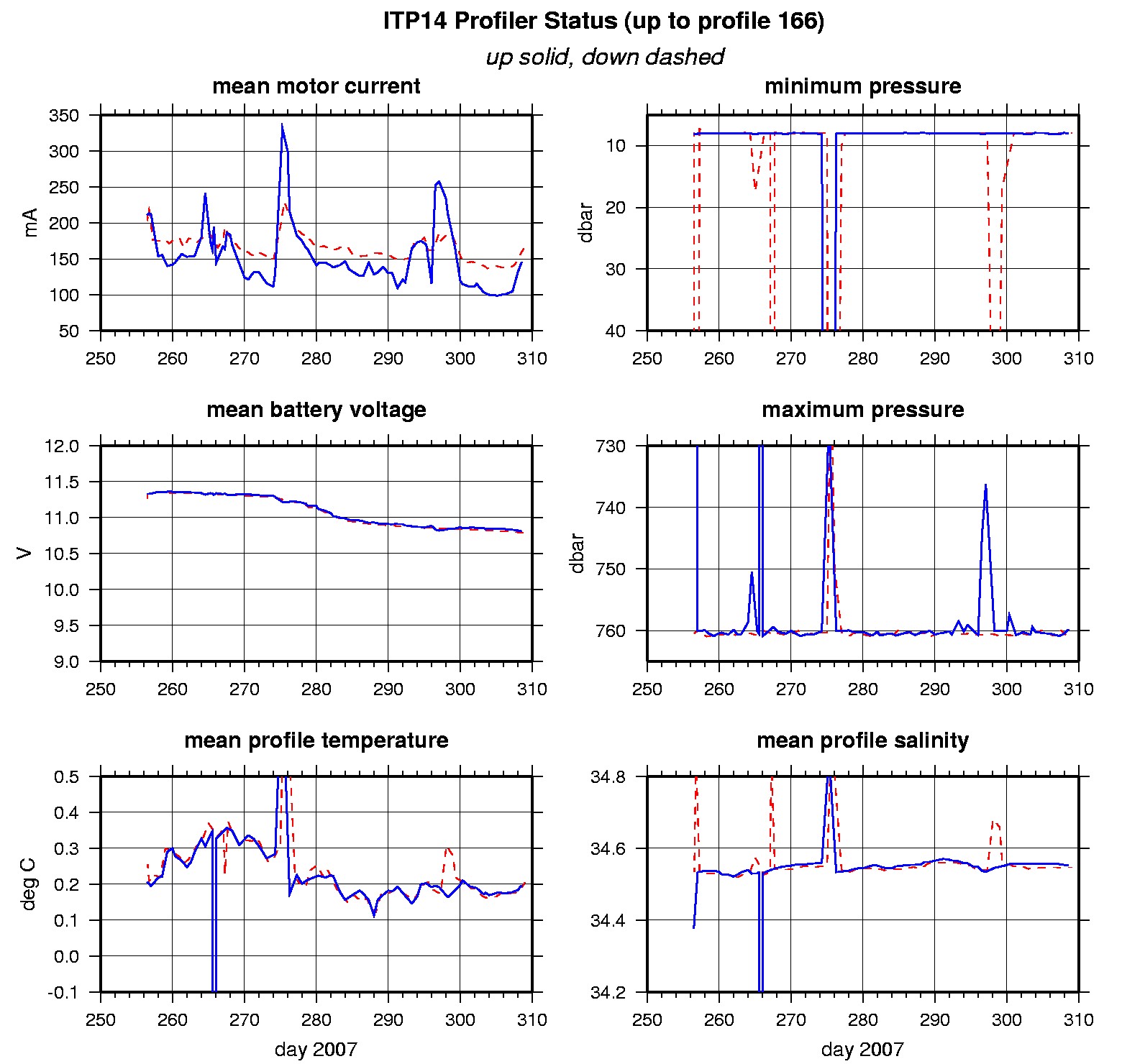
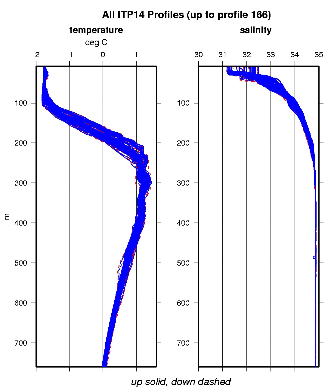
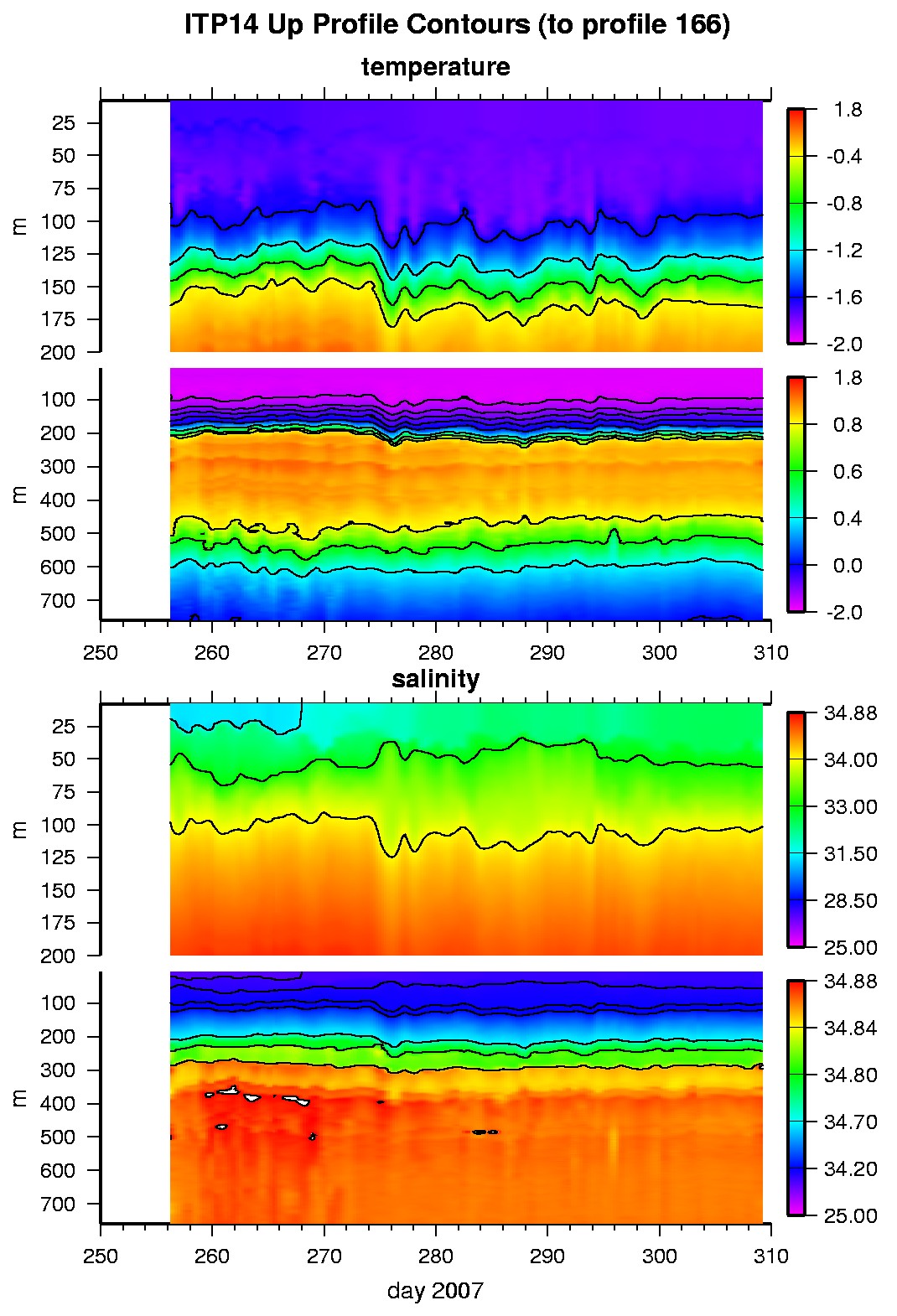
Last buoy status on 2026/5/14 230001 UTC : temperature = 1.61 °C, battery = 10.41 V Last position on 2008/11/9 180039 UTC : 66.4651° N, 22.8726° W Last profile (number 166) on 2007/11/5 24 UTC Last profile mean motor current = 167.5631 mA, mean battery = 10.7848 V Last profile depth: minimum = 7.8944, maximum = 760.5157 m Last profile temperature: minimum = -1.7876, maximum = 1.2358 °C Last profile salinity: minimum = 32.4521, maximum = 34.8703 The raw GPS buoy location data are available in an ASCII file: itp14rawlocs.dat Depth averaged profiler data files (with interpolated location) are available in two formats: ITP14 was deployed on a 3.0 m thick icefloe on 13 September 2007 near 89° 0.87 N, 104° 35.65 E from the Russian icebreaker "Akademik Federov" as part of the European Union DAMOCLES Program. The ITP is operating on a rapid sampling schedule of 3 one-way profiles between 7 and 760 m depth each day.
|