Ice Tethered Profiler 13 Data Data from ITP13 deployed in August 2007
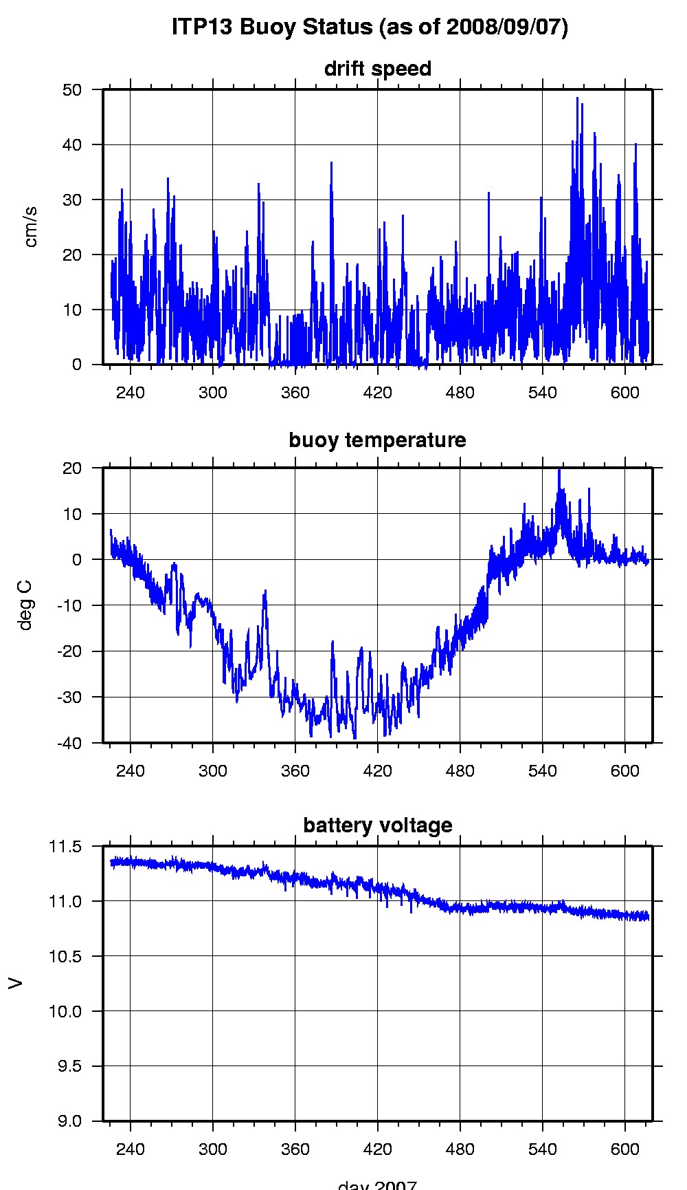
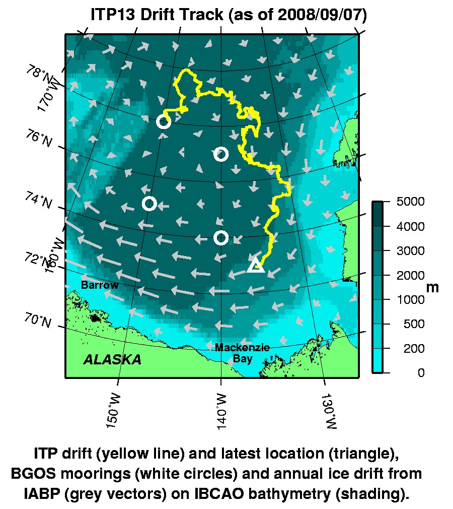
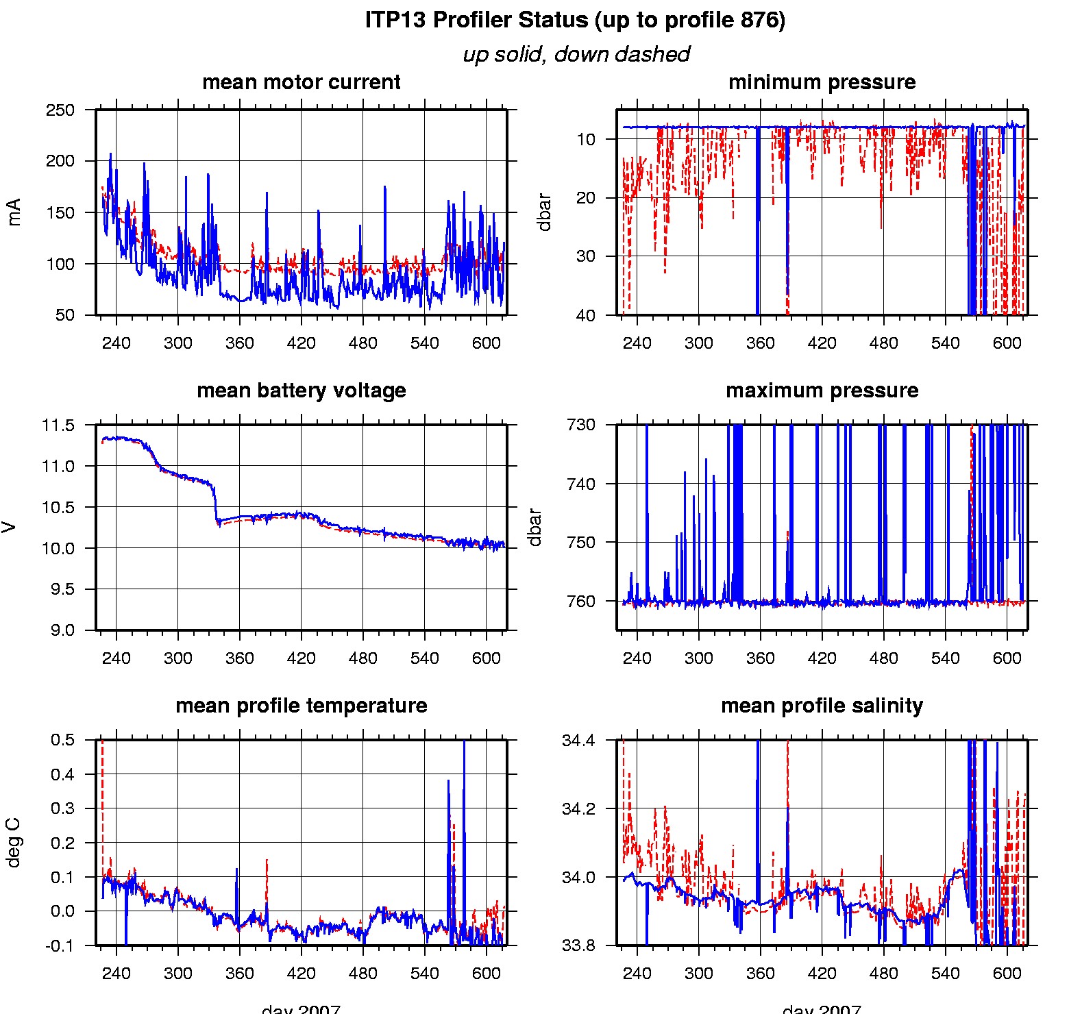
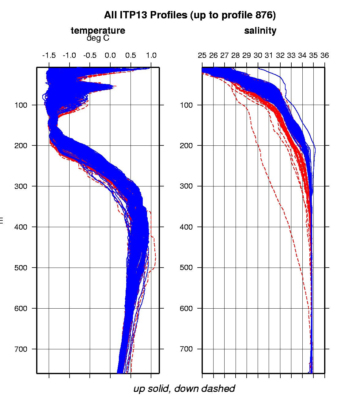
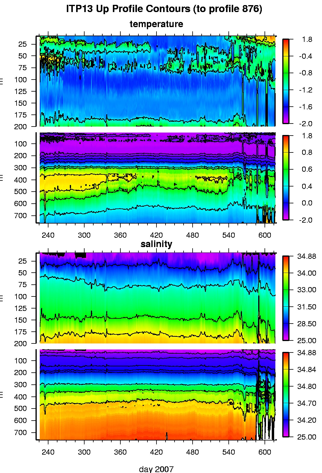
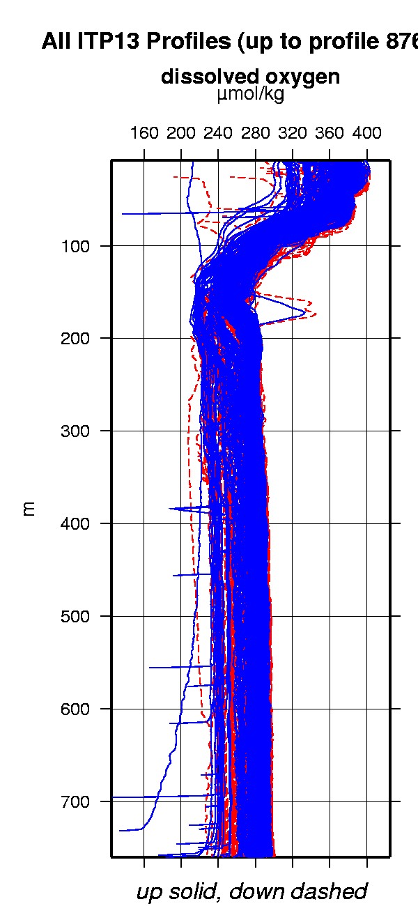
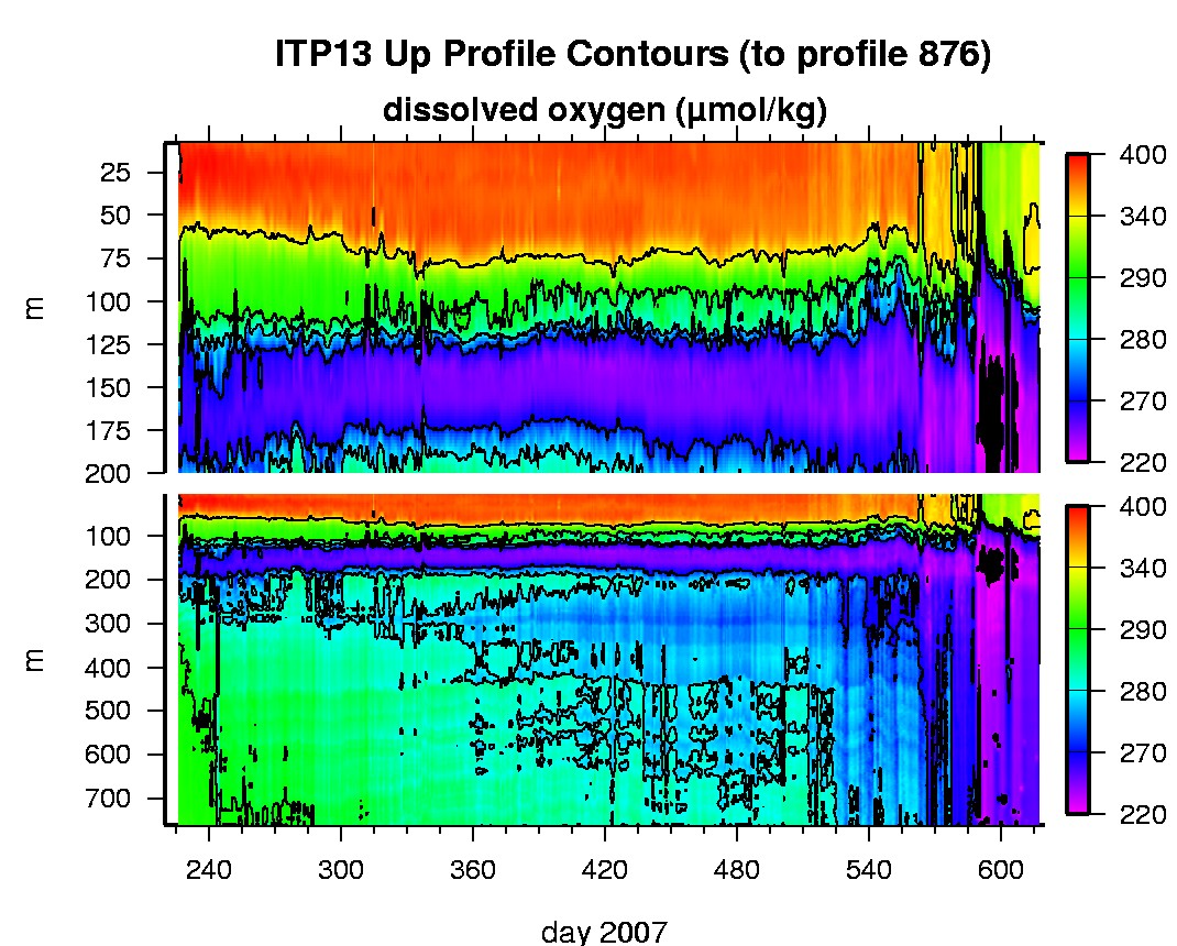
Last buoy status on 2008/9/7 230035 UTC : temperature = -0.4 °C, battery = 10.87 V Last position on 2008/9/7 230035 UTC : 72.9121° N, 135.7976° W Last profile (number 876) on 2008/9/8 624 UTC Last profile mean motor current = 94.5263 mA, mean battery = 10.0533 V Last profile depth: minimum = 92.5452, maximum = 759.8624 m Last profile temperature: minimum = -1.48, maximum = 0.67636 °C Last profile salinity: minimum = 29.9137, maximum = 34.8687 Last profile dissolved oxygen: minimum = 227.6388, maximum = 335.0171 μmol/kg The raw GPS buoy location data are available in an ASCII file: itp13rawlocs.dat Depth averaged profiler data files (with interpolated location) are available in two formats: ITP13 was deployed on August 13, 2007 on a 3.10 m thick ice floe in the Beaufort Sea at 78° 01 N, 149° 12 W as part of the Beaufort Gyre Observing System (BGOS) during the JOIS 2007 cruise on the CCGS Louis S. St. Laurent. On the same icefloe, a US Army Cold Regions Research and Engineering Laboratory (CRREL) Ice Mass Balance Buoy (IMB 30197) and a Naval Postgraduate School Arctic Ocean Flux Buoy (AOFB) were also installed. The ITP includes a dissolved oxygen sensor and is operating on a standard sampling schedule of 2 one-way profiles between 7 and 760 m depth each day.
|