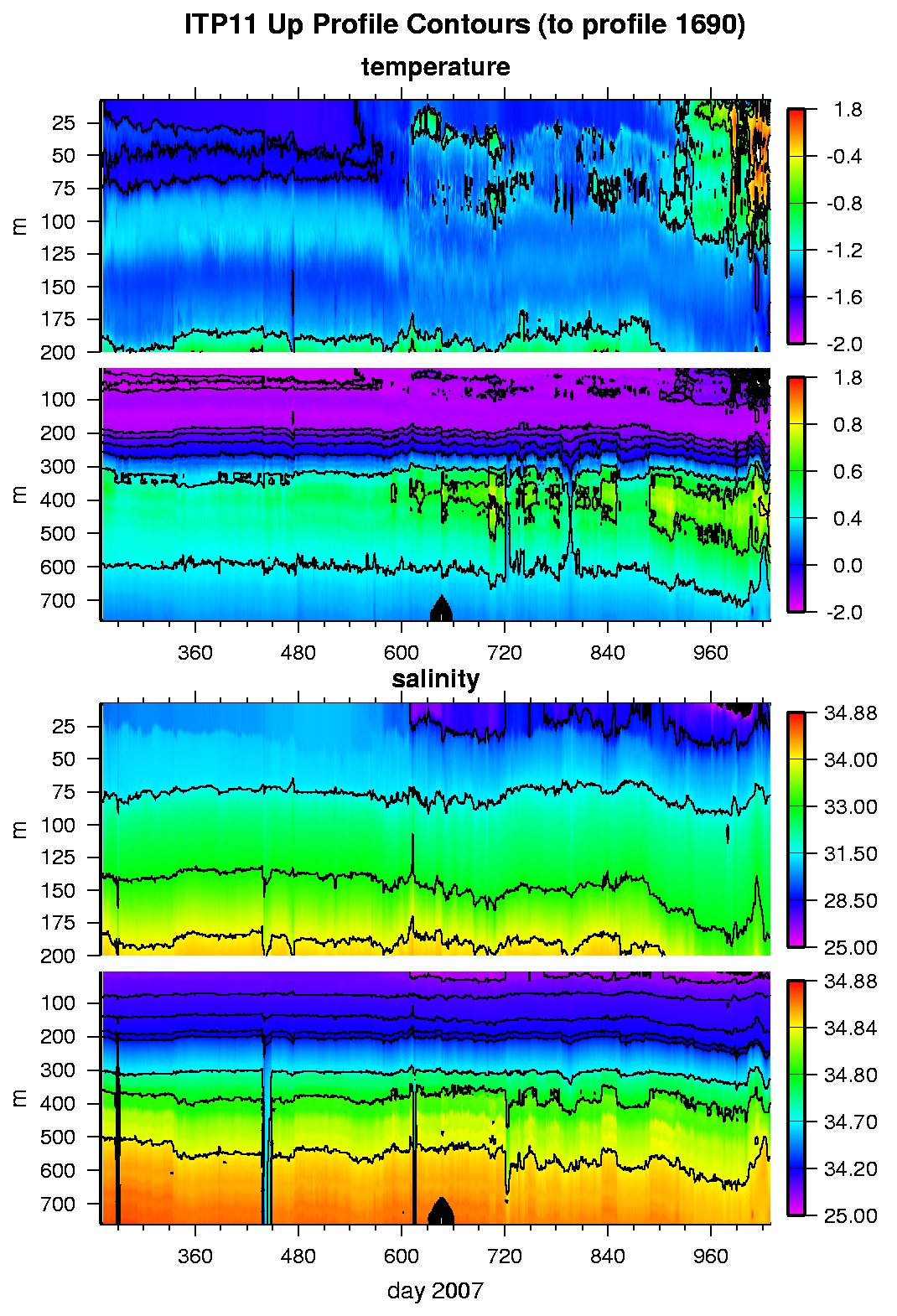
Ice Tethered Profiler 11 Data Data from ITP11 deployed in September 2007
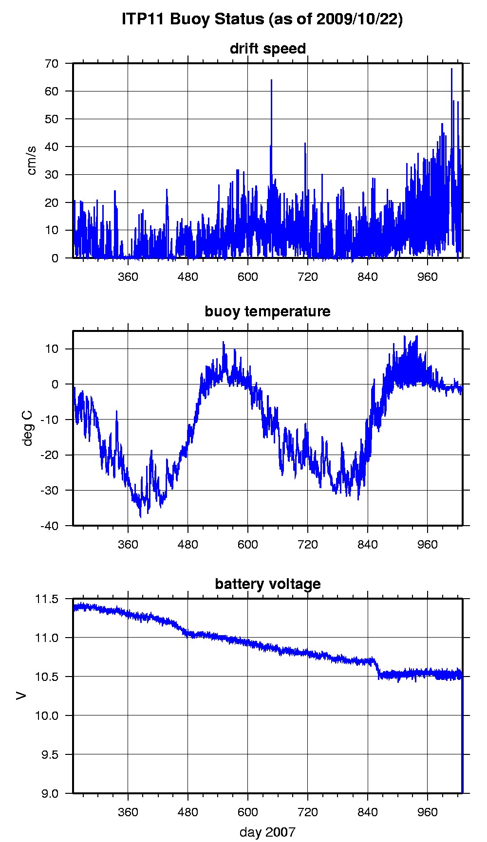
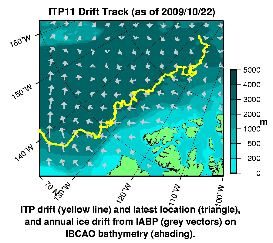
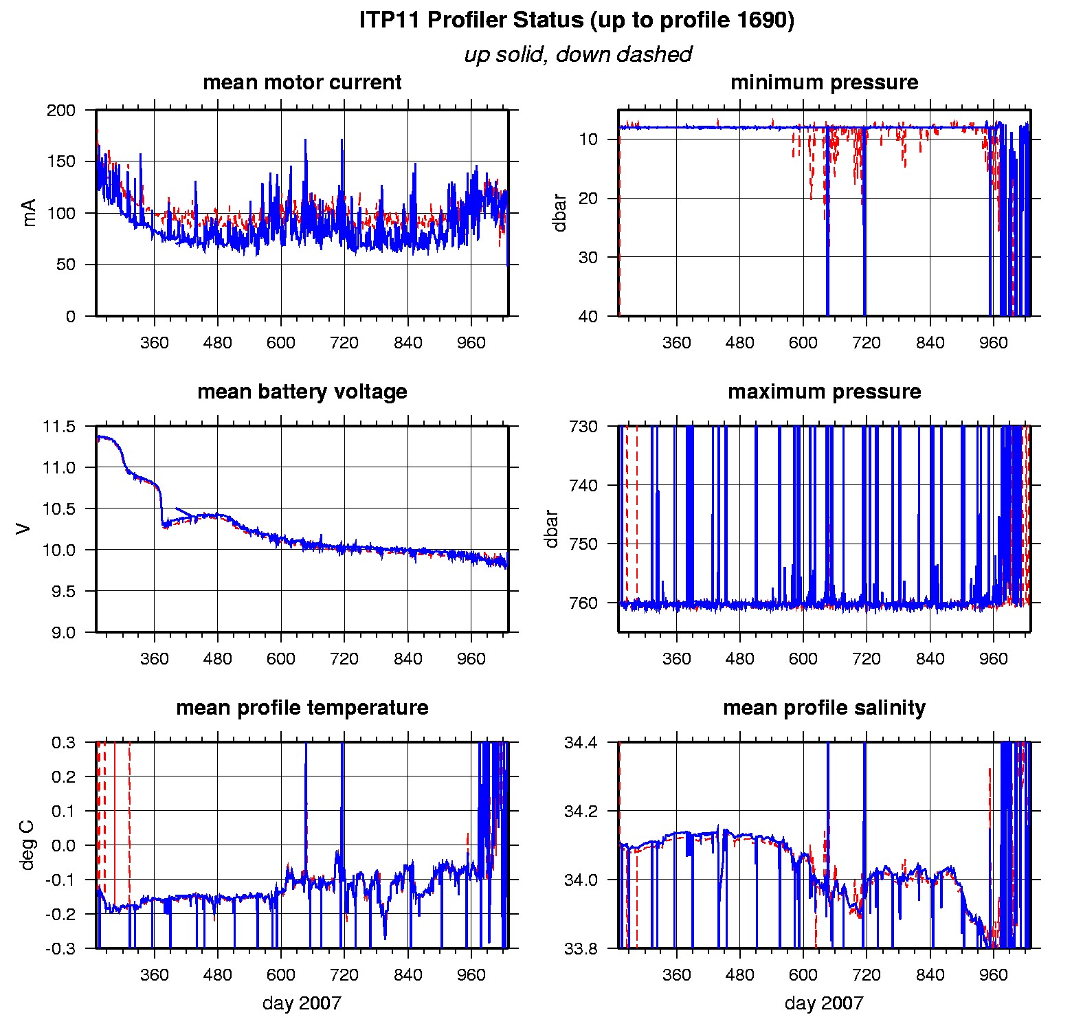
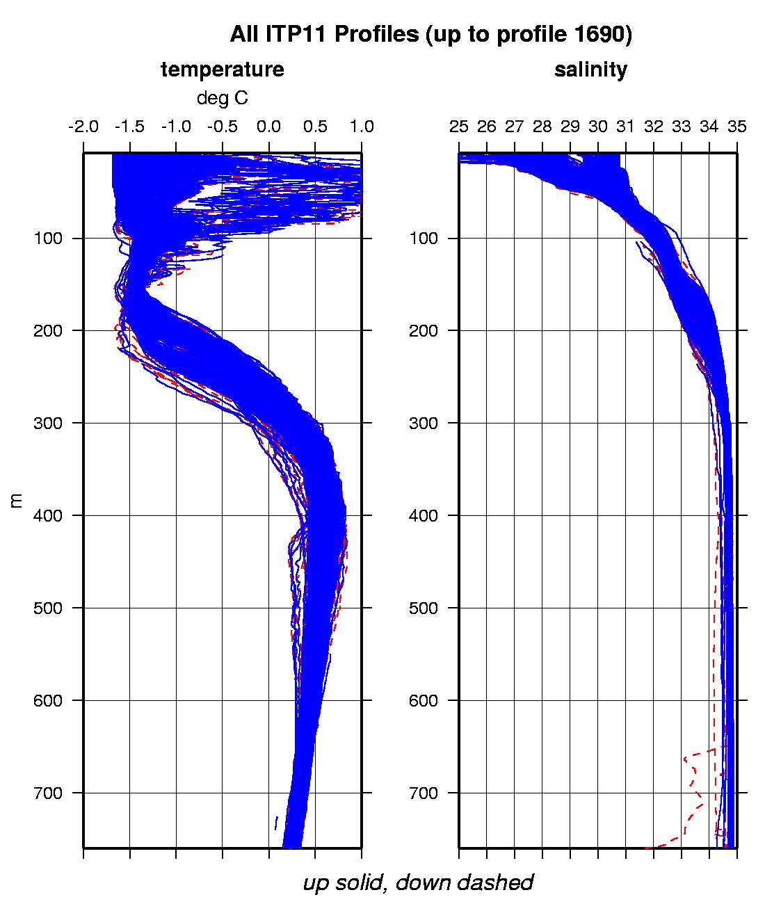
Last buoy status on 2009/10/27 230001 UTC : temperature = -1.95 °C, battery = 5.73 V Last position on 2009/10/22 150037 UTC : 74.5898° N, 161.5724° W Last profile (number 1690) on 2009/10/24 624 UTC Last profile mean motor current = 83.3919 mA, mean battery = 9.8813 V Last profile depth: minimum = 498.8383, maximum = 507.4089 m Last profile temperature: minimum = 0.75083, maximum = 0.77027 °C Last profile salinity: minimum = 34.8298, maximum = 34.8332 The raw GPS buoy location data are available in an ASCII file: itp11rawlocs.dat Depth averaged profiler data files (with interpolated location) are available in two formats: ITP11 was deployed on a 2.8 m thick icefloe on 9 September 2007 at 83.295°N, 127.632°W from the Russian icebreaker "Akademik Federov" as part of the European Union DAMOCLES Program. On the same icefloe, a US Army Cold Regions Research and Engineering Laboratory (CRREL) Ice Mass Balance Buoy (IMB 30306) was also installed. The ITP is operating on a typical sampling schedule of 2 one-way profiles between 7 and 760 m depth each day.
|